Hikshari' Trail extension and Eureka Marsh
Eureka City Parks

With a second day of sunshine, I decided to check out the trail extension along what will, one day, be a complete Humboldt Bay Trail. This bit has been referred to as the Hikshari' Trail extension or the Bay Trail extension. It's a piece of the Great Redwood Trail where the California Coast Trail follows along. Specifically, it is a mile of paved multiuse trail running between the breaking waves coming in through the bay opening and restored salt marsh. Since it is only a mile of trail, I planned on seeing a bit more and actually started at some parking at the Bayshore Mall for the Eureka Waterfront Trail. There's supposed to be trail parking somewhere around the mall, and I believe I saw it marked once near the oil pier at the other end of the long line of unused spaces where I parked. I got a spot next to a short gravel connecting trail and turned south toward the extension.


Rounding Chevron's pier and operations, one comes upon the Elk River, once known as Hikshari' and giving the next section of trail its name. I thought that would be a hard name to recall, but I seem to do it now in connection with the trail, so I guess it's not too hard. And no one would miss one less "Elk River" if we just reverted to calling it Hikshari'.

Just like the Baduwa't River (whose name doesn't feel hard to remember, there's really no pattern to what is or isn't), the Hikshari' travels a long distance north along the shore, separated from the bay by a long sand spit. It used to grow and shrink over the years, but has been extra stable over the last many decades due to both the invasive grasses claiming its sands and the permanent breach dug through the sand spit that defines Humboldt Bay.


There's an extra gravel loop of trail when the paved trail separates a little more from the nearby city and enters the Elk River Wildlife Sanctuary. That gravel gets close to the water and I followed it on the south going pass.


Around a corner and across a small bridge, the old trail continues on to a road that continues on to the Elk River Park and Ride. But that's not where I was going. Just past that little bridge was all new trail extending south, looking like it's always been there. It was a little different when I came in 2021.

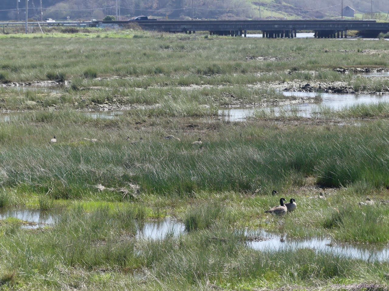
To the right are the old tracks and to the left are wetlands. On the north side of the river, they look much as they did before. Some restoration work (levee removal, for instance) was done on the far side and they'll need a little more time to shape themselves and grow into salt marshes.
To bridge the Hikshari' River, the trail just climbs up and uses the old railroad bridge. I'm not sure why it doesn't replace the tracks all the way, but there's a history of someone somewhere making noises that they could totally have an excursion train out on those tracks. For extra romance/unworkability, the steam engines at the fort should be pulling it. They're in better repair than the more modern engines in the train yard.

After the bridge, things split again. Once to the far side of the sand spit, the old track bed is exposed to the might and fury of the open ocean, tempered a little by having to squeeze through the bay opening. Here, the offset works to protect the trail. I'm a little surprised the tracks weren't removed as a safety measure.


Abruptly, the trail just gives up, turns left, and ends at a shinny new parking lot. If one wants to continue on the Great Redwood Trail (or the hoped eventual path of the Humboldt Bay Trail), one must cross over the dip and struggle along the sometimes overgrown tracks once more.


I was tempted to head along further and keep on the edge to the public beach at King Salmon. The right of way for the Great Redwood Trail following the train tracks actually stays inland there, but people do go along the edge. I crossed over for a view of the waves, which was missing from the sheltered trail, but did not continue.


So after listening to a little water washing the rocks, I headed back along this new trail.

But I didn't go directly back. I decided to head out onto the sand spit and took the major path over the tracks to the beach on the far side. The sand spit is also part of the City of Eureka's Elk River Wildlife Sanctuary.


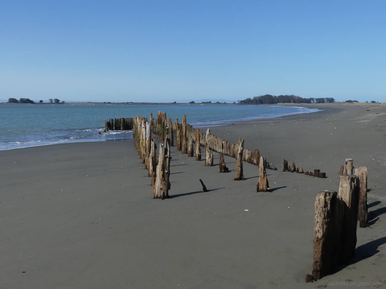
I wasn't really looking to head off to the end of the sand spit. I've done that before and there's well established interior trail all the way. Keeping to the well established trail does help protect the rare flowers that live here. I found a trail up from the beach to connect to that interior trail and head back.


Following the less steep path back up to the trail, I headed for the Eureka Marsh, dallying a bit on the bridge first.

Hikshari' River is a whole different place with the tide gone out.


The cats were out for the afternoon! They were all good cats on their little leashes, not like most those dogs. One was on the trail and one stopped for a picnic.


But I wasn't done yet. I wanted to wander the marsh and stop by the fishing pier at the end of Del Norte Street.


At the pier, you can see different abandoned tracks, at least for now. The bay is working away at them a little each day.


There was a pair heading down to the mud to look at the things squirting water. There are things that do that. Jets of water popped up a couple feet here and there. I think they're just the oysters. There's a lot of oysters to go after when the mud flats are exposed. I thought about wandering the little trail in the park, but it's in the fenced off dog park area. Probably the nicest dog park in the city! I was once again heading back to the car instead. I took the gravel interpretive trail as far as it goes, rather than the multipurpose path.


The expected weather for overnight had come in at the end, so I was ready to finish when I arrived again at the car.
*photo album*
©2024 Valerie Norton
Written 16 Mar 2024
Liked this? Interesting? Click the three bars at the top left for the menu to read more or subscribe!


Comments