Posts

Showing posts with the label old cabin

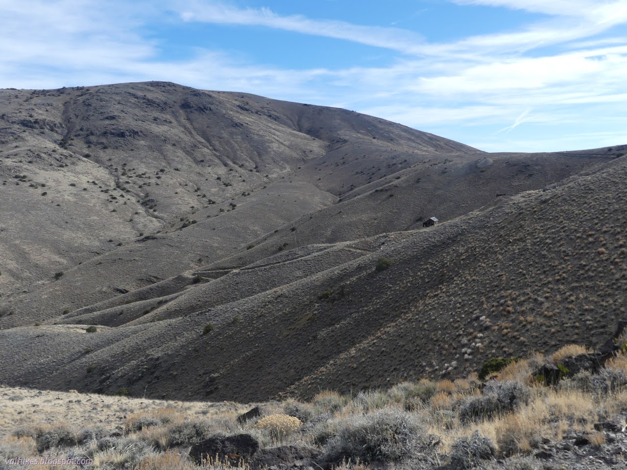
Cabins: Morrison, Jorstad, and Moliter Cabins along North Fork Trinity River and Grizzly Creek

Image
Shasta-Trinity National Forest DAY 1  |  DAY 2  |  DAY 3 Blue line for day 2. Click for interactive map My muscles felt abused from the day before, or perhaps from the insufficient activity over the week or two before that. Or maybe there's a little age creeping in. I've passed another 100th birthday! This one was base 7. Preemptive naproxin sodium seemed to have helped it not all be so bad and this day would be comparatively relaxing. Depending on trail state. A little bit of sunrise on Cabin Peak. New River (East Fork) over the local trash pile. We packed all of ours out because we know better. We didn't see the closer connection to the Morrison Gulch Trail the day before and while looking closely, we only saw a candidate for where it used to be. We continued on to the obvious further junction instead. Unsigned but distinct quicky became difficult to find as it passes along the bowl of land between the two ridges. Following gently upward gets aro...

Swift Creek Snow Survey

Image
Shasta-Trinity National Forest Click for interactive map We hit the Swift Creek trailhead for a day hike up to the snow survey cabin. Daniil wanted to do a survey of the terrain, but the fact of the cabin suggests it's pretty safe hiking in winter. We only hit snow on the road shortly before the trailhead around 4000 feet, although the trailhead parking was totally covered in white. We started out with the snowshoes on our backs. Snow exists, as we see at the trailhead. Into the wilderness that started a quarter mile back down the road according to the map. Soggy trail with a little running water at the second sign for the Trinity Alps Wilderness. The morning wasn't freezing and the trail ran with water. We passed several very seasonal streams and the ones marked on the map tended to need a well placed rock to keep the feet out of the water. When we hit snow, it was neither hard nor particularly soft. Swift Creek churning below. Closer to Swift Creek. Bei...

Lazy Man and Evening Star Mines

Image
Stillwater Field Office BLM ( map link ) The bit of geocaching at the mining areas on the way up to Mable Mountain seemed quite successful, so I set out to find a couple more before stopping by the library in Hawthorne and then finding a new camp with easy access to Corey Peak. They were actually on the menu for the day I drove in, but the faint roads that lead to them proved so hard to see that I went right past before knowing it. With a lot more care, I got stopped in the right places on the way out. Since absolutely no one would care if I parked at the side of the road, I decided against challenging off road parking spots and didn't repeat throwing the car into a sand trap. First up, Lazy Man . I approached it from a hill that had been cut, but not for a road. Buildings and other structures and tailings from the Lazy Man Mine, worked around the 1930s?, lie below. The mine spreads out all around the hill. I headed down the hill, trackless on the south side, to hav...

Mable Mountain of the Garfield Hills

Image
Stillwater Field Office BLM ( map link ) If I could figure out a way to make permanent travel work, I'd have turned south to finish wiggling around Nevada. I've not, so I turned north to finish circling Nevada. However, there were still a few days of good weather left, so I stalled out in the Garfield Hills to check them out. Reports for getting to the high point on Peakbagger indicate Garfield Flat Road is rather rough on the east side, where it starts in Mina almost at an NDOT station. I came by the west side, past a tiny NDOT sign stating this road gets "minimal maintenance", and up some wash crossings. It looked like that minimal maintenance was quite recently done. I decided I would go up Mable Mountain. I read it as "Marble" and was a little upset there's no obvious marble like spots on it. There is a marble quarry half a mile down the road from my camp, though. There's no hint of marble on this Mable Mountain. I considered combini...

Silver Peak and Red Mountain

Image
Tonopah Field Office BLM ( map link ) My plan for the day was an out and back to Silver Peak, a little over 3.5 miles distant for the crow. For myself as a land bound creature, it would involve some winding and negotiation of slopes. There are numerous ascents on Peakbagger , mostly involving long 4x4 drives to or near a radio tower south of the peak and a half mile walk up to the top. Some decide it's a bit rough or snowy and they might as well get a whole mile walk in. One sans-4x4 headed up a road a bit to the west that gets up pretty high. I decided on one a little less to the west that doesn't go so far, leaving more than half of the route cross country. But how hard could that cross country be? After a short walk on the good road, there's this pair of tracks heading south. The terrain ahead, but I'm going off to the right. Silver Peak is way in the back and a little further. The road climbs a bit higher than I needed it to, but it's gentle. It ge...

Rhyolite Ridge

Image
Tonopah Field Office BLM ( map link ) My initial plans for a western approach to the high point of Rhyolite Ridge may have been foiled (perhaps by my own timidity), but I could still find a way up on the east side to bag this 1000 foot prominence peak. The west side sure looks a lot easier. There is a track on Peakbagger indicating it didn't require any class 5.3 moves or anything, so I set out to make the attempt in spite of all the clearly visible cliffs. Rhyolite Ridge from the east side. Boundary Peak (and higher Montgomery next to it) through the gap. Taller, but not very prominent. The route up is far to the north on little used roads and my little car still has only two drive wheels and 6 inches of clearance, so there would be a bit of walking before the real climbing began. From camp, the roads going my way are inconveniently placed, so I just set out across the scrub. Not a hard hike with a patch of cholla along the way. I got to a rough road and followed it ...

Encampment: discovering the rest

Image
Medicine Bow-Routt National Forest (light blue line, map link ) DAY 1  |  DAY 2 I didn't quite have enough water for breakfast, so packed it all up and got the quarter mile or so up the trail to the next tributary to eat, drink, and make merry. I couldn't help poking around a little and found that there's at least a little bit of use trail going up Jordan Creek, or perhaps it goes on the Drunkard Creek side. I didn't get far, but it seemed to be going somewhere. I didn't really get along the trail until 9AM, which is better for having a little light down into the canyon. The river is still in shadow, but the shadowed rocks of yesterday are well lit. Here comes the sun. Rocky Mountain maples have a collection of winged seeds now and might be colorful later. Getting some high (and wide) ledge time on the trail above the river. I actually spent a little more time taking in the plants than the river as I walked the return.

Encampment: discovering the river

Image
Medicine Bow-Routt National Forest (light blue line, map link ) DAY 1  |  DAY 2 Okay, so somebody in Saratoga saying they want to do the Encampment River Trail probably isn't the best reason to go and do it, but I only had to go across the road for it so it sufficed. Since the Colorado side of this trail was such a mess, I decided to squeeze everything into the 33L pack instead of the 63L pack. Hey, it saves another pound. It's a tight squeeze, so I went with cold soak meals, saving a little more weight. I packed for an overnight with the goal laid back goal of just seeing how far I got. Since I was doing all this packing in the morning, the start was a little late. The Commissary Park Trailhead has parking, information signs, and a lot of open space. The Encampment River has grown by both the East Fork and West Forks joining. Wandering along in wide, glacial valley. I followed along trails near the river, but it turns out I was off trail. The official one ...

Bridger Peak

Image
Medicine Bow-Routt National Forest ( map link ) My original plan for the day was to start backpacking south from Battle Pass on the Continental Divide Trail (CDT), but I decided the evening before to put it off a day for a hike north as far as Bridger Peak. Here, the trail actually follows a road although my map showed two trail diversions. These weren't enough to persuade me to try it, but I decided that Bridger Peak is a worthy destination. It is a range 5 high point with 1884 feet of prominence and 25 miles of isolation as well as a former fire lookout site. I decided not to change my start point and walked the ridge from the rest area, break check, and trailhead on the south side of the pass. There's a second rest area on the north side with some good signs about Battle, Wyoming, which was once there. Now there's a scattering of homes built on mining claims and a few other remnants of mining history. Welcome to Battle Pass. At nearly 10,000 feet, it's a goo...

Miner's Cabin interpretive loop

Image
Medicine Bow-Routt National Forest ( map link ) With a bit of sun coming out, I continued up the road to the interpretive trail at Miner's Cabin Trailhead. This is a short loop with signs mostly provided by Wyoming Game and Fish Department. It's part of the "Wyoming's Wildlife Worth the Watching" program that is funded by a trust fund and stamp sales. (These sales support education efforts and many other things, but it seems only nongame management.) Around the parking loop, the signs are primarily concerned with geology. Medicine Bow Peak with a sign about its geology. This one is by Game and Fish, but there's an even larger one by State of Wyoming Geological Survey. These rocks come from 2 billion years of geological happenings. A monument to United Airlines flight 409, which crashed on the mountain killing 66 people. The trailhead and the first few signs along it. Since it is Game and Fish doing it, most the signs are ecology based. There...