Posts

Showing posts with the label Tonto National Forest

Dome Mountain - Goldfield Mountains high point

Image
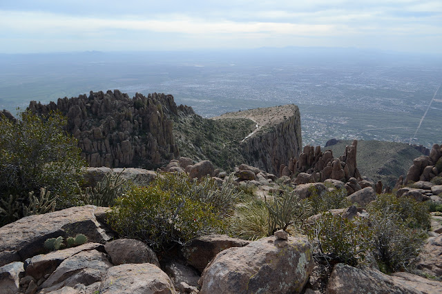
Tonto National Forest Click for map. I don't want to neglect the Goldfield Mountains simply because they have not been designated wilderness. I can see approximately two named peaks in an area that should have a lot more, so it looks like they have been neglected enough. There is one showing many layers that has caught my eye. It gets the sun long before a lot of what is east of it, so it must be quite high up. I want to go up that one. Maybe it is Dome Mountain, the high point of the Goldfields. It doesn't seem to be in quite the right direction, but I'll go for that one. If it's the one, great. If not, I'll still be on a worthy peak. To enter the area with a vehicle, one needs to pick up a free Bulldog Canyon permit from the Mesa Ranger Station, but since this is a 4WD area, I'll just use one of the many parking spaces outside the gate and walk in. One of a few gates into the Bulldog Canyon area of the Goldfield Mountains with a fellow dueling th...

Hackberry Spring and Hackberry Mesa

Image
Tonto National Forest Click for map. I had thought I might try this loop backpacking with the cat, staying near the spring, but it is just so short (as a shakedown trip should be) and that would preclude the possibility of finding a way up Hackberry Mesa and it really is just easier to day hike, so the excuses mounted and Timmy had to stay behind again. The weather man says there will only be a 4 hour break from solid clouds starting at 7AM, so I got moving early enough to enjoy some golden hour light. Since the trail is so short, I decided to just walk the mile rather than drive the 4 miles to get to the start. Across the way are the Goldfield Mountains bathing in the golden morning light. Hackberry Spring trail starts at the horse parking for First Water. There are bathrooms, no camping, and the Tonto Pass is not required for the abundant parking. There are a few cars already including one with backpackers getting their gear together. The trail is signed at the nort...

Hieroglyphics Trail

Image
Tonto National Forest Click for map. The Hieroglyphics Trail caught my eye while looking over the map for my previous visit to the Superstition Wilderness . Nothing happened with it then, but it will now. There is actually a way up to the high point of the same ridge I was on a few days ago along unmaintained use trails, but I am only looking for an evening hike to the spring today. Parking is available 5AM to 10PM after which cars might get towed, so I guess no overnight trips can start from here. Signs at the trailhead talk about the history of the trail and how the community has managed to get it where there was once access only by trespassing, but nothing about preservation of the petroglyphs (they are not known to actually be hieroglyphics) from careless visitation even though they are the destination of the official trail. Both the Hieroglyphics Trail and the western section of Jacob's Crosscut start here. Information is directed at the second. So through the...

The Flatiron and above via Treasure Loop and Siphon Draw

Image
Tonto National Forest Click for map. Ah, the Superstition Mountains. They really are a jewel of the state and right now they seem quite green. Of course, I'm out to get up into them and around here, they actually have trails. The one I am after is a non-system, unmaintained trail, but it will still be a nice change to be on even that much trail. Entries exist north and south of the Lost Dutchman State Park as well as within, but it seems silly to pay $7 to go in and then walk right back out again. I'm starting at the north end at the first lot on the road to First Water although the closest is at the south end. It's only 6 miles up and down, according to the information for the geocache at the top, so this gives me a little more area to explore. On trail! Cholla can still be a problem when on trail, but not all that often. Oh, the delight of being on trail. Southward to the Superstition Mountains. Siphon Draw goes right up the middle between the rock faces. ...

Superstition Mountains: Peralta Canyon

Image
Tonto National Forest DAY 1  |  DAY 2  |  DAY 3  |  DAY 4  |  DAY 5 We are wet again in the morning, but we will not have to worry about that anymore. It is just a few miles to complete the loop. Phoenix was not so much an eternal sunset without any clouds for the lights to shine on. Fewer things are frosty. Swinging my wet bag through the air can make it frosty and help shake off the water, though. I make breakfast watching the light hit Weavers Needle and the rock pillars all around me. They take on the character of a stadium of people, especially with the sun hitting their "faces". Weavers Needle bathes in the morning sun. Looking up at some of the pillars around the valley. One of the high pinon pines sits atop the nearby rocks. We pack up and head out. Both the Beartooth Publishing and the 1966 USGS maps show a big switchback after the camp, although the first does not actually show the camp, that was goi...

Superstition Mountains: Black Mesa and Weavers Needle

Image
Tonto National Forest DAY 1  |  DAY 2  |  DAY 3  |  DAY 4  |  DAY 5 We wake soggy again, as feared, and spend way too much time waiting for the sun in the deep canyon before I promise we can stop at the top of Black Mesa to dry things out. There should be some quality sun up there, especially if it lives up to its name. We head across the wash to the junction sign, which is resplendent in a bit of ribbon to help people spot it from afar. Maybe a quarter mile up the trail, there are pools of water. A thin trail seems to climb up the hill, but does not go much of anywhere. The trail crosses the creek and there is an accessible pool below it, but the water just above the trail looks oily. We look for access above this, but there really is nothing. Somehow the lower pool looks nice enough in spite of the higher pool. And it has a tamarisk. We settle for it and grab water for the day. Second Water Spring, the last of the relia...

Superstition Mountains: Peters Mesa, Charliebois Spring, and Boulder Canyon

Image
Tonto National Forest DAY 1  |  DAY 2  |  DAY 3  |  DAY 4  |  DAY 5 Phoenix was an eternal sunset in the southeast even from down in this valley. I was so hungry in the night, I ate half the chia seed pudding that was supposed to be breakfast. I did this while pondering the frozen drops of water on my food bag and the layer of wet all over my quilt. People keep saying Arizona is a dry heat, but it sure looks like a wet cold from here. It is still just barely freezing as I eat the other half of my breakfast. I am still a little bit hungry. I plot away in the first light, changing the trip a bit. It looks like we might be stuck doing a short day or going out early. I could still climb Black Mountain off off Peters Mesa like I had originally planned. A wave of dread passes over me at the thought of actually going up the mountain. That is odd. Like I have been traumatized by the cross country escapade yesterday when the unmaint...

Superstition Mountains: Music Mountain

Image
Tonto National Forest DAY 1  |  DAY 2  |  DAY 3  |  DAY 4  |  DAY 5 The night sure is long this time of year. Orion marches the entire length from east to west as the night goes on. Phoenix is like some sort of eternal sunset on the edge of the sky. Eventually the brightness in the southeast overpowers the brightness in the southwest and it is morning. A sky textured by clouds brightens in the dawn light. As we left, there was a 20% chance of rain for this morning. We expect nothing to come of it, but the cloud cover is nice. It helped keep us a little cooler yesterday and is doing a better job of that today. Not that the day has had much of a chance to warm up anyway. We get ourselves packed and start for the top, which is really just a few turns away. There are more and bigger spaces up there and the air has been very calm. Winds are always a worry at saddles, but last night would have been nice. The divide rolls...

Superstition Mountains: Miners Needle and Red Tanks

Image
Tonto National Forest DAY 1  |  DAY 2  |  DAY 3  |  DAY 4  |  DAY 5 I had wanted to get about an hour of hiking at the end of the drive yesterday, but it was dark already by the time we pulled into the trailhead. In planning when to leave, I remembered the time change, but all the other little things over the eight hour trip drew it out longer. We could have hiked out in the dark, but that would mean missing this new scenery. Besides, we seemed to have already flipped whatever internal switches there might be to change over from paying attention to the clock to paying attention to the sun. The sun was down and we were tired. We found a place to camp instead of hiking. We will just have to do a little extra hiking when we are fresh on the first day. Sunrise at the Peralta Trailhead. So the break of day finds us at what may be the most popular trailhead outside of Phoenix. Why here? I made a quick search for popular loop ...