Hackberry Spring and Hackberry Mesa
Tonto National Forest
Click for map.
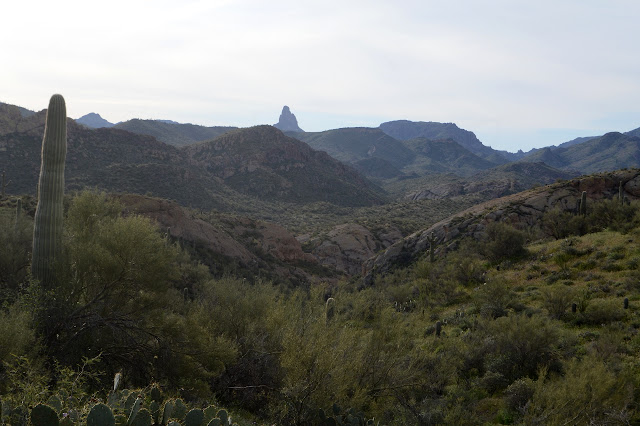
I had thought I might try this loop backpacking with the cat, staying near the spring, but it is just so short (as a shakedown trip should be) and that would preclude the possibility of finding a way up Hackberry Mesa and it really is just easier to day hike, so the excuses mounted and Timmy had to stay behind again. The weather man says there will only be a 4 hour break from solid clouds starting at 7AM, so I got moving early enough to enjoy some golden hour light. Since the trail is so short, I decided to just walk the mile rather than drive the 4 miles to get to the start.

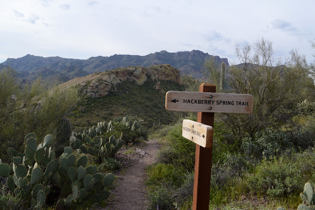
Hackberry Spring trail starts at the horse parking for First Water. There are bathrooms, no camping, and the Tonto Pass is not required for the abundant parking. There are a few cars already including one with backpackers getting their gear together. The trail is signed at the northwest end of the lot but wide use trails quickly try to confuse one about which way to go. It gets worse. A sign post a little further along shows the direction of the official trail where a major use trail breaks off and someone has attempted to "correct" the sign. That has been fixed, but now someone has added, "horse trail, steep" to the sign instead. Horse trails are rarely the steeper option. The trail to the right looks more used, but it quickly dwindles whereas the one to the left seems to grow, so after starting right, I ultimately choose left, sticking with the official, not at all steep trail. It does go up and down some hills instead of down along a gully allowing me to have some views.


I enjoy the official trail very much and am glad I took it. I do wonder how these short hills with trail that is just a bit more steep than gentle get to be called "steep" by someone. Maybe they only hike flat lands. The gully undoubtedly does not undulate at all, so comparatively it is so. There are plenty more signs pointing out the trail when use trails are strong.

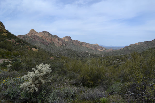
The wilderness has an old fence and is marked only by a small sign. As the trail descends down into First Water Creek, the trail starts to seem a little unofficial itself. This is steep, but it comes after too many junctions to seem particularly relevant to the first sign.

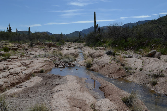
There is another use trail coming from upstream as the official trail goes downstream. It looks quite tempting to try as it travels through a magnificent canyon. The trail is quite thin beside the creek. I find myself evaluating the camping I see along the way and the best is furthest downstream right as the trail turns to leave the creek again. The spring, somewhere along the side of the creek, is not particularly evident unless it is the pool of stagnant water to the side of the trail at one point. At this time, only the mosquitoes are finding it lovely.


As the cliffs drop away, the trail climbs up around them away from that brief world of water. It drops in beside another creek, except this one is the more usual dry gully. It's pretty, but it's dry.

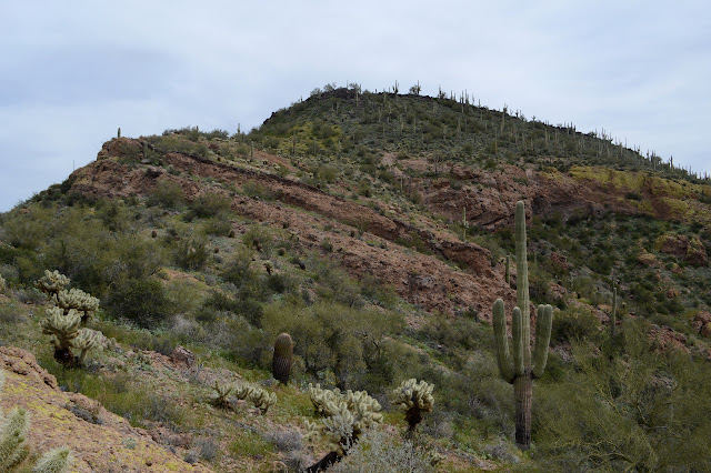
At the top is another set of signs pointing away from another trail that does happen to be the fastest way back to the parking lots. I started off with some thought about going up Hackberry Mesa, which is not far from the trail, but my experiences with unmaintained trail on the edge of Music Mountain made me hesitate to decide if I really would until seeing the area. Cats claw is not particularly in evidence, so I think I might. I follow the official trail a little bit longer until it hits a high point, taking great care around the rattlesnake sunning itself along the way, and start making my way up the hill. The high point is not the closest point, but the closest is not always the best.


I knew it was well warm enough for rattlesnakes. Just past the top is a blue line which is a dry, flat spot in reality. I make my way up and toward it using the areas least covered in vegetation that will attack. The creek often makes a nice place to walk, but it is randomly chocked off. Then there is an easy way around. And mylar balloons. I keep turning and finding another one until my new collection numbers four. I just keep on picking out a route without too much danger of spines or falling on a continuous climb. Toward the top, there is suddenly a cairn to help me figure out which way is up, I suppose. Two more follow me to the top.


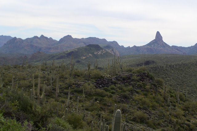
There is a newly placed register at the top. I hear a sudden crash below and turn to watch a deer bound away. I didn't even notice it until it was startled. Being a mesa with the high point over the area where I have just been walking, the new view is a little obscured, but there is some to it. I enjoy it all.


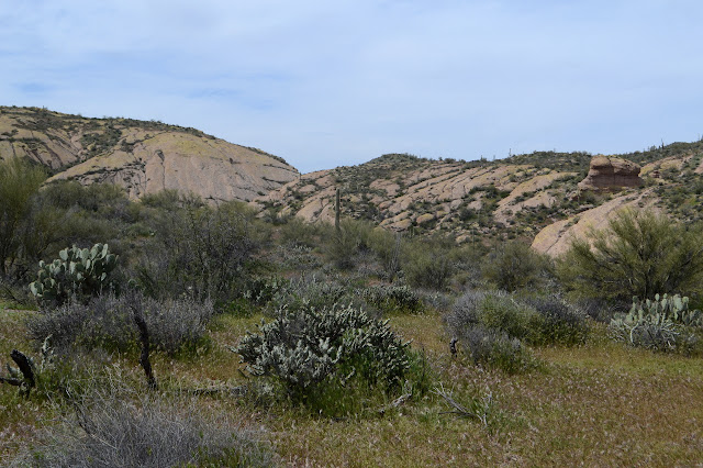
After heading back down, I was going to continue on the official trail, the turn to First Water to finish, but looking down on it all, it looks to me like going back to that last marked unofficial trail will be more interesting. Going the original way would mean touching my backpacking route of 2016. I guess that would mean that I have crossed the Superstition Wilderness, but I feel like I have anyway, although only the short way. More interesting wins easily. Now to make my way down. It looks like I could curve around at the top of some bits that get into low cliffs here and there to get down more directly and there are more cairns leading off that way, so I go ahead and try it.

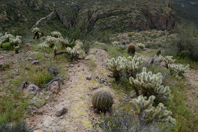
The cairns run out quickly, so I just have to feel it out. Getting down some broken up volcanic rock is easy. Getting through the carpets of yellow flowers is a little harder. Where to step without creating too much harm? Oh, and there's another mylar balloon to add to the collection.


One thing I did not notice from above is the fence. Maybe there was once range land on one or both sides of it. It looks in distressingly good condition. As I get off the steep hillside, I find I am standing on some old hunter's trail. Something about it is different from an animal trail. Following it makes the fence easy to navigate as the hunter took some wire clippers to it. The area a little past looks like it might have been a camp, so no more trail to follow. (Perhaps I should try to other direction.) So on to navigate the yellow stuff. There's a bit more cholla than in other places. I particularly notice it as I stretch my leg down the face of a short cliff and roll the unnoticed cholla dropping from the back of my shoe to the back of my leg. And then someone wants me to answer the telephone. That never happens. I'm just not very social. Especially not with cholla in the back of my leg.
Once the cholla is removed and I can go on again, I'm not really enjoying this route. The rocks are fine with good friction for walking down, but they have a bit more cliff than I was quite expecting and there is some rather steep slope toward the end that makes me feel about to slide. Also, I am definitely climbing down to a spot just below where the rattlesnake was. At least four groups have passed below while I sat at the top, so it probably has moved on. Will I "get to" see it again? Happily not. Once back on trail, I turn back to the junction and follow it along to First Water Creek once again, passing more random bits of old fencing from the ranch that was once in the area.


The trail gets hard to follow across the slick rock of one bit of creek that has water, but it is more puddle than flow. In fact, I can see a little flow upstream of the trail, but it quickly stops leaving distinctive pools downstream. When I get to First Water, it is flowing well.
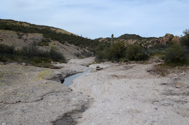

Just across the creek is more of the old ranch including an old windmill water pump. The creek is not quite reliable year round, so sometimes something else is needed. The pump is disconnected now. The trail I met going up the canyon when I first came to First Water Creek leaves from here. There might be an argument for making a couple loops through the area just to see what waits along the missed trail stretches. It is not in the plan for today.

I climb up and out of the, here, small canyon to the road, then head back along it to the start, then on a little further on a day that promises to be a lot sunnier than the weatherman said.

©2019 Valerie Norton
Written 3 April 2019
Liked this? Interesting? Click the three bars at the top left for the menu to read more or subscribe!


Comments