Timmy backpacking: Round the Mountain
Coronado National Forest
Click for map.
I want to go up Mount Graham and I want to do it right with some climb involved. It has 6300 feet of prominence, after all, and one should honor that. The sign at Round the Mountain Trailhead, the old summer CCC camp, says 17 miles to Columbine, the old winter CCC camp. I want to break off just short of that to take Deadman Highline Trail further up and across to finish coming down Noon Creek Ridge. I figure it for about 35 miles, which is too much for a day. That means Timmy, the cat, has to come with me, with all his limitations. He did a 5 mile day, hopefully he can do 7 mile days. That really slows me down to 5 days from probably 3 days. The big beautiful new kiosk at the trail says food has to be in the car or hanging in trees. I expect the bear canister is also okay and there do not look to be too many trees suitable for hanging food even where it hasn't burned, so that has to come. Oh, and there is snow up there and I got me some snowshoes, so those go too. The whole enterprise is almost certainly doomed to failure, but at least it won't be for lack of having an obviously necessary bit of equipment. There is a shorter loop heading up Gibson Creek after 5 miles, but I feel like when I fail, (er, "if", if you please) I'd rather have done as much Round the Mountain as I can.
Note: I hear rumors and innuendo about hiking in the "Red Squirrel Refugium Area" up at the top of the mountain. It says on OpenStreetMaps that all entry is forbidden, but there is an international observatory at the top and even if that thing is automated (as the winters here would certainly encourage) it still needs some maintenance, so that is obviously untrue. The Forest Service quad shows it, with very different boundaries, but does not contain the words "no public entry" as is common when public entry is not allowed, nor anything similar. I am looking at a shiny new kiosk with lots of room for more information at a trailhead that intersects a trail going to the top of the mountain in 5 miles, it certainly seems like the place to have information like that. It has a map that does not show the refugium at all, but does carefully highlight those trails within it as part of the "trail system". This rather strongly indicates hiking is legal. I will also enter the "Mount Graham Wilderness Study Area" in 2 miles. I don't know what a wilderness study area is, but there is noting to indicate it has the regulations typical of a wilderness. It's possible someone put the least amount of thought possible into the information presented here. There is a notice that pets should be on leash, which he is.
So I am off with my somewhat heavy pack and my handful of a leashed old man cat, down the steep path and over the creek. Oh, dear, why did I pack the hammock piece for carrying him? I knew he would need carried soon. He is not keen on getting carried across the creek, but I am pretty sure he would get even more unhappy if he got down in the middle, so I hang on while hoping the two big loose rocks along the way don't roll under me too badly when I step on them. He can walk again for the bit along the creek and the climb up into the burn. Very slowly.


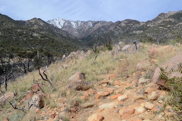
A lot of the trees that burned died outright instead of regrowing from their roots here. Some have managed to preserve a little. Maybe these oaks do not have that ability. I want to stop hourly to give Timmy a chance to eat and drink. Hydration is important for him too, and he doesn't have a drink tube like I do. The first hour comes a lot closer to the trailhead than I was hoping. I started late and now I am even later if I really want to finish off 7 miles today. At least I can get out the carry sling that shouldn't have been packed.


There is still a wooden sign at the junction with the trail to Noon Creek Ridge Trail #318, although the one pointing down the way I came has broken up into pieces. From there, the trail curves around past a couple streams that are almost flowing. I can see a little water in one. Then upward with a few switchbacks to the ridge top with another stop on the way for Timmy. The snowshoes are making a nuisance of themselves while getting out his food and water.

There is a ranch gate at the top where the wilderness study area starts. The "latch" side is tied up very tightly to the fence and overgrown while the other side has been undone and hangs loosely from a single twisted wire. The whole thing is twisted around. Someone appreciates ranch gates even less than I do. Handling the gate with an animal on a leash is even more delightful. He isn't sure what to do and has some very poor guesses. It is already lunch as we finish off the first 2 miles. But there is some new view for the stop.


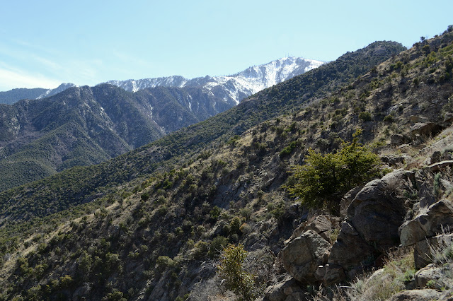
The view is actually a little better once we get started down the other side a little bit. About a thousand feet below, Marijilda Creek roars quite impressively loud all the way up here. Unfortunately, the trail condition goes downhill too. The tread is generally good, but the brush is often all the way across. It does not take long to encounter a couple downed trees, which aren't fun to negotiate stepping over with heavy pack and leashed animal scrambling under. It doesn't amuse me at all when he scrambles under the log that only stretches halfway across the trail. Then there is a boulder on the trail which he decides to go around first, then sits down in the middle of what little trail exists around it. All of this is on a very steep slope and is not making me feel safe at all.


Far below, I can see where the trail starts traveling from Marijilda Creek to Gibson Creek and a lot of white water where there should be a crossing. Creeks not crossable was one of my possible failure points for this trip and I'm not sure that this one is. It really isn't fair to judge it from way up here, but the roar is wild even at one thousand feet. Mostly it is clear I will not make it to Round the Mountain Spring, which is my proposed campsite, before dark at this rate and this was going to be the shortest day of them all. I'm not sure the creek is crossable, I don't feel safe negotiating the shrubs on the slopes with a leash, and I can't get the cat to do the miles needed, so I am turning back already to renegotiate all the stuff that was making me feel unsafe. No need to choose Gibson Creek or Round the Mountain after all. Then another nice, high resting spot to see if I can have a less grumpy cat if he has a bit of a nap.


And eventually we go down some more. We haven't even had a shakedown of my proposed system for keeping the cat with his needs met inside the tent, so I guess this can be that including a rather overloaded backpack. The junction is near the creek, so at it I take the other route. There are some flat areas to use there. A door and a few sheets of metal remain of whatever once stood in the area. Presumably the faint old road the trail up is sometimes coincident with once came here. Once the tent is up, Timmy seems to understand that is home, so that's one win. He sticks his nose in the collapsible "kitchen sink" full of dirt and tries to eat the dried grass blades that have also made it, so that might not work out. The other worry is the no food in the tent rule. It is bear country and food has to go away instead of being available all night long.
I am awoken in the middle of the night by a critter trying to find the opening in a door with no opening. Directed down to the bit of dirt, he still doesn't get it. The layout is even the same as the trailer to help him understand, but it's not working. If I'm honest, I have to go out too, so we both go out and I even give him a reprieve from starving all night. He doesn't seem to want to eat much. Well, then, back everything goes because it is cold out here.
time +1 day
Somehow this creature has gotten the middle of the tiny twenty inch mat that I'm pretty sure said was more like eighteen inches when inflated. It seems to have been a lot colder than camp was even though we are less than a mile away and not very much higher. There has been no use of the dirt, but also no accidents. It doesn't feel important to get up very early at all with so little to travel back, but laying down longer is just boring. I get up so Timmy gets up, but he sits at my feet and does full body shivers every few seconds. The little coat (that he hates to the core) doesn't seem to help much. Pulling up the top of the quilt so he can crawl under has an irresistible draw for him and then there is nothing of the cat but an immobile bump while I breakfast and sort out everything else.It has warmed a bit as I take away his shelter. The sun does get here nice and early and it is a clear day for maximum impact. (Also maximum cooling, but that doesn't seem to be the case today.) Packed up, I let him lead on the lead with a little bit of coaxing in the right direction. The dried grasses hit him in the face constantly because he and they are just that tall. The trail is a lot better than the getting to the trail. I am determined to go the last 3/4 mile to the corrals (according to the sign) all in one go and manage it with only a little carrying. He is still not happy to be carried, not even over the water. He is really happy to be back at the trailhead and campground and once near, takes off running for the site that I gave up to go backpacking. Lucky for him, those who occupied it the night before have left already.
©2019 Valerie Norton
Written 12 April 2019
Liked this? Interesting? Click the three bars at the top left for the menu to read more or subscribe!


Comments