Cortez Peak
Gila Bend Mountains, BLM
Click for map.
Cortez Peak stands out for its plainness to my eye, but I remind myself that when I'm on it, I'll be looking at all the other peaks. It's one of the higher ones of the area, besides Woolsey which is so much higher than the rest. It looks like it might have less cholla on it. With the distinctly different look, it could have different geology, different soils, and just not support so many of the things. Or it's just the fact that it's about three miles away and rather hard to tell at that distance. The route the surveyors took to place a benchmark at the top swings way back around Fourth of July Butte and then climbs up from a mining area on the northeast side of the mountain. I am sure that road and my car wouldn't mix well, so will walk the animal superhighways to the base and then up a spot that looks inviting on the map. I'll use the Yellow Medicine Wash for my approach and Loudermilk Wash on the way back for some different sights and see what the "Seep Tank" on the map is. The shorter route of these between mountain and road is Loudermilk.

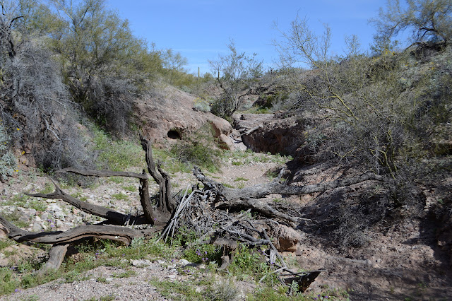
The first challenge is to get down into Yellow Medicine Wash. I could certainly try to walk along the side, but that will just mean having to cross all the smaller washes that empty into it. The sides may be tall, but there are spots that aren't so steep. I pick one and get over to it to follow it down. There seem to be old tire marks along the spot, but the wash has been left alone by vehicles for a long time and much of the sand feels solid under my feet. Travel is much faster along it, even where the sand is soft. There are animal footprints, coyote and deer, everywhere in the softer sand. It really is a superhighway for them.

Once in a while it does throw up an obstacle. All those animals traveling it means they are all easy to pass. The passage of hooves has chipped steps into rocks or there is an obvious trail around the side. One band of rocks seems to be holding in a bit of moisture and there are very small pools and wet dirt. The whole thing is kept clear by occasional violent storms that wash out anything trying to grow in the middle.


As I start to be able to see the hills all about instead of distinctive walls, the vegetation starts to offer itself as obstacles, too. The water volume must not be quite enough to clear it all out this far up. It is about time to start working off to the west and looking for my way up. If I go directly from the wash, I'll have a lot of ridge line to walk. I think another wash further west looks more attractive on the map. Up and out for me, almost tripping over a mining claim marker. So they begin. I just wander vaguely northwest over the slight hills. I can see a wash branch to the south that looks like it might have been a good choice for westerly travel, but the hills really aren't much trouble either.

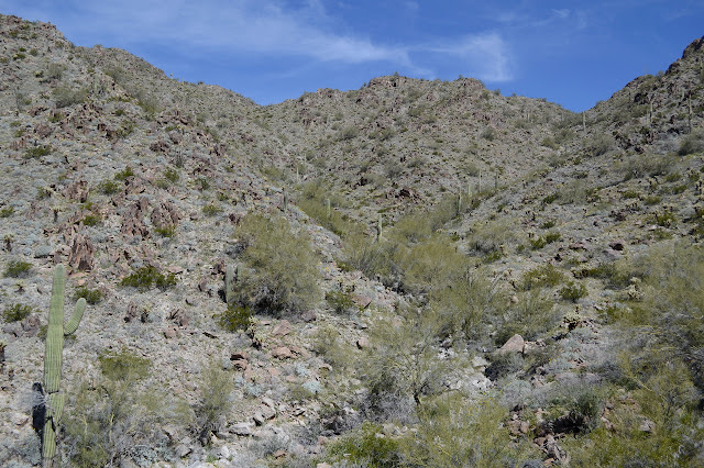
I have tended a little more north than might have been most ideal and seem to be coming to a large wash area on the mountain that is a little east of the one I was intending. Should I just go up this one, now that I'm at the bottom of it? Looking up the wash to evaluate it for climbing, there is no mistaking the cholla all over the mountain now. It is a little less dense, maybe. I seems particularly less dense on the more eastern slopes. The next one along will not have quite so easterly slopes, so I decide that I will climb this one. This time for a good solid reason rather than just because it is there at the time. And really, the ridge line of this smoother looking mountain shouldn't be so bad as some of them, so the extra length along there should be easier than some.


Getting past all the cholla is annoying, but I mostly get it done. One small piece rides my shoe to get itself stuck into my other leg, finally giving relief to the tension of anticipation of getting stabbed yet again that was making my stomach churn a bit. I hadn't even noticed how bad my stomach felt until it suddenly stopped. It also gives me two barbed pins deep in my leg that take a couple tries to remove. At the top, the ridge does have some sharp rocky sections with steep sides below, but I think I can see a line bypassing the first one on the north side. By the next saddle, I am on some semblance of a path.

The path very distinctly goes around the south side of the next outcrop and into the cholla garden there. There is always space for me, but it seems the two toes animals that walk this path normally are far more comfortable nearly brushing past the cholla than I am. At least the path is well defined through them. On it goes, until I am looking at the last climb. The ridge was not hard at all.

It gets much steeper for the last climb. It almost looks like there might be trail up the peak too. I'm not certain if animals would go over or around usually. They do their own thing. Still, I find myself trying to follow what trail there is upward. Just after starting up, I look back to see that I have just skirted the side of a big prospect without even noticing it. A bit of the mining came all the way up here. Below, I can make out the road that is the shorter route up. The gully looks nicer, too. For me, it is onward and upward.

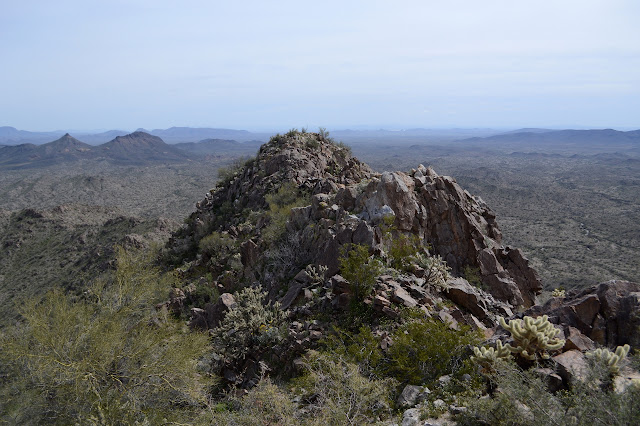
Then I am at the top. Well, I think it is the top. It takes a moment to locate the benchmark and references. The azimuth is described as "along the road" so I'm not going to look for that. There is one more peak just northerly that looks like it could be the high point. The benchmark isn't always at the very top. A little more looking and I can even find a register, last signed in 2013. One entry claims the real high point is the other one. Halfway through taking my break at the top of the peak, I notice the ticks. A few each of a couple different sorts are climbing their way up my pack. I guess you can tell how well used an animal trail is by the number of ticks crawling about after using it.


There are two rocky jutting things between me and the other peak. At first I figure, no, I really don't want to go there, but then start thinking I'm so far in and so close now, I might as well. Is there a trail around the edge? Maybe. In fact, yes, there probably is. It takes a bit of rock scrambling to get down, but around and up again is easy with only a couple threatening plants on the way. Looking back, I'm pretty sure I was already on the high point.


So it is time to go down. Since I am this far and didn't much like the climb up the last 300 feet, which had a lot of loose stones involved, I figure I might just try going down what is available here. Except on gaiter seems to have vanished. When did that happen? I head back up to the secondary peak and it is sitting right there at the top. The second try down the northerly bit of ridge doesn't get much further before I decide it is better to go with the devil I know. There is just too much steep and little cliffs and I'm not sure what is happening below me. I pause at the benchmark to add to my note in the register about my disagreement that the other peak is higher before heading down. Now the big hole of a prospect becomes a sign post to get onto the right ridge going down. It's actually very helpful that way, because some other ridges look much nicer.

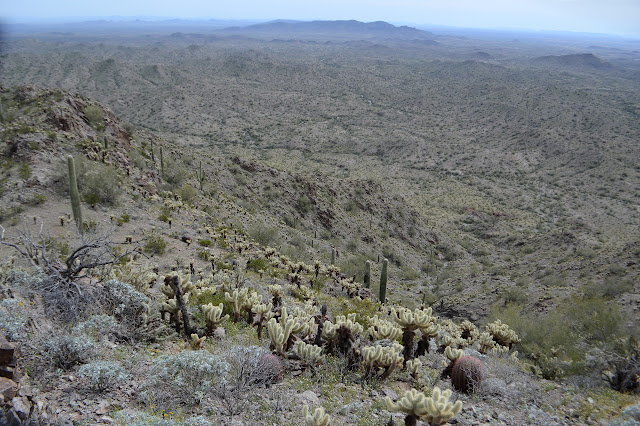
Back at the lower ridge level, I breath a sigh of relief to be off the loose, steep stuff on the upper climb of Cortez. As I squint downward at what I can see of the wash below me, I start to think that was a little premature. There are more cliffy bits all over the place and so very many cholla. Retreat! Retreat! The trail up here was easy enough. By the time I am ready to go down, I have retreated to the westernmost edge of the wash I came up, but decide I can cross back over the ridge and go down the one planned. There is a brief, uncomfortably steep, section, then it starts to improve. It has a lot of cholla to navigate, but I am on solid enough footing to do it and it just keeps getting better.

The main wash makes a wide curve around a bit of easy hills, so I flick another tick off my hat and just go over them following a minor stream cut. It grows and grows, but never quite has enough power or volume to clear out its bottom for easy travel until the main channel joins, at which point it has already developed walls that make it hard to get around a couple palo verde trees. After the main channel joins, it is animal superhighway again. Loudermilk Wash changes as it cuts across the landscape in a way that echos the changes of Yellow Medicine Wash.


There is a fence post along the way, and then I notice a bit of concrete in the bottom of the wash. I come to a ledge and look over it, down much further than anything so far has dropped. In spite of the concrete above, it is all natural rock. A pair of wildlife cameras point at it, or more specifically at the mossy pools at the bottom. I can't get down the rock, but the wildlife have beaten a very nice path around the side. I head down it and smile for the camera. They look very much like the one in use at the bottom of Telegraph Pass, but unlike that one I can't hear these clicking. According to the map, I have now found out what "Seep Tank" is. I suspect it corresponds to the layer where there was a bit more water in the other wash, too.


Suddenly the wash narrows down to a slot with high walls. It is not so narrow I worry I won't get through, but it is something that doesn't echo the changes in the other wash and fun to walk through.

After the walls open up, there are vehicle tracks. It seems quite a lot of people have confused the wash with a road since off road vehicle travel is prohibited. I know there will be no more obstacles to travel now except that the sand is soft and turns under my feet instead of holding me as it does where the vehicles have not been churning it up. The wash crosses the road in a ford where I take the left and start the road walk back to my start.


The road miles went even faster than the wash miles and I am back just in time to watch an amazing light show on Yellow Medicine Butte as the sun drops down under the cloud layer that formed over the afternoon.
©2019 Valerie Norton
Written 17 March 2019
Liked this? Interesting? Click the three bars at the top left for the menu to read more or subscribe!


Comments