California Coastal Trail - Arcata to Crescent City - hiking guide
Little River State Beach, Trinidad State Beach, Sue-meg State Park, Humboldt Lagoons State Park
Redwood National Park, Prairie Creek Redwoods State Park, Del Norte Coast Redwoods State Park
Introduction
The California Coastal Trail (CCT) is approximately 1200 miles of interconnected public trail following the coast from Mexico to Oregon. Or at least that's the dream. Currently, the trail is about 60% complete. In more populous areas, it often takes the form of boardwalks and multi-use paths marked by the swirl of blue wave crest. In rural areas, it may be pushed to the beach when that is usable, or to the nearest public route when that is not.
The hiking trail route of the CCT is largely actual trail as it passes through the Redwood National and State Parks. Humboldt Lagoons State Park and Sue-meg State Park south of these have more continuous beach and trail through them, with caveats. This seems like the sort of thing for which there should be a hiking guide. The closest thing I can find is the summary of the named sections through the Redwood National and State Parks. (Some of the mileages in these summaries have no relation to reality.) There are extensive details in the Humboldt County CCT Implementation Strategy from 2010, but I haven't found anything similar for Del Norte County. There are books on hiking the whole of the CCT. Considering the popularity of the Lost Coast Trail, another piece of mostly trail CCT, this particular section should have more interest.

Out of completeness, I will cover from Arcata to Crescent City, but the part of most interest is from Sue-meg State Park to the north end of the Enderts Beach Section. This has one long road section to cross the Klamath River and is otherwise short road walks between long trail sections.
Do not bring dogs. Dogs are only allowed on leash in campgrounds and parking lots in the various state and national parks. They are not allowed on trails.
Please do not bring hammocks. The parks are very attached to their trees and the things that attach to those trees. They do not appreciate hammocks no matter how thick your tree straps are.
Transportation
It is surprisingly easy to shuttle all or part of this hike using public transportation. The Redwood Transit Authority Route 20 between Crescent City and Arcata with numerous relevant stops along the way. If those stops aren't enough, they are also open to "flag stops". Passengers wishing to board at a flag stop should call ahead of time. (It might also be a good idea for scheduled stops as the place to wait may not be obvious.) Adult fares vary from $2 to $8 depending on how long the ride is and seniors pay half.Camping
The state and national parks all require camping in designated areas only. There are hike and bike sites in some of the parks and backcountry campgrounds in others. These have fees or require a free permit, respectively. Campgrounds that have not been removed have vault toilets. Two backcountry camps have been removed, so finding a spot at a private campground may be necessary if the camps are too far apart.
You may notice that none of the camping is under old growth redwoods. This is because people camping have a tendency to keep things "clean enough" and it isn't clean enough if there are crumbs around or orange peels, banana peels, or apple cores. These things attract scavenger birds that are not normally found in the old growth forests. These scavenger birds attack the nests of endangered birds who only live in the old growth. It is essential to be absolutely impeccable about food habits when in or near the old growth redwoods. (And please don't leave orange peels around normally. They are very difficult for the little bugs to digest. If somewhere else and you absolutely have to get rid of your organic garbage, all of it must be buried, not just tossed out of sight. Here, it must be packed out.)
A note on direction
Some people get really hung up on direction. I encountered a Pacific Crest Trail "thru" hiker who asked me why all those John Muir Trail hikers wanted to go south. He said you've got the sun in your face and all that snow on the north side of passes to climb up instead of glissade down. There are also timing issues that work out better going north. Meanwhile, those JMT hikers are thinking they are hiking up steadily more difficult passes until the Mount Whitney finale. They are generally hiking later in the year, so heading south means hiking up the cool side and down the warm side. The concerns are different when hiking only 9% of the trail rather than 100%.People hiking the CCT in its entirety seem to favor a southward direction. I personally don't see any reason to hike one way or the other for this section. I do agree that it is less pleasant to hike with the sun in your face, particularly if it is also reflecting off the ocean for double intensity, so I'm writing this in the northward direction. There is a strong contingent who believe south is the only correct direction on the Lost Coast Trail because there can be quite strong winds coming from the north. This can occur along these somewhat more northern coasts as well. This is a weather phenomenon one may never actually experience while on the trail. Admittedly, a visible sun is another weather phenomenon that may not occur, particularly in the summer when it can be very foggy for days.
While I am writing this south to north, I will try to make it easy to use north to south if that is your taste, and times being what they are.
Interactive map
Red lines (of various shades) on this map are trail sections while blue lines are road sections. Purple lines are some short excursions that might be interesting. (For the blue/purple color blind, they are easy to spot as they stick out without connecting to anything.) There are also a couple green routes that are possible. (For the red/green color blind, there are only three green lines and they contain "possible" in the label.) I have also attempted to mark camp sites, important bus stops, caution points, bathrooms, post offices, and grocery stores.Click to open this map in a new tab.
A possible trip:
I would start at Sue-meg State Park. (The heading for this section is red to make it easier to skip to it while not skipping the pictures when reading. I would give you a link, but I am feeling evil and want you to see a little of what you would miss out on.) I realize this cuts off nearly 30 miles and there are some very lovely spots along the way, but it is quite urban or at least road oriented. This could be split up into two approximately 15 mile days if there was camping at Moonstone, but there isn't. The stop at Sue-meg is a "flag stop" for the Route 20 bus. It is about 0.5 mile from the bus stop on the off ramp to the state park entrance.
Day 1: Sue-meg to Ryan's Cove Campground, 12 miles plus 2-3 for excursions because Sue-meg has a lot to see. (Also, register for the campground. Low tide toward the middle of the afternoon would be more opportune.)
Day 2: Ryan's Cove Campground to Gold Bluffs Campground, 16 miles. Gold Bluffs is the hard reservation to get, so a good thing it can be gotten online with the rest of them these days instead of just while passing the visitor center.
Day 3: Gold Bluffs to Flint Ridge, 15 miles plus 0.5 excursion up Fern Canyon.
Day 4: Flint Ridge to one of the many private camps in Klamath, ~10 miles. Expensive? Good day to resupply, if that's your thing.
Day 5: Camp in Klamath to DeMartin Camp, ~10 miles. Don't forget to grab some water at Wilson Creek before starting up off the beach.
Day 6: DeMartin Camp pushing on to the end, 14.5 miles.
About 77 miles total. For me, I've still got to find a place to stay because the bus won't run until the morning. It would really work better if Nickel Creek still existed as a campground leaving plenty of time to catch the afternoon bus back after checking out the lighthouse and other history in that area in Crescent City.
Sections
Arcata, ~6.5 miles
The CCT is seen as a braided route rather than one specific path. Primary paths (all marked as "needs improvement" on the Humboldt County report on the trail) pass to either side of Humboldt Bay. The east side goes along the not yet completed Humboldt Bay Trail while the west side follows CA-255 around and across the bridges. (There is even a comment about looking into the feasibility of a water shuttle to cross the mouth of the harbor. Don't hold your breath for that, the water is considered dangerous for small craft. Probably shouldn't try to cross in your own packraft either, but hiking the rest of the spits is easy on wide beaches below dunes.) Wherever one starts, make a way toward the Mad River Bridge on the south end of the Hammond Coastal Trail. The light blue line labeled "primary route" is about 6.5 miles from the transit station where you can get Greyhound, Redwood Transit Authority, or Redwood Transit System busses. It passes within 1 block of the post office on city sidewalks until arriving at the multi-use path along L Street. This is where it joins a proposed primary route. Turn north on the multi-use path. There are sidewalks again along Alliance Road, but they vanish quickly when leaving the city. Q Street and Foster Ave can have fast traffic. The rest of the roads tend to be narrow bits of pavement with no thought to walkers and little to oncoming traffic, but the traffic is light and slower.Hammond Coastal Trail, 6 miles
The bridge over the Mad River is the southern start of the Hammond Coastal Trail. (Related trip report.) This is paved multi-use path and low traffic road for its whole length. It is generally well signed. Near the halfway point, there is a choice to continue on paved road and trail to the right or gravel trail to the left. I find the left more interesting and have marked that. Right is shorter and with little elevation change, but no little taste of nature and creek. It passes within a mile of the airport before dropping to Clam Beach County Park.
Clam Beach to Moonstone Beach, 3 miles
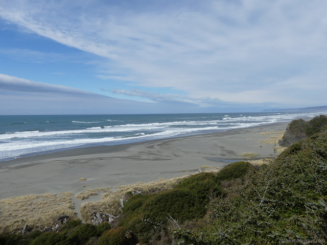
(Related trip report.) The paved multi-use trail may one day continue including its own bridge over Little River and a trail up to the end of Scenic Drive. For now, either go out to the road (no place to walk) or to the sandy beach (plenty of area to walk at all tides). The immediate trail out to the beach is often flooded in winter and it can be better to go a short way up the road to follow another trail to the beach. Stick to the beach until it runs out, just about. Little River is usually a simple, wet foot crossing near the surf. If not, it is possible and legal to go up to US-101 and use that bridge. (Little shoulder and fast traffic.) There is camping at Clam Beach County Park, but it probably won't make you happy. Strawberry Creek is just south of this dry camp. Little River State Beach and Moonstone Beach County Park do not have camping.
Scenic Drive and Trinidad, 4 miles
Moonstone Beach marks the end of the passible beach area and start of some solid road walk. Head to the parking lot and up the road, then follow Scenic Drive north to Trinidad. This is a narrow road, sometimes gravel, sometimes with a lane off the side of the cliff, with moderate traffic. There are frequent chances to drop down to the short beaches, but no chance to follow a beach for a while until Groth Lane. Follow Groth Lane and a driveway to the Parker Creek Trail, then take that down to the beach. Head west on the sand to a disintegrating cable stairway to climb up (difficult if muddy) to the memorial, then follow road and community trails down to the harbor. Alternatively, just continue to the end of Scenic Drive at Main Street. (The road continues as Patrick's Point Drive.) Turn west on Main. Trinidad has a number of private camping and lodging opportunities, mostly north of the city.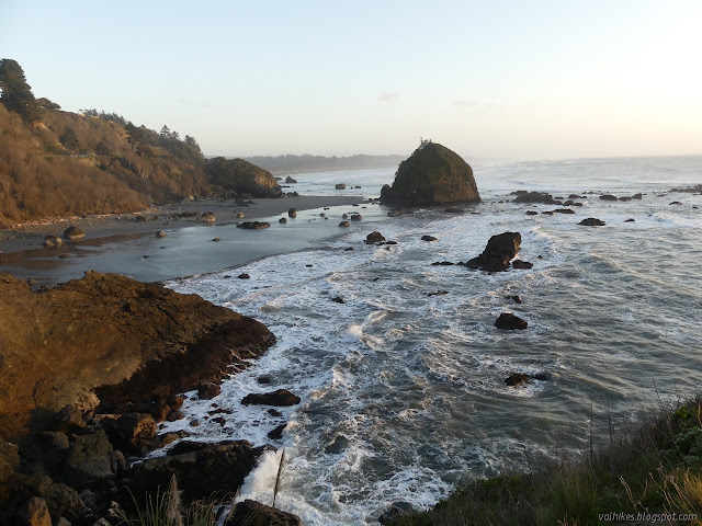
Excursion: Take the loop around Trinidad Head. If it is the first Saturday of the month, you can even visit the Trinidad Lighthouse.
Trinidad to Sue-meg State Park, 7-8 miles
Select a route along beach and trail to wander through Trinidad State Beach. (Related trip report.) Once at Stagecoach Road, turn north. This is a narrow road with tight winding spots that ends at Patricks Point Drive. Continue north on Patrick's Point Drive to the Sue-meg State Park (formerly Patrick's Point State Park) entrance. This is another narrow road with single lane areas.Sue-meg State Park, 6 miles
Enter the park and make your way via Penn Creek Trail to the Rim Trail. (Related trip report.) There is no fee to enter the park on foot or by bicycle. (The usual entrance fee is $8 per car.) Follow the Rim Trail around. There are numerous opportunities to head out to the rocky edge and some of the best tide pools. Inland, there is a traditional village and Ceremonial Rock. The trail finishes in the north part of the park. Continue along the road to the next parking area and follow the Agate Beach Trail down to Agate Beach and onward. The park extends down the wide pebble and sand beach for about 2 miles more.

There is a lot of camping available in the park including a hike and bike option. This is first come, first served and $5 per person. The car sites are reserved in the summer and cost $35 per night. Campgrounds have water and toilet and quarter operated showers. If wanting to stay here or at Ryan's Cove in Humboldt Lagoons, stop at the entrance station on the way. (There is no place to the north for southbound hikers to register for Ryan's Cove.)

Humboldt Lagoons State Park, 8 miles
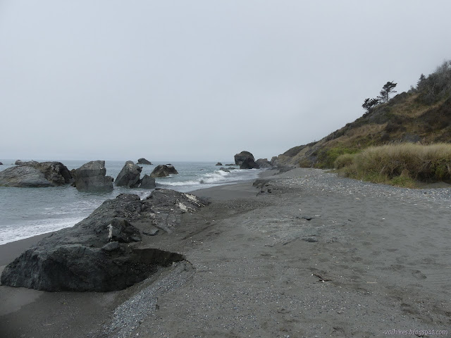
This is a whole lot more sandy beach hiking. (Relevant trip report.) There is a brief segment of beach that is not park below the community of Big Lagoon, then a brief segment of Big Lagoon County Park (camping available), then it's all Humboldt Lagoons State Park. First up is Big Lagoon with about 4 miles of barrier beach holding it from the ocean. This would be extremely unsafe in a storm. The barrier breaches at the north end some 6-7 times a year and may be impassible at high tide. From here, there is a half mile of rocky coastline below a huge slide. The beach washes out in winter and it may require a very low tide to cross.
An alternate route exists using fisherman trails that climb up a little at the north end of the lagoon, then traverse along difficult trail to a tree with a rope swing. Easier trail continues up from the tree to the end of a spur road. One must then walk along US-101 for two miles to the Dry Lagoon access road, then follow that back to the beach. The spur road is old highway, but there is no way to follow it 50 years after abandonment. It might be possible to traverse north along the slide to connect with trails from the closed environmental camp. (This would not be an easy traverse and is not possible when wet.) Water along the fisherman trails may be contaminated by toxic algal blooms.

Next up are Dry Lagoon and Stone Lagoon. (Relevant trip report.) The first was drained for agriculture, but that never really worked out. There is a wide beach and dunes. Trail actually goes through the low dunes. When the dunes end, it starts up into the bluffs under Sitka spruce and red alder. It is often muddy as it winds along, eventually with peeping views of the water of Stone Lagoon. Ryan's Camp is about 2 miles along on a short downhill spur. Take the left to continue around the bluff. The trail drops down to the lagoon for the final half mile. In winter and spring, this is generally significantly flooded. (This is a great time to have a packraft.) Once around the bluff, hike along the beach or dunes for another mile to the parking lot.
An alternate route exists using unofficial trail that goes west toward Sharp Point from the narrow spot along the bluffs. It is possible to go down the north side to the beach. Rocky areas on the west side offer better footing for a class 2 climb down, but only at lower tide. Other areas will be soft if wet and swallow shoes whole. (Yum.) The beach to the north is wide and easy to travel. There is also trail going south off the bluff to the beach that is only passable at low tide.
The Stone Lagoon barrier beach can breach in the winter at the south end. This is usually only twice over three years due to the much smaller volume of water draining into Stone Lagoon.

In the future, there may be a trail up and over Gyon Bluffs half a mile north of the parking lot. Until then, there is a 1 mile road walk up to and along the highway. The lagoon and beach access road is narrow and paved. The highway does have some shoulder, but it is minimal. It is also possible to go around the point at low tide, especially on a late summer beach.
Camping is available at Ryan's Cove, 6 miles from the south end or 2 miles from the north end. There is nonpotable water in the creek above the camp. The lagoon water is brackish, so not recommended. There are six marked campsites with tables, bear boxes, and fire rings, and a central toilet. Register at Sue-meg State Park (entrance kiosk) to use this camp. $20 per night for up to 8 people.

Redwood National Park near Orick, 6.5 miles
There's 2 more miles of sandy beach. (Relevant trip report.) In summer when the water is low, it is possible to cross US-101 and walk along beside Freshwater Lagoon instead, but you'll just have to cross back. Road traffic is drowned out by the crashing of waves if on the beach. There is a trail to connect the beach to the Visitor Center. Stop by for a free permit if planning to camp at Gold Bluffs Beach, Flint Ridge, or DeMartin Campground. (This is online for the duration.) Otherwise stay on the beach to the mouth of Redwood Creek (the park warns against drinking this water due to toxic blue-green algae) and turn east to follow it upstream. You may have to wade through the South Slough on the way.
Find a way up the rocks to the top of the levee and follow it through Orick. You can walk under the bridge rather than crossing US-101. The north side of the bridge has a sidewalk separated from traffic. On the far side, follow the levee some more. The post office and general store are among the first buildings on the left after the bridge. The levee is used extensively by locals and there are access trails to these places and more. The protected levee walk ends when the highway comes to occupy it. US-101 is narrow and winding with no shoulder with a little breathing room along a dirt turnout. It gets wider when it gets straighter. Look for a road on the left signed "Skunk Cabbage Section". Cross over carefully, take the right fork of this narrow gravel road to its end.

Skunk Cabbage Section, 5.5 miles
(Related trip report here and is written up at Redwood Hikes.) There are a couple really big redwoods to start this section off, but much of the area was logged. The trail is often noticeably on old road on the way up Skunk Cabbage Creek. There is a bridged crossing before it finally gets to a little bit of climbing. There is a signed viewpoint near the halfway point. It climbs a little more past some larger trees before following a drainage down to the beach. Some trees down, but obvious to follow. There are large signs at the bottom for southbounders to spot the way up. If they miss it, there's 1.5 miles of wide beach before impassible Mussel Point stops them.North is also wide, sandy beach with a few dunes before the bluffs shoot upward. Major Creek is the largest water source along the way. If you pop up to Davison Road at just the right spot, there's a sign marking the north end of this section, not that it's important.
Gold Bluffs Section, 10 miles
You're now in Prairie Creek Redwoods State Park. Hike the wide beach or road for 2 more miles to get to Gold Bluffs Beach Campground. A backcountry permit from the Visitor Center/online is required to stay here, plus a $5 per person fee. It wouldn't be crazy to stay two nights (or stay inland at Elk Meadow, also $5 per person at the hike/bike but not permit required) and hike a big loop over the ridge to Prairie Creek to see some of the biggest California coastal redwood trees. (Relevant trip report or written up at Redwood Hikes.) The camp has water, tables, bear boxes, and quarter operated showers. After the camp, there's 2 more miles on beach or road before trail begins again.
It is easy to miss the turn to catch the trail. There is a lagoon area somewhat north past the parking area. If people are around, they are probably coming from the parking area. Go to it and there is a signed trailhead. Follow this trail north to the creek. Trail gets difficult in this watery intersection. James Irvine crosses and climbs. Fern Canyon (a worthy excursion that most the people will be there to see) is in the creek going upstream. The CCT crosses, but does not climb. Follow the creek downstream slightly going north and the area forms back into trail. Keep to this at the base of the bluffs. There are three small waterfalls along the way. (Relevant trip report.) It is possible to do another 2 miles on the beach instead, but it does miss attractions and variation is good for the soul.

Things get confusing again near Ossagon Creek. (Relevant trip report or written up at Redwood Hikes.) Follow the signs and there are bridges across the wetlands in relevant places on the way to the beach. (Finding the trail from the north can be hard also. It is half a mile south of a choke point. Drift inland and pick up a trail to follow further inland and south. The trail that turns north and climbs the hill is Ossagon Creek, which is not the primary route.) The beach comes to a narrow point half a mile north of Ossagon Creek that may require a tide below 4 feet to cross. It gets wider as it goes north about 2 miles total. Just past another creek is Carruthers Cove Trail climbing a mile to to the road. The beach ends just a quarter mile past, so it can't be missed, but it might be hard to spot.
At the top (which only has a small sign for southbounders to find it), turn north and follow the paved road to its end. There are no shoulders and can have more traffic than one would expect for people not going anywhere. The county line is around here somewhere, so wave to Humboldt and greet Del Norte. You're also back in Redwood National Park.
Tey-wo-lew Section, 5 miles
(Relevant trip report or as written up on Redwood Hikes.) This follows a closed section of Coastal Drive high above the waves. There's even an interpretive sign at a turnout. The Alder Conservation Camp is just up the hill, so leave the inland spur road unexplored. The use trails near Split Rock might be interesting, but dangerous, to explore.
It runs into the still open part of the Coastal Drive. This is one way traffic headed north on a dusty gravel road. There's a lookout point (Overlook Bluff) just down the hill that can be nice. Go a bit more than a mile north to the signed trailhead for Flint Ridge. Along the way, there's some WWII history on a short spur.
Flint Ridge Section, 5.5 miles
From the signed trailhead, Flint Ridge Camp is just 1/4 mile up the hill. This camp is dry. Klamath River will be brackish and suffers from toxic algae. Richardson Creek offers a little water at the other end of the section, but is not easy to get. There must be little streams along the Coastal Drive, but they are hard to find. There is a trail down to the beach from the west end of the trail and this passes water (a trickle in summer) just before reaching the sand. A permit from the Visitor Center/online is required to camp here. (Relevant trip report or as written up on Redwood Hikes.) Climb a little further and the spruce get replaced by redwoods. These might be the best redwoods along the trail, so remember to enjoy them. Down at the bottom, there's some stumps before coming to an old mill pond. Turn right at the dirt road and find the trail again a little further to continue around the mill pond to the trailhead beside the old Klamath Bridge. Stop a moment on the bridge to appreciate how big this river is that would just wash away such a thing.
Klamath River roadwalk, 8 miles
Maybe if you've got a packraft, you can just hang a left and find a way down and make your way across the river to the public boat ramp on the far side near the mouth. The very big river. (Is it safe? Which way is "uphill" will depend on the tides.) Then follow the road up, take the left, and continue to the Klamath River Overlook. There's quite a bit of traffic on the river. Maybe you can even stick out your thumb?
Otherwise, there's the new bridge. It's about 2 miles up the road. It has no shoulders. It has people zooming by at over the speed limit. The main bridge is straight so people can see you, but the part over the overflow is a big curve. Oh, and you're out there for about a mile. Then it's a long way through Klamath still on the highway. Finally turn off at Requa Road, which is signed. Follow it to the Klamath River Overlook. It would be nice if there was a bus stop at the south end of the bridge and another at Requa Road.

Klamath Section, 4.5 miles
(Relevant trip report or as written up on Redwood Hikes.)This starts at the signed trailhead at the overlook. The view is better if you take the excursion down to the actual overlook, which is left at the signed junction. The section is right at the sign and looks much less used. This follows old road above the ocean. Listen for the barking sea lions on the hidden beaches below along the central section, which doesn't see enough maintenance and has trees down. There's a very short route down to the not hidden Hidden Beach if you are missing being in the sand. Just before that junction is a trail east to US-101 that accesses some private camping options and Trees of Mystery. Near Lagoon Creek is trail east to the old mill pond and picnic area. Keep going north and you are dumped out onto the sand. (This trail is difficult to find coming south. There are posts set in the sand to help, but they are hard to see. It is about 1/8 mile before the beach ends.) The barrier rocks protecting the US-101 roadway are impassible at high tide, so you may have to use the shoulder for some of the beach walk. Keep on going to the Wilson Creek picnic area.
DeMartin Section, 7.5 miles
(Relevant trip report or as written up at Redwood Hikes.) Cross US-101 and there is an almost helpful sign at the corner. Supposedly, you can continue down the road here, take the first left (probably past a closed gate), cross the creek (when low enough), and follow old road up to the trail. Really, you should probably get some water for this dry section, then start up the bridge with no shoulder. They could reline it to make the passing lane start a few feet along to give pedestrians enough room, but they haven't thought of that yet. The trail is signed on the far side on an old road. Follow it up under the Sitka spruce and red alder. As it passes under some power lines, there is chance to go astray. Keep straight on through the grass and horsetails, climbing, and you will come upon the trail making a way through the trees once more. (Southbounders, keep straight and continue dropping.)
DeMartin Campground is about 3 miles in. A free permit from the Visitor Center/online is required to camp here. It is dry and in some seasons the closest water will be Wilson Creek at the start of the section. The north side of the trail is even drier than the south side and in all seasons, the closest water is near the road. There may be a flow about a mile south at the end of a switchback or water in the pond.
Continue along the trail, ignoring the extra trail to the west (it goes about 1/2 a mile to the road) and on to Del Norte Coast Redwoods State Park. The new park comes with some redwood trees. The trail gets onto the other side of the ridge and the shelter from the salt is enough to allow the redwoods to flourish. The trail stays flatter on this half until one last steep down and up to connect with the road. (For southbounders, this trail is next to a memorial grove sign, but there is no trail sign.)
Last Chance Section, 8 miles
(Relevant trip report or as written up at Redwood Hikes.) Cross US-101 carefully to the signed trail on the far side. This just goes up a little, then around the ridge, replacing a bit of road walk to a gated road. The junction is signed. Turn north and start walking on the old road. It's long and flat and these might be the best redwoods along the trail. No need to put them in a competition. Enjoy them all. But these are pretty good.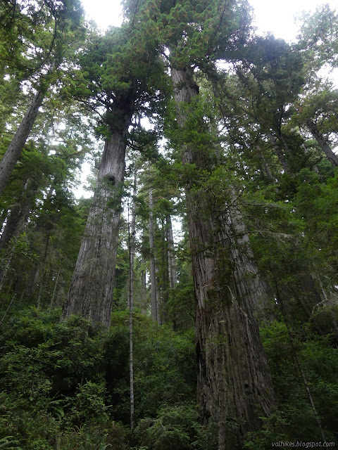
Excursion: There's an option to hike down to the mouth of Damnation Creek for a little beach and tidepools. You'll have to go around the closed bridge to get there. This also gives the best access to the water in Damnation Creek because it flows better near the bottom and it is crossed by a bridge at the top. This is another rather dry section.

After Damnation Creek Trail, the road continues until the actual Damnation Creek. A bridge has replaced a washed out crossing on fill, after which the road is much more like a trail. It swings south and west for a bit before turning north again, leaving the redwoods for the ocean roar. A viewpoint shows off Crescent City. Continuing north is under red alder and Sitka spruce. It climbs on an old logging road with logged forest all around, then drops more and more steeply down to Nickel Creek and the still extant crossing on fill. (Also crosses back into Redwood National Park.) Nickel Creek has plentiful water that can be accessed by trail spurring east or heading west to Enderts Beach. The camp was removed due to fears of slide dangers on the north side of the creek and the trail gets closed in the wet season for the same fears. When open, it is just half a mile to the parking at the end of the section.
Enderts Beach Section, 2 miles
Past the parking area, a trail starts that parallels the road, crossing it once before ending at Crescent Beach. One can follow the beach toward Crescent City for a while here. Walk around the harbor to the lighthouse, which is as good a place to end this as any.What's next?
The Bigfoot Trail starts (or ends) at the lighthouse, which means you are perfectly situated to turn around and start hiking it. Have fun and good luck!There's still some creaky and thin spots in this guide. Suggestions, criticisms, more information can be added via comments or email. Encouragement of illegal camping will be removed.
©2021 Valerie Norton
Frist draft up 5 May 2021
Liked this? Interesting? Click the three bars at the top left for the menu to read more or subscribe!


Comments
You'll have signal in Crescent City and Trinidad and McKinleyville and Arcata. The big cities north of Trinidad along the way are Orick with almost 400 people and Klamath with a little over 600. There may be no signal there. I certainly don't have any, but I have a cheap Sprint reseller. I have usable signal in Arcata and Trinidad and I see signal I can't use in Crescent City. Consumer Cellular, which uses AT&T and T-Mobile, is the usual for locals.
Updated now because Patrick's Point State Park is now named based on the much older area name: Sue-meg State Park. Since I walked Tey-wo-lew again (so much better in the sun) I added notes about water. Specifically, I only saw it at the bottom of the use trail to the beach from the parking on the west end of Flint Ridge. It's an adventure trail. It has ropes on it, although those seem excessive to me. I wandered the Stone Lagoon area again, in summer, and the points are rather easier to pass with the extra sand on the beach, so that is noted.
Generally speaking, posts for hikes on the California Coastal Trail get tagged with CCT, so can be found here.
Cell coverage notes: good T-Mobile coverage at Stone Lagoon and nearby. Nothing in Prairie Creek, plus some south and north. It's good north of Overlook Bluff. (My provider has morphed into a cheap T-Mobile reseller.)