I must admit, I was sort of out to check off trails I had not yet hiked in Pairie Creek Redwoods. On the list is Ossagon Creek and Hope Creek, which are handily across the street from each other. If there is a little time after, then Carruthers Cove as well. I did not plan to do the two together because what I read about the Coastal Trail in between, which just follows the beach, implied that it wouldn't be possible to do unless the tide was quite low because the beach had washed out significantly. I expect the source of that information knows that there is some seasonality to beaches and didn't just happen to come in summer before, see a grand beach, then come again in winter and see much less. Anyway, I got parked, crossed the road, and got going down, which actually requires a short climb at first.
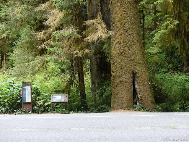
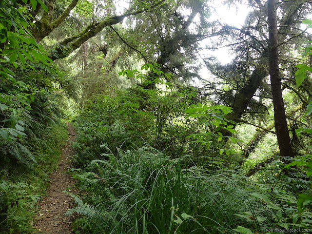
Detailed signs at the trailhead with hike suggestions and trail regulations and a map on one, a little something about the local ecosystem on the other. The trail is excellent, but the trees were getting lost in the low overcast stuff. They're still super massive.
Trees on the far side of the hill were generally smaller. The trail wraps around some redwoods with dark burn a long way up the sides, then down past a varied forest. It took a while to hear much water running and when I did, I barely saw any even when standing in the middle of the bridge over it.
Some merely large trees with long black stripes up the side from some old fire. Looking upstream from the bridge over Ossagon Creek. I see a beach below.
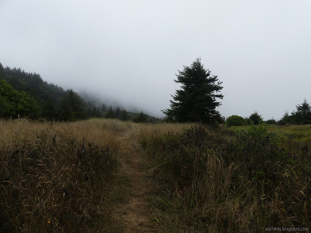
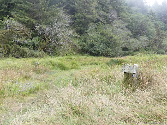
The trail goes pretty quickly. The trails multiply when it hits the flat. It looks like it crosses the creek again, but there's been trees down and more to block it now. I turned right for a trail along the side and found a sign rather randomly by a grassy field. There was no junction, but one would have expected it to be. I came to a puddled crossing and climbed a tree a little to get across with dry feet. Then the trail ran into a well used track through the grass heading both ways along the coast.
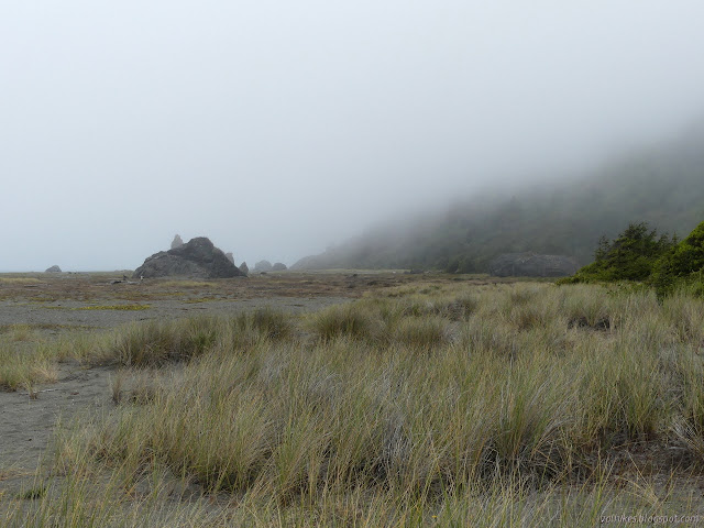
Looking the other way. The coastal hills from the bottom. At the track through the grass and turning south.
I figured I would do the half mile down to the loop I did recently for the rather silly sake of completeness of this section of Coastal Trail. The path split into two well used tracks again and I went right because left seemed to turn back the way I came. I ended up traveling to the beach over a seasonal bridge. I guess that's official trail. At the beach, feet just scatter, generally going north.
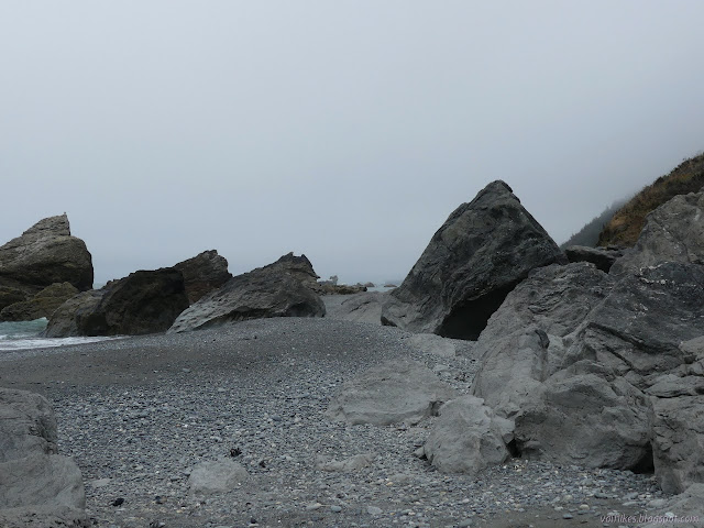
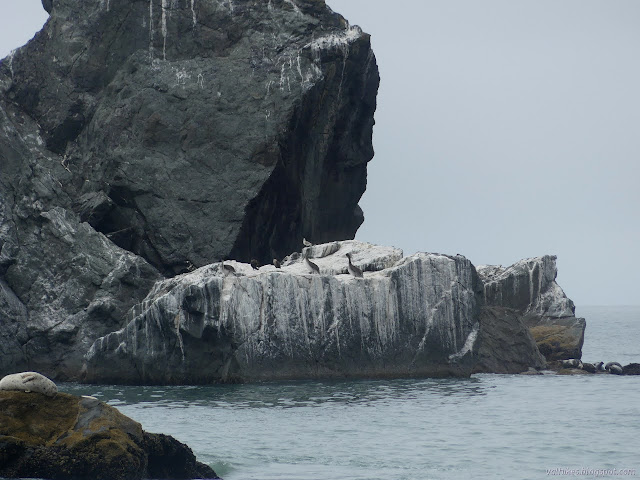
The seasonal bridge over a pool of water tilts a bit. They seem to often tilt a little wonky somewhere along the length, but generally have rope side rails. Ossagon Rocks on the beach. I had heard a family coming down behind me. It looks like they turned right at the big track to get more directly to the rocks. Two of them are toward the left side of the near rock. Blooms on the beach. This appears to be yellow sand verbana.
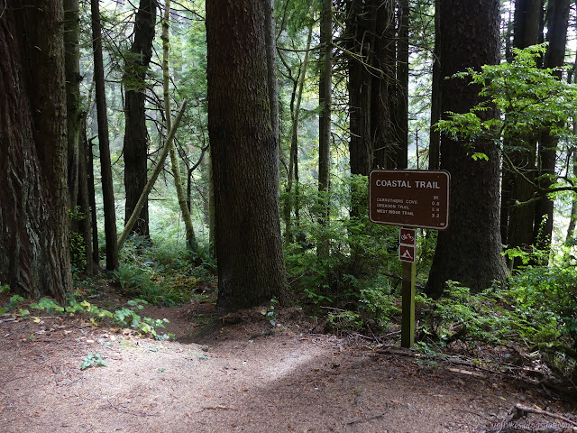
Since that was Coastal Trail the other direction, I turned back to try the other route. It didn't turn back so much after all, just got back toward the trees on the way past some more signs and probably the former location of the vanquished backcountry campground. According to them, I'd come from the Coastal Trail and another bit of trail I'd missed is Ossagon. It's just a web of trails.
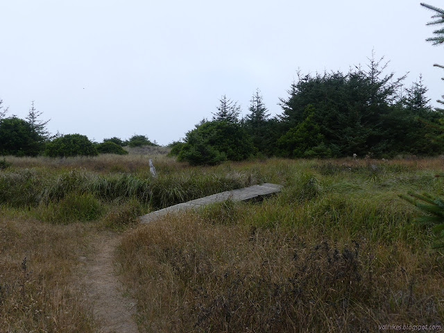
Signs trying to keep things orderly in the grass. They've both got the cute little blue swirls to mark the Coastal Trail.
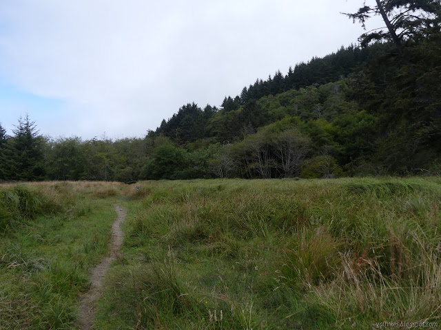
Things got a lot more orderly as it got up into the trees. The half mile passed quickly except for one small slide area to navigate.
Comfortable little green bit along the Coastal Trail. Arriving at the loop I did a couple weeks ago. This is the shortest and easiest way to get to it without driving miles of dirt road.
Having connected my trails, I turned back to poke around Ossagon Rocks like the family that came down behind me. I followed the signs for Ossagon Trail since I'd missed that bit and conducted another partial tree climbing crossing of the puddled creek before running into the track through the grass once more and taking the right.
A little mule deer with little fuzzy antlers coming in froze so I wouldn't notice it. There could certainly have been a camp here, but there could have been one in a lot of other spaces. Trail just goes gooey as it gets to the area over which creek water flows. Another view of Ossagon Rocks.
I found trail making a direct way northerly and followed it through the sparse vegetation until it suddenly just wasn't. From there, I tried not to stomp too much vegetation while continuing northerly around the rocks.
Watching the cormorants through the rocks. The rock tops are encrusted with a dudleya of some sort. Ossagon Rocks from the far side. The tire tracks on the beach aren't from anyone legal.
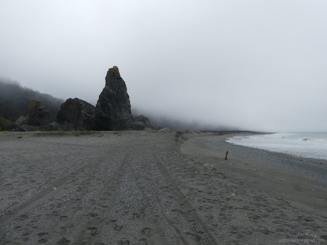
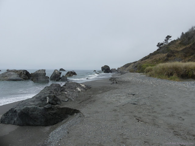
As I continued north, the beach did seem to narrow down to nothing until there is a clump of boulders. At first, they appeared to be getting washed with waves and offer no way around. As I got closer, I could see a way around although a few feet would have to be timed. I didn't actually check the tide charts before leaving since I didn't expect to continue along the beach, but my reading of the beach was that the tide had recently been high and was going out. Also possible was that a larger wave had happened along and the tide was coming in. I'm really not confident in my ability to read the beach that way. I need more time to study it. Anyway, I decided I could risk getting past the rocky spot and at least see what was beyond. If I got desperate, I could follow the other desperate steps that have clambered in the clay like dirt of the bluff.
Looking ahead, it doesn't look promising for getting past. The ocean was particularly flat. A spot where a little water comes down to the ocean. The dark lower layer looks to have a clay consistency.
I had a lot of time to cross beside the one rock and get up on a log wedged between it and another, far above the gentle waves. Then I had to crawl along the well sanded log to get between the rocks. It was easier than it sounds except for my insistence on having a large camera hanging from my neck. On the far side, I just had to walk around a few more big rocks and there was wide beach before me.
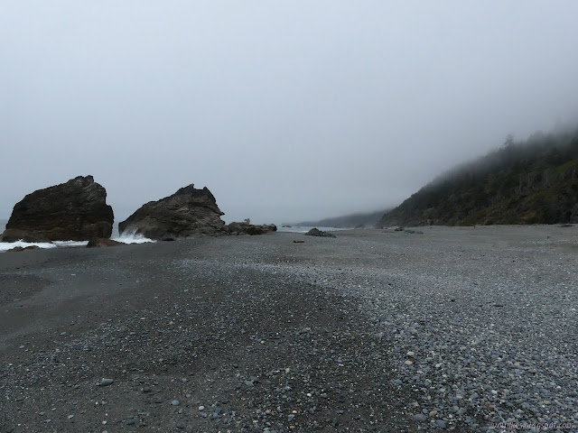
There's plenty of dry beach around these rocks to walk easily. Then there's nothing but beach for a good long while. It's a bit over a mile to the next trail up.
Facing that much beach, what could I do? If the tide was coming in, it certainly wasn't going to come in over all that beach. There were way too many footprints in the sand to all be since the last high tide. I kept going.
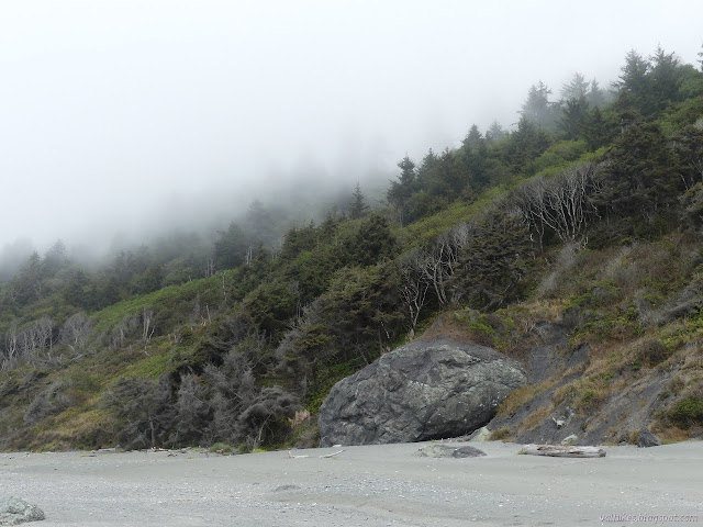
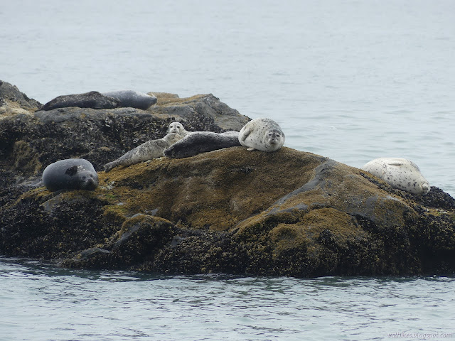
The salt in the air kills off the vegetation that gets too much exposure causing the vegetation on the hill to be sculpted into a gradual increase in height. The high tide line is easily seen as a much more dense area of shells on the beach. There are old footprints above, but not below. Pelicans and sea gulls on the higher rocks and harbor seals on the lower ones. The harbor seals are alert, or at least a few are, as they lounge on their rocks. I also saw a head in the water a couple times.
I found another batch of large rocks that looked washed by the ocean, except I'm fairly certain there are ways past further up the beach. I didn't need them to get past. There were even more footprints on the beach as I neared the trail. I walked to the far end of the beach where driftwood logs had been thrown, noting a likely spot for the climb up. The footprints seemed to fan out from that area, adding confidence to my identification. First, a bit of lunch on the smooth logs.
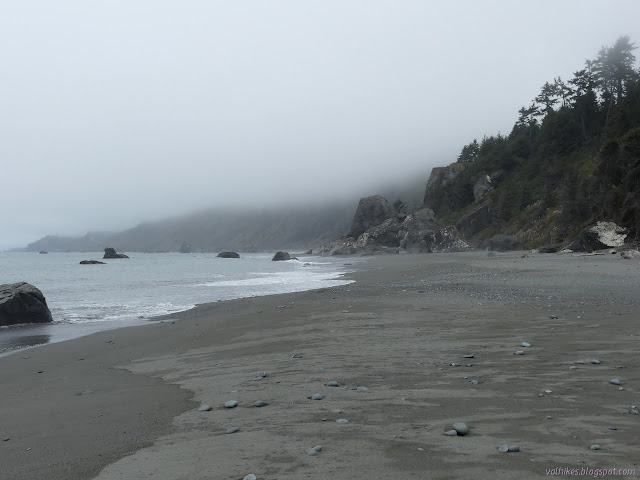
Another spot of big rocks, but these don't cut off the beach. The only mildly difficult spot was back by Ossagon Rocks. Johnson Creek comes down here and vanishes into the sand. The trail should be just north of the creek. A reddened point rises above the tumbled boulders as a sign post of the finish of the beach section of this part of the Coastal Trail. Pondering the way the footprints gather in the sand. Past here, it becomes impassible, at least at this tide.
After eating, I headed back to the trail heading up. I had not been wrong in the location. It quickly becomes a wide trail on an old road. Carruther's driveway since the area is Carruthers Cove? It's a little direct about getting to the road above.
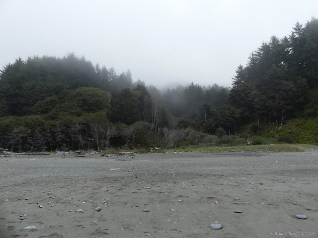
The last view of the beach. It is interesting to see how the salty winds sculpt the trees in the bottom of the creek bed, but not those at the sides. Tall trees of spruce and alder and increasing redwood. One redwood was making it rain from the fog to the western sword ferns below. The sign at the Carruthers Cove Trailhead is a little more basic. It still shows mileage. There is a turnout for parking nearby, too.
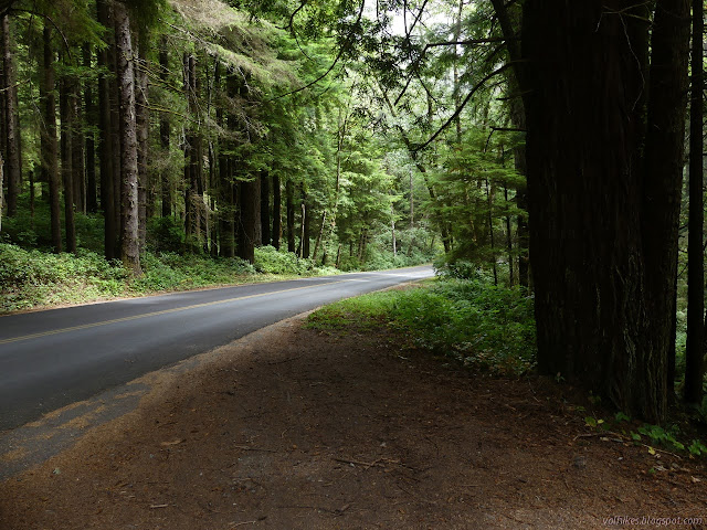
The next section of actual trail that is Coastal Trail starts a short way further up the paved road where it ends. I've actually already hiked it, so did not go to see it. Instead I turned to the unfortunate side effect of making it past the rocks, which is the road walk back. I suppose I could walk the trail back, but since I wanted to do more after, I went ahead and went with the road. There was quite a bit more traffic that I expected on the dead end road and it was no worse, just faster, on the parkway.
I don't remember this road being wide enough to support a yellow line or very smooth, but that new paving is on top of wider old paving.
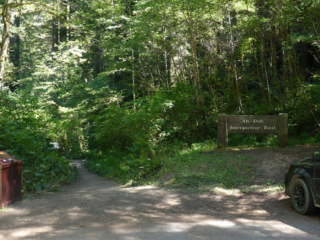
There's supposed to be a trail around memorial groves along the road. I saw the sign for the groves, but no trail nor parking in the area. I wasn't really looking for a trail, either. I stopped at the Ah Pah Interpretive Trail as much to have a break from the road walking as to check its short length off my list of hikes I've not done.
The start of the Ah Pah Interpretive Trail.
The signs along the way are about the removal of an old road, particularly those areas where it partly blocked creeks, in order to restore the ecosystem. This particularly helps out salmon. There was another sign back at a turnout near the Carruthers Cove Trailhead that was about the effect of salt winds on the coastal vegetation which is more my style. I was even admiring its work on the way to that sign. Here, I can try to admire the goneness. There are pictures to help on one sign.
Narrow, but tall trees along the old logging road. Admiring the goneness of the majority of a large, twisting tree.
The trail ends at another memorial grove in audio range of the current highway. Still, the trees are tall and straight and getting ever bigger. I headed back and finished off the road walk. Less than a mile all downhill, it went very quickly. I felt pretty good about getting in more than I'd expected I would.
Liked this? Interesting? Click the three bars at the top left for the menu to read more or subscribe!
Comments
Anonymous said…
Hi how are you? I hope that very good. I'm talking to you on behalf of Suda Outdoors. We would like to share some of your photos on our account (@sudaoutddors) with our community. Clearly tagging you as the photographer in the photo. Stay tuned, thank you very much!
Uncompahgre National Forest (map link) The Forest Service seems to be uncertain if it is Lake Hope or Hope Lake, but more certain that it is the Hope Lake Trail. It consistently marks the road up to the trailhead as a 4x4 road, so I parked in a turnout at the bottom and started up, getting increasingly grumpy about how it is a rather good road with a loose rock here or there. I chatted with some campers about how it was probably great all the way up, but they'd gotten to their rather brilliantly picturesque site and been sufficiently mesmerized by it not to continue on. Talking with them got me sufficiently emboldened to actually stick out my thumb at the truck that came by as I finished the chat. When you're going 5 MPH anyway, it's easy to stop, and he did. Greg was going for the hike too and actually wouldn't mind having a buddy. The road promptly turned to something it wouldn't be wise to try the Scion on. With good judgement, I probably could make it, but...
Humboldt-Toiyabe National Forest ( map link ) I had a big day planned and got up in the early cold. That first dim, dawn light played in a band across the western peaks of Lamoille Canyon. The edge of it diffused downward into the rest of the canyon and then the band was repeated, this time with the first light of sunrise. It took a lot longer for the edge of this light to travel down into the bottom of the canyon and I was long on the trail by the time it did. Trailhead at the end of the road. Detailed signs about possible destinations are a short way down the trail on the left. Looking behind to a long canyon of shadow A pleading to stay on the trail in this fragile environment There are two trails to choose from for going up. The hiker trail travels the east side of the canyon, so would be cold longer, but would look across to the lit part of the canyon, which I hoped would make for better photographs. The stock trail climbs the other side and I could see it sitting...
Apache National Forest Click for map. What struck my fancy to hike while at Quemado Lake was Escondido Mountain, although I'm not sure how one can get away with calling a 1800 foot prominence peak "hidden" is beyond me. It has no trails up it, so I have to determine my own route. Escondido Trail caught my eye first, but it really doesn't go high up the mountain and it doesn't do it on one of the steeper slopes. The road it starts from looks like a better bet, follow it up as far as it goes then grab the ridge tot the right. The easiest way up, though, looks like a 4WD road that starts further south on the (should be) Scion friendly Baca Road #13D. This one climbs high up to a saddle west of the peak leaving less than a mile of ridge walking to the top. Although it means a couple miles road walking on something I can drive, I think I'll combine the two into a loop. I just have to find parking near the intersection of 13D and 4018J, which is pretty eas...
Klamath National Forest (Map link.) It has been a couple years since I actually did some trail work besides kicking the odd log and a lot of sticks off the path. There have been some excursions by the Siskiyou Mountain Club that got far enough south to tempt me, but none had worked out thus far. I noticed they would be working out of Clear Creek for five days and that sounded long enough to make it worth the drive. Is it odd that these California trails are getting a lot of maintenance by people from Oregon? Yep. I also notice that the folks driving out of Ashland are actually a couple miles closer to the trail than I am. I'm coming from another county too. Judging by the license plates on the way, it looks like more people from Oregon are using these areas too. In fact, you can find it covered in guide books for southern Oregon. Thursday The lower (last) parking area at No Mans Trailhead with the traditional burn area hazards signs marking the trailhead itself. The wo...


Comments
Hi how are you? I hope that very good. I'm talking to you on behalf of Suda Outdoors. We would like to share some of your photos on our account (@sudaoutddors) with our community. Clearly tagging you as the photographer in the photo. Stay tuned, thank you very much!