Zigzag #2 to Fern Canyon by West Ridge, Friendship Ridge, and California Coastal Trail
Prairie Creek Redwoods State Park
Click for map.
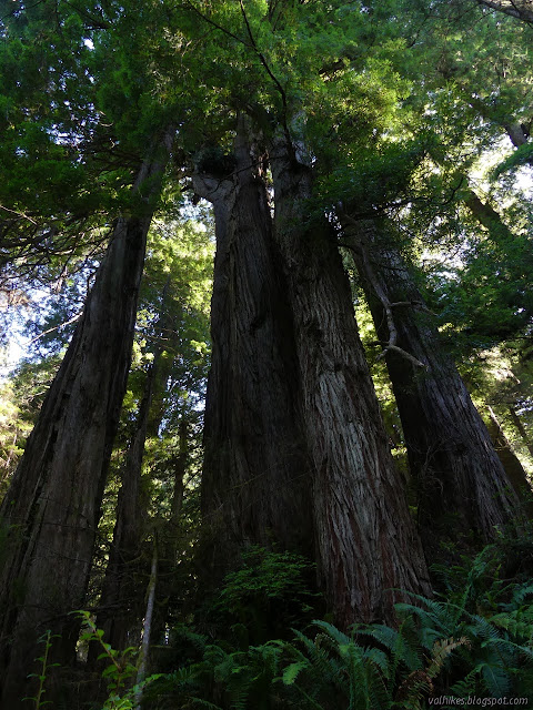
It is my opinion that on any given day, Prairie Creek Redwoods State Park will have the best weather anywhere. Well, at least it's most likely to have good weather. It is possible a few other people have heard, or maybe it was just that it was a Friday, because there were quite a few people in the various turnouts. There were fewer as I got north and by Zigzag #2, there were only two cars there already. This is actually the north trailhead for the Prairie Creek Trail and the spot I crossed the road to start back when I failed to find any rhododendron blooming along the Rhododendron Trail. It's too late for those now, but the redwoods are always about and tall.


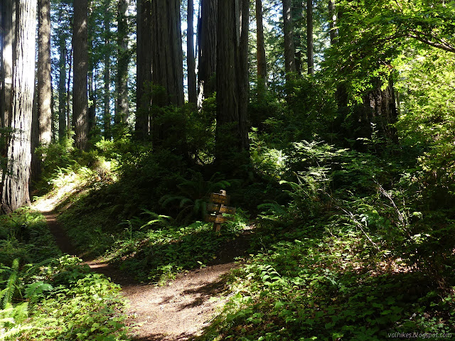
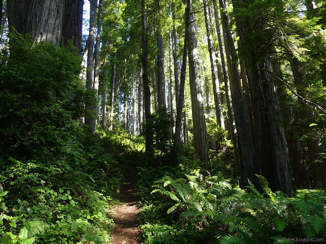
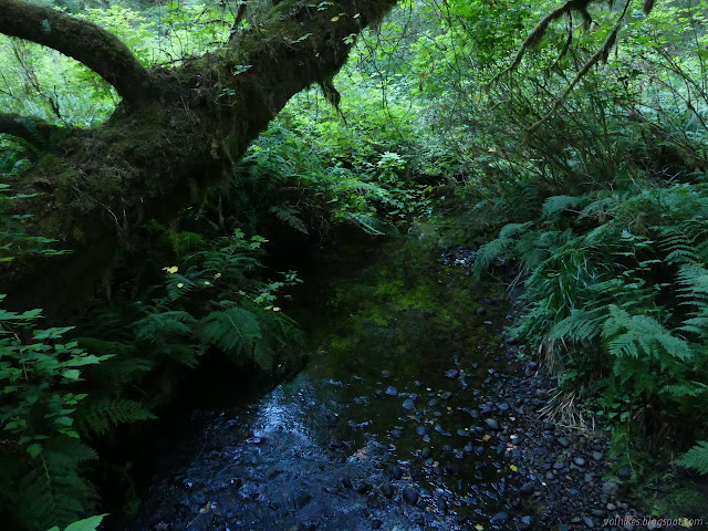
Everything is well signed. The Prairie Creek Trail turns south and Zigzag #2 turns north looking like it will follow the creek the other way. It crosses the shallow creek, a little further, and then turns to climb. The zigzags are short as they climb to the ridge trail above. There are a several, then a longer stretch, and several more. It flattens out a bit on its own ridge just as it arrives at West Ridge Trail.

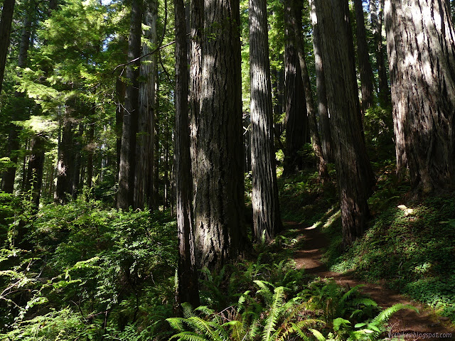

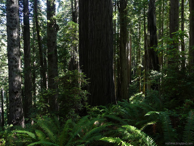
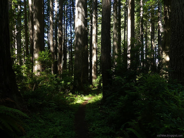
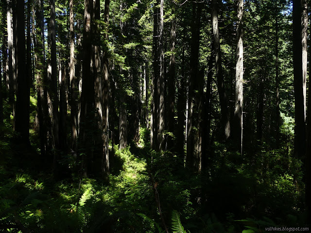
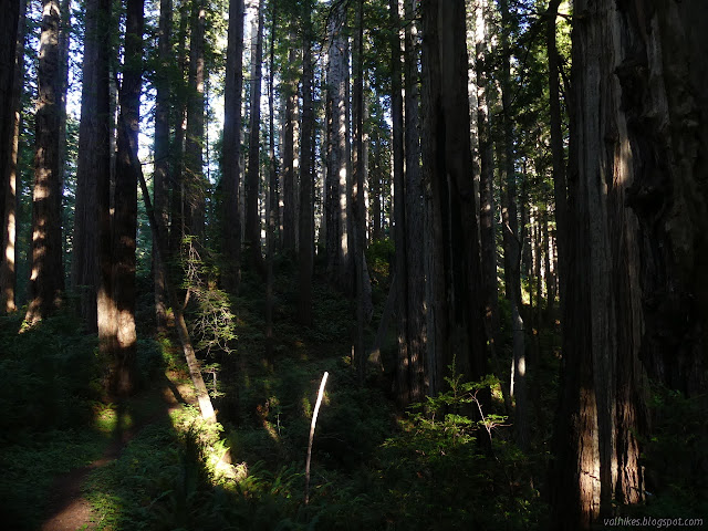
There's memorial groves up on the ridge. One even has a little trail, but it doesn't go very far at all. I very much enjoyed walking along the ridge top trees, their multitude being very visible down on either side. The ocean roar became very audible along one section above the crease of a creek.
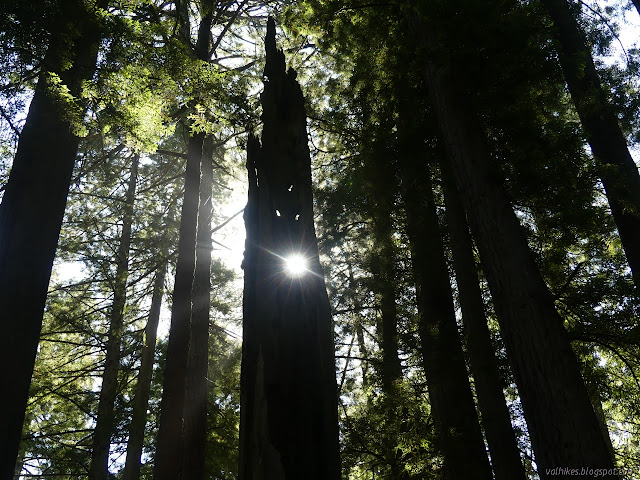
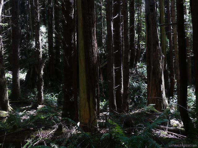
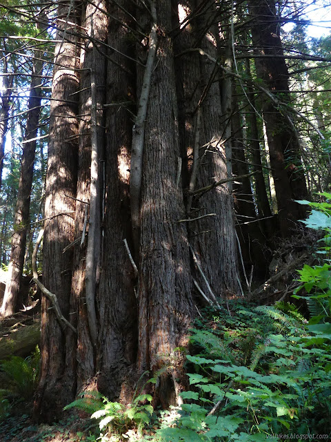
Then I saw the stump. I had not been expecting that. Past the first stump, the trail is on an old road and there are more roads that travel down toward the ocean. There's a bit over half a mile that was logged, and not that long ago. The area is thick with tiny redwoods. It is crazy to see an area of just four huge stumps with more than 100 tiny stems trying to take the space for themselves. The forest is dark and the floor thick with the litter of discarded branches and fallen trees. A few big trees were left. One with crazy iterations wasn't good enough. A pair that were shortened by a storm weren't worth cutting. A row of four, each with a burned strip down the side were left for later. Otherwise, the forest is like a crazy tangle of thin wood.

If you look at the old USGS maps, they show where the road came up from the main road below and a Zigzag #3. Neither is apparent as a path now. I wonder what became of #3. The evidence of destruction ends and ocean roar is audible as the trail becomes trail again just before the junction with Friendship Ridge. I turned left for a clockwise circuit and met the first people of the day on trail. There were four groups going counterclockwise all nearing the top of the ridge. Perhaps I was going the "wrong way". Near the top is a trail marked as memorial groves which I suspect is the Boat Creek Trail marked on the park map.


I passed another group before coming down to Irvine Trail where backpackers were just passing. I could hear a lot of voices. Some of them, like the backpackers, were even German. I walked the short way down to Fern Canyon, where someone greeted me in the traditional way, "Is this the way to the waterfall?" It must be traditional since I got the same greeting last time I was in that spot. As the waterfall is somewhere up the coast and that junction is inland up a creek, no, it is not the way to the waterfall. I decided to wander through the canyon again even though I knew it would be stuffed with people. I'd thought it might not be. I thought I saw the state park web site saying the road was closed for repairs and the bridges weren't in yet. Maybe I imagined it. Neither was true. Even with the bridges, I didn't make any attempt to keep my feet dry this time. The canyon wasn't crammed in shoulder to shoulder, but there were a few dozen wandering about. There were more Germans and others from Europe mixed in. I thought travel between counties was difficult at the moment. Did I imagine that too? One can only hope. That more than half the people wandering the place were wearing masks suggests not.


I got to the James Irvine Trail again and went up the steps to see of that's where the California Coastal Trail is. It isn't. I just ended up having to pass a couple more groups who had decided to circle back from their short jaunt up the canyon. I went down and tried again just following the canyon down. That worked. I just had to avoid anything with a sign indicating that it was marshy beyond and I should very much keep out.

I was sort of expecting to end up on the beach and making my way on sand to the next bit, but the trail actually travels a lot like the road does, just inside the trees below the cliffs. There's a wide expanse of not-quite-dunes before the beach and the waves I couldn't see. It doesn't stay within the trees and comes out into spots I suspect become shallow puddles when it rains. I could see remnants of the old road it followed within the trees, but wasn't going to try to follow those when everything it dry.


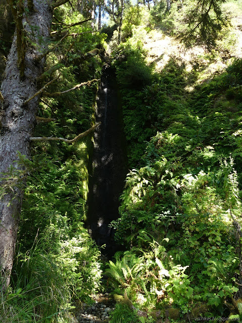
The trail dips back into the trees once in a while and along one I could hear water falling. I'd made it to the waterfall. Well, not so much the waterfall as a waterfall. There are actually three in close proximity and I expect the middle one is the waterfall. All have little trails up to the base, but the middle one also has a bench down by the main trail and is slightly more flow.


I continued on, noticing no more possible waterfalls. There are a couple spots where there might be streams, but they have canyons.


The next time the trail gets into the trees, it is on its way to the junction. There is no bridge over Butler Creek, which isn't all that big. There probably was one once as there is another nearby. A little sign points the way up West Ridge Trail once again. It also points the way to a trail camp in another half mile. That's where I would want to do my backpacking to. Too bad it has been removed.


I briefly thought about checking out the trail camp, but decided to leave that to another outing. I headed up the steps and past a sign proclaiming me safe from tsunamis. The trail looks like it was once a road. It follows beside the creek, but I couldn't see it running down below the short cliff. I heard some sounds like water falling into a pool shortly before the trail crosses the creek. That must be where the cliff sided canyon starts. There's probably another waterfall to check out there somewhere.


The trail on the old road starts climbing steeply up along the ridge.

I found more memorial groves, many with benches, once at the top. I dreaded passing the junction a little. It means quickly getting back into the cut forest. Not only is it a mess, but the trail drops off the ridge and into soggy areas with lots of low growth along the way. There is encroaching vegetation an mud to worry about.

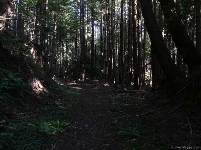
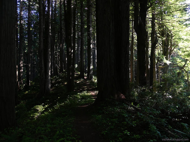
I enjoyed the light in the forest as the sun got lower. Back at Zigzag #2 I had to decide if I wanted to continue on to Zigzag #1. Yes, I did want to stay up on the ridge a little longer, but I felt my legs were voting against. It would probably be past sunset when I got back if I did that. Truthfully, the only deadline is when parking along Newton B. Drury becomes illegal at 10PM. One can wander these forests a certain amount in the dark. I headed down the same wiggling track I climbed in the morning.
There was still one other car parked in the turnout. It was one I'd seen in the morning too, so I wondered how far they were going that they managed to hike even longer than I did.
©2020 Valerie Norton
Written 15 Aug 2020
Liked this? Interesting? Click the three bars at the top left for the menu to read more or subscribe!


Comments