Posts

Showing posts with the label Uncompahgre National Forest

Blue Lakes: the return

Image
Uncompahgre National Forest DAY 1  |  DAY 2 (map link) I had trouble getting up until I decided I didn't really want to go back up to the upper lake and then up the pass. Then the morning just seemed to flow as it should. It got me tucked in under my kitchen roof just before the rain started again. I ate breakfast to a soundtrack of thunder, which settled things nicely against going up at all. It cleared up after that, but based on the weather report I'd gotten the afternoon before, it would be a good idea to finish by noon when the heavy rain would start. Camp site view as the mountain gets some sunshine during a light rain. I tried to dry things out a little before packing up, but it is always a ridiculous attempt. The wetter things are, the wetter they are all around. The sun is weak in the morning. The time to dry things is out in the open under the noon day sun. Morning under the trees really doesn't work. I shook things out and stuffed them away and then...

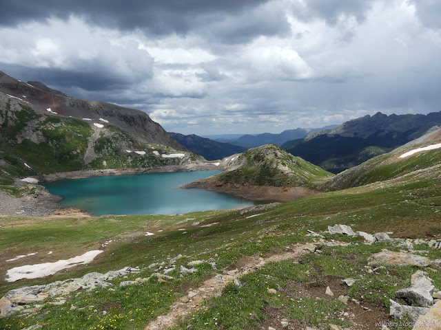
Blue Lakes: exploration and the lakes

Image
Uncompahgre National Forest DAY 1  |  DAY 2 (map link) I had a plan for a more elaborate Blue Lakes trip than the typical, and extremely popular, up to the first lake, the second and third lake, the pass, or the peak trips. I was going to start off with a little adventure! Well, exploration. Well, I'd already poked around on the sunny morning of a day that was supposed to rain all the way through and found the old road where segmented, blobby white lines on the map happen to be. I'd been up about half a mile, so that was known to be solid road with a well used path. The rest, though, exploring! The road went up the mountain quite a ways and there were more segments suggesting a connection to the Blue Lakes Trail. I figured I might go up to where there is a reliable creek shown and, after getting to the end of the road, might camp by the creek. I expected it was a mining road once and had visions of ore carts and other oddities strewn about once I got to wherever was t...

Hope Lake

Image
Uncompahgre National Forest (map link) The Forest Service seems to be uncertain if it is Lake Hope or Hope Lake, but more certain that it is the Hope Lake Trail. It consistently marks the road up to the trailhead as a 4x4 road, so I parked in a turnout at the bottom and started up, getting increasingly grumpy about how it is a rather good road with a loose rock here or there. I chatted with some campers about how it was probably great all the way up, but they'd gotten to their rather brilliantly picturesque site and been sufficiently mesmerized by it not to continue on. Talking with them got me sufficiently emboldened to actually stick out my thumb at the truck that came by as I finished the chat. When you're going 5 MPH anyway, it's easy to stop, and he did. Greg was going for the hike too and actually wouldn't mind having a buddy. The road promptly turned to something it wouldn't be wise to try the Scion on. With good judgement, I probably could make it, but...

Sheep Mountain

Image
San Juan National Forest Uncompahgre National Forest (map link) I had thought a bit about hiking up Sheep Mountain, checking it out as I hiked across Black Face and along the bottom of Lizard Head. With the sniff of signal at the top, I'd downloaded what Peakbagger could tell me about it. One person stated that they had found an old trail through the forest, but it wasn't going to where I wanted to approach the top, so I decided not to follow that track. I might have had a hiking partner for this, but when many days of rain were promised by the weather machine, we both ran for somewhere that wouldn't get quite so muddy and slick. He had scouted a route through the forest and reported that there was a lot of downed trees. That's not surprising considering how many standing dead trees you can see in this forest. With things dryer (but not dry), I decided to return and get something out of the effort of thought already expended. I headed out from the corral from muc...

Black Face and Lizard Head

Image
Uncompahgre National Forest San Juan National Forest (map link) I don't know why, but yes, it is really called that. It doesn't call itself that, so I'm not holding it against it. The sign at the trailhead suggests this is a popular loop with the Cross Mountain Trail and, if you can't get together a shuttle, about 2.3 miles of highway. Ugh. But that's what I set out on, with a plan to divert over to the pass above Bilk Creek to check out that distinct view that is rather close to the trail. The weather, so far as I knew, had a slight chance of thunder storm all day. There's trees up there, so I decided to risk it. I walked over from my dispersed camp at the corral across the highway (a large area set up for the purpose) to the trailhead to start the loop. The weather, so far as I knew, had a slight chance of thunder storm all day. Lizard Head Pass from the trailhead. The sign below marks the boundary between San Juan and Uncompahgre National Forest. Th...

Lake Fork Trestle Bridge

Image
Uncompahgre National Forest (location) You can find out a little bit about the train that once moved gold and goods and passengers through this area at the Lizard Head Interpretive Site right at the top of the pass. Across from that is the trailhead for one of the segments of "single and double track" trail that follow the route of the tracks, now long gone. One thing that does remain is the trestle over Lake Fork. (A fork of the San Miguel River.) I walked over and had a look at it. Even on the trestle, the tracks are long gone. The trestle from the side. Another view of the trestle, from above the road crossing the river. The coming of Lake Fork on the other side of the road. ©2022 Valerie Norton Written 6 Jul 2022

Uncompahgre: Middle Fork Cimarron River

Image
Uncompahgre National Forest DAY 1  |  DAY 2  |  DAY 3  |  DAY 4  |  DAY 5  |  DAY 6 Today will mostly be road walking to get back to my parking at the trailhead on the East Fork. It is sort of like a small payment for a great hike, and may not be all that "expensive" anyway, since the area is so nice. I think I am within a mile of the trailhead, but did not notice the trail up Porphyry Basin, which might have been an excellent spot to camp, yesterday. That would put me quite a bit further up the trail than I think. Down by the Middle Fork Cimarron River and down in the trees. The wilderness boundary follows the river along here and so signs dot it in the middle to say so.

Uncompahgre: Coxcomb Pass

Image
Uncompahgre National Forest DAY 1  |  DAY 2  |  DAY 3  |  DAY 4  |  DAY 5  |  DAY 6 It was a chilly night, but only because my flat spot was next to a little leftover snow and the ground next to it was still quite cold. Today is all valleys and passes and just seeing how far I get. Packing up, I cross the creek and swap my shoes for the hikers. It is just easier to wade it than to find a crossing spot. The trail drifts upward again, away from the trees and back into views. Looking down Middle Canyon. And back along the trail in Middle Canyon. Trying to leave Middle Canyon.

Uncompahgre: Wetterhorn Peak

Image
Uncompahgre National Forest DAY 1  |  DAY 2  |  DAY 3  |  DAY 4  |  DAY 5  |  DAY 6 Wetterhorn Peak also has fairly close access from the road and sitting up on the hill, I can watch them wandering up the trail. One group seems to be moving a little oddly, dawdling here and there and popping up on rocks waving their arms about. They pass by the junction as I finish breakfast and I am sure they are past by the time I have everything cleaned and packed, but end up startling them a bit as I pop out from behind the trees. We chat as we attempt to navigate the creeks without getting wet feet. It seems I have fallen in with some famous climbers out showing a brother and his son some class 3 climbing. Up on the edge of the basin, there is a pair of skittish elk. We pass by large number of marmots who are not skittish as the green meadows yield to snow. Climbing up Matterhorn Basin to Wetterhorn Peak. The target for t...

Uncompahgre: Uncompahgre Peak

Image
Uncompahgre National Forest DAY 1  |  DAY 2  |  DAY 3  |  DAY 4  |  DAY 5  |  DAY 6 Things are wet in the morning from a few brief rains overnight. Today is an short day starting with a day hike attempting Uncompahgre Peak and I can leave the camping gear to dry while I do that. A couple posts can be seen climbing the hills, marking where the trail passes. The trail climbs very steeply to the first one along a couple tracks. A couple elk on it last night took the less steep one, and I agree with them. The snow is fairly solid when I hit it, sometimes a little too solid. The snow fields around Wetterhorn Peak look difficult to deal with leading to worry about getting up this slightly higher peak. The section of the San Juan Mountains to the south start to reveal themselves. Snow fields are under Uncompahgre Peak, too, but now I can see the trail avoids much of it. One day hiker is along the ridge ahead. ...

Uncompahgre: Silver Jack Mine

Image
Uncompahgre National Forest DAY 1  |  DAY 2  |  DAY 3  |  DAY 4  |  DAY 5  |  DAY 6 The night was cool, but not freezing. Today, I will find out if it is too early to get out of the canyon because of snow. It is all melting just about as fast as it can. A little breakfast, a little packing, and I am set to really start the trip. I drop back to the trail below and start up the gentle slope beside the East Fork once again. The crags across the river from camp in the bright morning light. The few columbines along the trail are the least frilly I have seen. A glance up the East Fork.

Uncompahgre: East Fork Cimarron River

Image
Uncompahgre National Forest DAY 1  |  DAY 2  |  DAY 3  |  DAY 4  |  DAY 5  |  DAY 6 The Colorado backpacking loop I found last year was stunning, so now I am out for another. This year I chose a loop mainly in the Uncompahgre Wilderness following different forks of the Cimarron River up and back down connecting over the ridges to the south. This gives me access to two 14ers with trails most the way up. All this depends on the snow, of course. It is a little early in the season and a late snowfall may mean I cannot get out of the canyon, much less climb a mountain that is 14,300 feet high. I have been casting my eyes toward the San Juan Range for the last few days, and they do look very snowy. It seems unlikely that I will get out of the canyon and I am a little resigned as I collect everything together. The day hikers who went up to the Silver Jack Mine do not offer much hope. The trailhead says "no camping" so I stu...