Sheep Mountain
San Juan National Forest
Uncompahgre National Forest
(map link)
I had thought a bit about hiking up Sheep Mountain, checking it out as I hiked across Black Face and along the bottom of Lizard Head. With the sniff of signal at the top, I'd downloaded what Peakbagger could tell me about it. One person stated that they had found an old trail through the forest, but it wasn't going to where I wanted to approach the top, so I decided not to follow that track. I might have had a hiking partner for this, but when many days of rain were promised by the weather machine, we both ran for somewhere that wouldn't get quite so muddy and slick. He had scouted a route through the forest and reported that there was a lot of downed trees. That's not surprising considering how many standing dead trees you can see in this forest. With things dryer (but not dry), I decided to return and get something out of the effort of thought already expended. I headed out from the corral from much closer to the highway where gravel and hill slopes prevent the mud fest that can happen deeper in the camping area. I headed for the forest, aiming at the far western ridge where the cliff bands dissolved into smooth, steep slopes.


I followed game trails, the bigger the better. I reasoned that the better game trails should be using the easier places to travel. It did seem to be working out to fewer trees to jump over and marshy bits to wade through. There were lots of little streams, and so bogs (or fens?) were obstacles along the way. True to game trail form, they would find somewhere hard and just vanish and I'd have a bit of work getting through an area, but then I'd find another that might even be stronger and was going my way. The animals were largely picking the easy routes.

I was nominally traveling toward some bare spots, although really for just a bit east of them. The map showed a finger of land that I suspected would be extremely tempting to follow, should I come to it. I tried to go around, but it not only proved tempting, but really a very nice way up to tree line and did put me on the slope in a good spot for getting around the cliff bands.


I emerged from the trees to find clouds already puffing into energetic existence all around me. Do I really want to leave the trees? I went on, expecting that it wouldn't take the next 15 minutes to roll into a massive, dangerous storm. It can come on very quickly indeed. I expected to have a few hours still, and that was all I needed.


I turned upward and found a very good trail heading upward and to the right, getting past the rocks without any climbing involved. From there, I just walked upward on the flower covered slopes. I still tended to the right, but not too far. I still used a few game trails for an easier climb. Mostly, I had solid footing all the way up to the ridge.


I reached the ridge to find a gaping bowl below leading off to Trout Lake. The ridge itself had a small trail leading up to the peak that wasn't too much further. I could see where it was raining already. There were distant rumbles too. This sky was capable of danger, but it wasn't quite ready yet here.
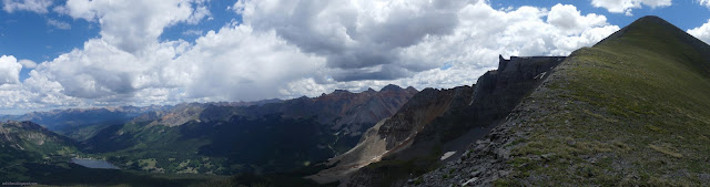

I got to the top and took in the view. There would definitely be no attempt on San Miguel Peak, the high point of this group. It isn't at my skill level anyway. I could see why the track of the others had continued on to an unnamed point. It is clearly higher than Sheep Mountain after only a small dip.


I was still feeling fine about the weather, in the short term anyway. I decided to continue on to that higher point too. I was seeing the rock off the end separated from the grass, but it isn't all that. The high point isn't the grass, it's the rock. That could be done, too. Perhaps. I got very uncomfortable when I saw the ladder.
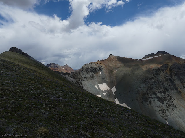
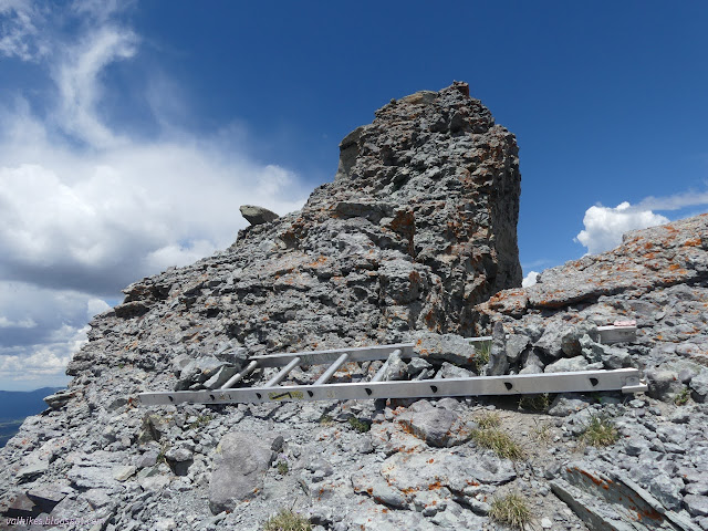
Okay, why is there a ladder? Is there a gap to bridge? Something vertical and unclimbable? Someone just thought it would be fun to haul it up here? I left it undisturbed as I continued toward the top. Neither of the first two are apparent. I dropped my pack before starting the last climb. It is across path sized bit of rock and then up about 5 feet with lots of holds. After that, there's another climb, but you could probably reach up and touch the high point. I climbed the first bit and it was immediately apparent my fear of heights has returned.


I had to fight shaking and freezing and the fact that I CAN'T SEE WHERE THE HOLES ARE TO PUT MY FEET not to mention these rocks BREAK OFF A BIT! And look at it, it's practically cracked off already. It could go at any time! But it's only 5 feet. It's shorter than I am. That path may not be wide, but it's plenty wide enough to catch you if you fall. A rock I kicked settled about half a foot below the top as if to illustrate this point. Trying to block this thought and think about that, I settled a foot onto the small path and took the pictures off either side with great difficulty and focus on breathing. And then I scampered to relative safety beside my pack.


So when that rock does break off, the grassy hill will be the high point above Sheep Mountain and I'll have visited it. Also, there is no way I am trying to use that ladder to get up after all. I got off the rocky bits and settled down to a calming snack on stable ground. I noted raining all around, sometimes not far off, but was still enjoying generally sunny uplands for myself.


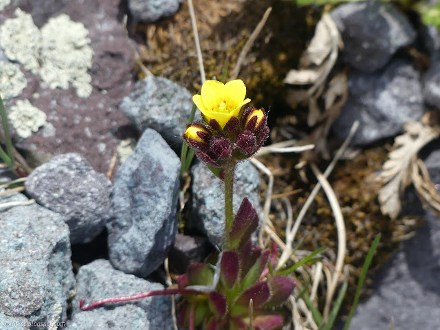
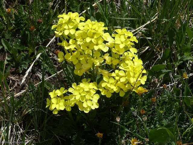
Being in the sun and comfortable with the place my feet occupy, I wandered downward taking a greater interest in the extreme variety of the floral show. Why not if I was going down anyway and everything that might be unpleasant kept happening over there. Although I did get hit by a couple drops along the way.

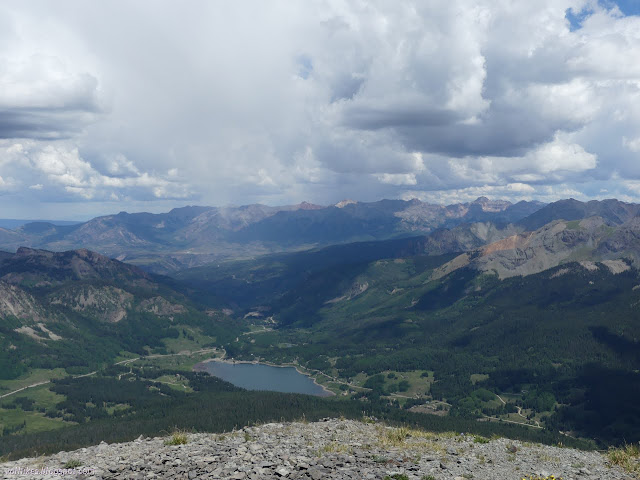
I diverged from my path up to go to a further point and have a better look at a waterfall that is down near the Lake Fork. How does one get to see that? Perhaps from somewhere along the Hope Lake Trail. Perhaps it's on private property. There's a lot of it right around the lake and a long strip along that fork and even another high strip that seemed to have four cabins along it.


I had had some looks at the ridge the trail supposedly follows and I didn't like it. It has some vertical spots. The track diverges from the ridge in a couple places, presumably at those vertical spots, but I was feeling shaky looking at it. I went back the way I came, sort of. I got below the animal trail I'd started on out of the trees, which was almost a problem, but otherwise it was essentially the same.

I took the ridge down, since it had been nice walking up. When it stopped being nice, I started diverging from my route in. There was a strong trail heading down the side toward the meadow and I took it, then right across the meadow and into the next one and across that. I worked my way over toward the "old trail", but didn't seem to be getting there very fast.


I was almost getting into watery messes as I got near the trail. I finally crossed one good sized stream and found it. I suppose "old" could just mean well used. What I found had been recently logged out and made for some much easier travel for the last mile through the forest. Soon it was apparent that it was, in fact, an old road. Sometimes the trail diverged from the road, I image for an easier time cutting through trees, although it often didn't look like it could have been.


The old road got familiar as I entered the meadows above the corral and dispersed camping area. I had poked my way along it past the numerous "no motor vehicles" signs wondering why the path was so strong along it. It starts off at the most obvious chunk of old road now blocked by big rocks, but following it to the trail through the forest is not assured.


That weather that had swirled so long around me without actually breaking over me finally did once I had shelter to tuck myself away within. What a day. What wonderful views. What brilliant, churning, yet cooperative weather.
*photo album*
©2022 Valerie Norton
Written 17 Jul 2022
Liked this? Interesting? Click the three bars at the top left for the menu to read more or subscribe!


Comments