Calico: Sockrider Peak
San Juan National Forest
(map link)
DAY 1 | DAY 2
Okay, new backpacking plan. Since I had already done the section of Calico National Recreation Trail from the Calico Trailhead to the far side of Elliot Mountain, I decided to approach it via the West Fall Creek Trail instead. First day would be climb and follow the loop of trail over Sockrider Peak and Calico NRT back. There should be a rivulet of water just before the climb back up to the ridge. If that didn't work out, I would know how far down West Fall Creek I needed to go to get the all important stuff. Next day, lots of named peaks to be bagged, then back down. Some variations were possible in the second day, but in general, sorted. There's a bit of a turnout for parking and that's all at the trailhead.


The trail crosses a number of little streams, none of which are Fall Creek. That stays off to the side and I'm not certain I ever saw it. The crossings all rate seasonal designation on the map, if even that, making this an unattractive route to plan for a diversion for water.


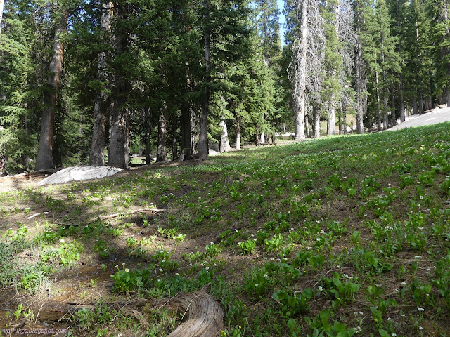
After just 2 miles, I was back on top of the ridge and to my proposed camp site for the night. I dropped off some gear, but since the weather was to be rather fair, that only meant about 3 bulky pounds relinquished from the pack.

As I pondered these new peaks, I could see three figures moving about at the top of Calico Peak. There was someone parked at the bottom of East Fall Creek when I went by. Perhaps they were from that truck. They had gone up the side nearest me and appeared to vanish over the other side. I turned the other way for that loop over Sockrider.

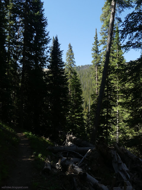
The trail over Sockrider Peak is hiker only and clearly signed as such on both ends. The bikes and motorcycles that ride on the other side of Elliot Mountain were quite good about staying on trail and the meadows were much nicer for it. My good feelings for them evaporated when I saw the state of this trail. There were plenty of tracks on it, but almost none from anyone actually allowed on it. When I came to false peaks, I traveled around the north side on fading trail. The few hiker steps I could see had missed these more pleasant rounds for the groove carved in the hill right over the top.


I got to the top, had a look around, and signed the register. The few footprints were from a group earlier in the day, perhaps even those folks I saw up on Calico.


The route down the other side of Sockrider Peak was much rockier and steeper. It was steeper still once it got off the rocky parts, thanks entirely to motorcycle riding knuckleheads who can't stand to be told a trail is not for them. They have dug out multiple direct tracks up the hill and I couldn't find the correct route. It was a much better designed trail once.

Once back down to Calico NRT, I decided to continue to the bottom of the use trail up Elliot Mountain. I considered going up it again. There's certainly an argument that I should have and I'd have had less time at the end of the day to just feel at loose ends. I didn't. I followed Calico back west.


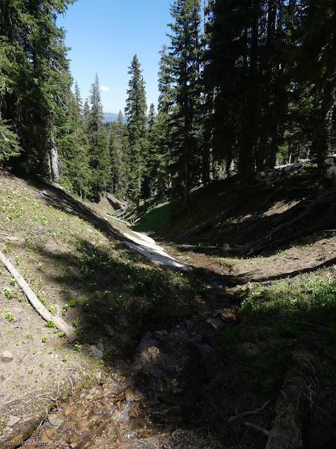
There were small pools of water below the trail, but I didn't find the rivulet across it. I did find a bit of a muddy spot. I decided that I would go back down West Fall Creek to get water after all. I guess I should have just got it on the way up or even started with enough for camping and the next day too. That would be weight I could leave, as well.

So I headed down. It seemed longer to the water than I remembered. It was about 400 feet vertical and little over half a mile of trail. There's first the small stream, which is plenty big and where I stopped, then a larger one shortly after. The larger streams do tend to be nicer, but I was happy with nice enough.
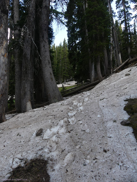
And then, having added 10 pounds of water to my back, I had to get back up to the top. Through the various snow drifts. Well, there were a few boot stomps through them to help out.
I got to the top and a wind was getting itself up to blow. Ah, that is another use for a tent, keeping the air from moving around you so much. I'd been told there is a nice camp spot at the junction, but it was a bit exposed to that wind. I found something a little further up tucked into the trees instead. I still had two hours to what feels like a good stopping time, so considered bagging Johnny Bull Mountain and/or moving on to the next junction where there might be a better, more sheltered spot. It seemed like it would require carrying my gear over Johnny Bull one way or the other and I ultimately decided against.
Continue on to the next day ⇒
*photo album*
©2022 Valerie Norton
Written 2 Jul 2022
Liked this? Interesting? Click the three bars at the top left for the menu to read more or subscribe!


Comments