Calico: Johnny Bull, Eagle, Anchor, and Calico, Basin and Peak
San Juan National Forest
(map link)
DAY 1 | DAY 2
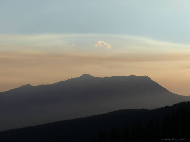
I woke up to a sky that I was certain contained a whole lot of smoke. I could, yes, definitely smell it too. It arose so quickly and I could feel panic following along. But around me, it was so evenly dispersed, and, if I'm honest, it was doing some downright lovely things marking out the air currents high over the local 14ers grouping.

So, by my best guess, the wildfire could not be near, no matter how fresh that smoke was smelling. I had good signal when I could see Rico and mediocre signal on that side of the ridge otherwise and something that wouldn't let me connect on the other side, so I found a tree to hide behind from the wind and tried to be sure. Caltopo's active fire and satellite detection layers indicated no big fires until I got all the way out to Coconino National Forest more than 100 miles away. Windy indicated that the wind was coming from there at all altitudes. The wind is rarely so coordinated. Googling "San Juan National Forest wildfire" had a result from May in Pagosa Springs, the wrong direction. I finally had the sense to get up the smoke report and it confirmed there was a mighty plume of the stuff coming off Coconino. The worst of it was south of me, but I was getting plenty. I didn't investigate which exact spot of Coconino that was because I'm sure it's one I've thought about hiking but not gotten to. I noted the Skyline Trail in Santa Fe National Forest was still on fire, and that was more than enough to deal with.

I still had this nagging feeling that I should run, run, as fast as I can, even with all the evidence stacked up that the fire would have to come across a lot of sparse land to get to me. I decided to push that emotion down and go with intellect. The only danger was the air quality, which was still better than being anywhere near a campfire. I packed up camp, tucked some under a tree again, and started off. I was going to save Johnny Bull Mountain for last, but it was downright cold and I figured the climb would warm me. On the other hand, the wind was probably worse along the ridge. I was still pretty cold as I went up.

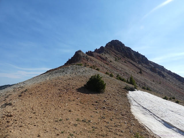
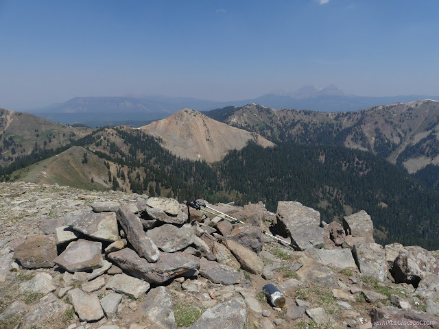
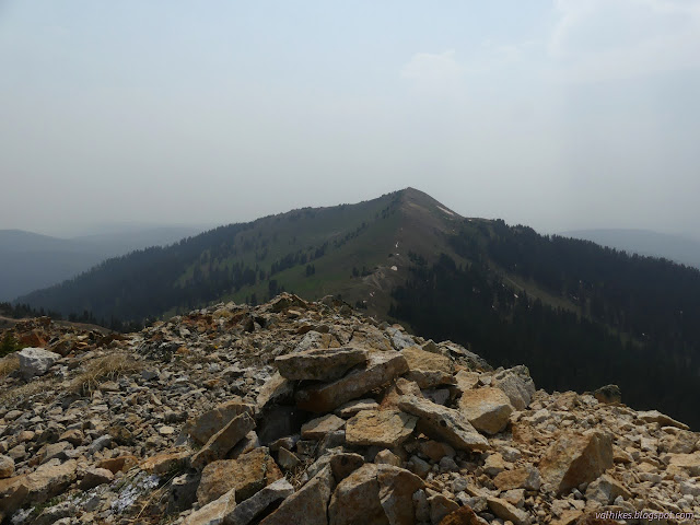
Getting to the top was an easy walk and someone had built a wind shelter at the top to help out with the blowing cold. Unfortunately, it seemed to blow right through without hinderance.


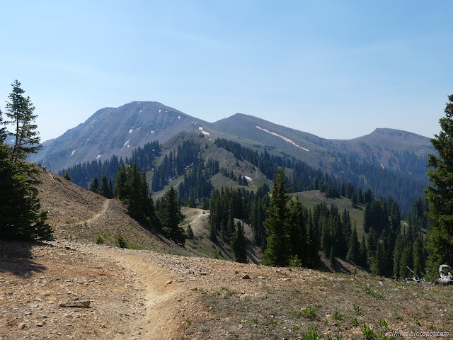
Calico looked like an easy walk up from that side. Johnny Bull, it turns out, is quite a steep walk down and comes into an area that was heavily prospected. There were a few big holes to avoid. I guess they could have been wind sheltered spots for the night, but it would have been a bit of work to get back out.


On my way down, I realized I was missing a flower I expected: glacier lilies. About 20 steps later, I found some, although they were looking crushed by the weather. When I got to the saddle with Calico, I decided I would do the shorter up and back on the other side rather than go up and over. I found a few much nicer looking glacier lilies as I followed the trail through sheltered forest. Past that, it becomes a rocky jumble on the sliding face of Calico.


I had a look at the short way up to the top of Calico and thought, nope, I don't have to.
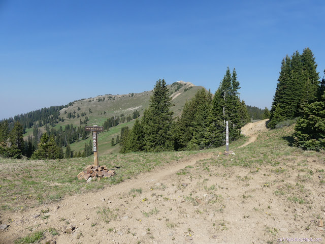
So I turned and walked the short way to the next trail junction. Eagle Peak Trail No. 645 according to the sign, but Stoner Mesa Trail No. 629 according to the Forest Service topo. Either way, it allows motorcycles and I wasn't going to stay on it very long. At the first saddle, I left it and started walking up Eagle Peak, which has a benchmark. It was still windy and cold as I went.


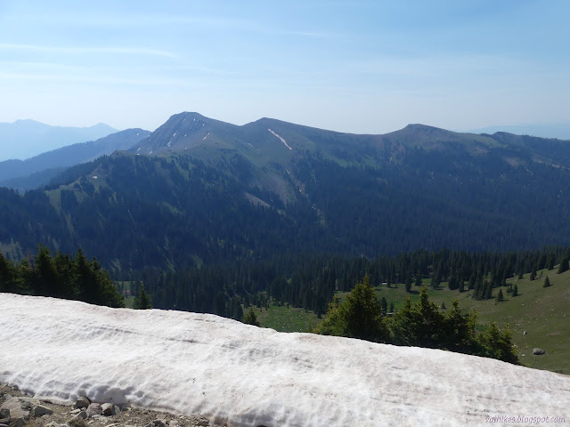
I came down Eagle Peak having had even better looks at the short slope up Calico and didn't change my mind. Nope. I don't have to. When I got back to Calico NRT, I turned to continue on to Anchor Mountain.


I originally had Storm Peak on my list to bag for the day, but decided it was just too low prominence to bother with after all. Expectation Mountain would be better and it even has a benchmark. I stuck to the trail until it got to its highest point along Anchor Mountain, then doubled back and started climbing. I was following a low trail that looked like it might go around Anchor to Expectation. I got indecisive again and eventually turned away from it to climb Anchor first.

On top of Anchor, I got to thinking how nice a loop it would be if one came up the Burnett Creek Trail No. 641 to Calico NRT. Tag Storm Peak, come up Anchor Mountain, on to Expectation Mountain, then make a way down to Burnett Creek once more. Somehow this made leaving both Expectation and Storm untagged okay even though I'm rather unlikely to do it. I'm not even certain how one would access the trail, though I could easily pick it out below.

I made my way the shorter way down the mountain to the trail below to start back the way I'd come. Anchor Mountain seemed especially stuffed with wildflowers.


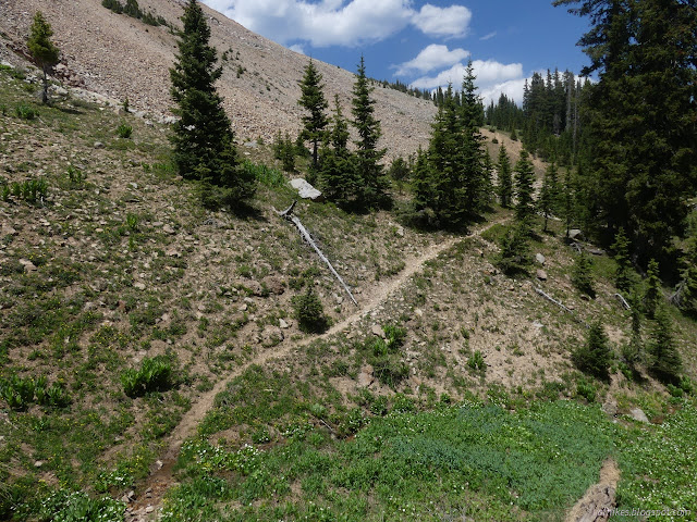
When I got back to that junction where I turned to Eagle Peak, I had a choice again. One reason I was hesitant to go for the little peaks on the side was a background desire to return via Calico Basin rather than Calico NRT. I turned down Horse Creek Trail No. 626 and found myself dropping down past all sorts of glacier lilies.


I passed one creek expected to be reliable, then came to the junction with Calico Basin Trail No. 187, or at least I hoped. It was the only junction that wasn't signed in any way. It was also the only trail with a tree on it, which I came to very quickly. I started to worry about the rest of it because of those glacier lilies I had been missing. Here, they grow quite happily all over the trail. I could see the print of a single user. A mountain bike had been up and back down. Or down and back up. Whatever, someone else had been there.

I passed under what must have been the biggest mine in the area. The trail was particularly rough through that area and then climbed very steeply for a short distance. I looked back to the mine and could pick out the route to it gapping hole. As I looked closer, I could see the flat of trail on the far side of it too. This trail probably originally passed right by that maw.


I was worrying for no reason. The trail wound this way and that and came around to the saddle between Calico and Johnny Bull. There was no sign at the junction, again. There were, however, actually two trails that weren't signed. I suspect the lower one is Horse Gulch Trail No. 188, which is shown on the map as a preposterous straight line joining Calico NRT further east to Horse Creek Trail.


I decided I still had time and energy for Calico Peak itself, so turned to climb the 400 feet to its top. There is no obvious trail at first, but it quickly develops. I just followed it up as it got steeper, then leveled off again.


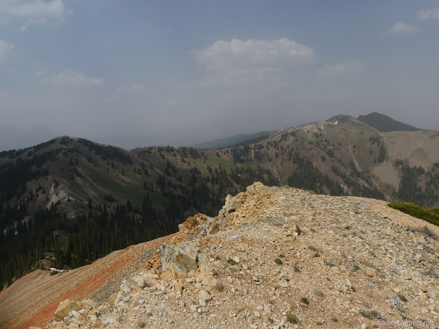

I made another check to be certain there was still no fire nearby. There wasn't, but the smoke report now put me in the middle of the worst of it. Visibility was down to a few miles and my eyes were starting to sting. It was time to be headed down. Luckily, that's all I had left of my plan.

I found some of the trail back to the junction with West Fall Creek Trail a little worrisome. It is washing down the hill so that a little momentum to hold one to the side might be nice. I had little and just had to watch my step.


I gathered up my gear from under the trees and headed down the steep trail with its leftover snow drifts and rivulets and wildflowers. It was better down under the trees. My eyes weren't stinging anymore, anyway.

*photo album*
©2022 Valerie Norton
Written 3 Jul 2022
Liked this? Interesting? Click the three bars at the top left for the menu to read more or subscribe!


Comments