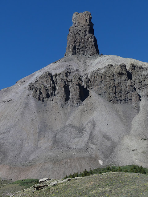
Black Face and Lizard Head
Uncompahgre National Forest
San Juan National Forest
(map link)
I don't know why, but yes, it is really called that. It doesn't call itself that, so I'm not holding it against it. The sign at the trailhead suggests this is a popular loop with the Cross Mountain Trail and, if you can't get together a shuttle, about 2.3 miles of highway. Ugh. But that's what I set out on, with a plan to divert over to the pass above Bilk Creek to check out that distinct view that is rather close to the trail. The weather, so far as I knew, had a slight chance of thunder storm all day. There's trees up there, so I decided to risk it. I walked over from my dispersed camp at the corral across the highway (a large area set up for the purpose) to the trailhead to start the loop. The weather, so far as I knew, had a slight chance of thunder storm all day.

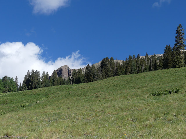
The trail heads off to the east to go up the side of Black Face. It crosses meadow and plunges into forest that is only broken by rock slides off the side of the ridge above.

It actually drops a little before crossing the wilderness boundary and setting to climbing. Again, I didn't start off with much water because it's easy to get along the way. The thing is, it isn't all that easy on this trail once it starts climbing. The switchbacks are short and there's no creek near them.


At the junction to Wilson Meadows, I pondered if I shouldn't go down there and get water. I really didn't start with much. I climbed up instead. I looked back and noticed there was a pool near the junction. It was muddy and I was going up, so I didn't go and get water from it either.
More little wiggles upward didn't seem to suggest there would be any water to be found, but just as I drank the last, I could see water wetting a rock above the trail. At the end of that switchback (and nowhere near that first sighting of a slight bit of water) was a trickle heading down the hill across a good animal trail. I actually ignored the water initially for what that animal trail was accessing: an extensive view over Wilson Meadows.

It took a while to get a liter of water from that little trickle, but I got it and was on my way. I'd been passed by all sorts of hikers. It really is a popular trail.

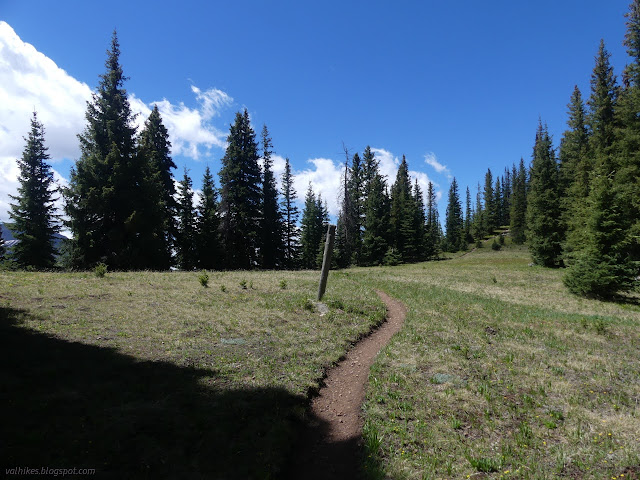
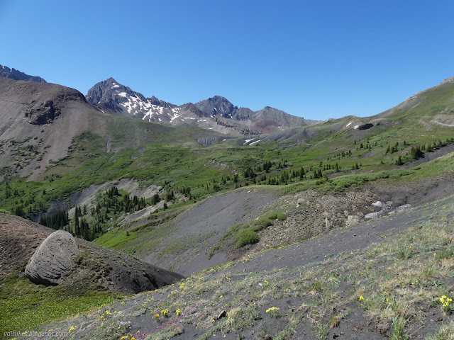
I reached the top without seeing any more water. The trail never got near that first trickle I saw. The top is wide and flat and, in this season, covered in wildflowers.

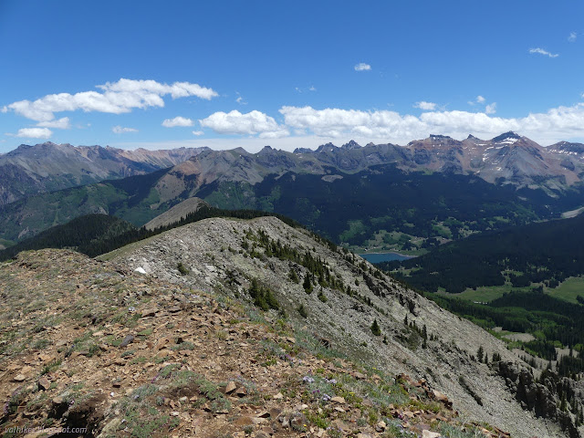
The high point of the ridge comes quickly.


There's a short bit of trail to its top, so of course I took it. I finally had some signal and got better news about the weather for this day, but poor news about the weather for a try at bagging Sheep Mountain on the other side of the highway.


The trail drops gently at first, then gets quite determined to get down. Water runs along it when it rains and it is now in a deep ditch.

Eventually, it levels off to cross a huge and soggy meadow. Black Face is left behind to start climbing toward Cross Mountain and Lizard Head, regaining much of what was lost.


Over a ridge, the landscape changed to a badlands of sorts. The trail travels over the top of blacker rocks with a great tendency to crumble down the hill.


As I arrived at Cross Mountain Trail, I noted that it was an old road. While technically Lizard Head Trail is the one that continues, it is on this road. I turned to spur to the saddle up ahead and it stayed obviously an old road. There seemed to be a little more climb than the map indicates.


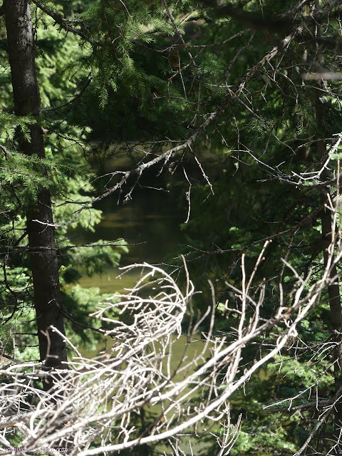
Upon getting to the saddle, I found that most the valley can't really be seen as it curves off to the right. I passed the saddle and started up the next hill slightly to get a little more view before stopping. Off to my left was a dreadful roar including a waterfall. Way down the valley, I could see long switchbacks going upward for a trail that the Forest Service doesn't think should be on the map, but National Geographic does. Rather the opposite of the trail along Kilpacker Creek. This particular one looked like it would produce a nicer backpacking loop than is otherwise available.


After a short while, I headed back the way I'd come, at least for a quarter mile or so.

At the junction, I kept to Cross Mountain Trail. There are spots where the road has narrowed and one where the trail has taken a new route, but mostly, it's all old road and it's really steep. It was enough to make me extra sore as I made my way down.


Since the road was left out of the wilderness for a length, I tried to notice what reason there was. I saw nothing. There's one spot where it actually curves way outside of its corridor and at the extreme point is a meadow full of piles of sticks. They look like they were lumber once, at least roughly, but not quite like collapsed buildings. Other than that, all I saw were trees and some views.

I passed the junction with the Groundhog Stock Driveway and things turned to meadow. I could see the parking for the trailhead below, but never quite got to it. Off to the side is another old road and on it was a sign about a buried high voltage cable. It matches a sign near the bottom of the road to the Lizard Head Trailhead. Logically, the buried cable should follow somewhat the path of the old lines, which are on my Forest Service map. Also, there's a pretty well used path along it. I figured it was a better option than the side of the well used, shoulderless highway and took it.


It worked out well. I even bumped into three people taking their exercise on it. It was smooth with a fairly steady climb and certainly no longer than the highway. I just wondered why they wouldn't suggest it as a much safer option than the highway.

Of course, since I had walked over from the camping area, I had to cross the highway back, too. Still, much safer than actually walking the edge of the highway for 2+ long miles breathing fumes.
*photo album*
©2022 Valerie Norton
Written 6 Jul 2022
Liked this? Interesting? Click the three bars at the top left for the menu to read more or subscribe!


Comments
Actually, I understand it's a native American word. Or old miners' fumbling attempt at Romanizing it. :-)
Just gorgeous country.