Navajo Lake
San Juan National Forest
(map link)
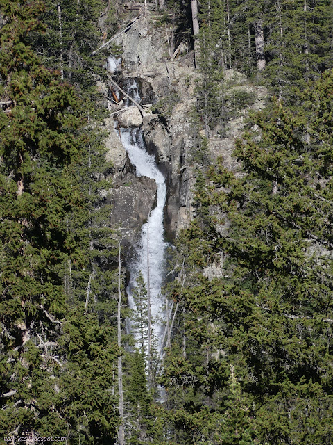
As I was wandering and looking about near my campsite, as one does when one is in a beautiful place, I spotted a huge waterfall in the distance.
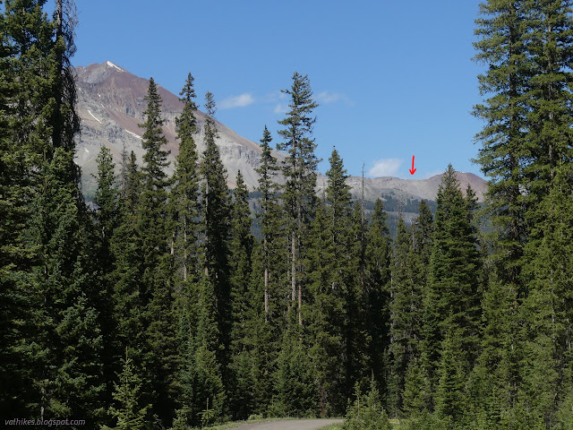
I pondered the maps and the landscape and decided that this waterfall might be somewhat near a trail and that trail was the one up to Navajo Lake. There was a second one near the trail. Both seemed to face a bit to the west, so I made a plan to start at that trailhead, take the Groundhog Stock Driveway and Kilpacker Trail up for the variety, then pass by those waterfalls coming down when the sun would also be somewhat to the west.
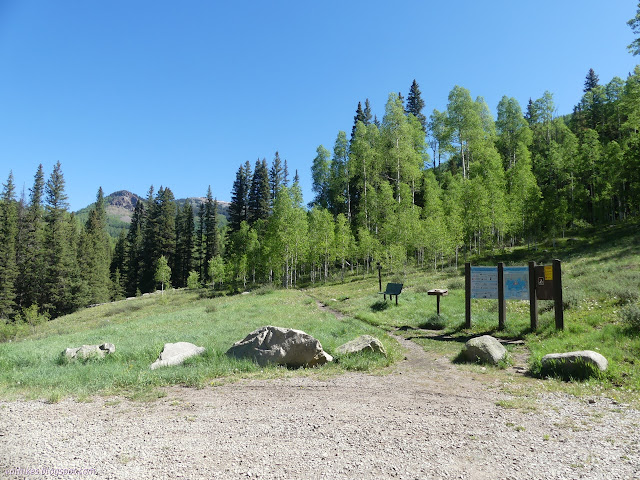
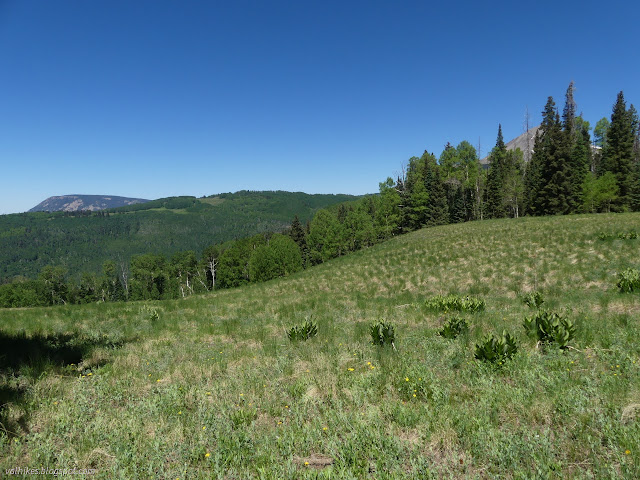
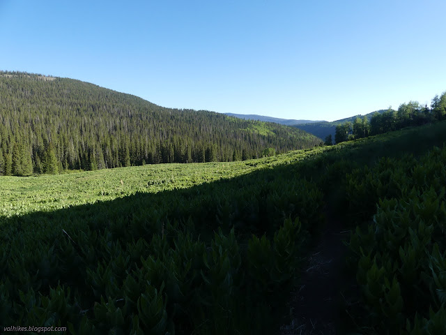
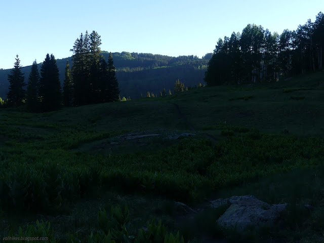
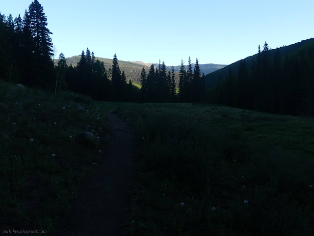
The trail splits almost immediately with the Groundhog Stock Driveway (Groundhog Trail) climbing off to the right through meadow and aspens. One of the things my informant at the Priest Gulch Trailhead mentioned was that only trails getting horse or motorcycle use were getting maintenance. It was quickly apparent that neither one uses this trail. (Only the horses would be allowed.) Annoyingly, I'd actually seen a trail crew going out on Calico as I drove by, a trail with only one tree down that was giving the bikers any trouble. This trail had a whole lot more for them to do and they wouldn't even have to take different tools since it isn't in the wilderness.

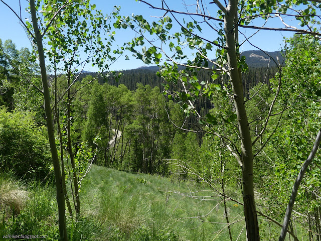
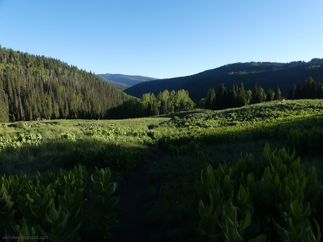
After a half mile, the trail joined up with an old road, or perhaps the actual "stock driveway", which do seem to be wide routes. There got to be more open meadows (and fewer trees to jump over) as I got closer to the Kilpacker Trailhead.
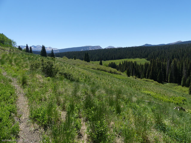
The trailhead wasn't yet visible as I came upon the junction with the Kilpacker Trail. I turned up it, trading meadows slowly for forest. It wasn't long before it was clear that this is also not a route frequented by horse traffic.
I bumped into someone wondering where the trail for Mount Wilson might be. She'd bumped into something sign "al dente" or something like that. It rang a bell. I said Open Street Map said the trail was before Kilpacker Creek, the Forest Service claims after using a line that looks likely to be inaccurate, and National Geographic don't even include the trail, so maybe it's not signed? She said navigation wasn't her strength. I suspect more research is needed, too, since prior to meeting her, I met her dog, and she was apparently looking for a class 4 climb. Maybe a quarter mile more, and I found the sign for "El Diente ___ Route". (It was broken.) The trail behind it was very clear indeed. The only trail that I knew of that might be there was the trail along Kilpacker Creek and then climber routes to the peak. I expanded the map and it reminded me that El Diente Peak is the shorter and closer 14er. Since it is also a class 4 climb (with a "classic" class 4 traverse between the two peaks, but you can totally make it class 3 if you skip some pinnacles), I had settled on not going there. I did think that some of the Kilpacker Basin Trail No. 153 (as it is labeled on the Forest Service map, because consistency is not a high priority) might be a nice hike or even short overnight backpack.

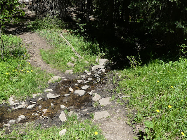
As I stared at this huge trail, I mentally put another black mark down for National Geographic maps. Not even deserving an "unmaintained trail" line? Open Street Map wins again for accuracy. This day would be long enough without the diversion, so I turned to continue on Kilpacker Trail. (No. 207 on the sign and No. 203 on the map.) That meant getting across the rather large Kilpacker Creek.


Soon after Kilpacker Creek, I had to cross West Dolores River. It wasn't much bigger than the creek and a tree had fallen into making a pretty good bridge across it. I sat to lunch and gather more water since I thought there wouldn't be much before the lake.

A couple (honestly, the number of people using the trail suggests that it probably ought to get some maintenance) came along who weren't liking the trail options, so I got out the map again to say that the one on the left was probably the trail and right might be some camp. Then I noticed (again) the little black box along the river to the north. My pace was actually slightly slow for where I wanted to be, but I also wanted to see what that "building" might be. I crossed back over and took some okay trail along the east side of the river to find it.
The trail got to a camp site, then kept on going and faded. I had to follow game trails for the second half of the distance (of about 0.2 miles). When I was a couple hundred feet off, I was at the bottom of a meadow looking up at the clear cut of an old road. I climbed up to it and found that the exact location of the "building" was a rock slide older than the road on the steep slope. Unless it was a toll booth, it didn't look like a place that would ever have a building. I followed the road as it went across the top of the meadow and into the trees. I suspected it wasn't going the same place I was, although I was curious where it might go. I considered following it the other way until it met the Navajo Lake Trail, but suspected the river crossing wouldn't be quite so easy, so I dropped down the hill and took the same way back to Kilpacker Trail, then the last little bit of it.

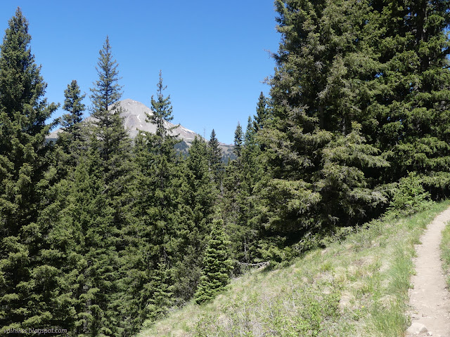
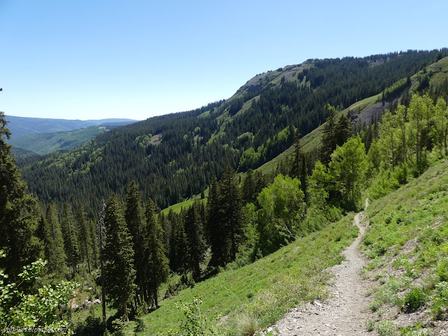
The trail does go a little longer than expected before climbing up to meadows and finally arriving at its signed end on Navajo Lake Trail. There's more views on this trail plus, I noticed quite quickly, recent trail work cutting away trees. Travel would be much easier now. One of those trees on Kilpacker was a bit of a challenge.


One meadow contained a mighty roar and as I climbed, I gradually got a better and better view of the distant waterfall. It was not the one I had seen from camp, but it was large. I never noticed the suggestion of a trail heading out to look at it more closely either. It is difficult to guess how one might approach it if one wanted that closer look.


As the trail climbed further, the roar diminished again. The huge fall of water becomes hidden by rock as well as trees. The trail climbs steeply up a slope of scree to eventually come to a junction with the Woods Lake Trail, the high point of the route.
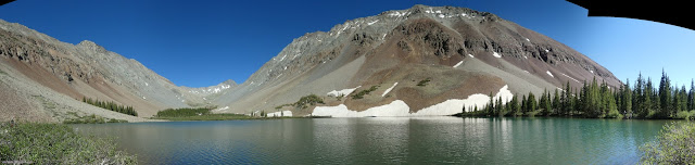
From the top, the trail rolls downward past old mining prospects to the lake.


I worked my way around the lake a little and found a nice spot to sit. I was trying to get a little way from the youth group that had been quite loud on the trail. They were quieter now as they tried out fishing. The fly rods seemed to be their only provision other than water bottles carried in hand, but they did move along the trail fast enough.


It was late and I started down hoping there would still be enough sun on the other waterfall when I got there. The youth group in their shorts was still there, but I did eventually hear them coming down after.

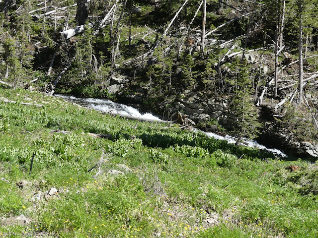
At the junction with Kilpacker Trail, I continued down along the river. No need to hop over any more trees! I heard and then spotted a waterfall below the trail. This one had a well trod trail to its base. The map only shows one waterfall on a tributary. I got down and was so taken with the waterfall on West Dolores River that I almost didn't notice that Kilpacker Creek also threw itself over a precipice before joining up.


To really see the waterfall on Kilpacker Creek, I would have had to wade through the river. It shouldn't have been a problem, but I wasn't feeling quite motivated enough. Perhaps I should have. I was still expecting to have to wade through the river about 1 mile from the end of the trail. What's another wading? I climbed back up from the bottom of the waterfall and continued on my way instead.

The trail gave up the meadows and dropped through trees to the river where I found, as I hoped but didn't dare expect, a bridge. No wading through the river for me after all. It was getting chilly, so that was nice to find.
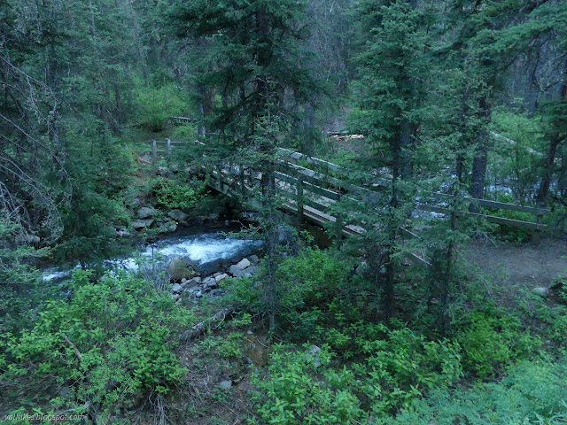
The trail climbs up again from the bridge, staying above the flood plain until the wilderness boundary. There (where there is a sign) it drops for the other side of the Groundhog Stock Driveway, which also has a bridge over the river. That one looks a little newer, but the same design.
I made it down with the sunset, but it did feel a little later than that. Unfortunately, that waterfall is still a mystery. It seems like the forest only likes to mark waterfalls if they can be seen from the trail.
*photo album*
©2022 Valerie Norton
Written 6 Jul 2022
Liked this? Interesting? Click the three bars at the top left for the menu to read more or subscribe!


Comments