Dangerous Park Trail to Black Bull Peak
Apache National Forest
(map link)
How, I ask you, how could I pass up a trail to Dangerous Park? I found it passing by Black Bull Peak and decided that would be a reasonable goal to propel me to walk along Dangerous Park Trail beside Dangerous Park Canyon through the actual Dangerous Park. Although what exactly was Dangerous Park, I wasn't sure, but suspected it was either where there was a coral or the flat bit before that. My vote is the flat bit south of the coral.

So I passed through the gate, then around some fencing through the coral even though there was a second gate on offer. It was a closed ranch gate with barbed wire on the holding loop and I didn't feel like dealing with it. Then it was just the same as the interpretive trail for about 200 feet where it forks and this time I went right. It climbs to gain some views over the first mile.


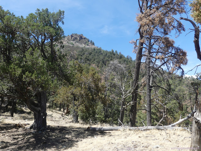
While I was hiking up looking out over the tree covered areas to the south, I got to wondering where the canyons are. I know there's canyons because the main trail from Pueblo Park goes along in one. It took a while to get around to an angle to actually see it and that it was going downhill.


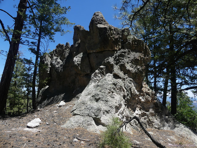
I started to find more textured rock outcrops right by me as well as afar. Not too many and none of them photographed well through the trees.
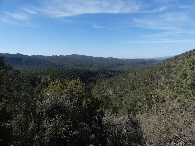


I got some looks into Dangerous Park Canyon and it really doesn't look that dangerous. Buckskin Canyon on the other side looked more interesting.


I arrived at an open ranch gate and the junction for Camp Canyon Trail a little sooner than the map would have me believe. Or at least that's what the sign would have me believe. I couldn't actually pick out a trail with any certainty. There was a really good animal trail down the fence line on the other side of the gate from the sign. There might have been some blazes along a track that was more a dry wash than a trail. Maybe it gets better further down. My trail was still clear enough although some of it, too, had become a bit of a dry wash.

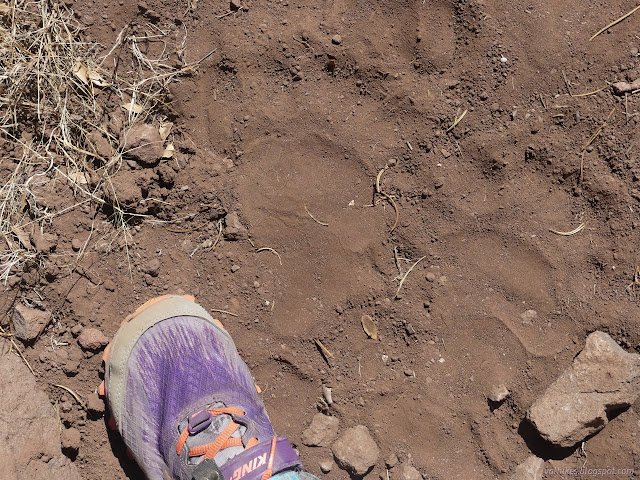
The sign said it was half a mile to Dangerous Park. I was pondering the way the generally all hoof prints, cow and sometimes a horse shoe, that marked the trail had yielded entirely to bear prints when I realized I was probably in Dangerous Park. This probably isn't why it got named, it just happens to be how I experienced it.
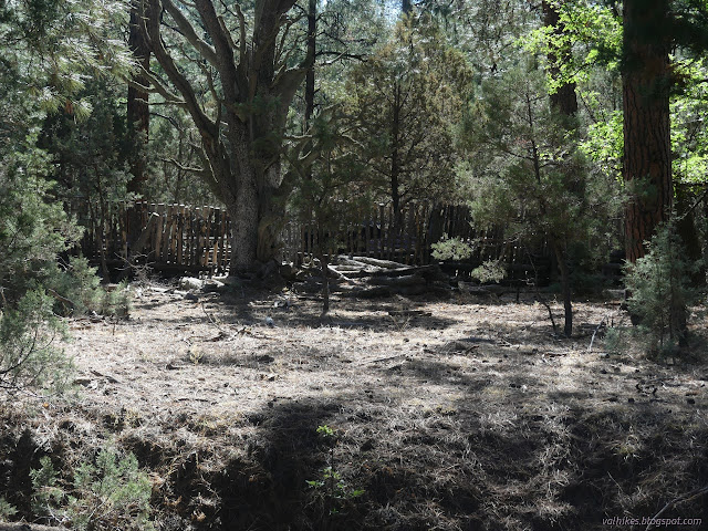
With very little drop, the trail settles itself right into the middle of Dangerous Park Canyon where there is a coral and another trail junction. I found one sign on the ground and one with its back to everyone. I presumed that once the trail coming in from the east crossed there and my trail was the one continuing straight. Nope. It really has it's back to everyone and I started to get quite unfound.

So I went straight and saw where the general traffic took a sharp corner and crossed to the coral and presumably beyond. Not going that way, I had a couple of choices that weren't looking that good. I went with the one that was climbing first, discarded it, followed the one along the creek and discarded it further. It was neither going in the right direction nor looking like other than cows walked it. I headed back to the climbing one that at least paralleled where I should be. Eventually I jogged over and found plenty of lovely trail coming up from somewhere.

I was getting my first look at Black Bull Peak and it was slightly concerning. There seemed to be a ring of cliffs around it near the top. Perhaps I should be going up there after all. But as I examined it, I saw some weak spots. There was still a chance.


My plan once the trail got up on the mountain was to follow it until the high point, then start upward cross country. Then, hopefully, I find a gap in the cliffs that I can use. There seemed to be one in about the right spot. The only thing going wrong was the trail wasn't continuing to climb. When I got to the point around the mountain I meant to take off from, I was 200 feet lower than expected from the map and had 600 feet of cross country vertical climb instead of 400 feet. I was just short of an area that had burned badly and had lots of little oaks popping out to make travel a little more difficult. I turned up just before that.


Off to my left, I found the break in the cliffs I was looking for. I scurried up it, but not quite carefully enough. I dislodged a rock I was hoping would be solid, rolling it down on my foot. It was just a minor inconvenience, but showed how rotten some of the rocks were.

I came out in a tree shrouded area that looked like it could be the top. I checked the electronic map and it suggested I better keep going, so I could hope that this was not all there was. I was going downhill as I followed it faithfully, then there was a brief up and multiple possible high points, each with its own view out one direction or another.
I started up the summit block, but was very aware of all the cracks in its rocks. It was rather rotten rock, too. I was needing to go over a particularly weak looking part and decided against halfway up. Anyway, they keep telling me summit blocks are optional and I was certainly at the top of the mountain as I roamed it. I poked my way out past it for some lunch with a view.


I finished eating and started exploring what other views were available. I found some higher cliffs as I went, but also more break through spots to get past them.


I examined the area below me and thought it looked like a better way down. Less like a water chute and more like landscape. I couldn't quite see everything I wanted and ultimately chickened out of trying that way. I then moved along back to the other side of the peak where oaks shroud the views. There I found another spot to go down. It looked reliable to me. The vegetation turned out to be a bit of work as it was chaparral. I followed animal trails through it. It would have been hard to get through without them.
I got out of the chaparral and under the trees to make it more of a walk than a bushwhack again. I tended to the left so I would intersect with the trail. I got there just a little further north of where it starts its travers along the side of the mountain. Safe once more on Dangerous Park Trail.


I followed the trail down to Dangerous Park, finding that it splits between how it typically gets used and an old trail. I kept to the old trail and found myself exactly at the sign for the junction. The sign still faces absolutely no one. There are some broken pieces of another sign on the ground, but that is for Cottonwood Trail, the one passing by the coral on the other side of the gully where the creek might run. Having solved the mystery, I continued down without much difficultly.


So I got my hike on Dangerous Park Trail. Except for trying to get me lost somewhere around Dangerous Park itself, the trail didn't seem to live up to that name. It had been another hot day (with a predicted high also of 87°F) and I felt I needed to get a bit further north and/or higher.
*photo album*
©2022 Valerie Norton
Written 19 Jun 2022
Liked this? Interesting? Click the three bars at the top left for the menu to read more or subscribe!
Comments