Rio Lado Trail
San Juan National Forest
(map link)
After too long spent in the desert, Rio Lado looked like it would be a good trail for basking in the wonder that is flowing water. The map promised no views, but a couple miles along the stream and then a big loop at the top. I estimated that the whole thing would be about 5 miles, so not very long. I made an easy start of it to give the sun a chance to get high and filter through the trees. The trailhead is a rocky spur with a tiny sign off the side of a road and I actually parked in a turnout just past it. The trail follows the old road prism which most decidedly does not take vehicles now. It does seem to see a lot of horses, which park below just past the bridge and walk up cutting the switchback.

I got going up the trail. There is a spot of private property crossed early on, but beside a couple "Forest Service land behind this sign" markers and a grey spot on the map, there's no indication of it. Past the private property, there is a cabin with paths well worn traveling around it, but not to the door. It has no explanation.

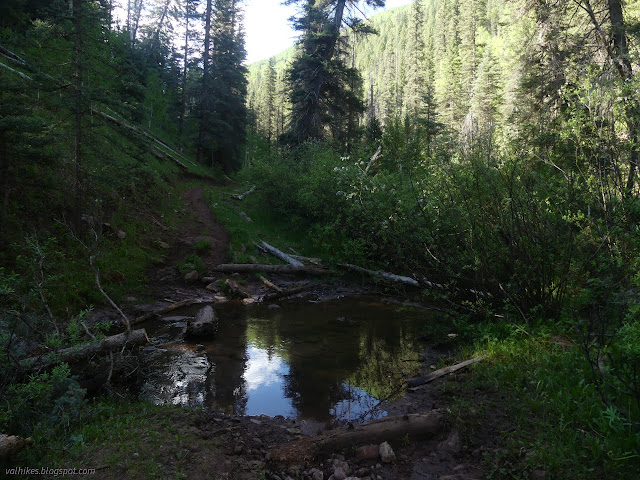

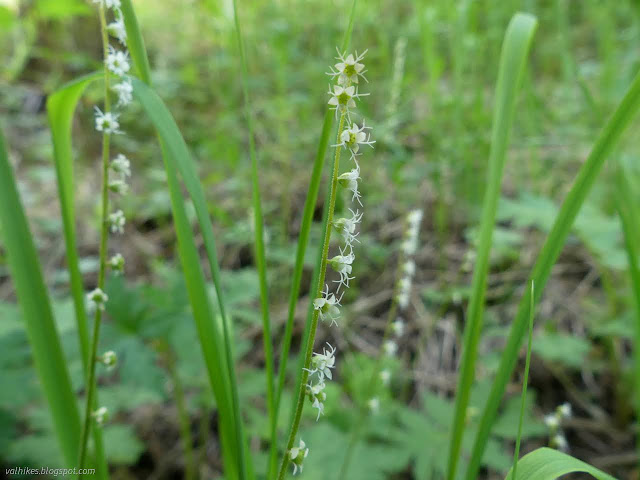
Past the cabin, the trail was smaller and the fords tamer. I found an abundance of wildflowers and a slight confusion as the trail split to cross over the rio or not, then came back. I think it might have been some tree avoidance for some trees now logged out.

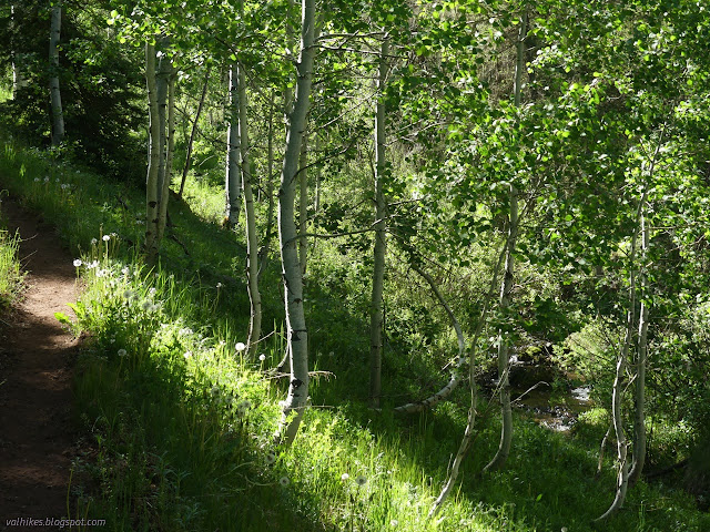


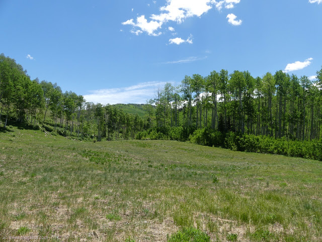
While no views were promised, a few views were certainly had from the meadows. There's a lot more green out there.


I came upon a sign post with no sign a little bit earlier than expected for the split for the loop at the end. The GPS referenced map put me still 0.8 miles from it. Perhaps a reroute? The tree across the lower trail made me take the upper one until I noticed the giant cairns on it, then I decided to take the lower one after all.

The trail changed character. It was harder to follow, although never quite vanished. All the cuts on the trees were many years old while there had been fairly recent logging activity on the previous section of trail. (And this wasn't just because there lacked need.) It did agree with the map location for the trail, so I kept on.


The trail climbed a little and came to a triangle intersection at about the right place for the split for the loop. It should wiggle up on the left and cross the rio nearby on my right. It definitely wasn't doing that second one and the little bit of climb it had just done getting away from the rio didn't seem right in the context.

I took the right hand side of the trails before me and it crossed a tiny stream and started to get fainter. An even fainter trail split off going downward, but when I tried to follow it, it just fizzled. The main trail stayed level and passed by aspen graffiti dating from 1966 and seeming to get more common in the last 20 years. Trails joined and split and I was getting further and further from anything resembling the trail on my map. (It is a Forest Service map and suspect depending on the forest and sometimes district.) I sat in a meadow and ate and thought about either trying to scramble through the forest and find the trail further along or just try the other side. What I could see of where the trail should be didn't look promising.


Try the other side won out. I followed the other trail, watching closely for where it might want to switch back toward the south (the other way) and never seeing the faintest suggestion of it while it headed off high and northerly. The loop on the map definitely wasn't going to happen. I kept on going, passing giant cairns again as I did. It was marked quite frequently.


I followed sometimes faint trail through the aspen encroached meadows and down through pines and came upon a much better used trail. Perhaps this was the loop the horses were using?

I guessed that the trail to the right would be the longer one and took it. It was the trail the horses were using because I met them coming the other way. The fellow in front said his was still learning the trails around here. I stepped well aside as there was lots of room and it seemed nervous about passing anyway. Shortly past the horses, the trail faded into a meadow. And who is teaching me the trails around here?
The trail seemed to be headed in a direction, so I went that way and looked for it to reappear. It didn't. I made a circuit around the meadow looking along all the edges for trail and found none. It really seems to just end there. I headed back and decided to start exploring. There had been another faint trail off to the side, so I tried it. It had a couple big trees down on it, but had been more recently maintained and even had a couple ribbons to mark it. It followed a tributary for a while then started upward. I wondered if it might be going to meet the road above. It met a much larger meadow up above.


Again, the trail faded away soon after arriving at the meadow. I went far enough into it to see it offered better views than the one below. I didn't circle it to see if there might be more trail somewhere, either off to another large meadow shown on the map not far away, or climbing up to the road which probably would be most of a mile. I was running low on water and hadn't dropped in the filter to grab some on the way. Exploring was done. I'd follow the trail with the new hoof print back down.

This trail twisted quite steeply downward sometimes. There were old routes and new ones and it seemed to be getting steeper as it aged. I was glad again that I had chosen the right hand side at the post, eventually.


*photo album*
©2022 Valerie Norton
Written 30 Jun 2022
Liked this? Interesting? Click the three bars at the top left for the menu to read more or subscribe!


Comments