Posts

Showing posts from March, 2021

DeMartin Section of the California Coastal Trail

Image
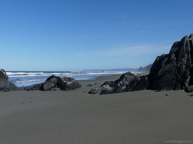
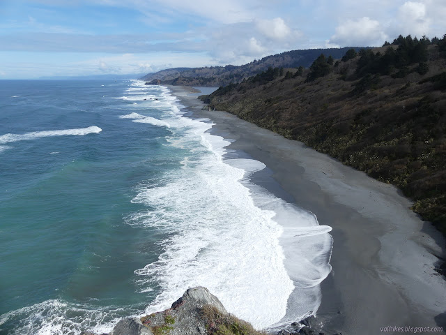
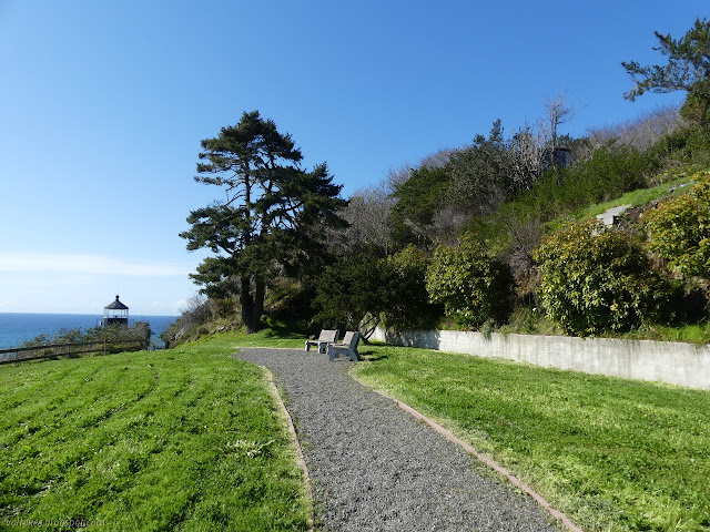
Redwood National Park Del Norte Coast Redwoods State Park Click for map. I spent most of a day working up a map of the California Coastal Trail as it exists between Arcata and Crescent City and I got to wanting to get that last* bit of trail along the DeMartin Section hiked. It's not like I can't come back to see the rhododendrons in bloom if I hike it now. It's good to see a trail in different seasons. This is the one part of the trail that is further inland than US-101, so it might even have some of those hills I've been wanting. I got an earlyish start and found my way to the beach parking beside Wilson Creek to start. (*There is actually one other piece of trail I haven't been on: Enderts Beach Section. This is a short section that parallels road and I probably won't bother with it. If I had a temporary base near Crescent City, it would get included in the places to explore. The 80 mile drive just for it doesn't seem worth it.) False Klamath

Wetlands Trail to Milwaukee in Samoa Dunes

Image
Samoa Dunes State Recreation Area Click for map. I decided I would go and visit Humboldt Bay's first lighthouse. This one was set on the North Spit and was soon deemed too low, which prompted the building of a replacement up on Table Bluff . I aimed at it once before and didn't quite make it. Then I wanted to meander over to the wreck of the Milwaukee at low tide. That was only expected to be -0.4 feet and it really needs to be -2 feet (which happens in the summer) to see everything above the sand. I figured it sticks up a bit and I would see something. It isn't exactly the hills I need, but there's some sand dunes. You get to go all over them. Be aware, you are sharing them with OHVs, but it is pretty common for people to walk them as well. I followed the signs for the staging area on Bunker Road and found plenty of parking, picnicking, and why it's called Bunker Road. On the south side of the parking area is a sign marking the Samoa Dunes Wetland Trail. It

Waluplh-Lighthouse Ranch

Image
California Coastal National Monument Click for map. After making my tour of the Ocean Ranch Unit of the Eel River Wildlife Area , I went up the road that little bit to visit the old lighthouse, or at least the base of it, and the little bit of California Coastal National Monument that surrounds it. It is certainly one of the easier spaces of that monument to visit. You just park in the dirt area next to the road and walk through the gap in the low fence. A small (~0.5 mile) loop trail passes around the grounds with a small abundance of interpretive signs. They cover the area history and conservation efforts. Besides the nearby national, state, and county wildlife areas, there is also a Marine Protected Area offshore. Signs at the national monument and the first stretch of gravel trail. The lighthouse foundation remains, but the lighthouse is on Woodley Island now. The rest of the buildings have left even less impression on the land, but the plants have stayed. I expect tha

Ocean Ranch

Image
Eel River Wildlife Area Table Bluff County Park Click for map. I found myself halfway through Eureka in the middle of the morning, and that's half the battle of getting past what has become my Little LA. It took me half an hour to get through the bit where US-101 turns south again and the next mile once. I headed further south for some area that has been insufficiently explored by me. I could at least stop by the old lighthouse location on Table Bluff and South Jetty, but I kept my eyes open. There's a big chunk of space marked Table Bluff County Park that I've never sorted out how to visit. When I saw the sign for Eel River Wildlife Area , Ocean Ranch Unit, about a quarter mile short of the lighthouse, I went for it. That's an even more vast area, stretching all the way to the Eel River mouth, part of California Department of Fish and Wildlife lands. The Eel River is really the Wiya't, a river so important that the people here are called by the same name.

Freshwater Lagoon

Image
Redwood National Park Click for map. I stopped at the parking lot just outside of the gate for the Thomas H. Kuchel Visitor Center. (The gate is locked at 5PM, so inside is not a good option.) I figured I'd hike the beach over to the Gyon Bluffs to check out what they look like from the north, then cross over to the lagoon and hike back. After, I could loop around the beach to Redwood Creek, then back along a boardwalk. There's parking all along the side of US-101 above the beach, so there's people scattered all along the beach too. Looking north, there's a picnic area with sheltered group areas and the visitor center. There's lots of sandy beach between me and Gyon Bluffs. Signs all along the parking by the highway illustrate that this is a particularly dangerous beach due to the way it drops off steeply just under the water. They indicate the waves will pull you down under along that slope and keep you there. The warning of strong undertow (and rathe

Redwood Creek Levee to Mussel Point

Image
Redwood National Forest Click for map. Can you walk the levee through Orick? Generally, yes. The California Coastal Trail going north comes off the beach at Redwood Creek, turning to follow the levee along the south side, then over the bridge and along on the north side until it runs out at the edge of US-101. To start the Orick Horse Trails, one walks the rother bit of south levee. I couldn't find out anything about the last bit of levee that I wanted to hike, so I asked at the Thomas H. Kuchel Visitor Center and was told it's all Redwood National Park. They don't actually claim it on the brochure map, but if it's not theirs, it is Army Corps of Engineers (who built it) or Humboldt County (who maintains it). Also, I could just skip the levee walk and drive out to the beach parking right on the end of it. If that's my pleasure. I decided it wasn't. Parking near the bridge is either city related or at the horse trails. I had read that the parking was &quo

Janes Creek Loop

Image
Arcata Commumity Forest Click for map. There is one entry to the community forest that I haven't yet used (besides things at the university) and I headed out to it. Okay, I did get quite close to it once, but there's a sensibility about the entrance with the route from it that I couldn't pass up. The entrance itself it up a neighborhood street, but it does have a large bit of street parking that isn't so much by houses. It even has a dirt turnaround and parking for horse trailers. Horses are allowed and sometimes seen on many of the trails of the community forest. The entry to the forest is marked to be fairly visible from the street. So I plunged into the speckled shade of the second growth forest with its 150 year old stumps and even older natural stumps. Redwood survives, which is part of what makes them so attractive to cut down. The trail from Diamond Drive quickly joins with another trail from California Avenue. There's not quite so much parking o

Dry Lagoon and Stone Lagoon, California Coastal Trail explorations

Image
Humboldt Lagoons State Park Click for map. I was thinking I might try to write up a guide to hiking the California Coastal Trail through the Redwood National and State Parks, where quite a lot of it actually is trail. Then I reflected how much better I knew the southern parts of that especially as I found out there's a little trail before getting to Crescent City north of the Last Chance Section. Then I realized that there are parks nearby to the south of the redwood ones and... where does it go there? It only gets the briefest thought on the Patrick's Point State Park map , out on Agate Beach. It is actually marked on the Humboldt Lagoon State Park map , but with holes. Mostly it follows along the sand spits that wall off the lagoons from the ocean. There is one bit of proper trail to get around Sharp Point that I have actually hiked before, albeit in a hurried fashion . The north end of that is one of the holes. I already knew that was real for official trail. There a

Trinidad Head Lighthouse and Old Home Beach

Image
California Coastal National Monument Trinidad Coastal Land Trust Click for map. I didn't get to see the lighthouse (or properly visit the national monument) so I came back the first Saturday of the month. The official web site for the California Coastal National Monument is no more specific about when the gate is open than that. On the AllTrails page for the hike , it claims the gate is open 11AM-5PM. I hadn't actually checked as I went past a week before , but there's a sticker on the sign on the gate that says 10AM-2PM. I went out slightly late according to that sign for an afternoon in Trinidad and found the parking lot to be quite a negotiation. Half of it was blocked off with floats connected by thick chains to what looked like highly corroded engine blocks. There's actually more spots on pavement toward the harbor, but I found one in the dirt. The memorial lighthouse has been relocated from higher up on the bluff. The bell beside it is the original fo

California Coastal Trail - Skunk Cabbage Section

Image
Redwood National Park Prairie Creek Redwoods State Park Click for map. There are two last trail sections of California Coastal Trail between Orick and Crescent City, where it passes through the Redwood National and State Parks, that I've been leaving to the right season. The rhododendrons on the DeMartin Section are still a ways off and the namesake on this section were just popping up out of the mud when I hiked nearby Trillium Falls . I decided to stop waiting and go for it even though I was sure it is still a bit early. There are signs to mark the turn off US-101, but no turn lanes to help traffic flow. The road in is not paved and one lane with turnouts, but is currently in excellent shape. There is a large lot at the end just before the road used to cross Johnson Creek. The trailhead has a vault toilet and detailed sign. Overnight parking is only allowed for backpackers. Among the trees beside Johnson Creek, a tributary to Skunk Cabbage Creek. It was really chill

follow by email