Ocean Ranch
Eel River Wildlife Area
Table Bluff County Park
Click for map.
I found myself halfway through Eureka in the middle of the morning, and that's half the battle of getting past what has become my Little LA. It took me half an hour to get through the bit where US-101 turns south again and the next mile once. I headed further south for some area that has been insufficiently explored by me. I could at least stop by the old lighthouse location on Table Bluff and South Jetty, but I kept my eyes open. There's a big chunk of space marked Table Bluff County Park that I've never sorted out how to visit. When I saw the sign for Eel River Wildlife Area, Ocean Ranch Unit, about a quarter mile short of the lighthouse, I went for it. That's an even more vast area, stretching all the way to the Eel River mouth, part of California Department of Fish and Wildlife lands. The Eel River is really the Wiya't, a river so important that the people here are called by the same name. Today, they generally live up on Table Bluff, so still near.
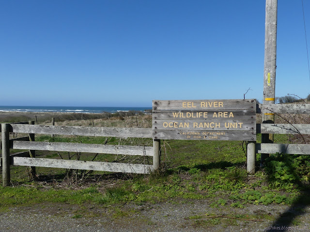
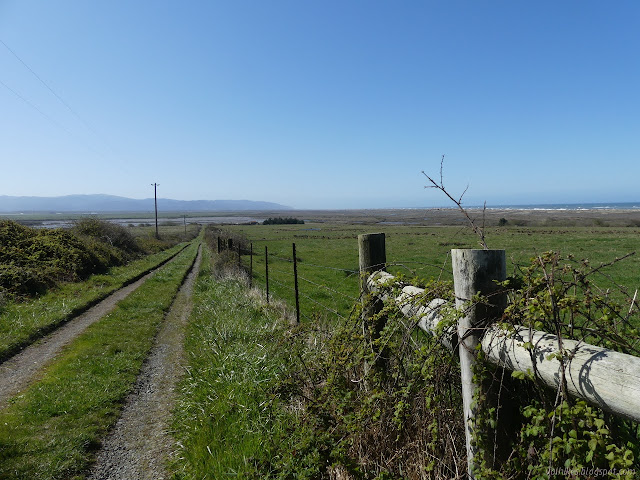
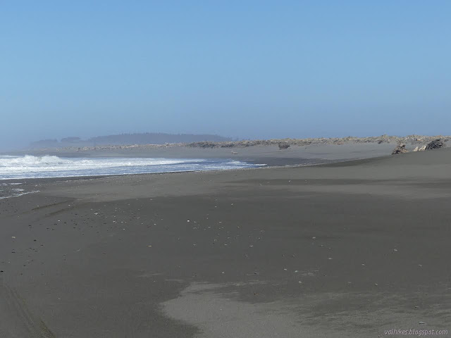
Besides the sign telling me where I was, there was no trail information to be found. The wildlife area is basically stretches downhill to the miles of very loud breakers visible over the top of the sand dunes. What a roar. My OpenStreetMap showed the area and a couple roads. I followed a well worn trail around the side of a locked gate and down the rutted road toward one of the remaining buildings on Ocean Ranch.

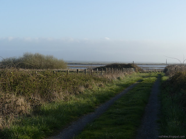
A well used trail took off toward the water where the old road turned for the barn. I stuck to the road, then took the left as it split. I was thinking I would try to connect with the beach toward the end and loop around.
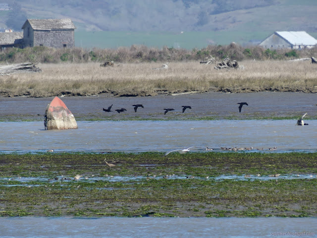
The birds didn't seem too comfortable with me being there, even though they were usually a large expanse of muddy water away from me. The location is a big birding area, but maybe they're remembering hunting season which wasn't that long ago.


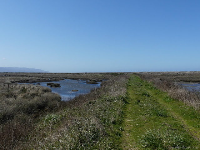
I continued on to the end of the levee where it ran into another along the side of the McNulty Slough.

The maintained trail area ends at the water, but there is a well used trail heading south along the top of the decaying levee. I started down it and found that it is not all that well used in that there's still a few thorns on the blackberry branches that cross it. It also doesn't stay on top of the levee entirely, sometimes making a way around the thick bushes by dropping off the west side toward a ditch.

I could see spots where the levee was getting thin and decided it was silly to assume it had survived along its entire length. In fact, it was silly to assume it was even built very far in the first place. It most likely wouldn't leave me an acceptable route out to the dunes. I turned back before too long and retreated all the way to the first split to take the other road. This crosses a levee that has been purposely dug out to prevent vehicle traffic crossing it, but left enough for pedestrians. It connects with the public road along the dunes where I had already seen a few cars and horses earlier. It would get me close to the mouth of the river.


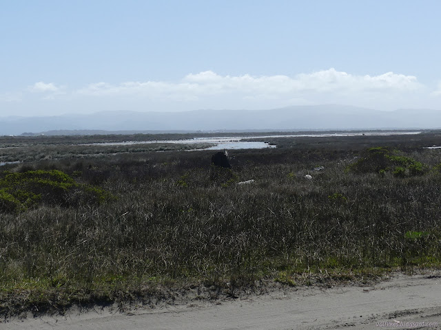
I wandered out on another bit of levee that seems to be getting a little bit of traffic. If the levee I started on along McNulty Slough is complete and passable with just a bit of determination, I would have come out on this second bit of levee. (That is, if USGS can be trusted.) It wouldn't have been easier than just going around. I found a spot out of the wind and watched the ducks in the channels emptying with the tide.


I got a little further along the road before once again meandering to the edge of the little North Bay. The lupines are starting to bloom. It was nice to see native purple varieties instead of the invasive yellow ones.


The road gives a few more opportunities to see the North Bay and the life on it before turning to end on the beach.
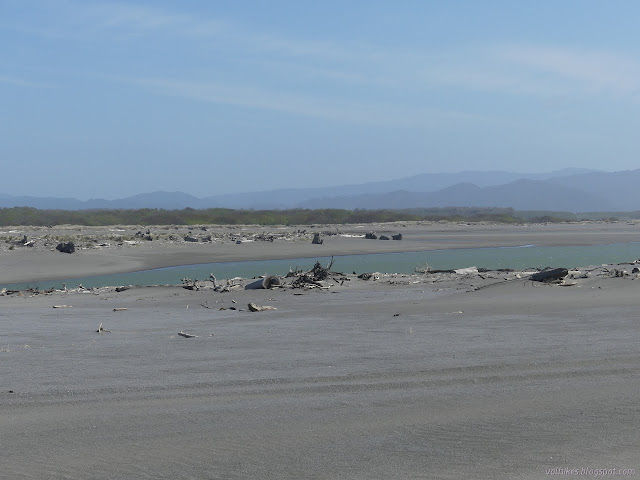
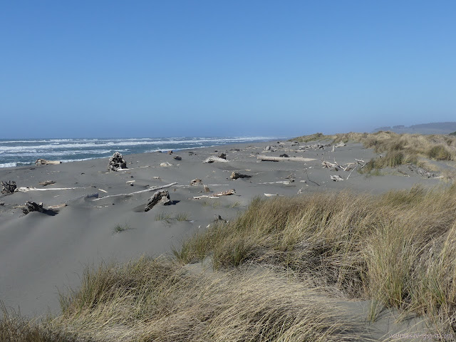
The growth stabilizing the dunes was mostly done by the time the road ended, but there was a lot more sand before getting to the mouth. I was set on getting out to the mouth, so I kept on going.
I spotted fishermen and seals as I approached the very end of the land. The fishermen drove most the way. (One set parked at the end of the road and the other came most the way down the beach.) The seals didn't seem to be too concerned with the fishermen nor the fishermen with the seals, but they were probably competing. Maybe for salmon, but that seems to usually be done with a net on a long stick and they had hooks on short sticks.

I didn't spend so long at the end. I turned to follow the edge of the waves back up to the parking area on the South Jetty Road. The wind had been blowing all day. It was a bit of a stiff breeze up on the levee. It was something to find shelter from if stopping along the road. Next to the water it was hard and cold. I was glad to have a jacket to break it and a little warmth underneath that too. Walking against it was a fair bit of work. I could find spots among the dunes for shelter from it when I wanted that.


I stopped to watch the waves sometimes and in one area, they were putting on an odd show. It looked a bit like a special effect for a sea monster just under the surface. The wave would be broken and rolling in smoothly when suddenly a spot moving one way or the other would jump high. The disturbance would move fast, then slow. Two would collide from opposite directions in a spectacular splash. I think it was just from waves reflecting off the shore and coming sideways, but maybe there are monsters in the shallows.

As I got close to the county parking, there were lots of driftwood structures and the odd truck on the beach. They're not very good at staying on the waveslope.

I stopped at the trash cans to drop off a few things I'd found on the beach. (Not the V8 engine, though. That I had to leave as it sat.) I headed back along the road and old levee and more road.
I finished the day feeling like I can't really do the long miles on the flat after all. I need hills. As for the large portion of Table Bluff County Park I had been wondering about, according to the signs around the edge it's a large preserve area and the public is not allowed entry.
©2021 Valerie Norton
Written 27 Mar 2021
Liked this? Interesting? Click the three bars at the top left for the menu to read more or subscribe!


Comments