California Coastal Trail - Skunk Cabbage Section
Redwood National Park
Prairie Creek Redwoods State Park
Click for map.
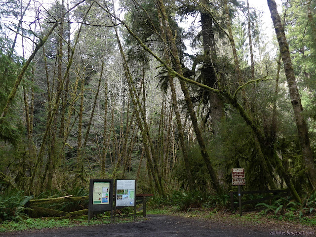
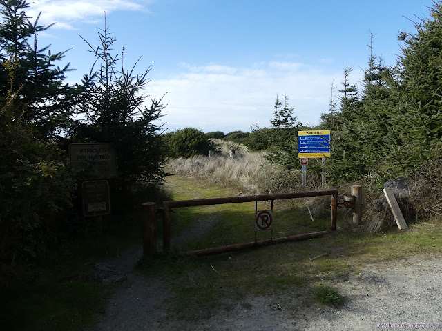
There are two last trail sections of California Coastal Trail between Orick and Crescent City, where it passes through the Redwood National and State Parks, that I've been leaving to the right season. The rhododendrons on the DeMartin Section are still a ways off and the namesake on this section were just popping up out of the mud when I hiked nearby Trillium Falls. I decided to stop waiting and go for it even though I was sure it is still a bit early. There are signs to mark the turn off US-101, but no turn lanes to help traffic flow. The road in is not paved and one lane with turnouts, but is currently in excellent shape. There is a large lot at the end just before the road used to cross Johnson Creek. The trailhead has a vault toilet and detailed sign. Overnight parking is only allowed for backpackers.
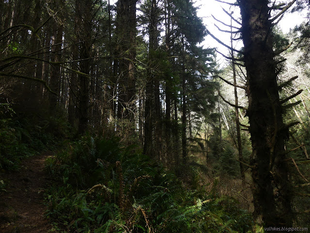
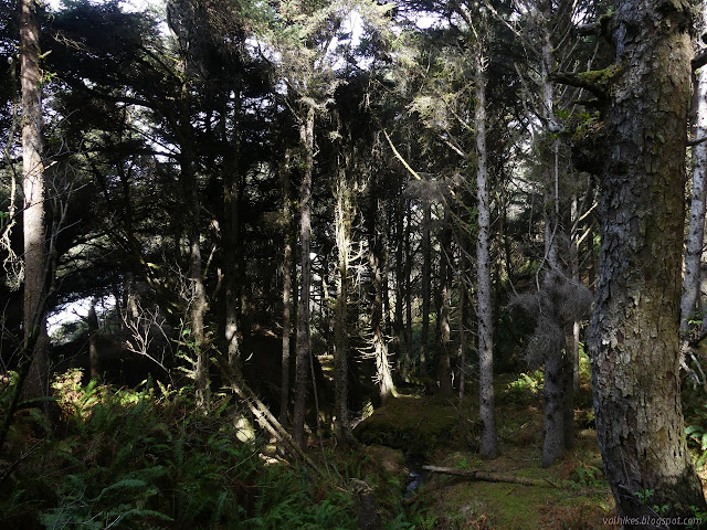
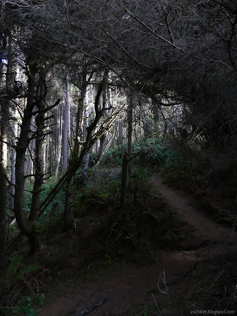
It was really chilly when I got out and I pulled on my buff so it stayed up over my ears and kept the cold off my neck. Sun gloves and sun hat helped with the rest of the chill since long sleeves and trousers is my typical ensemble. I headed out across Johnson Creek on the old earth fill that serves as a bridge. There's a couple pretty big redwood trees along the creek, but that doesn't last. The sign says it has been logged and now is in a state of lots of tiny trunks often referred to as "dog hair". It's not nearly so bad as a few spots I've seen. Most of it is not bad at all.


I was finding the trail to be rather noisy, at least today. There is just wide canyon between it and the highway, so I could hear the trucks navigating the tight curves of the area. The recent rains were translating into very audible water flow and the wind advisory into high treetop noises. In between the water and the wind, there were eruptions of bird noises. Mostly, I was hearing the natural noises.

The skunk cabbages were in bloom after all. It was still early in the season, but certainly not too early. It became clear why the creek is well named. It flows slowly down a wide canyon full of swampy flats that are perfect habitat for skunk cabbages and well utilized by them. I was surprised to see so many blooming when they are so small, but it seems like a lot of plants are rushing to bloom this year. I've been seeing blooming currents for a month and they still barely have any leaves on them.


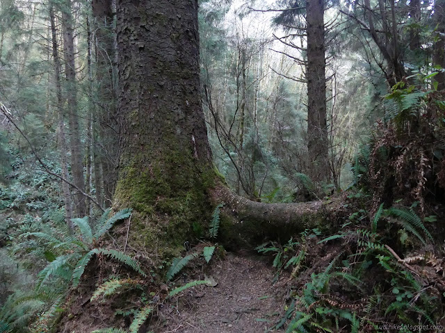
By the map at the trailhead, there's no old growth that the trail passes through, but it does pass next to some. (The description indicates travel through old growth, but it also says there's some grassy hillsides and then identifies a smaller creek as Skunk Cabbage. It seems to go off the rails a little.) There are some moments to bask in the enormous.


I crossed Skunk Cabbage Creek on a bridge (one of many) and the trail climbed up into the area that looks most like "dog hair".


The canyon narrows down and the trail crosses back over the water to switchback up a steep side. There's a sense of openness up ahead, at least now when the alder trees haven't got any leaves, before it comes to a saddle and a spur to an overlook. That adds the rolling roar of incoming waves to the mix as well as letting me feel a bit of the wind.
Of course I took the little spur to the overlook.
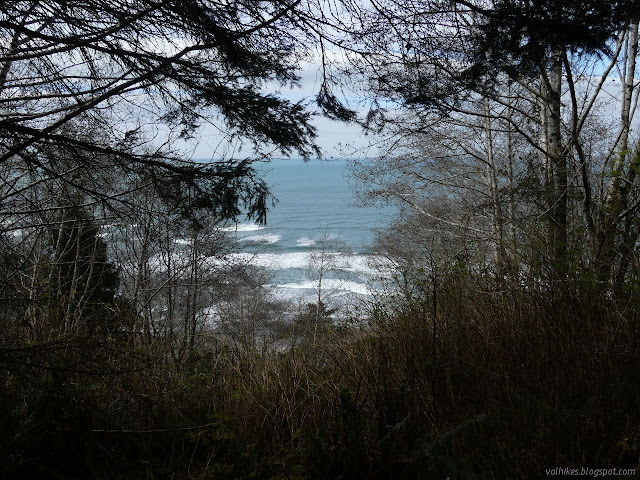
The saddle isn't the low point, so I climbed some more. That section of forest looks like it had a bad fire long ago. There are tall, broken stumps going up the short slope. They are surrounded by medium trees now. Over the top, there is a better overlook as the trail travels north among the short trees facing the ocean.

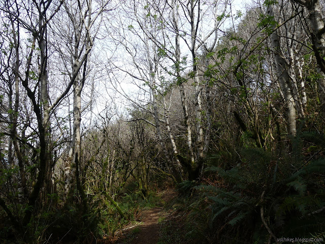
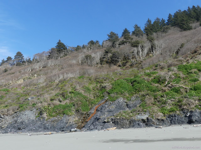
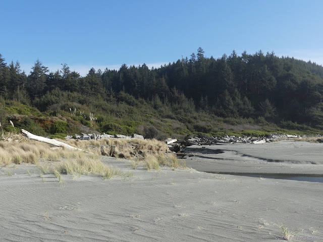
It finds another narrow canyon to travel back down along. With the little bit of protection of the canyon walls, the trees are big once more. That is, until the creek is about ready to flow out into the sand.

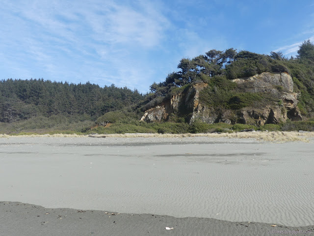
The trail breaks out into short stuff for one more overview of the beach stretch ahead. There's some big signs to mark the bottom for those coming the other way. The beach itself continues on, so that's good.
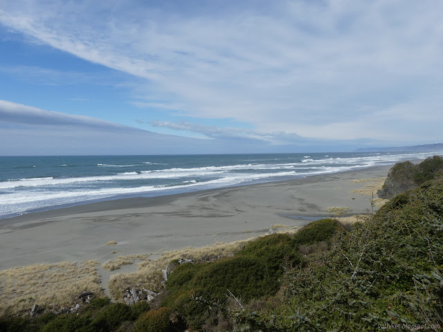
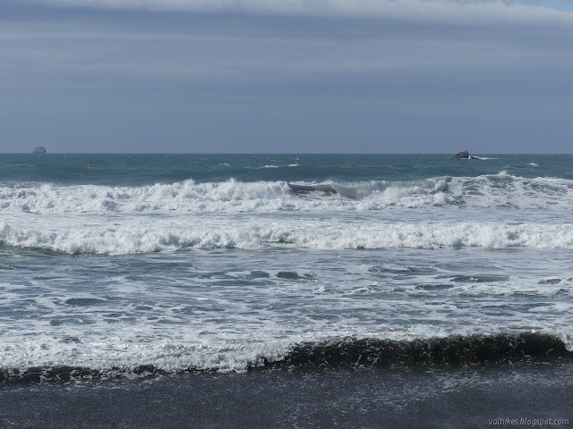
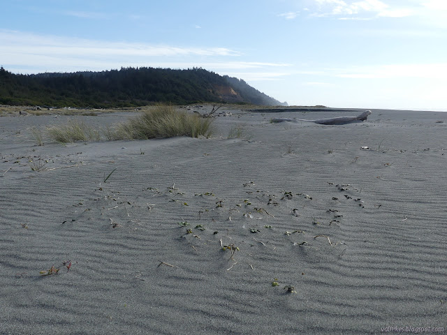
Then I was out on the beach. It's a huge beach and there were no prints anywhere. Mine, all mine. I didn't actually find any information on how easy it would be to travel except that it looks about as wide as the stuff further along and that's got plenty of room whatever the tide. The tide was coming up and the wind coming from the south with a bit of force. I had not exactly planned how much beach to walk, but decided I would turn south and go as far as I could before turning north and walking as far as the road. That would break up the wind in the face portion of the walking.
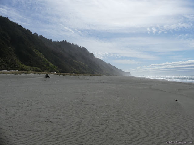
I figured I would be able to get just over a mile along the beach before coming to a constriction. Mussel Point was actually already visible far down the beach in the mist. On the way, I found a minor point with a scatter of rocks with the water playing chaotically among them. Ducks hanging out in the surf reminded me that I had meant to be looking for puffins when I went to Trinidad. They get this far south. The beak was all wrong on these, so I hadn't accidentally found them.


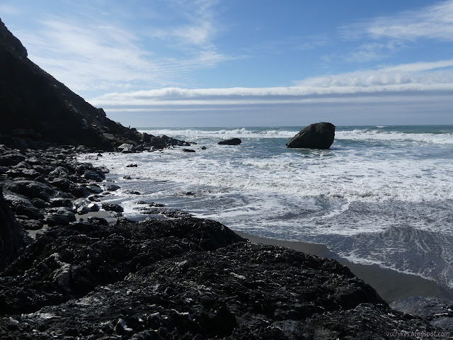
I got to Mussel Point and settled onto a rock just before the loose rocks came down to the ocean. The water was very much churning around the end of the rocks. I suspect it is not passable even at a 0 tide. It certainly wasn't at 3.7 feet. I was a little surprised to see no evidence of an "overland trail" in the soft rocks above the waves. Maybe any such thing doesn't last long. My guess from the map is that there is just one other, smaller constriction on the way to Redwood Creek.

I turned back and walked with the wind at my back watching the edges for water. It is really rather frequent with at least three streams coming down in that mile I had just walked.

Back on the California Coastal Trail as it follows the beach, there are creeks that keep getting bigger.
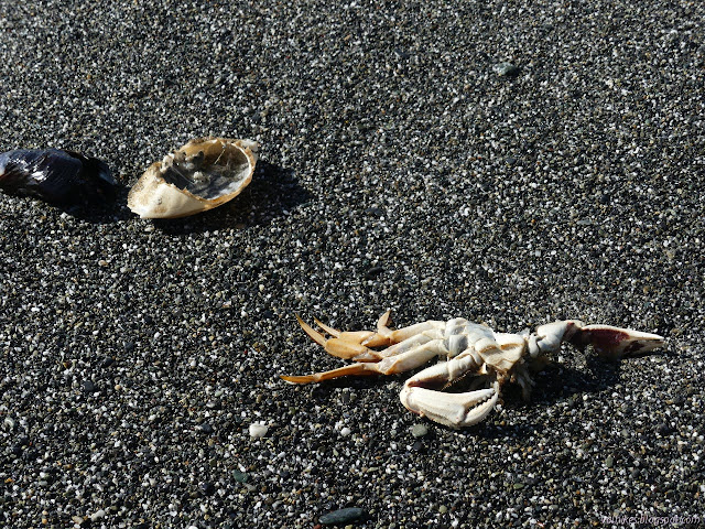

I noted the beach was no longer mine alone when I spotted a stick buried upright in the sand in the surf. After that, there were ever increasing footprints and boxy creatures moving in a smooth motion as if on tracks.

I decided to check out Espa Lagoon, but that apparently isn't really a thing people do. There wasn't much space to actually get a look at it other than maybe the road marked "authorized use only" beside the entrance kiosk.

I found the trailhead for the Skunk Cabbage Section on the Prairie Creek Redwoods State Park side. The description on this side is the reverse of the other and seems less garbled about how many Skunk Cabbage Creeks there are. There's still a mention of "grassy hillsides" along with big-leaf maple and the stink of skunk cabbage. I squinted up into those alder trees and saw the cone-like seed structures in the high branches. I didn't notice the big-leaf maple but they do commonly live together and are quite nude at the moment. I also have never found the skunk cabbages to be particularly pungent.
I decided to stay high on the beach as I went, but not for that first crossing which has a lot of water. It's a little different experience above where the waves will typically break.


I arrived back to find that there were fresher footprints on top of mine at the bottom of the trail. Someone else had been on my personal beach! I wasn't ready to give it up until, well, a minute later. I started up, quickly forgetting the absurd feelings of some minor violation.
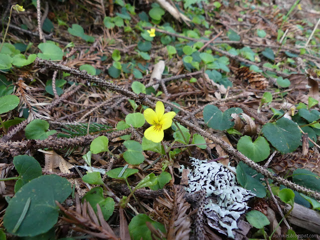

I stopped to smell one of the skunk cabbages on the way. The local crops smell more like skunk, I think. It's more like a bland fart. They aren't really blooming yet. The buds are the little cones visible along the yellow stalk. They certainly aren't bad yet.
©2021 Valerie Norton
Written 7 Mar 2021
Liked this? Interesting? Click the three bars at the top left for the menu to read more or subscribe!


Comments