East Fork Willow Creek to Horse Mountain
Six Rivers National Forest
Click for map.
The previous day was beach, so naturally I planned to go to the snow the next day. You can actually drive within 100 feet of the peak even in this season and with my car and complete lack of keys. But where's the journey in that? I spotted a bit of 4WD road that climbs most of the way up from East Fork Campground and decided that could be a route. There's actually a break in the middle, but I suspected it would connect. Anyway, there's a bit of ghost road in between on the Forest Service topo. (What's a ghost road? On the topographic maps showing vegetation, there's often white lines in the green where roads used to be marked. I've even found some of these that were still labeled with road designations.) These roads are both closed to motor vehicles in the wet season to try to limit the spread of Port Orford cedar root disease. That means I should have the roads all to myself, but probably need to quit the hike if mud is clumping on my shoes.

I found the gate locked right at the highway. There is space for a couple cars at the side, so that's where I parked. It was really cold when I got out my gear. The county said they had the road open to the top and there was three inches of snow, so I decided not to haul up my snowshoes but did grab microspikes. I didn't want to be in the big, waterproof boots, so I stuffed in some neoprene socks for if my wool became soggy. I'd been dithering about really hiking up or just looking around at the top (which is no way to get a proper early start) and it was already past 10AM, so I threw in puffy pants and jacket in case I was dreadfully late down. I set off down the paved road of the East Fork Campground wondering if the crossing up ahead would be bridge or ford.
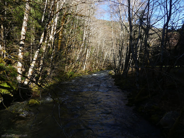
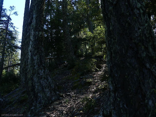
The answer is it is a bridge that becomes a ford when the water is particularly high. The water was far below the level of the top as I crossed. There are some really nice camp sites on that side of the creek, although a little loud with the water roar. As the campground ends, the road turns up to start to climb. The pavement ends soon after, but remnants of old paving continues. The road winds upward through some big trees and the odd clear-cut growing back in a thick mass of tiny trees. I lost the roar of Willow Creek as I climbed, but gained the sounds of Ruby Creek on the other side as I gained the ridge.


I passed one ghost road on the way up and it looked not entirely abandoned. The branches were crowding in to leave a vehicle sized hole. A few other roads exist that aren't even ghost roads on my map. There's one particularly nice dispersed camp site, then the road I was on started looking like a ghost road. There's a high dirt mound a little earlier than the barrier marked on the Forest Service topo. The online forest recreation map showed the top portion of the road as closed, so that's probably the purpose of the mound.

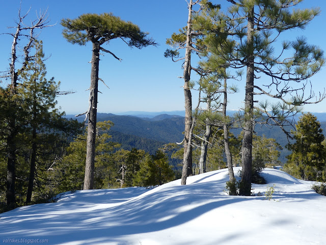
I stopped for snacks just before spotting the first little bit of snow on the ground. I was starting to get some views as the patches got big enough that I couldn't avoid them entirely.


And then the road really did end, much to my surprise. I couldn't find the ghost road, but as shown it doesn't quite connect to the lower road. Plan B: hike cross country. There's a long section of steep road cut sides right up to a steep edge. Getting off the road and onto the ridge proved marginally difficult, but once on the ridge there is an excellent game trail. It's a very steep section, but the views just keep getting better. The last part was a rock scramble with a thin layer of snow down the middle to make it extra interesting.
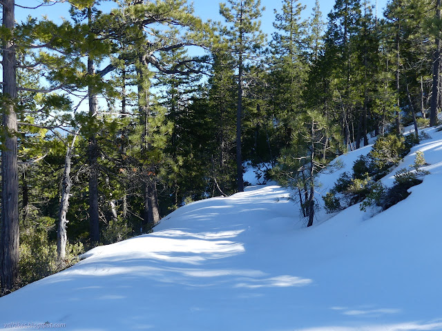
I found a lot more snow on the road from the top. It also stops as mapped. There's no evidence of a ghost road, which would be even steeper than the ridge as it is shown. I was really enjoying the increasing views but the crunching snow was making my muscles clench every time my feet would seem to settle, then break through just a little more. It was particularly tiring.

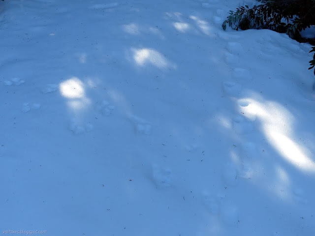
I passed another ghost road. One set of snowshoe prints came down it to join my path upwards. I think that route is about a half mile shorter, but decided to keep to the main road. There were more and more bare spots as I went with the snowshoe prints trying to avoid them. Around the south side, there was more bare than snow and with a big scuffle, the snowshoe prints turned into big boot prints. The dirt made it much easier to climb the last bit.


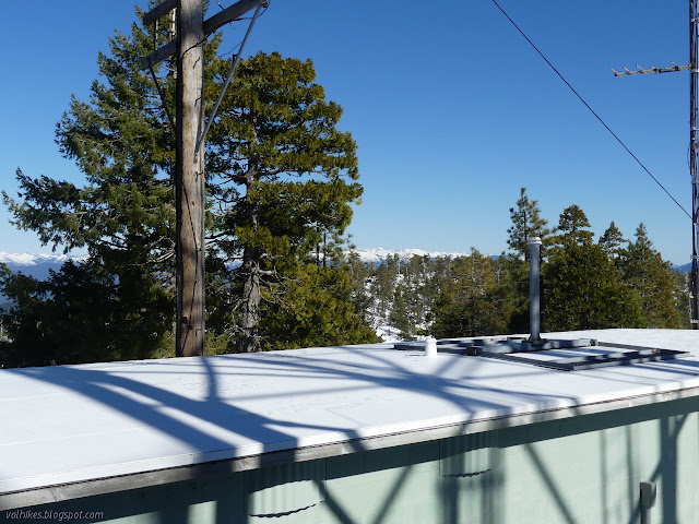
Around another corner, I could see the antennas at the top. I found a little car in the parking area on my way up to emphasize that I could have just driven up. I no longer had the mountain to myself. I walked up the rest on plowed road.

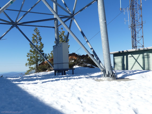
There actually is a peak for the mountain in among the antennas. There's some view, but the antennas do tend to detract from it and outright block it. Still, I found some high peaks (most of which I'd already been looking at) and some ocean breakers all in a line. I think there's Mount Shasta, too, but I'm less confident the thing sticking up is the ever-snowy one when the lower peaks have snow too.

I headed down. There's a rougher road down, which was not plowed but had been driven. It proved much more difficult going and while the ruts were easy walking where it was flat, they were icy and slippery on the hill. There was a lot more than three inches. Down by the spot where the little car parked, I'd seen a bit of old road cut. I suspected it connected with the one below although the map didn't indicate it got all the way up. I found lots of footprints starting down, none of them on snowshoes. That was disconcerting until the tracks thinned down to one pair of big boots that morphed into snowshoes to continue down.

The old road cut looked like it was probably very degraded somewhere down there under all the snow. It runs into the ghost road I'd seen below. The snowshoes had taken the left to look out at the view, then crossed back to the right to continue down. I felt that was quite sensible and followed along somewhat.
The second bit of road looks less degraded, but there's still some big trees growing in the middle of it and a few fallen across it. None of it made it difficult to walk. It certainly seems an excellent loop that more than one should have taken. My legs were finally getting used to the feel of steps in the snow and not clenching so badly with every little adjustment.

I was mildly worried about getting to the ridge trail before dark. I made that easily. The upper scramble with snow wasn't quite so bad for getting down as I feared.

It was dark with a big moon starting to show over the trees in the campground by the time I got back down. It wasn't any colder than it was when I started. The puffy warm things and extra socks and microspikes were just extra weight to make the 4000 foot gain hike into a better workout. It was a better journey than expected for a long road hike in dense forest.
©2021 Valerie Norton
Written 5 Mar 2021
Liked this? Interesting? Click the three bars at the top left for the menu to read more or subscribe!


Comments