Ma-le'l Dunes South
Bureau of Land Management
Click for map.
I enjoyed the north section so much, I decided to come right back and visit the south section again. Without the closed days or the mile of bumpy road, but with a much larger parking lot, dogs allowed (on leash) and horses too, it gets a lot more use. There are a few more trails and a lot more use trails. A mild display of the tragedy of the commons. Few of the junctions are signed, so one may not even know a selected trail is not official when walking it. Some of the use trails are signed against further use. There are trailheads at both ends of the parking lot. I chose one of the two near the north end, but not the one next to the sign.

I headed up the sand on Vou'gal Trail, finding a trail that goes back down to the road on the other side. A sign suggested I should turn left to get to more trail, but I didn't want to walk the road, so I turned back, up the sandy hill, then turned to go into the trees. Sitka spruce (the greyer ones) and shore pine (the yellower ones, but not all of them) still make up most the forest. I found myself surrounded by small birds chirping although it took me a while to actually find one flittering around the branches.

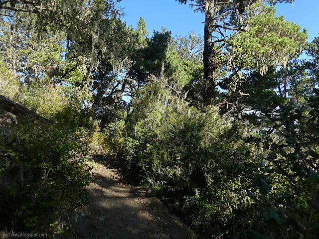

I wound my way among the trees at the very top of a narrow hill of sand held by those trees. The land falls off quickly to either side but the vegetation growing in the bottom is tall enough to reach up above the trees along the top.

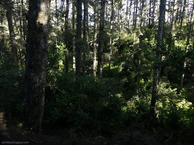
The trail split and I took the right fork to follow Du'k Trail. This took me down the side to have a look at what the lower trees have to allow them to grow so much more. Dirt and water instead of sand.

The trail travels up and over the next ridge and back around to a tiny second parking lot. This had the only downed tree and nearly all the mud I encountered in the day's travel.


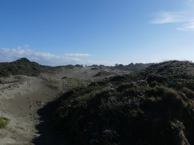
I turned back again, navigated the tree without getting my feet too muddy again, then took the left fork. This trail leaves the forest for a long, sandy slope down, but not all the way to the waves. Low vegetated dunes make one last barrier to those, which seemed to be higher and crashing with more energy than a few days before. I took a while to watch something that was not quite right for a red tailed hawk (probably a northern harrier) gliding about the place for a while.


I kept right again at a signed junction and followed trail signs along the edge of the silent gun club through the dunes to the beach.


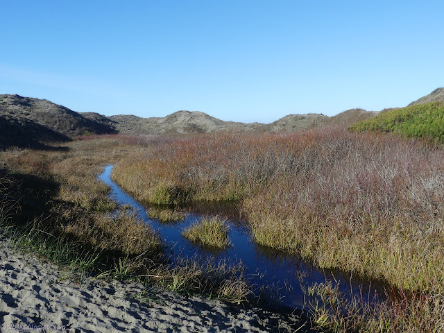
I hiked north with the tide coming in the last little bit before the high. I walked up to the bit of driftwood I walked down to before and then just a few steps further. Along the way, I kept noticing how the sand fell away in little holes all around as I placed my feet. Evidence of the life hiding below. (I made an attempt at a film to show the holes opening up. It sort of worked.)

I headed back, past the trail I came along, past Lutguk Trail, to the southern trail along the dune, which might also be Lutguk Trail. The sign mostly names trails leaving the parking lots, but after they join and split, it could be anything. The sign at the beach only indicates horses and hikers are allowed access.


Other than the climb over the short dunes that buffer the land behind from the biggest of the waves, this makes a fairly flat route back to the south side of the parking lot and the most popular route to skip all that apparently boring land stuff and just walk on the beach.


Taking the easiest way back wasn't quite what I wanted to do though. I dropped the sodden, sandy slipper and a few pieces of plastic I found on the beach (which was looking very clean, but it doesn't hurt to get cleaner) in the trash and circled back for the Ledik Trail I had failed to turn onto. This is also short, but it gives little flavors of the landscape as it goes.


There is a junction without any signs and it would have been hard to know the trail was official from that side. Most take the turn and walk down another wide sand ramp.


©2021 Valerie Norton
Written 6 Feb 2021
Liked this? Interesting? Click the three bars at the top left for the menu to read more or subscribe!


Comments