Posts

Showing posts from April, 2021

Little South Fork Elk River Trail

Image
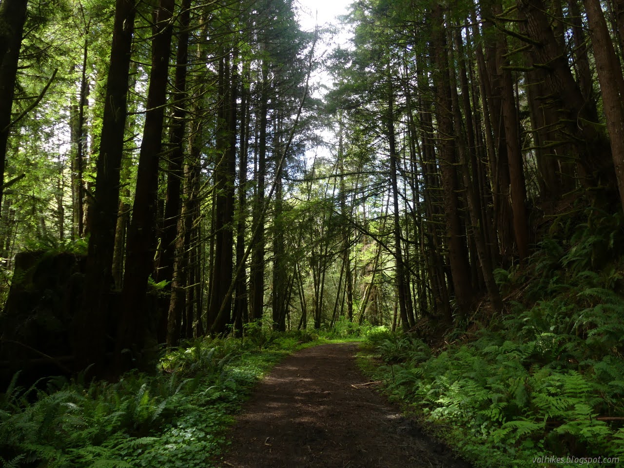
Headwaters Forest Reserve Click for map. I think I have missed fawn lily (AKA adderstongue) season, which is very strongly April. There's still some to find into May. Thinking of fawn lilies made me think of the Elk River Trail, although the splotchy leaved things there are actually fetid adderstongue which is a different group of the lily family. It would be cool to see in bloom, too. The flowers come February and into March, so it's even more missed. On the other hand, it's a good hike and the bypass at the slide area should be less treacherous now that it has been mostly dry for a few weeks. I headed south to spend the afternoon on a long hike to a tiny loop under old growth redwoods. Beside the citizen science sign for the bigleaf maple , I could see flowers blooming and leaves filling in the gaps. It's hard to get a good look at flowers hanging so high up. Along this wide, paved road. The first mile is ADA compliant. Flowers that don't belong

Rim Trail and Ceremonial Rock

Image
Patricks Point State Park Click for map. I headed out to Patrick's Point to "see it all". (This park has an $8/car day use fee.) I have missed a couple spots so far. The entrance station was in a moment of being unmanned, so I stopped by the visitor center. The volunteer within didn't know the answers to my camping questions. She probably does know various interesting things about many of the parks, but I wasn't able to form the right questions to get that either. So I left and popped over to see the Sumeg Village. It's not one of the spaces I've missed, but it is in the process of being renewed, so it's not the same as it was. The trail to the Sumeg Village starts just past the living being of a canoe. Not much change to the houses yet. These appear short because much of the space is actually below ground. Materials are being gathered. This likely represents quite a bit of work as traditional methods are being used. Then I remembere

Azalea Nature Trail on Stagecoach Hill

Image
Humboldt Lagoons State Park Click for map. With time left in the day and it being practically across the road, I went to visit the azaleas on Stagecoach Hill even though I didn't expect much of the azaleas themselves. There's a couple rhododendron on a fence beside the freeway in Trinidad that have started to throw off color and there's even one or two trees so big they stretch over a house roof that are already dripping with flowers, but there's not a lot to be seen of azaleas or rhododendrons in the more natural settings. I turned up Kane Road because I knew that's where to turn. It was signed at the next junction, then I stopped where things just start to look like driveway instead of road way, but there's enough room to park head in. Across the road, I found a small sign next to a large trail. If the flowers are showy, you'll know it before starting because the road travels along the bottom of the hill covered in bushes on the way to the parking

overland route search, Dry Lagoon to Big Lagoon

Image
Humboldt Lagoons State Park Click for map. I wanted some four hours to freely search out the trail that must exist over the hill connecting Big Lagoon to Dry Lagoon. On the one hand, I probably had this thought of "How hard can it be?" for following a bit of old paved highway. It's really just the getting down to Big Lagoon that is difficult. Except it's not just that, because there's clearly places where that old road is traveling down the hill in little pieces. The parts I had seen in person certainly don't support it being an easy walk. On the south side, I stared down a black, watery abyss surrounded by green and no trails at the broken edge of the road. On the north, I could see a track with some use actually climbing a little way up the hill away from the road to get around the green covering it. Anyway, if there is a track getting used, four hours should be enough to sort it out. The stretch just isn't that long. First I had a tour of the lo

Streelow Creek and Davison Trail

Image
Redwood National Park Click for map. I keep noticing the Streelow Creek Trail and wondering about it, so I headed out to try it. It's not very long. It seems to be part of an effort to make more trails available to mountain bikes, but that doesn't mean I can't walk it. I made it a loop with a bit of Davison Trail I'd noticed across the road from the parking for Trillium Falls and Berry Glen. So that's where I went to start. It does leave a little bit of Davison Road to walk. I put it at the end so I could chug along while thinking about the places I'd just been more than, well, the dusty road. As you arrive at the end of the pavement, there isn't anything to say what you might turn onto, just a complicated one about what is ahead, including a fee station. Left is Trillium Falls and right is the gated Davison Trail. Leaving, there's a good direction sign. I wasn't expecting much of Davison Trail. It follows along US-101, so of course ther

Little Janes Creek Loop

Image
Arcata Community Forest Click for map. I had bigger plans for the day, but a poor reaction to a vaccine made it feel unwise to go out so far. (But at least the chance of dying or disability at the proteins of some novel virus is reducing by the day?) I did feel better when moving, so came out for an afternoon hike. And do you know, I somehow seem to have never hiked trail 7 in the community forest? This is the sort of thing one can find out after taking far too much time to populate a map with everything she's tracked , although I really did it to see the larger holes. How to go? Well, it's out there a bit from everything, so it doesn't really matter where you start. I picked Fickle Hill. The parking is back in only. I might not have noticed except that there were four cars already there and all backed in. I expect it's for safety as people come down a little fast and I decided to go with it before finally noticing the sign after parking near it. And then... wel

Big Lagoon, Dry Lagoon to Patrick's Point

Image
Humboldt Lagoons State Park Patrick's Point State Park Harry A. Merlo State Recreation Area Click for map. Now that I've finished off the named sections of the California Coastal Trail (except Enderts Beach), I still have one more section of trail, or at least trail like, coastal trail between Arcata and Crescent City: the bit from Patrick's Point to Dry Lagoon, mostly along the side of Big Lagoon. This has some difficulties. First, directly south of Dry Lagoon is a section of beach that doesn't look particularly passable, even at low tide. Second, Big Lagoon is four miles long. There's a reason it's called Big Lagoon. After that, there's about two more miles of beach before the trail up to Patrick's Point. Six miles of beach is too much. Since I'm day hiking it out and back, six miles and then doing it again is way too much. So I resolved to do it. Almost. I dithered and got there 20 minutes after the time I was aiming at, which was just b

Azalea State Natural Reserve

Image
Click for map. It's April, so time to check on the azaleas. The web page for the reserve says they should be blooming in April and May. I wasn't expecting much. The listing for Rhododendron occidentale on iNaturalist does show an increase of observations in April, but the majority are May, June, July. The number of observations marked "flowering" lags a little with "budding" coming up most in April and May, but only about 16% of observations have had anyone bother to mark them at all. I didn't find much. They might be leafing out to try to identify them from the nude sticks, but none were ready to flower and none of the leaves I photographed were them. I did find other flowers as I toured the loops in exactly the same order. It had been a nice order. Twinberry honeysuckle was green buds, a pair all yellow, and this pair. I spotted some berries in Colorado and wanted to see the twin flower to go with the twin berries. The budding leaves can

Lost Coast Headlands

Image
California Coastal National Monument Click for map. I've been waiting for things to dry out a little and some low tide to try this one. That is partly because the Bureau of Land Management greatly overstate the potential of the road to be impassible to small cars, particularly if you are only going to Fleener Creek and not even leaving pavement until the parking area. The other part is because the dirt is a sort that becomes very slick when wet and makes the final transition from trail to beach difficult and the other way can become impossible. Low tide is just because I wanted to be able to get around all the cliffs to make a loop of it. Unfortunately, it seems to have got to that time of year when the weather computer thinks it'll be sunny in two or three days, might rain in five days, but it's foggy today and tomorrow. It keeps rolling along and neither the rain nor the sun come in the eternal fog. It was supposed to be sunny, but it was overcast and a bit foggy.

Jacoby Creek Land Trust

Image
Jacoby Creek Land Trust has four areas that might be visited by the public , all along Jacoby Creek if you can believe it. As far as I know, this is the last of the little local hikes in the area, however I'm suspicious that McKinleyville has a few hidden away. When I thought to hike this one, it was quite flooded with the creek running high. It's a lot drier now. I made an attempt to visit all the locations. Kokte Trail Click for map. Kokte Trail is on the Kokte Ranch that is the headquarters for the land trust and is the easiest to find. It has an address and a sign and parking and a kiosk with information and brochures. Just slip the chain off the gate and head out across the grass to the side of the creek. The trail starts beside the kiosk a few feet down the driveway. The land trust headquarters are around behind the barn. Or at the barn. Once by the creek, take a left and travel between the trees and brambles. A piece of the trail. Those alder trees

follow by email