Rim Trail and Ceremonial Rock

Patricks Point State Park


Click for map.


I headed out to Patrick's Point to "see it all". (This park has an $8/car day use fee.) I have missed a couple spots so far. The entrance station was in a moment of being unmanned, so I stopped by the visitor center. The volunteer within didn't know the answers to my camping questions. She probably does know various interesting things about many of the parks, but I wasn't able to form the right questions to get that either. So I left and popped over to see the Sumeg Village. It's not one of the spaces I've missed, but it is in the process of being renewed, so it's not the same as it was.

dug out canoe with more details than other sorts
The trail to the Sumeg Village starts just past the living being of a canoe.


very short buildings
Not much change to the houses yet. These appear short because much of the space is actually below ground.


slats cut from a nearby log
Materials are being gathered. This likely represents quite a bit of work as traditional methods are being used.


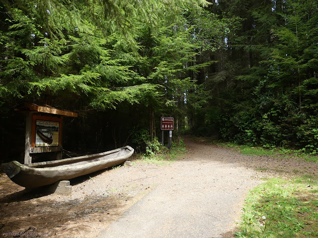
Then I remembered that the village is actually at the end of my planned loop around the park and returned to the entrance station to have my questions quickly answered by the returned attendant. (It's $5 each to stay at the hike/bike at Lookout Rock and $20 per site at Ryan's Cove hike/boat-in at Humboldt Lagoons. You register at the Patrick's Point entrance station for those. Why wouldn't you make that information easy to find on the parks' web sites?) Then I went around the other side to find the Penn Creek Trail. It wanders over to and around a loop of camping. It was empty in spite of the "campground full" sign at the entrance. I guess some of it is just closed off to reduce the density of people.

lots of signs
The Rim Trail is the preferred primary route for the California Coastal Trail and was marked with the crest in 2008, but this one on the Penn Creek Trail was the only one I actually saw.


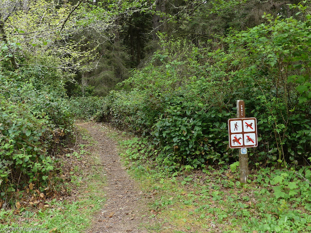
The trail winds back toward the road where there are some old trails to connect to the entrance road. I spotted one of the wide and squat wooden markers that are a previous generation of trail marker at the junction. It might have been an official connection once. The scruffy little trail imporved as it started to wind back the other way, crossing a bit of dry stream repeatedly.

big Sitka spruce
Sitka spruce are the dominant tree in the park. There's quite a few Douglas fir, some shore pines, and a few random plantings.


Penn Creek and bridge
A little bit of water in Penn Creek.


I stuck to the longer trail when coming to a junction near the actual Penn Creek, but it wasn't that much longer. I was soon out on the road and making my way to the Rim Trail. Then I walked right past it to go to Palmer's Point.

blooms of pink and yellow
A single western azalea bush in the meadow near Palmer's Point was getting a solid start at blooming. Did you notice the spider?


point of land that is called Palmer's
And there it is. Palmer's Point.


southerly view with lots of dark rocks sticking out of the ocean
Looking south. There's a small storm coming, which could mean amazing cloud patterns or could mean this almost flat grey.


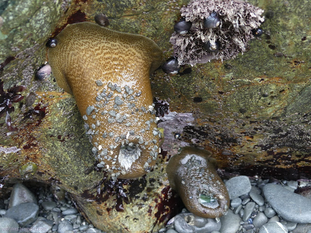
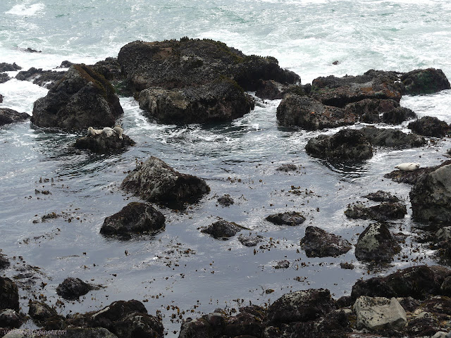
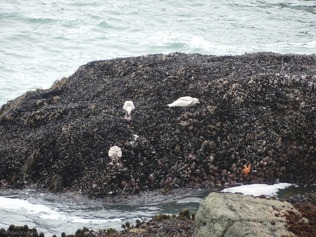
I then followed the trail down to Cannonball Beach. It was just 15 minutes or so to the low tide of around 0.5 feet. Excellent timing I hadn't actually planned. The rocky beach should be good tide pools.

dark rocks that are light where the water doesn't soak
Trail down to Cannonball Beach and the beach. The far inlet is where Beach Creek and Penn Creek set off into the ocean.


The cable and wood steps had come unmoored, so were useless to help in making the way down. I followed the rocky path many others had used before me. Then off to some tide pools, carefully trying not to step on anything. Such steps are only possible because others were there before me, too, keeping whatever little things might try to attach from ever becoming big things. Trails form the same way on the ocean splashed rocks as up on the dirt.

rim of pink tentacles
One deep in a little pool looking a little defensive with the outer tentacles inflated a little. On the left looks to be with the same sort of snail, but that little blue foot is a hermit crab.


mostly open anemone
Not every anemone was closed up.


pink and dark green lumps
The differing colors of these aggregating anemones had me wondering if it was different sorts of anemone, but they seem to be touching without fighting. The colonies of touching anemones are all clones and they attack anything that is not exactly like them.


thumbnail size mussels
I was trying to stick to anemones, but the tiny little California mussels are just too sweet. They're just thumbnail size and have their ridges.


giant anemone hanging down
That base is not permanently stuck to the rock. These strange animals can move around still.


blue and white and pink tentacles
A hint at the tentacles hidden within.


water rolling into the rocks, becoming calmer as it goes
Waves roll in, but mediated by the rocks, the water becomes very calm before long.


hermit crab crawling on an anemone
This little hermit crab fell upon this giant green anemone, then went scuffling off. The anemone didn't seem to react.


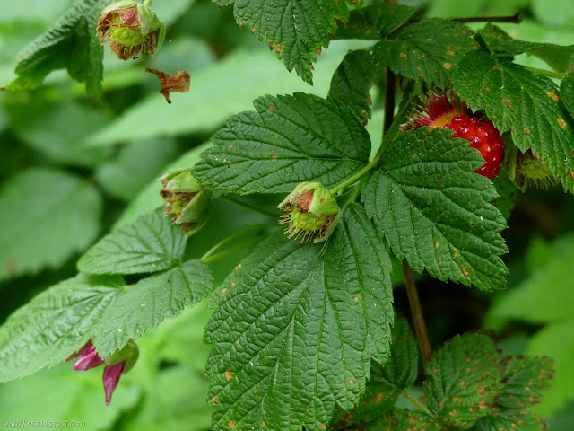
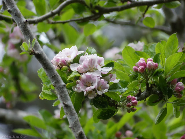
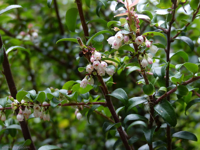
I headed back up. On my way up, I chatted a little with a guy sitting at the top of the steps watching the beach combers, including his wife and an otter. None on the beach noticed it as it came up and left again. I certainly never get to see the otters. I stopped by the southern viewpoint, then finally started down the Rim Trail. There's only two miles of it, so even though I had already dallied long and hard at the beach, I dallied some more trying to note the wildflowers better than on the last visit.

sign on the southern end of the Rim Trail
The southern end of the rim trail. Of the three or four different white flowers on the right, I didn't bother to note the blackberries in the middle.


stalks of small white flowers from deeply grooved leaves
Western lily of the valley might be part of the lower white flowers.


dangling white flower with a bumble bee retreating
These largeflower fairybells are certainly a part of the lower white flowers. They were fragrant and this bumblebee was one that got attracted by it.


divet in the coast line
The inlet where Beach Creek and Penn Creek arrive at the ocean.


tiny white flower bunch
The high white flowers are from elderberries.


grey squirrel with skinny tail taking a cone to a stick
The little Douglas' squirrel made sure I wasn't going to try anything while it took a cone down to its constituent parts. I later found a California ground squirrel that was also had no inclination of begging.


white flowers on a vine
The white flowers of the manroot vine weren't part of the different whites at the beginning.


bright red berry hiding in leaves
A salmonberry is starting to fruit. Someone had even sampled on from right above this spot.


I was determined to take all the little side trails, so when Rocky Point appeared, I went that way. It drops about halfway to the shore and there are ways to get closer. I stayed at the major stopping point.

lots of rocks
More rocky shoreline, with four harbor seals for scale. Another tourist felt the one on the right was posing.


rocks and rock climbers
Big rocks to the north including Wedding Rock out in the water. There's rock climbers on the far right. Hopefully that is one of the three rocks you are allowed to climb using permanent holds.


more rocky coast
Looking back to Palmer's Point and Cannonball Beach.


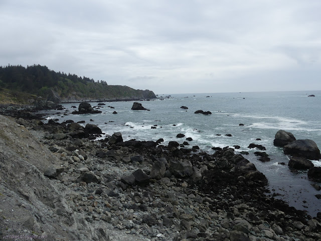
From Rocky Point, the things to see come quickly. I stopped to check out what the hike/bike camp by Lookout Rock actually looks like. There was someone relaxing in it when I went by before. Then I headed up Lookout Rock itself. This is a trail from a different generation that climbs on stones held in place by cement. For a lookout, there's really not so much view from the top. Much of it is blocked by trees.

double flowers stretching across the trail
Another twinberry honeysuckle pushing out into the rather clear trail.


top of lookout rock
The top of Lookout Rock with bushes and trees. It has a benchmark, but I only found the second reference and the post of the station.


tables and fire rings and bear boxes below
The hike/bike camping area at Lookout Rock is well in view. There's bear boxes and tables and a couple fire areas and garbage and water spigots. The bathrooms even have showers.


Next along the trail is Patrick's Point. The ADA compliant trail out to the north end of the point makes a very easy wander to more views of rocky coastline. I stopped, then returned to the Rim Trail and followed it around just a little more to Wedding Rock. Trail goes out to near the top of the rock where platforms and walls were built in the time when the state thought of its park more as a "park" than the "preserve" it is today. Admittedly, that is still balanced with "park" at least a little bit. There are over 100 campsites scattered throughout the place. After the rock, I wandered the rather moist trail north along the edge.

cliffs and rocks
Looking back at Patrick's Point and Rocky Point from Wedding Rock.


trails and cliffs
The short trail to the north, the cliffs, and Big Lagoon in the distance.


rocks breaking off
Wedding Rock looks a bit different from the north side.


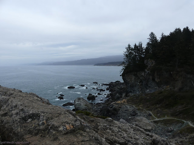
Next along are the Mussel Rocks. This is another spot where one might scramble down to the edge of the water to see all the animals that live in the splash zone. I didn't scramble so far down.

mostly mussels on the rocks
I watched gulls picking off food from the rocks covered in mussels and barnacles. The starfish might be eating too, but they aren't so active while doing it.


Past Mussel Rocks, the trail takes a longer wander along the top of the cliffs for the rest of its length. The only spurs are a few steps to overlooks.

rock sticking up among the trees
Ceremonial Rock is just visible through the trees.


pink buds and flowers
A single apple tree is making a show of itself at the edge of the trail.


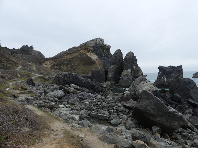
At the end of the trail, I still had one more destination, so made my way across the camping area to find a trail going to Ceremonial Rock. It was right around behind the bathroom. Signs were missing at some of the junctions, but I found my way.

row of planted trees
A row of planted cypress must have been standing here for quite some time.


large grass area and tables at the end
A group area, the sort of area that is likely to contain ceremonies today.


pink bell flowers among curved leaves with saw tooth edges
An evergreen huckleberries is putting on a good show of little pink bells.


There are cement and rock steps up to the top of Ceremonial Rock. The top is fenced in to prevent anyone walking off the side accidentally. It does tend to slope a little, then drop outright. I stopped at a lower overlook before climbing to the top.

Big Lagoon and Agate Beach
The trees surrounding are taller than the rock, so the views are limited. Still got Big Lagoon and a bit of Agate Beach.


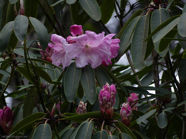
Nearly back down, I turned to follow a fainter trail that was only obviously built because there are a few built steps on it. This is the Ceremonial Loop Trail, which has a little climb on the north side before joining back up with the more used trails. I returned the way I came, then turned to make my way back to the entrance station area. I skipped the village since I'd stopped there on the way in. Perhaps I should have stopped to check the native plant garden, too. I did stop by the rhododendron by the entrance station, which is likely a planting.

posts marking the trails
The posts that mark the trails. Currently, the tall and thin is favored. Before, they were short and fat.


big pink flowers and buds
The tall, manicured rhododendron by the entrance station has started blooming. Another planted beside the visitor center isn't ready at all.


©2021 Valerie Norton
Written 2 May 2021


Liked this? Interesting? Click the three bars at the top left for the menu to read more or subscribe!


Comments

Jaunting Jan said…
I've really enjoyed your series on the Calif Coastal Trail. I'll use your post for future reference. I don't know if there is anything that can be done easily but your site is not phone friendly. Maybe I need the blogger app? Thanks again for sharing your photos and experiences.
Valerie Norton said…
Thanks. There will be a guide up eventually. Since it's the first guide I've written, it might be missing something important, but it'll cover getting from Arcata to Crescent City on majority trail, so it'll have something important too. I've already put in a week worth of work on it (not counting the hiking bits) and it's still got some left to do. So, um, yeah.

I'm aware that the site is not really phone friendly, I'm just not certain what to do about it. That's another thing I need to spend some real time on sorting and it needs to be soon. Another problem is that "follow by email" thing is handled by Feedburner, which will stop doing RSS to email list in June. It has become some sort of magical element of my page that has no source and can't be removed, so there's other reasons to just totally redo the window dressing of this blog soon.

I doubt the Blogger app will help. It's meant for posting and doesn't even do that well, unless there's some other Blogger app.
Ah, brings back memories. This is such a jewel of a little park.
Valerie Norton said…
Well, it's got all those nice cliffy bits.
Valerie Norton said…
Jaunting Jan: The last year's worth of posts should be a lot friendlier for phones now. One step is easy (once I found the setting again) and one step is hard. The rather extreme number of photos will remain, I'm afraid. My HTML is improving and now I know how to get a style sheet on blogger, but I can't figure out how to get captions restricted to the size of the photo. It's so ugly going off the end...

follow by email

popular posts:

Jennie Lakes: Belle Canyon and Rowell Meadow

Lost Coast: Cooskie Creek Route

Mount Lassic

If the Map's Wrong, Fix It!