Now that I've finished off the named sections of the California Coastal Trail (except Enderts Beach), I still have one more section of trail, or at least trail like, coastal trail between Arcata and Crescent City: the bit from Patrick's Point to Dry Lagoon, mostly along the side of Big Lagoon. This has some difficulties. First, directly south of Dry Lagoon is a section of beach that doesn't look particularly passable, even at low tide. Second, Big Lagoon is four miles long. There's a reason it's called Big Lagoon. After that, there's about two more miles of beach before the trail up to Patrick's Point. Six miles of beach is too much. Since I'm day hiking it out and back, six miles and then doing it again is way too much. So I resolved to do it. Almost. I dithered and got there 20 minutes after the time I was aiming at, which was just before the low tide. I noticed the splash of water on the road past one stream crossing, so wasn't surprised to see someone had done a better job of getting up for the tide. I got moving quick as I could.
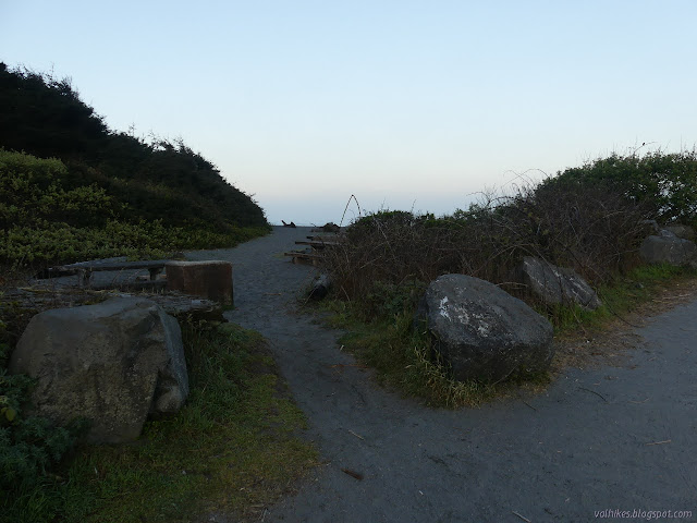
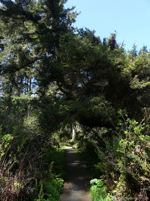
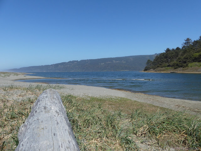
Just take off onto the beach and turn south. There's no trail markings besides the well trod sand past the picnic tables.
I followed the fresh footprints over the rough sand and across the sand smoothed by the last high tide and into the narrow rocky beach. At first, there is plenty of space between the rocks to just walk the sand, but there are some stretches where it is a clamber over mostly knee high rocks. I tested them carefully and found my shoes stuck to them pretty well even though they were wet. I moved carefully anyway. I had to time a few movements well.
Following footprints from the mass to the sand cleaned by the last high tide.
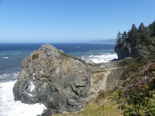
I got to a spot with a large rock with water around its base and the short cliff cuddled up behind. It actually cleared for a moment. I could just walk through the wet. I scanned the cliff by me and noted that the clay that forms it was dry and even had sort of steps in it from someone who had gone that way when it was a little wet. It was easy climb. I noticed a piece of road, one side flat and faded was once the surface, as I went up. There was a road here once? The hill almost looks as if there are trails along it. I went up and selected a trail I liked and had a pretty easy time of it until the end of the impassible zone. Then I tried to go a little bit further because I wanted a way down I could use when the low tide was 1.5 feet higher like it would be in the evening.
Not just the rock ahead, but the smaller rocks are also rather wet. I decided to use option B. Just a little left of center certainly looks like a used trail through the dead pampas grass. Slides along the way were just a scramble, but not a bad one.
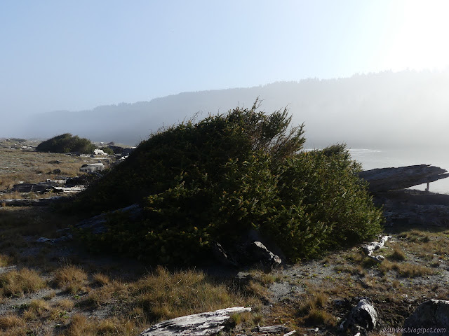
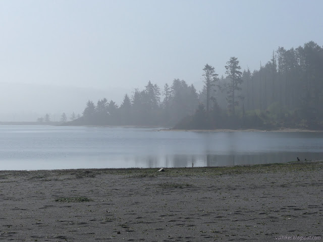
The hill is not beautiful, but it tells a story. There is a line of trees above with the ones along the edge tilting at a horrible angle as they start down the slide to the ocean. Sliding like that isn't good for roots, so lower down are just the broken remnants of trees. Even the pampas grass is having a hard time getting roots in that don't get destroyed. Further along, bits that looked like trail from afar turned out to be cracks that opened and caught water, meaning growing plants and clay that into right to the top of my shoe. The clay really is bad when it is wet. As I got to places the ocean doesn't wash the bottom so much of the day, I started to find more living plants all over and the going got harder, so decided to make a way down rather than fight the plants. There would be a way back even if it wasn't the one I took going out. I ended up using a moist clay spot to get down something very steep, but was safely standing on the sand on the far side. The line of footprints still goes on. I think they stayed on the beach, but they were washed away in spots. The high tide washed into Big Lagoon on the left last night in this spot where the barrier beach can breach.
Up ahead, I saw two fishermen. They weren't the makers of the single set of footprints that marched quite determinedly right past their spot. I asked the first if he was willing to divulge his route.
"You see that tree?"
I could see a lot of trees. I picked out the unique one that looked to have a camp to the right of it. "That crooked one?"
He said, "Yeah," in a way that sounded like "No, but close enough." He probably meant the one in the camp looking area with the swing hanging from it, but I couldn't see that in the morning light. He said there was a good trail up to Kane Road from there and workable trail along the side to it.
It's not Kane Road, but that doesn't matter. I'd been pondering what it was and looking at it in satellite view and had seen the various bits of pavement going to where the environmental camp is decaying away. I figured I should be able to take it to a spot to cut over to the camp, then I could use the camp trail down. The one that has been reported to be gone. Not a foolproof plan, but something would work out better than a 1.5 foot tide if this is what it looked like at 3 inches.
Then he added, "Did you see the whale vertebrae?"
No, I hadn't.
"You see that tree?"
There were fewer, but it still didn't make a good landmark. Anyway, it was up on that cliff over there a little closer to the waves than where I came down and I decided that is something to see and the tide wouldn't be any lower than it was then.
Looking back at the water splashing against the cliff. There's a whale bone to see out there. One giant bone. I had plotted going down about there. I should have seen it. Below is a bit of a cliff I wouldn't have gone down, but I wouldn't have known that until I was close enough to the bone to sit on it.
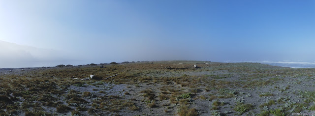
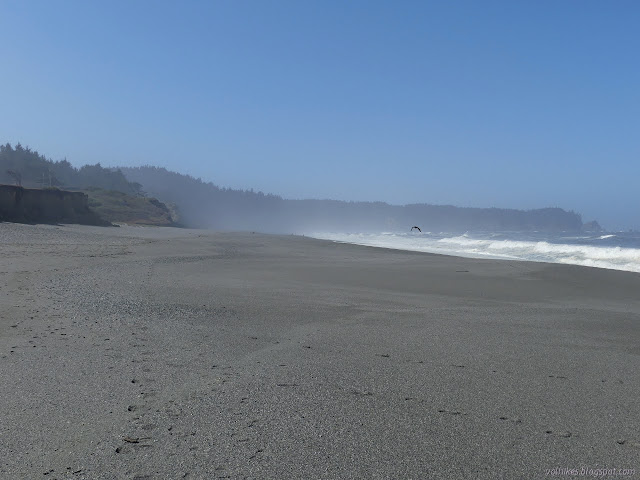
Someone else had come down while I checked out the whale bone. He was fishing for rocks. I turned to face the six miles of sand ahead. I stayed high where the little dune plants were trying to make a way, but the little bit of fog was taking away any view and there was no established trail through the plants. And what about the plovers? I picked up a bleach bottle, who knows why it was there, and I dropped down to the wet sand for a while. Unlike the wet clay, the sand is stiffer and easier to walk on when it is wet. The only trouble is, the wave slope is so steep it's a bit uncomfortable.
I found a spot to watch a bit of TV. There's only one channel with one show out here. After a short cliff of sand, the dunes start. Maybe this part is more rightly called a sand spit than a barrier beach. I took the blobs of conifer to be shore pines from a distance, but the leaves look like scales around the branches. It's spruce. Even at a distance, shore pine should have longer needles. With the tide coming in, the chance of having to run up the slope from a wave is greater.
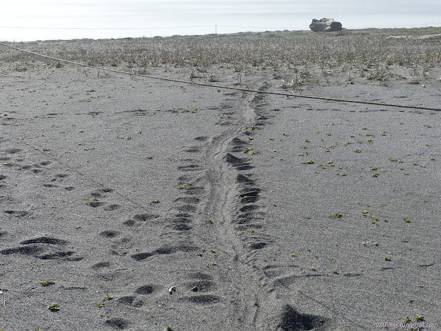
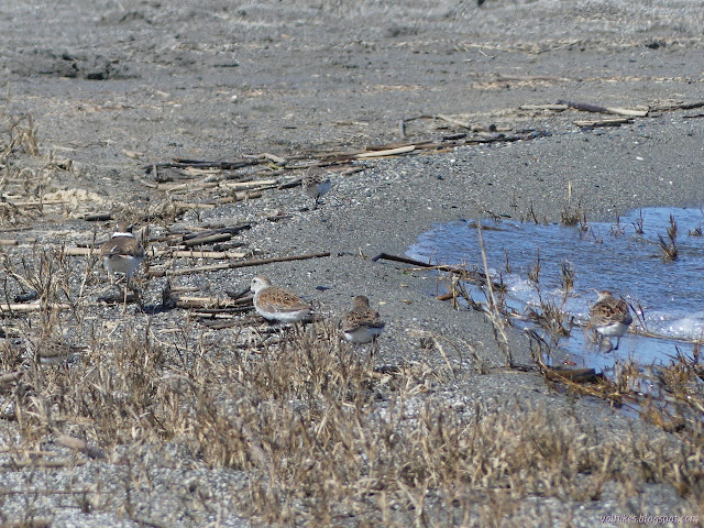
I spotted something man made up ahead in the mist. My first impression was pipeline on stilts. They seem to pop up randomly. It was a little smaller than that. Snowy plover protected ground? Just a roped off area cleared a bit to be attractive to the birds and marked to be avoided by the humans. Their nests are just a few stones and easy to step on accidentally.
The pinniped does not honor the closure. Probably harbor seal tracks.
There wasn't that much area marked off for the birds and what there was was split in half with a marked trail down the middle. I walked along the dunes for the last mile to Big Lagoon County Park. There were people scattered about, some from the park and some from the neighborhood behind it.
The far edge of Big Lagoon. There is a campground there among those torched trees. I find myself suspecting campfire as the ignition source. Patrick's Point is starting to be visible in the fog. The little spots on the sand in the distance are people making sure Agate Beach does not, in fact, have any agates to see.
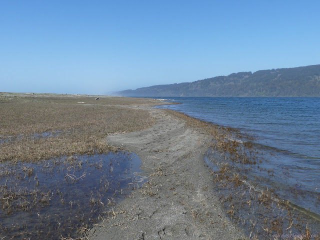
Agate Beach is wide enough that it has space whatever the tide. Storms probably clean it of footprints and bring down a little more cliff. There were old pipes from long gone houses sticking out of the cliffs in at least three places. Once I was below those cliffs, everyone I passed seemed to be industriously looking through the spots where pebbles gather. I industriously filled the bleach bottle with bits of plastic. The cove seems to catch it. At least the people coming down from the park were more incidentally looking. I didn't see one agate.
There are breaks in the tall cliffs where streams come down. One even had a little water visible. Looking across the cove. No surfers out today.
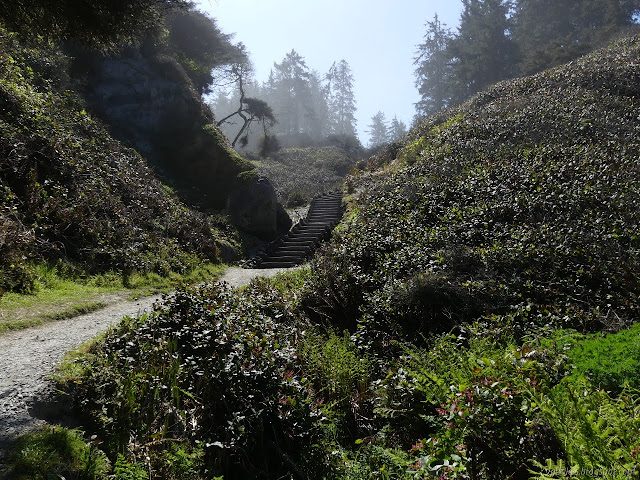
There's use trail up the creek, but the official trail is just past that with cable and wood steps. I headed up. I wanted to drop off all the plastic I'd found, and the beer bottle too, and had enough time to get out to Patrick's Point the actual point.
The gulls scatter before a couple of tourists. The official trail is unmistakable. The way up to solid land from the shifting sand. A few trees hanging on between the valleys in the cliffs.
It's annoying that there's not trail between Agate Beach and the Rim Trail. Instead, there's a little road walk past a few of the cabins and car sites. (I may have spotted a trailer that's even smaller than mine!) The camping was pretty filled but the Rim Trail was rather deserted until I got to the next parking area and the first trail to a lookout point.
It would be hard to continue along the beach, so up to the Rim Trail. The trail is generally well maintained, but there are a couple tread problems. The rock had three distinct levels of vegetation with three distinct ferns at each. This is the middle level. The immature cones on the Sitka spruce were pink when younger and wafting great clouds of pollen.
I overshot the trail to "Patrick's Point" the spot because it was labeled as an overlook (of the thing?) on the sign. Spotted the hike and bike camp and turned back after a look out on another spur trail. It's the accessible trail out to the top of a rock.
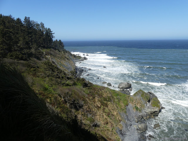
Rocky Point below and south-ish. Wedding Rock is the best viewpoint.
I hid away from the wind blowing across the point and had snacks before heading back.
There's quite a lot of back to go, almost all on beach. The water of Big Lagoon is barely visible at the end of the cliffs.
There were even more people down on the beach, but with a tendency to be enjoying the sand rather than examining it by the park. They were still examining it by Big Lagoon, with another group enjoying actually at Big Lagoon.
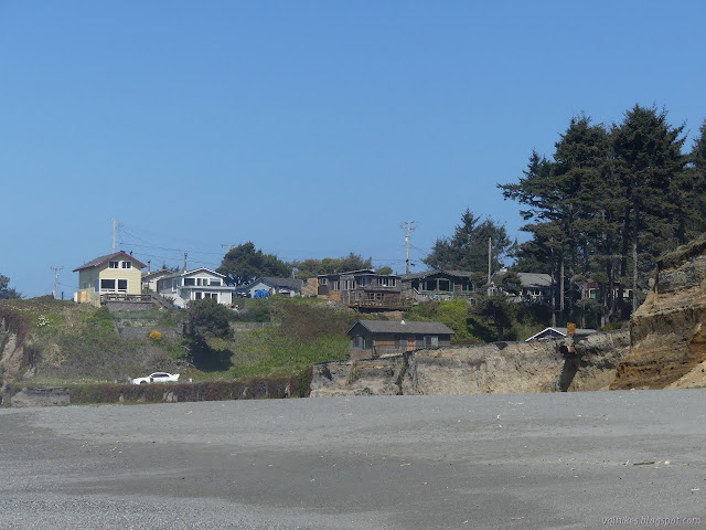
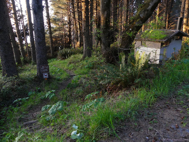
Little boxes on the hill side, all waiting for their turn at the edge. There's pipes sticking out of the cliff from the last one.
I was ready to be done with sand as I got to Big Lagoon, but that isn't how trails work. You hiked it out, you gotta hike it back. I sat on a log and poured sand out of my shoes and shook it out of my socks and wondered if one day I would become smart enough to wear shoes that don't have fabric permeable to sand when on the beach. It gets the job done, but it's hard on both socks and feet.
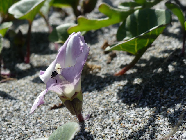
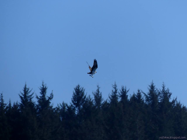
I didn't bother to document any of the profusion of flowers at the park, but I did seem compelled to do so on the sand. There's this morning glory relative that had a few ants drinking from it. The edge of Big Lagoon. I noticed a large bird maybe 100 feet up just before it splashed down and got a rather large fish. Osprey with its next meal.
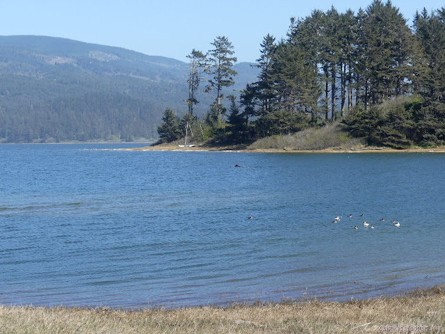
I walked along the edge of Big Lagoon for quite a while. There was often a bit of a path there. It looked like the water had recently dropped a foot or so.
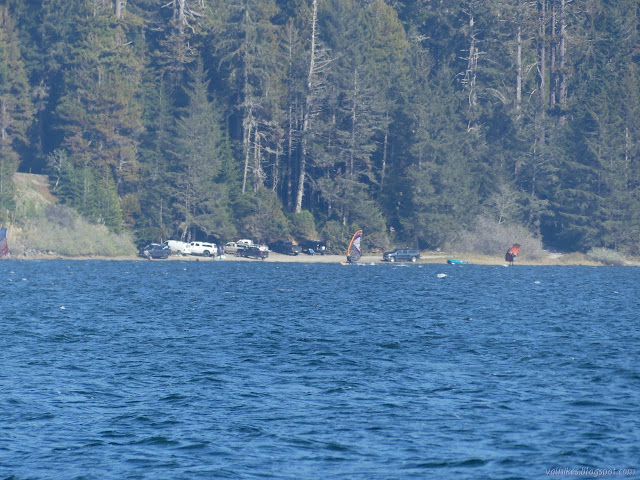
The open water swimmer paced along with me for almost a mile before turning back. The lagoon has a lagoon. And what about the snowy plover? Well, these closer two seem to be plovers, but not that kind. I found myself disturbing more and more birds along the water, like these scrambling dunlin. Everyone was out at Big Lagoon including about six windsurfers and related. The one on the right seems to have a handheld wing as did the fallen one in the middle.
I moved away from the shore. Someone had been plucking out ice plant and leaving it to dry on the driftwood. Since I wasn't picking up trash to stuff that bleach bottle anymore, it made me feel guilty. It's not the only invasive out there, but it's one I'm very confident about. A few more vanished from the ground.
This little lupine is really a sweet pea. Almost back. Sharp Point has been easy to pick out when the thin fog doesn't get to be too much.
I wasn't surprised to see ocean waves causing splashes on all sides of the rocks below the clay bluff. I was surprised to see the 5.3 foot high tide had washed the low area a the north end of the lagoon clean of footprints. I didn't even check for passage along the beach. When I looked for the goal area, I spotted the ropes in the tree, a good sign there really is a trail down to it. I went to the edge of the lagoon and found the scrambling trail upward. It would not be easy to handle in the wet either as it is more clay. From there, I started to climb. There was more trail going up, but I eventually decided to scramble over. There were many trails. The lower ones were better used, but I liked the upper ones better. It was surprisingly far over to the rope swing, or at least it felt it. As he said, there was good trail going up from that to the road above.
A view of the better used lower trail. It tends to hang out over the water and has sudden ups and downs.
I got to the road just in time to watch an oversized 4x4 come along through the branches. I had a look over the long drop off at the end while waiting for the lumbering thing to awkwardly turn around. He tip-toed through the ditch where the pavement had been removed to help warn him against going that way. There's not much to the road. Just enough room for 2-3 to park and the drop off. Next to the ditch was another warning against drinking the water or touching the poisonous blue-green algae. The trouble for me was that there wasn't even trail out past the end of that road. I would have to walk the highway, which goes a bit out of the way before coming back. I got going. It's more than 1.5 miles. I did find a steep and well used path down to the park road before getting all the way to the stop sign. The park road is much less stinky and noisy than the four lanes of highway.
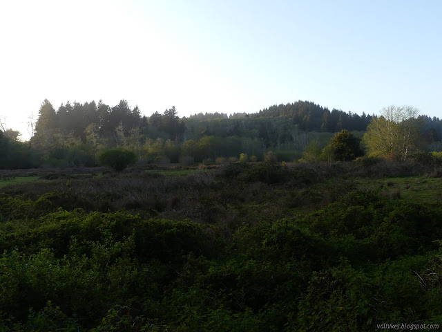
Back to Dry Lagoon. There's little puddles in it.
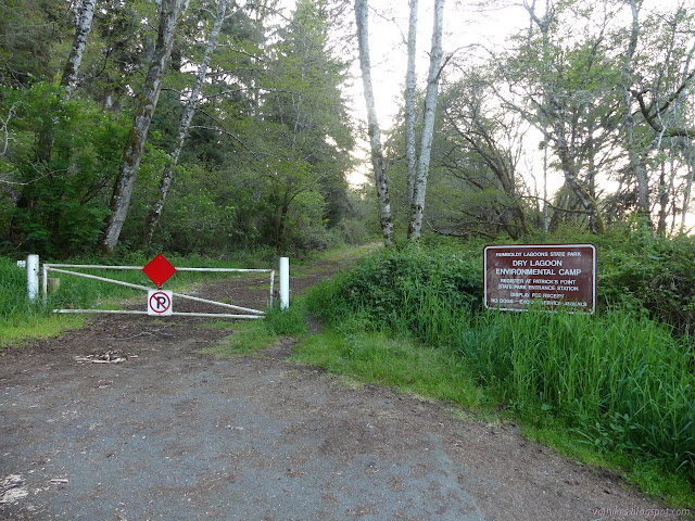
I got to the gate for the camp and, as much as my feet hurt and my legs were done, I decided I would go see it. There's very clear paths in the debris over the pavement. The old road is wider and even has old yellow paint (over the older white paint) down the middle. I didn't expect it to be so long or so far up. I passed a "leaving tsunami hazard zone" sign even. At the top, there is a very nice Sitka spruce forest and a failing barrier. There's trail continuing past that. Also, the trail down is not quite so gone as reported. It had even had the trees cut out recently.
The gate to Dry Lagoon Environmental Camp and the well worn path around it. The camp trail travels between the two vault toilets with spurs for the camp sites. This toilet is locked and decaying. Trail past the end of the road. This is likely the better overland route.
I found the trail easy to follow all the way down, although at one point it wasn't clear which was trail and which was camp spur. It came out practically at the back of the toilet.
One camp site, maybe two. The bear box on the right has rusted off its supports. Some others are in better shape. Another look at Dry Lagoon from under the nice trees.
I didn't know how much highway I had walked until I dropped my track onto the old USGS maps. They are desperately out of date in this area and my track on the little spur road and as it goes down the park road and up to the camp are all on the highway according to that map. The park road takes a sudden right turn because that used to be the turn off. The new, straighter highway with passing lanes both ways is just land to it. If I'd just kept on going directly up, presumably I'd have got to the next section of road past the big washout. I may not have been able to follow it. There is a spot where old road pieces can be seen fanning out above where I found one near the beach. I got back down with a minute to sunset, so no time to explore more. The park was closing.
Uncompahgre National Forest (map link) The Forest Service seems to be uncertain if it is Lake Hope or Hope Lake, but more certain that it is the Hope Lake Trail. It consistently marks the road up to the trailhead as a 4x4 road, so I parked in a turnout at the bottom and started up, getting increasingly grumpy about how it is a rather good road with a loose rock here or there. I chatted with some campers about how it was probably great all the way up, but they'd gotten to their rather brilliantly picturesque site and been sufficiently mesmerized by it not to continue on. Talking with them got me sufficiently emboldened to actually stick out my thumb at the truck that came by as I finished the chat. When you're going 5 MPH anyway, it's easy to stop, and he did. Greg was going for the hike too and actually wouldn't mind having a buddy. The road promptly turned to something it wouldn't be wise to try the Scion on. With good judgement, I probably could make it, but...
Humboldt-Toiyabe National Forest ( map link ) I had a big day planned and got up in the early cold. That first dim, dawn light played in a band across the western peaks of Lamoille Canyon. The edge of it diffused downward into the rest of the canyon and then the band was repeated, this time with the first light of sunrise. It took a lot longer for the edge of this light to travel down into the bottom of the canyon and I was long on the trail by the time it did. Trailhead at the end of the road. Detailed signs about possible destinations are a short way down the trail on the left. Looking behind to a long canyon of shadow A pleading to stay on the trail in this fragile environment There are two trails to choose from for going up. The hiker trail travels the east side of the canyon, so would be cold longer, but would look across to the lit part of the canyon, which I hoped would make for better photographs. The stock trail climbs the other side and I could see it sitting...
Apache National Forest Click for map. What struck my fancy to hike while at Quemado Lake was Escondido Mountain, although I'm not sure how one can get away with calling a 1800 foot prominence peak "hidden" is beyond me. It has no trails up it, so I have to determine my own route. Escondido Trail caught my eye first, but it really doesn't go high up the mountain and it doesn't do it on one of the steeper slopes. The road it starts from looks like a better bet, follow it up as far as it goes then grab the ridge tot the right. The easiest way up, though, looks like a 4WD road that starts further south on the (should be) Scion friendly Baca Road #13D. This one climbs high up to a saddle west of the peak leaving less than a mile of ridge walking to the top. Although it means a couple miles road walking on something I can drive, I think I'll combine the two into a loop. I just have to find parking near the intersection of 13D and 4018J, which is pretty eas...
Klamath National Forest (Map link.) It has been a couple years since I actually did some trail work besides kicking the odd log and a lot of sticks off the path. There have been some excursions by the Siskiyou Mountain Club that got far enough south to tempt me, but none had worked out thus far. I noticed they would be working out of Clear Creek for five days and that sounded long enough to make it worth the drive. Is it odd that these California trails are getting a lot of maintenance by people from Oregon? Yep. I also notice that the folks driving out of Ashland are actually a couple miles closer to the trail than I am. I'm coming from another county too. Judging by the license plates on the way, it looks like more people from Oregon are using these areas too. In fact, you can find it covered in guide books for southern Oregon. Thursday The lower (last) parking area at No Mans Trailhead with the traditional burn area hazards signs marking the trailhead itself. The wo...


Comments