Posts

Showing posts with the label guide

A Trilogy of Trails Books by J. Smeaton Chase
Image
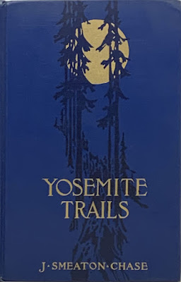
While not hiking anywhere particularly new or interesting in the recent months, I have still managed to have a little project on. I have pulled together, mostly from Internet Archive material, a set of e-books that chronicle some of the travels of one J. Smeaton Chase. These are in epub format. As it is essentially a zip archive of html files, it should be pretty universal. Not nearly so universal as a text file, but with infinitely more formatting and picture including capability, so I think it's worth the compatibility hit. Chase was born in 1864 and seems to have spent some time in rainy Cumbria (it gets a few mentions) before emigrating to California in 1890. He only saw the east as he transferred onto a train and watched it pass into the distance. He deposited his money in a bank which promptly lost it. (This gets no mention, but is found here .) From there, there are many odd jobs, social work, and travel that make up his life. There are only provided for personal reading. ...

Winter Backpacking in and around Humboldt

Image
I have only had one single solitary backpacking trip this year and it is not nearly enough. It has me thinking about winter backpacking opportunities in the area. I am specifically thinking about trips that, in a fair weather window, require no special winter equipment, although microspikes might still be a good idea. While you shouldn't need to exercise any special winter skills, the are still important to have. Weather tends to be a bit less predictable and a swollen creek will be more dangerous than one the same size that usually runs high. I'll start with some I have done, one way or another, then move on to trips that are speculation. These do happen to be reasonable summer trips, too. Keep in mind that while a trail may be low enough and not cross large bodies of water, access may still be a problem for potential backpacking areas. Anything over 3000 feet can have snow that sticks around for a while. Storms can bring snow levels down to 1000 feet and less. For elevation c...

California Coastal Trail - Arcata to Crescent City - hiking guide

Image
Little River State Beach, Trinidad State Beach, Sue-meg State Park, Humboldt Lagoons State Park Redwood National Park, Prairie Creek Redwoods State Park, Del Norte Coast Redwoods State Park Introduction The California Coastal Trail (CCT) is approximately 1200 miles of interconnected public trail following the coast from Mexico to Oregon. Or at least that's the dream. Currently, the trail is about 60% complete. In more populous areas, it often takes the form of boardwalks and multi-use paths marked by the swirl of blue wave crest. In rural areas, it may be pushed to the beach when that is usable, or to the nearest public route when that is not. The crest for the CCT marks a coastal access trail at the Lost Coast Headlands. There are thoughts of a route beside the ocean, but the primary route is substantially inland along Mattole Road for now. The beach becomes impassible in several places south of here and above the high tide mark is private property. The hiking trail rout...

HOWTO: free offline electronic maps on Android

Image
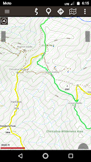
It is always better to have a paper map of some kind when hiking in an unfamiliar area, but they can be hard to get hold of and the expense does mount up a bit. If one has access to a good printer, CalTopo is an excellent resource to create maps. It's still possible to do quite a lot of mapping right on the tiny screen of the pocket computer we all like to call a "phone". Before I headed out traveling on the first day of winter 2018, I tried quite a lot of applications (er, "apps") for offline mapping. I'm uninterested in anything that requires a connection I likely don't have. These all had one thing in common: they are free. I have never attached a credit card to the app store because I live in fear of pulling my phone out of my pocket and finding it has just bought something random and expensive. Perhaps this is a phobia. I could probably attach a gift card to it, but I'm also cheap. Free Apps There are two apps I kept at the end my trying: A...

HOWTO: download USGS maps

Image
I had an old post for this, but they changed the look about a week later and now they've changed how the whole thing works.  So here is a new one. USGS makes their maps available for free in PDF format.  This collection includes historical maps as well as the current set in various scales.  Once in a while I claim I am wandering up a peak to see if I can find a benchmark that is on a 1905 map.  It isn't that I have some magnificent collection of maps, brought together by a grandparent and parent and kept up by myself, filling an entire basement.  It's just that I downloaded the historic map and gave it a look over to see if it had anything interesting.  I had an older version of these instructions, but the interface has changed significantly, so this needs updating. First step: Go to the map locator .  This will lead you to this rather nondescript page: Now find the region where you want to download maps .  This can be done by navigatio...

HOWTO: download USGS maps

Image
The United States Geological Survey has been making their maps available to download for free from their store website for a number of years. Over the last year, they have been making many of their historical maps available as well. This is done from the map locator and downloader linked on the store page. To download a map from that page, you will need to place a mark on the Google map displayed, then click on the mark. This will give download links for each map available for that location from 7.5 minute squares to 1x2 degree monsters. This process could be more straight forward. Here is how to do it. There are two ways to place marks. The first uses navigation on the map: With the "navigate" radio button selected (the default when starting), move the map to the area you are interested in and zoom into the area until the zoom level is at least halfway to the highest zoom. Once in the desired location, click on the "mark points" radio button. No...