Posts

Showing posts with the label river

Henryton and the HoCo Thru Trail

Image
Patapsco Valley State Park interactive map link Just down the road from my parking for an excursion east of Marriottsville , I pulled into a gravel lot for an excursion west of Marriottsville. I wouldn't have thought this was a legal lot, tucked up next to the active train tracks, except that I found there was already one parked, another pulled in after me, and there's an information kiosk at the end. What I didn't find was either of the trails I planned to hike in a loop of sorts. The train came by right after I got out of the car for a start that was more extraordinarily loud rather than excellent. Wowsa did it ever screech and rumble. Parking just off the railroad right-of-way access road by an informative kiosk. My map showed a trail running off the side of the access road to the right and another crossing the rails to wander off left of the tracks. I looked for the one on the right, but couldn't find it. Something to worry about later since it was my pl...

Smith to Summit: Smith River

Image
Six Rivers National Forest DAY 1  |  DAY 2 Click for map I didn't exactly jump at the chance to head up South Kelsey when Daniil offered the trip, but it has been nearly 5 years since I was on it and he had the good sense to want to go up the mountain, not just stay by the river, and there was a break in the rain. And it would be a sad thing to waste a break in the rain. And it would be a sad thing to miss a chance to hike something other than another loop through the community forest. On the drive up, I noticed I'd forgotten how pretty the Smith River can be. The G-O Road looked a little more clear, the narrow gravel off it to the trailhead and trailhead looked just the same. The trail is still in outstanding shape with bits of water passing it frequently. It's a while to see the river. The vertical rock walls are a thick garden of green. It wasn't a problem for me when I last was on this trail, but I recall hearing that Yellowjacket Creek can be a...

Lower South Fork River Trail

Image
Shasta-Trinity National Forest Click for map I was a little worried what the state of the county road serving this trail along the South Fork Trinity River might be, especially for the last mile after it encounters the long, "good" forest road. When I got to it, I found it in better shape than the one I'd been driving. It is good unpaved road all the way to the end, which is just a slight bulge surrounded by a dark forest. It took a moment to find the well signed trailhead back at the start of the bulge. Indecisive over the proper orientation to park here. As this is about 20 miles from the nearest pavement whichever way one comes, I was a bit worried it might be faint. Nope! It looks used and the few trees down look somewhat recent, at least in the first mile. Rather clear trail as it skirts a piece of private property. It's a while to the first view of the river. Had I been slowed down by having to walk the mile of road, the sun would have been hi...

Hammond Trail

Image
McKinleyville Parks and rights of way McKinleyville Land Trust ( map link ) All the rain that came through has brought the Mad River to a level not seen at any time last year. Admittedly, it stopped and the water has dropped back down a bit. That has allowed the little creeks started to run clear again. It's prettier when it all runs clear. I decided to go out and visit the river in its long run from getting almost to the coast (near the old railroad bridge) to actually breaking through to the ocean waves over 3 miles to the north. This time I would use the more common path on the McKinleyville side of the river rather than the long sandbar . There's a lot more places one might start such a trip and I've marked all the spots with public parking along the route. I actually started at the aforementioned bridge, the southern terminus of the Hammond Trail. Feeling a kind of tunnel vision at the southern terminus of Hammond Trail. The Mad River is still muddy on its...

Encampment: discovering the rest

Image
Medicine Bow-Routt National Forest (light blue line, map link ) DAY 1  |  DAY 2 I didn't quite have enough water for breakfast, so packed it all up and got the quarter mile or so up the trail to the next tributary to eat, drink, and make merry. I couldn't help poking around a little and found that there's at least a little bit of use trail going up Jordan Creek, or perhaps it goes on the Drunkard Creek side. I didn't get far, but it seemed to be going somewhere. I didn't really get along the trail until 9AM, which is better for having a little light down into the canyon. The river is still in shadow, but the shadowed rocks of yesterday are well lit. Here comes the sun. Rocky Mountain maples have a collection of winged seeds now and might be colorful later. Getting some high (and wide) ledge time on the trail above the river. I actually spent a little more time taking in the plants than the river as I walked the return.

Encampment: discovering the river

Image
Medicine Bow-Routt National Forest (light blue line, map link ) DAY 1  |  DAY 2 Okay, so somebody in Saratoga saying they want to do the Encampment River Trail probably isn't the best reason to go and do it, but I only had to go across the road for it so it sufficed. Since the Colorado side of this trail was such a mess, I decided to squeeze everything into the 33L pack instead of the 63L pack. Hey, it saves another pound. It's a tight squeeze, so I went with cold soak meals, saving a little more weight. I packed for an overnight with the goal laid back goal of just seeing how far I got. Since I was doing all this packing in the morning, the start was a little late. The Commissary Park Trailhead has parking, information signs, and a lot of open space. The Encampment River has grown by both the East Fork and West Forks joining. Wandering along in wide, glacial valley. I followed along trails near the river, but it turns out I was off trail. The official one ...

Zirkel: West Fork Lake and West Fork Encampment River

Image
Medicine Bow-Routt National Forest (purple line, map link ) DAY 1  |  DAY 2  |  DAY 3 No frost over my feet this morning. Actually, everything was nice and dry and probably a little warm for that. The lake was pretty in the dawn colors, but more photogenic a little later. Gem Lake from the shore near camp in the morning. So I headed back down to Main Fork Encampment Trail and lost the trail on the way. It was in right about the same place as I lost it on the way up. It's just a bit too thickly covered in trees there. Getting back on track was easier on this second go. Following the trail along the outlet stream back down to the river. The outlet stream gets big on the way down. A random pool along the way down to the river.

Zirkel: Main Fork Encampment River and Stump Park

Image
Medicine Bow-Routt National Forest (orange line, map link ) DAY 1  |  DAY 2  |  DAY 3 I settled on a three day loop plan to see a bit of the Encampment River at the north end of Mount Zirkel Wilderness with an excursion up Davis Peak for a bit of variety of terrain as well as visits to a few lakes. I thought about including some of the Continental Divide Trail, but the odd fat dotted line it follows turns out to mean ATV trail (on the western edge of the wilderness). Pass. I swapped out the Exped Ultra 5R for the Big Agnes AXL Insulated, so camp will look very similar to the picture a couple days ago except the mat matches the bivy instead of the roof. It saves half a pound and if I can't use that "3 season" thing in August, when can I use it? The Encampment River Trailhead might be the only one in Colorado you're allowed to camp at, or maybe someone's just removed the sign. There's a large loop with a few spots and a corral in the middle and a toil...

Halverson Creek River Access

Image
Klamath National Forest DAY 1  |  DAY 2 ... oh, bother again (map link) This is the overnight plan I was most looking forward to. The Forest Service quad shows a trail running 4-5 miles north (upstream) along the Klamath River from the road at the Halverson River Access to a pair of odd shaped inholdings. Things like that are usually patent mine claims. This was likely access to the Stenshaw-On-Klamath placer mine, originally. Just south of a massive landslide, another trail climbs away from the river to an old road that in turn connects to Ogaromtoc Lake with a campground. A nice walk along the river, then a climb to a lake with luxury accommodations (= tables and a toilet could be provided!) in about 6 miles. Short, but otherwise what's not to love? The marked river access next to the bridge. There were some clues this plan might not work out as I hoped. The Forest states that this is a 0.6 mile trail down to a spot popular with fly fishermen , substantial...

(South Fork Eel) River Trail

Image
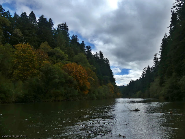
Humboldt Redwoods State Park Click for map in new tab. For a second day among the redwoods, I proposed to wander the gentle loop of Rockefeller Grove and cross Bull Creek in my ripped up old shoes, then put on my good shoes and socks to hike beside the Eel River for as far as I got. (Perhaps I should refer to it throughout as the Wiya't River in a private little campaign against banal river names foist upon already well known bodies of water.) I figured this would be an excellent way to take in the autumnal season. Okay, I was worried it might stay too far up above the side of the river to really see those colorful trees at the edge, but it would be a good hike and I'd probably have it to myself without the bridges put away. The start of a trail over a flat expanse covered in huge trees. I was surprised to find no notes at the kiosk warning that the bridges were gone for the season and held out a little hope that they might still be out for my use. The trail is ...