Smith to Summit: Smith River

Six Rivers National Forest

DAY 1  |  DAY 2
static map
Click for map

I didn't exactly jump at the chance to head up South Kelsey when Daniil offered the trip, but it has been nearly 5 years since I was on it and he had the good sense to want to go up the mountain, not just stay by the river, and there was a break in the rain. And it would be a sad thing to waste a break in the rain. And it would be a sad thing to miss a chance to hike something other than another loop through the community forest. On the drive up, I noticed I'd forgotten how pretty the Smith River can be. The G-O Road looked a little more clear, the narrow gravel off it to the trailhead and trailhead looked just the same.

01: stream crossing really good trail
The trail is still in outstanding shape with bits of water passing it frequently. It's a while to see the river.

03: moss, lichen, and ferns
The vertical rock walls are a thick garden of green.

It wasn't a problem for me when I last was on this trail, but I recall hearing that Yellowjacket Creek can be a bit much to cross.

05: cascade of much water
Yellowjacket Creek makes a nice cascade.

06: water over the trail
And it is all over the trail. Daniil shows the drier feet crossing beside the trail.

07: downstream look at the river
And a quick glance over the South Fork Smith River.

The trail tends to be high up above the river with plenty of growth between. Not getting a good view of the river didn't matter when the trillium put in an appearance. They were leaves and a couple seeds on my previous trip. Now they were soggy flowers as the last few spatters from the finishing rain still fell.

08: pink spotted trillium relative
The very soggy brook wakerobin is actually a Pseudotrillium.

09: amphibian with tan top and black underside
The little Del Norte salamander should have been safely unseen under its bit of wood.

10: matchstick and felt lichens on rock
More lichens populate a vertical rock.

11: much river
The big view of South Fork Smith River. It looks like a glacial river to me this day, but maybe it's been too long since I saw one of them. It is nearly 20 years since the last Alaska trip.

12: flower with peticoats
The sierra gooseberry is getting some flowers around its thorns.

flower pulled down by water
And the wakerobins continue to struggle under the weight of the gathered water.

14: bends of the river through trees
Another semi-view of the river. Much of the time it is even harder to see.

The river got distinctly closer as we approached the shelter at Buck Creek. Suddenly we were practically on top of it.

15: gushing water
River view from a camp site just short of the shelter at Buck Creek.

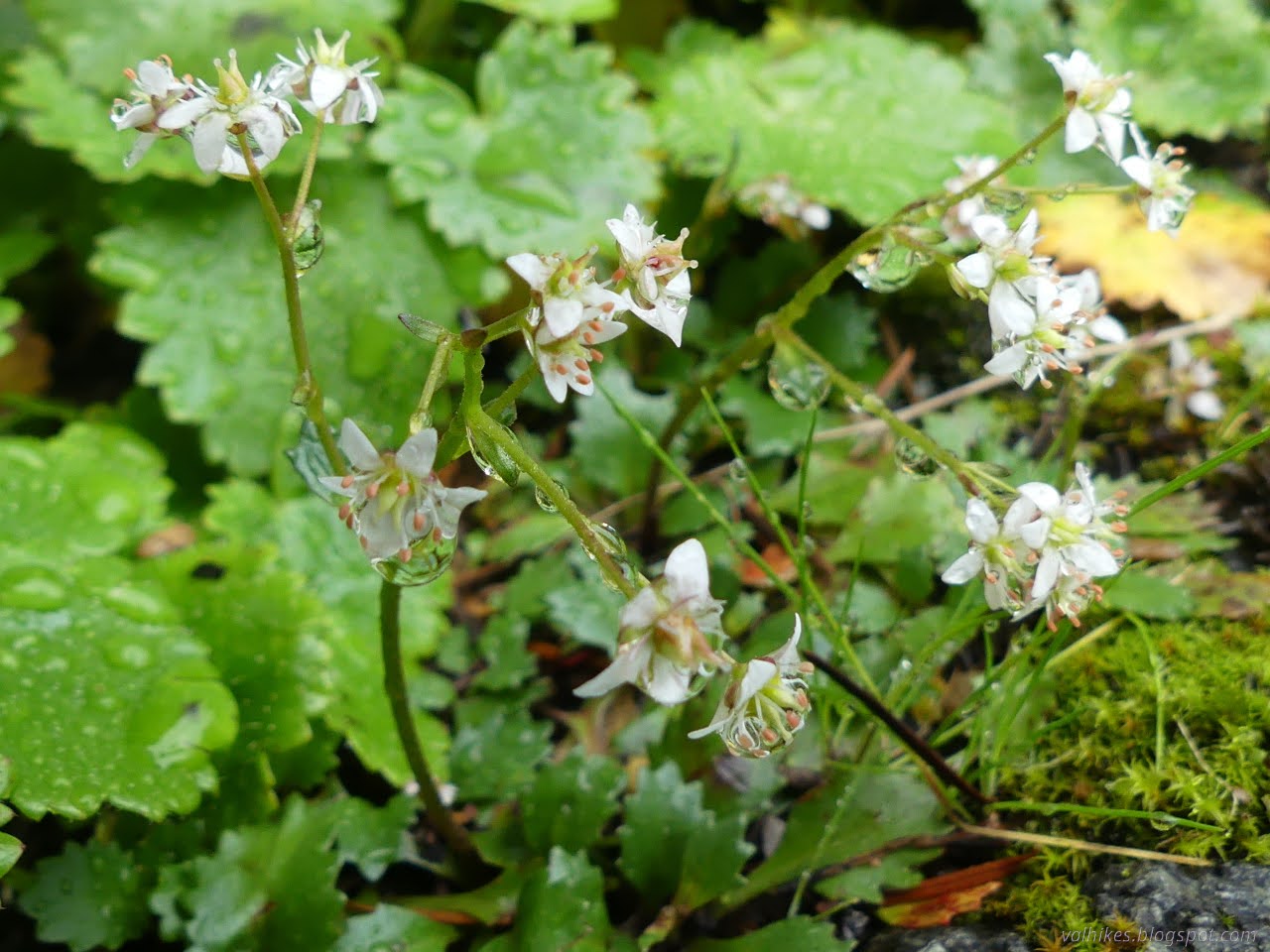
The shelter was having a mighty wildflower display. I gather it's a popular place for the short backpack and a lot of camping and swimming sort of trip, but there's plenty of space around it that isn't getting stomped. That was gearing up for an extravagant display of lilies, but already has plenty of others blooming.

17: little blue/purple bells
Snow queen (speedwells) along the sides of the trail.

drooping flower head
The checker lilies getting ready for a grand show.

19: three sides protected
A remaining shelter of the many mapped by USGS in the area.

21: high flow creek
Buck Creek coming over a little waterfall just before emptying into the river.

22: tiny white flowers
Wood saxifrage full of water drops.

24: lots of water beside a trail
It's all good when there's a bridge.

25: lots of water
Buck Creek is so much water under the bridge.

26: sign
And finally into the Siskiyou Wilderness.

The trail retreats from the river once more, although not always so high up a cliff. Well, a steep, rocky slope. Not so much of that.

27: small waterfall
A small waterfall as one tributary empties into a swimming hole.

28: huge creek
Quartz Creek is another big one, but it pours in from the other side.

30: fern covered hillside
Lots of green along the trail.

31: plenty of water in a little stream
Another stream crossing requiring wet feet unless there's a perfect set of rocks.

We were camping at the trail junction, or rather just past it at the sign for Elkhorn Bar Camp near another of those shelters USGS mapped. It is long gone, but there's some flat and it isn't under water. (Daniil came here recently just after a night with 6 inches of rain, and the water was deep then.) I wanted to visit Eightmile Creek again, so we dropped some gear and continued on. It's less than a mile further.

33: river of a creek
Arrived at Eightmile Creek. As I recall, it was simple to get to the island, really a long finger of land, and a little more difficult to continue to the other side. Also, there were more rocks to be seen through the water.

Much like Buck Creek, Eightmile Creek would be all good with a bridge. I looked a little along the banks to see if I could find the cables from it but could not. I think that was this creek and not Harrington. We poked around the camp area and watched the water rush and roar a little.

white water below crooked trees
Some of that water rush.

37: waters joining
There's a level of calmer at the confluence.

38: Leaves with a lot of purple
Future milkmaids.

fire ring with much built up waling area
The camp area at Eightmile Creek.

We headed back to our own camp for a bit of food and set up. This short day would be in support of a rather longer day heading for the summit of Summit Valley.

40: bits of blue
Sunset finally shows the clouds clearing.

Continue on to the next day ⇒

*photo album*


©2025 Valerie Norton
Written 11 Apr 2025


Liked this? Interesting? Click the three bars at the top left for the menu to read more or subscribe!


Comments

popular posts:

California Coastal Trail - Arcata to Crescent City - hiking guide

Bluff Creek Historic Trail

Loleta Tunnel

Jennie Lakes: Belle Canyon and Rowell Meadow