Posts

Showing posts with the label camping

Stone Lagoon and the Arch
Image
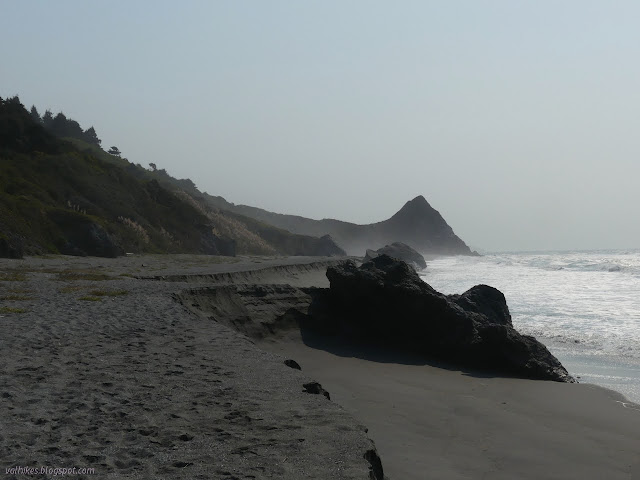
Humboldt Lagoons State Park Redwood National Park (Map link.) I was determined to experience the bit of California Coastal Trail along Stone Lagoon as it was "built". The predicted weekend rain wouldn't be enough to raise the level of the lagoon sufficiently to leave the north end of the trail once more underwater, but it might be enough to allow some attention to the inland areas that have otherwise been smoky and even slightly on fire. Now is the perfect time to finally walk the whole of this short trail. I planned to go all the way to the parking lot at the north end, then return the same way. I did have some thoughts about heading to Sharp Point and then walking the beach south from there, but the tides weren't looking very cooperative. They were coming in about 3 feet at sunrise and then climbing to about 6 feet at sunset with a brief backtrack in the middle to about 3 feet again. Sometimes there's just no such thing as a low tide all day. On the trai...

Racetrack Valley

Image
Death Valley National Park Locate the trailhead. The road into Racetrack from the north is best with high clearance although some were carefully making their way in passenger cars. We got to the parking by the Grandstand with the shadows getting long and walked out onto the dry mud of the playa (dry lake bed). The footprints of those who came when it was wet and ignored the sign warning against walking on it then are few, but well preserved. There are also tire tracks, both from when it was wet and dry, from those who really want to mess things up. The land is designated wilderness away from the road and the park does not allow off road travel. All these marks were fewer as we got further out. A single island in the middle of the lake bed is called the Grandstand.

Eureka Dunes

Image
Death Valley National Park Locate the trailhead. Sung gave me a last minute chance to return to Death Valley and jumped at it. This did mean giving up another trip to Joshua Tree, but the logistics of finding a hike while others are focused on climbing rocks is not as simple as finding a hike with someone focused on poking around and hiking. The first stopping point is Eureka Dunes. We approached them in the late afternoon along the best road in, a wide strip of washboard dirt road the average passenger car would be capable of traveling. The dunes are at the far end of the valley on this approach, a sudden large pile at the end of a vast flat like some giant has just emptied his shoes after the beach. The mountains behind them make them seem small although they are some of the tallest, rising nearly 700 feet above the dry lake bed. They got more impressive as we got closer. A huge pile of sand rises in the distance. We settled into the camp, a place with a few concr...

Mono Campground area

Image
Los Padres National Forest We headed up to Mono for camping and hot springs. The road is currently open and since there wasn't any water in the ford, it doesn't look like it'll be closing for the frogs this year. The web site even indicated that the road was open all the way to Little Caliente. Although people have clearly been driving all the way up, the road closed sign still stands across the road at the ford of Little Caliente Creek. We headed up for a moon light soak in the waters, then camped at Mono and had a poke around toward the jungle the next day. We didn't go very far, and disliking the rather abundant poison oak swishing at our legs, took a plunge through a spot clear of the stuff into the creek bed. We'd seen very little water coming over the debris dam and much of the bed looked dry. Nothing to see here, as far as water is concerned.

Himalayas: Chandrashila

Image
Uttarakhand, India <- Back to day two. We climb out of bed for a breakfast, including chocolate chip pancakes, and the last bit of hiking, climbing to the top of Chandrashila. The trail up the mountain starts a little way up the road, so we drove up to it. Buildings to serve all the needs of the average tourist stood empty so no one tried to sell us postcards of where we were about to go. The trail starts off paved until an area of temple and shrines about halfway up that also stands abandoned in anticipation of the coming winter. A couple of male Himalayan monals, the state bird of Uttarakhand. The paved path snaking up the mountain side.

Himalayas: hiking

Image
Uttarakhand, India The women of Sari came up the mountain in the morning early morning light, passing our still lazy selves chatting. They headed into the forest ahead of us where they climbed the trees (in their saris) and collected wood for the household. We got up for breakfast and had hot water for washing. Luxuries abound! The lake had formed a thin layer of ice on the surface in places and I wondered again about the orange trees such a short distance away. After breakfast, we packed up our personal stuff and grabbed what we wanted to have with us for the day and followed the women into the forest. Chaukhamba in the well established morning light. A small tree hanging over Deoria Tal. The growth pattern of the trees seems a bit odd, perhaps influenced by all the growth on them.

Himalayas: Deoria Tal

Image
Uttarakhand, India I went to India, as one does. One friend was having a wedding ceremony there and another had been demanding I should go at least once. Those brought me to Bangalore and Delhi and there were a few trips from each, but can you say you've been in India if you haven't been to the mountains? I had to find a way. Also, I had some encouragement from my friend in Bangalore who likes to run off to the mountains from time to time. She was trying to get us a set trip with a tour group, but in the end couldn't go herself. There was a couple going up on the perfect trip for me who were happy to have others join their trip, so I got to be a part of their tour. It is quite a different mode of travel than I am used to for a multi day walk. The trip started in Rishikesh and I was in Delhi, so I got myself a 2nd class ticket and boarded the sleeper train up to Haridwar. I wasn't sure how well I would sleep in such a setup or even what exactly the setup was....

Joshua Tree National Park

Image
A crew of folk, mostly international students, were going off to Joshua Tree to look about the place and I managed to go along with them. Once there, we quickly found a Joshua Tree to marvel at. Also some other plant life. A very large specimen of Joshua tree, which is some sort of yucca and not a tree at all.

Reyes Peak area (camping)

Los Padres National Forest Chorro Spring | Raspberry Spring | Reyes Peak We headed out looking for a place to camp. The main plan was somewhere on up highway 33 near Wheeler Gorge. First we looked for a spot in the valley, but the Gorge campground itself was full with people reserving spots and had weird rules for weekends. Middle Lion and Rose Valley were both quite full when we went by, so we climbed the mountain. Dropping into Pine Mountain and found one site empty. I dropped off my passengers to hold it and wait for the second car while going up to see if there was something in Reyes Peak, our preferred spot, but there wasn't. It was quite nice, though, and I found the trail down to Chorro Grande. After setting up and getting ourselves fed lunch, we headed over to Chorro Spring on foot. Then back for lovely dinner and a bit of star gazing. The stars were nice and crisp and plentiful. Then along came the very annoying not quite teenagers who felt the nee...

Alamo Mountain

Image
Los Padres National Forest Decided to have an overnight on the mountain. Haven't been there for quite a few years now and the little car should have plenty of clearance for the fairly well maintained roads up there. So up I-5 to Smokey Bear Parkway and just sort of go strait to get to the entrance to Hungry Valley. Then watch out for kids on dirt bikes that are worse than jackrabbits since they'll come back around to jump out in front of you again. I went up to the top of Alamo mountain some three times when I was a camp councilor near Fraizer Park and had been up there twice since, but not since the 4x4 died. The road used to be a bit of a sand trap but it had gotten paved the last time I went so I figured they were probably taking care of the road and it would be fine to take the car up it. It's now mostly gravel, but still a very nice road. Especially considering it's going through an off road vehicular park. I guess it's nice they're taking care ...

Strawberry Peak from Red Box

Image
Angeles National Forest Locate the trailhead. Just across the street from the far eastern end of the parking lot at Red Box Junction, where the road up Mt. Wilson turns off the 2, there is one end of Strawberry Peak Trail. From here it is a little over three miles to the top of the peak. The first two miles are very easy ones on fairly level trail that spends about half the time along the southern face of the mountain. First, though, it winds along some telephone poles. What I read of it said this was an old road for the first half mile and it may have been the old utility road but it was not particularly apparent. It also said the trail wasn't signed but it clearly is. The trail followed along the road climbing for a short way before turning into the mountains. Very shortly after starting, I passed a mile marker marked with the number 7. The road quieted completely as the trail found its way to the back of a nearby peak, but the observatory was still easy to spot. ...