Posts

Showing posts with the label great rocks

Grimes Point and Hidden Cave

Image
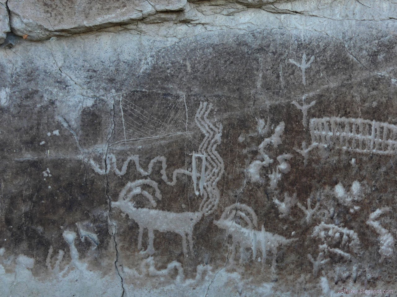
Stillwater Field Office BLM ( map link ) I passed right by Grimes Point on the way out to see the annular eclipse , which quite definitively closes my circle through Nevada that started with the Pony Express and other ruins . (There's an introduction at the Lassen overlook , but that's in California, so that doesn't count.) I wanted to stop this time because there are petroglyphs. These aren't just any petroglyphs, either. Estimated to be at least 8000 years old, they're some of the oldest in the state. There are some that are probably at least 10,500, perhaps 14,000, years old, so they're not the oldest. One of a few information signs at the highly developed Grimes Point Trailhead which includes toilets, covered picnic tables, paved road access, and more information signs. My plan for the visit was to take a turn around the interpretive trail that visits some of the petroglyphs in the area, then head up the Observation Point Trail. There were some...

Monte Cristo Canyons

Image
Tonopah Field Office BLM ( map link ) I got a late start because, well, it's cold out there. I don't particularly want to deal with the part of the day that's below 20°F, quite frankly. A south facing slope and warming sun can fix it right up in a little time. It's bad enough when water freezes, but when the pancake batter or even the eggs freeze, it is really annoying. When I did start out, it was still too early for a raptor that I kept disturbing as I headed toward yesterday's missed Earthcache . My target, the line of white cut into the desert slope in the distance, more toward the bottom than the top. A disturbed raptor, probably a northern harrier, takes flight from the sagebrush. I disturbed quite a lot of sage sparrows, too. The little flocks would flutter and swoosh and become dark spots on one turn and flashing white spots on other turns. I decided it was time to try to capture a flock with the camera as I walked across the less impressive l...

White River Narrows

Image
Basin and Range National Monument ( map link ) The three rock art brochures I picked up at the Caliente Field Office included one for the White River Narrows. When I had iffy signal, I had seen, but not kept, the printable map from this site . That would have got me to the sites, but the brochure has more to say about them besides don't touch, not even to take a rubbing. (But also, don't touch. Especially not to take a rubbing. It's illegal for a reason.) I did try to visit anyway, but it didn't work out well. I debated if I really wanted to backtrack out of my way 24 miles to try again, but while flipping through the Rock Art book from the Nevada Rock Art Foundation (also available in PDF here) , I spotted a particularly interesting panel and found it is part of the site here. Okay, I do. But first, this is what it is like to visit without the brochure in hand: 20 Nov 2023 I was traveling from the Wayne E. Kirch Wildlife Management Area toward Caliente with...

Big Rocks Wilderness and Pahroc Spring

Image
Caliente Field Office BLM ( map link ) Camping at the edge of Big Rocks Wilderness by the "Welcome to Mecca!" sign, I decided that my goal for the day would be the Big Rocks Wilderness high point, which is also the North Pahroc Range high point. However, I did not want to walk up the road I had driven, nor did I want to risk driving it again with my inappropriate car, so I wouldn't be starting from the points west of the unnamed peak where the most successful attempts have originated. I would be traveling from the south, probably along a ridge. The one person who had traveled similarly from the north indicated that this was some of the most taxing terrain they'd been on. There is also a lower benchmark that would have been a more reasonable goal from my starting point, but no, it was not mine. I've been getting high points and here was another 4 miles off and I had all day to do it. I wanted another high point. Sign to welcome folks to Mecca. It's not...

Geocaching and Finding Mecca

Image
Caliente Field Office BLM After stopping by the Oak Springs Trilobite Site a second time , I had a relaxed program of travel aiming at Mecca, #19 on the Ely District Recreation Opportunity Guide. It has a toilet and picnicking, so it would be easy to find although these circles aren't always well placed. (Crystal Wash Petroglyphs is marked on the wrong side of the highway, for instance.) It's not far, so I added in stops for a couple geocaches on the way. They were supposed to be stops during the first pass along this road. This time, I hit the "toggle talking" on c:geo so I could actually stop in the right place for these. It's annoying, but the Lincoln County High School radio station kept finding dead spots leaving nothing at all for my driving entertainment. I'd Go a Mile for a Smile-Yuccy Dead : Says it's "on a road you could take your mamma's Jetta." This really is a good road except for a little washboarding and part of the road t...

Boulder Loop: Middle Boulder Lake, Cement Banks, and East Boulder Lake

Image
Klamath National Forest (green lines, map link ) DAY 1  |  DAY 2  |  DAY 3  |  DAY 4  |  DAY 5  |  DAY 6 Morning at Telephone Lake. It's a funky looking thing. Perhaps the two lobes look a bit like a telephone receiver with enough foreshortening? I would run into clues for another reason to call it Telephone Lake later. The water is significantly below the rim and below the high water mark. Telephone Lake The nicer view of Telephone Lake. The rocks at the back glowed nicely in the sunset, but I didn't have my camera with me as I watched it. I took off down the trail. It's all rather badly burned. Hoofprints marked where the equestrian went. I got upset at how much milling and messing up the trail he did until noticing that the milling prints are the two toed ones of cows. Cows are trying to lead hikers on this trail astray at a few strategic points. The horse prints managed not to be lured and neither was I. Makin...

Lead Mine Hills and Provo Tufa

Image
Salt Lake Field Office BLM Wells Field Office BLM ( map link ) I wasn't satisfied with the hike up Mount Pisgah as a hike next to the alkaline desert because Ferguson Mountain sat there blocking a lot of the view. Meanwhile, there is tufa at the Provo level of Lake Bonneville and I was interested in seeing some of it. The only information I had for that was walk around and you'll find it. The Provo level was around 4740 feet, which is higher than Blue Lake, but lower than the top of the Lead Mine Hills. I found a spot to park at the fence for the Air Force bombing and gunnery range a little below 4400 feet and aimed at exploring my way toward the Ferguson benchmark at 5565 feet and then the high point at 5661 feet. Ferguson benchmark at sunrise. Are any of these structures around its feet the Provo tufa? USAF Bombing and Gunnery Range. I was pretty sure none of my peaks were within this since it ends pretty quickly. Expecting this part doesn't get much use sinc...

Black Face and Lizard Head

Image
Uncompahgre National Forest San Juan National Forest (map link) I don't know why, but yes, it is really called that. It doesn't call itself that, so I'm not holding it against it. The sign at the trailhead suggests this is a popular loop with the Cross Mountain Trail and, if you can't get together a shuttle, about 2.3 miles of highway. Ugh. But that's what I set out on, with a plan to divert over to the pass above Bilk Creek to check out that distinct view that is rather close to the trail. The weather, so far as I knew, had a slight chance of thunder storm all day. There's trees up there, so I decided to risk it. I walked over from my dispersed camp at the corral across the highway (a large area set up for the purpose) to the trailhead to start the loop. The weather, so far as I knew, had a slight chance of thunder storm all day. Lizard Head Pass from the trailhead. The sign below marks the boundary between San Juan and Uncompahgre National Forest. Th...

Lizards Mouth Rock

Image
Los Padres National Forest Click for map. I popped around to Santa Barbara and visited Bernard, who was skipping the holidays for the Wednesday night hikes, but out for the very short Lizards Mouth hike for the weekend. We hiked a mile extra along Camino Cielo on the way in and got that shortened for the way out. That meant passing the Playground, which wasn't so busy, before getting to the rock, which was bustling and humming with all the folks out for the last weekend of the year. Clear, but that doesn't mean there's much to see of Carpinteria on down the coast. The last couple storms through actually dropped some snow, at least on the stuff that's 5000 feet high. Some fell lower, but it's gone now. Some rocks of the Playground below. Further is a reservoir, the lagoon at UCSB, and the Channel Islands. The separation between Santa Cruz and Santa Rosa can just be seen from here. I take the first trail into the exposed rocks around Lizards ...

O'Leary Peak and Lookout, Darton Dome, and Robinson Mountain

Image
Coconino National Forest Click for map. I almost went for O'Leary Peak instead of the wanderings I did on the fee free day, but it is actually just outside of the monument and requires no fee, so I came back for it. It didn't take long. Today I'll make my way to the lookout, which has road all the way up, then decide what I feel like stopping by on the way down of the various smaller peaks near the road. Three other cars have beaten me here. Gate and trail sign on the road to the lookout on O'Leary Peak. The road rolls a little, first dropping and then rising, as it wanders the forest toward the base of the volcano that holds the lookout. Trees and cinder and only the slightest undergrowth stretch out every way. It swings northward as it comes to the edge of the Bonito Lava Flow. Little signs march along the imaginary line between forest and monument as it cuts through one corner of Sunset Crater National Monument. Quite the nice road up to the looko...

Monarch Point

Image
Bears Ears National Monument Click for map. Today is another day for peak bagging, but there may be other goals along the way. The name of the peak may even be a clue. There's actually a couple peak goals, but I decided to break it up into different hikes with the usual checking out one canyon on the way up and a second on the way down. This one starts off not just on trail, but with an official trail marker! There can still be a challenge to follow it among all the other trails. Most of the challenge is in the wash. Once on the rock, there's a clear trail of cairns going right into the canyon I'm aiming at for the climb. Marked trail. The trees may look a little funny, but that's because they are growing from a level about 20 feet lower. A cairn to at least suggest a way to those who pass. Just a shallow canyon at first and even with some fall colors remaining. The trail finishes under a magnificent waterfall, at least I'm sure it would ...