Lead Mine Hills and Provo Tufa
Salt Lake Field Office BLM
Wells Field Office BLM
(map link)
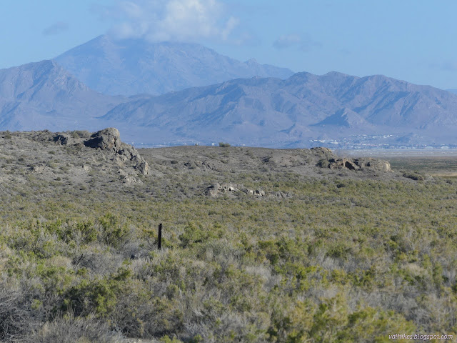
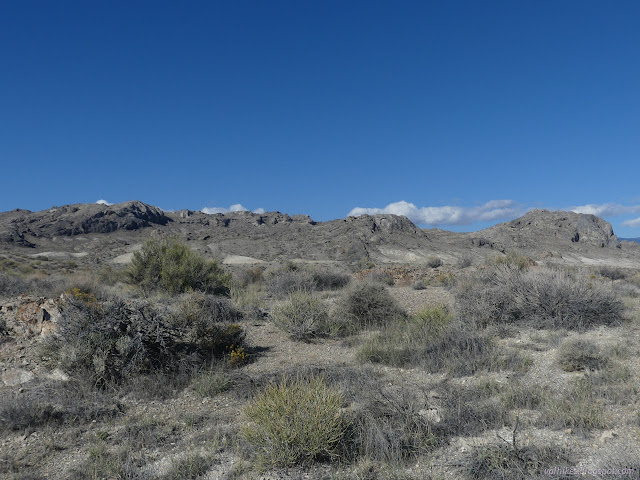
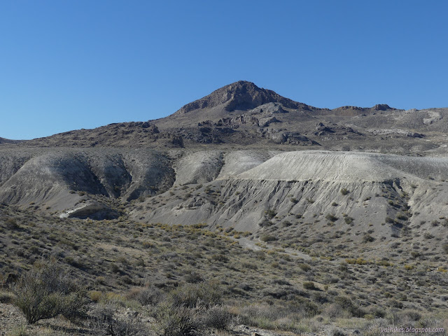
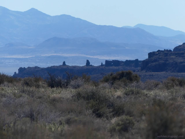
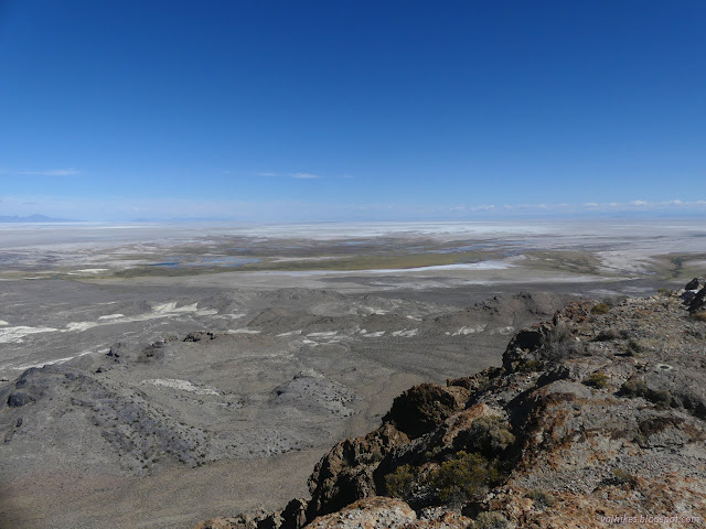
I wasn't satisfied with the hike up Mount Pisgah as a hike next to the alkaline desert because Ferguson Mountain sat there blocking a lot of the view. Meanwhile, there is tufa at the Provo level of Lake Bonneville and I was interested in seeing some of it. The only information I had for that was walk around and you'll find it. The Provo level was around 4740 feet, which is higher than Blue Lake, but lower than the top of the Lead Mine Hills. I found a spot to park at the fence for the Air Force bombing and gunnery range a little below 4400 feet and aimed at exploring my way toward the Ferguson benchmark at 5565 feet and then the high point at 5661 feet.


The fence for the Air Force reservation just ends next to a quarter section corner at the state line, at which point I got distracted by the potential of finding a state line marker.

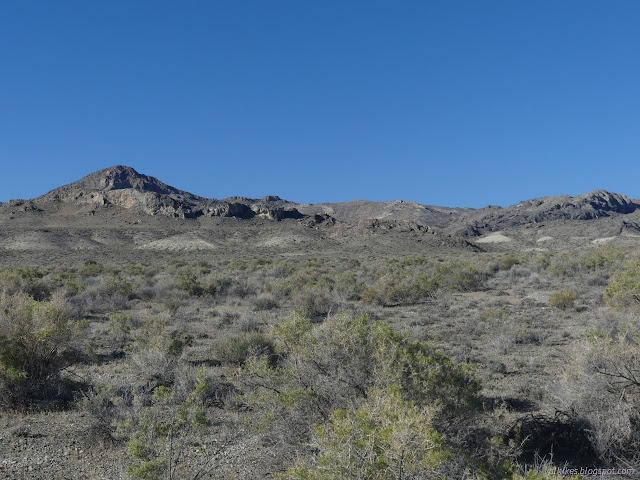
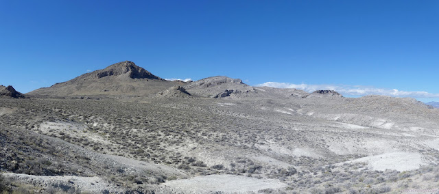
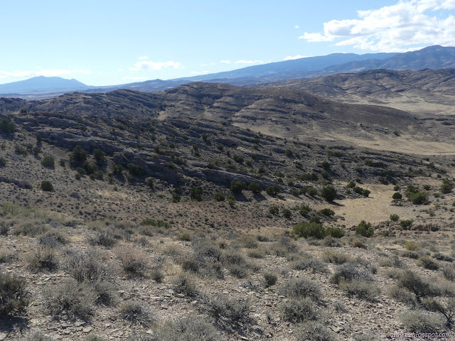
I got to climbing to the white slopes that appear to be just below the level of ancient shoreline in my search for 14-15k year old tufa. The search is made a bit harder by not knowing exactly what I'm looking for. I found a thesis using tufa to estimate historic fault line slip rates which included some locations (not particularly nearby) and a picture. It's probably not the white slopes.

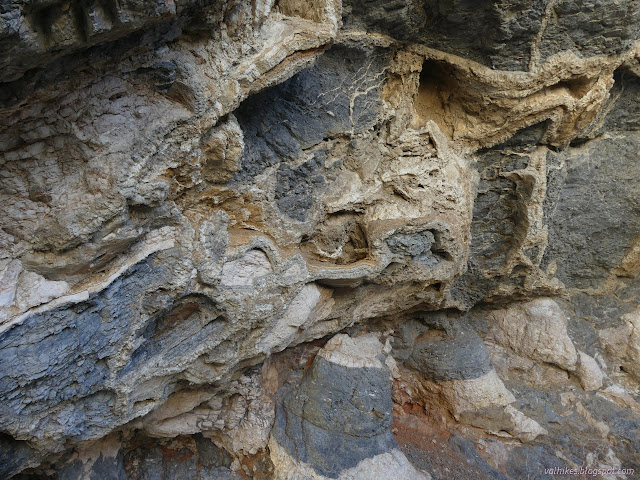
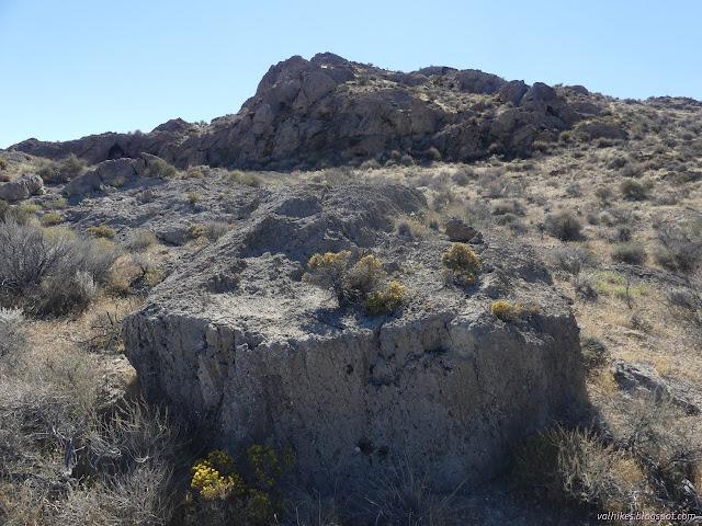
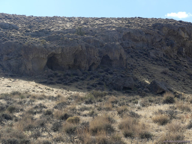
I thought I saw some caves and went over to investigate.

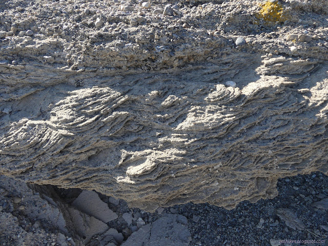
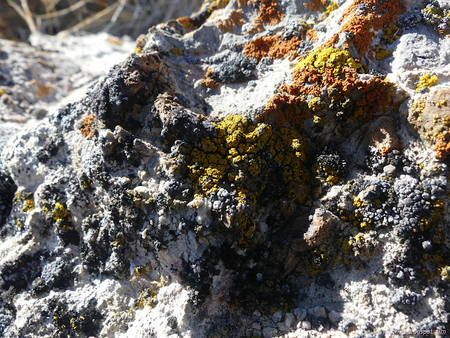
The arch was just the start of cool stuff. There's all sorts of crystals that have formed along the edges of rock domains. Pretty certain it's not old tufa, but it is part of being at the bottom of an alkaline lake. (Although it wasn't particularly alkaline until it shrank.) Or maybe it's just gypsum. I made sure it wasn't going to burn and decided to taste it, but it didn't taste of much. Certainly no sharp salt sensation. There's even better, cooler crystals along the rock ledge near the arch.


That all is maybe at the edge of the lake, which means the tufa should be downhill. I wandered off toward what I thought might be tufa just a little bit lower.

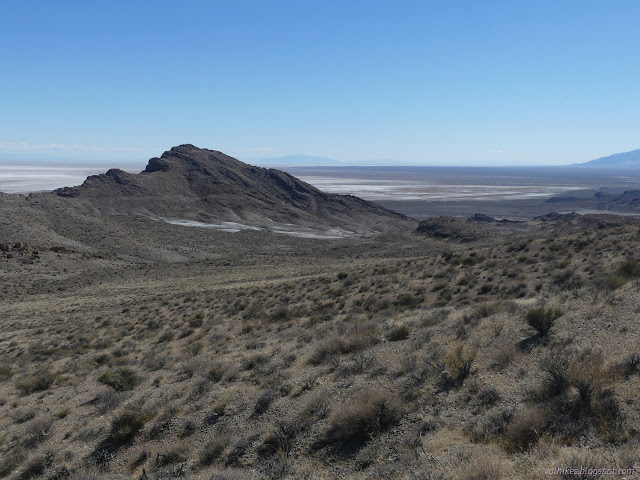
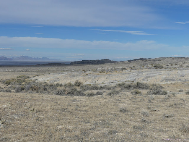
The Provo tufa will never get a crowd of photographers out for the sunrise that can be found at Mono Lake. It's a soft rock and doesn't really stand the test of time so there are no turrets or other fun shapes.


I took to finding my way closer to the Ferguson benchmark, but with no desire to get there directly. I wandered downward into an interesting gully with its own calcite formations, aiming to approach the peak from the east.


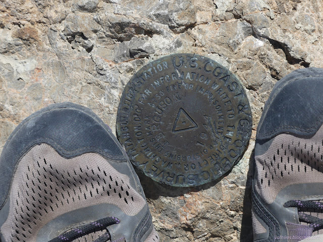
The last bit to the top got quite narrow and was very nearly sporting a trail. It's nice at the top with quite a lot of view.

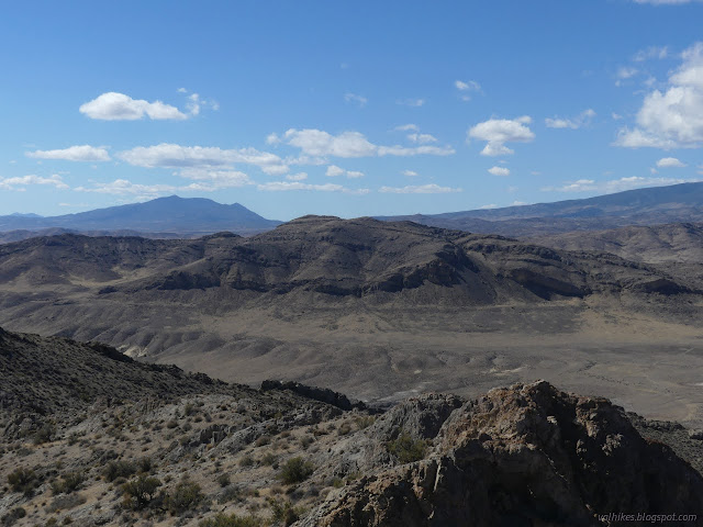
I traced the last part of my route back down, then picked a convenient ridge to continue along to the high point. I decided to swing around to the left to go up it, too.


I found prospects and junipers as I neared the top. Just tall enough for junipers! Except they actually stretch quite far down the west side of the mountain. I wonder why that is although the answer is always water. West sides tend to be drier because they get the direct sun when the day is hotter, all other things being equal. Here, rain comes from the west and the east tends to be in a rain shadow, so all things aren't equal.


After a time enjoying the high point, I rolled down the other side, into a gully that I figured would be a good start to looping my way back to the car and seeing new bits of geology it would be nice to ask someone about. Maybe I should bug a geologist I know not too far off in Salt Lake.
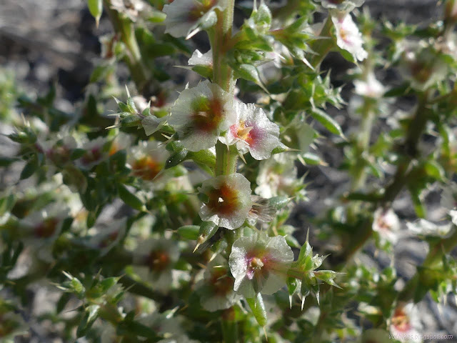
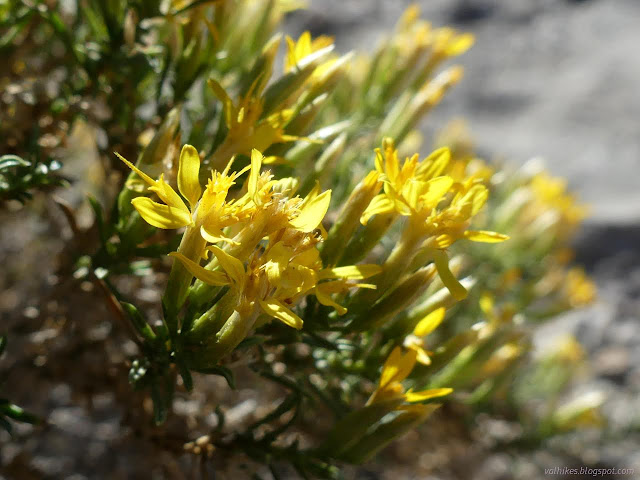
Also growing in the bottom of the valley were these plants full of flowers on long stems. They had been blown into wonderful swirls by the wind and were mildly fascinating. Turns out, they're known as saltlover, which is a type of Russian thistle. Which is to say, it's tumbleweed.

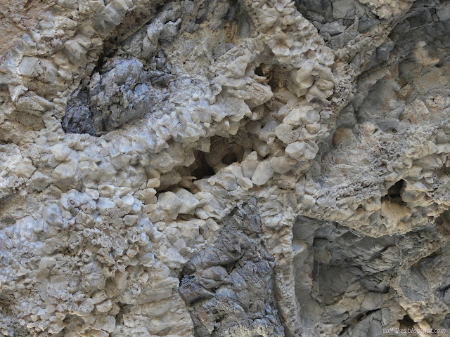
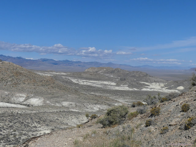
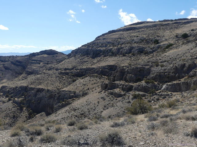
I found another selection of little caves. Wave caves? They seem a little high for that, at least for being from the Provo shore, but they do come up at a similar elevation. There's a lot of fainter lines all around here anyway.
After the caves, I got distracted with benchmarks again. There was a PLSS corner on a hillside to the east, so I wandered over there. Apparently I went directly north from there, because I practically tripped over a quarter section corner that wasn't marked on my map as I made my way toward another gully through the white layer. All were the same 1971 set.


Getting down the chalky layer took a little attention. I stuck to the ridges of the gully for a bit. The bottom curves around nearly onto itself over and over again. Eventually, I had to drop down into it and just follow those curves. It mellows out toward the end.


I got distracted again with finding a closing corner along the state line. I found that, but not a benchmark that is supposed to be next to the road. One last distraction were some "ruins" marked along the road. They would have been another valid place to park.


Then I strode on down the road to finish the loop. I went out searching for some tufa. I think I found it, but there's so much more too. This scratched that itch to hike next to the alkali desert while offering plenty of other things to discover.
*Lake Bonneville photo album*
©2022 Valerie Norton
Written 12 Dec 2022
Liked this? Interesting? Click the three bars at the top left for the menu to read more or subscribe!


Comments