Gray Falls
Six Rivers National Forest
(map link)
It was a geocache that brought this spot to my attention. I didn't find it or anything, but sometimes there's more important things to a geocache than being there. Well, for me who is a hiker who geocaches rather than a geocacher who hikes, anyway. (I might be part of a very small minority.) There's also a Redwood EdVentures Quest to bring people here. I didn't have signal or the PDF nor are there any brochures provided, so couldn't do it. The map on it would have been nice since neither the Forest Service topos nor OpenStreetMap had any information on the trails. (Another on my list of things that need editing on OSM. At least that's one that can be fixed.) There's signs out on CA-299 for Gray Falls to help find this spot. Take the right fork on gravel too narrow for any attempt at passing 0.5 miles to the picnic area with tables and a toilet and a small trail system.

I headed to the kiosk, which doesn't have anything to say about anything except rules and regulations. Still no clue where to find trails. Behind it is what looks like a very steep road and I made my way carefully down it, then down some trail, then along to the east over a small bridge. I had managed to guess correctly to get to the waterfall... I think.

The Forest Service does say where the falls should be here on the Trinity River. There's two bands of falls, one on the straight just before the curve upriver and one between two curves. I just see water cascading over a rockfall band between the two marks.
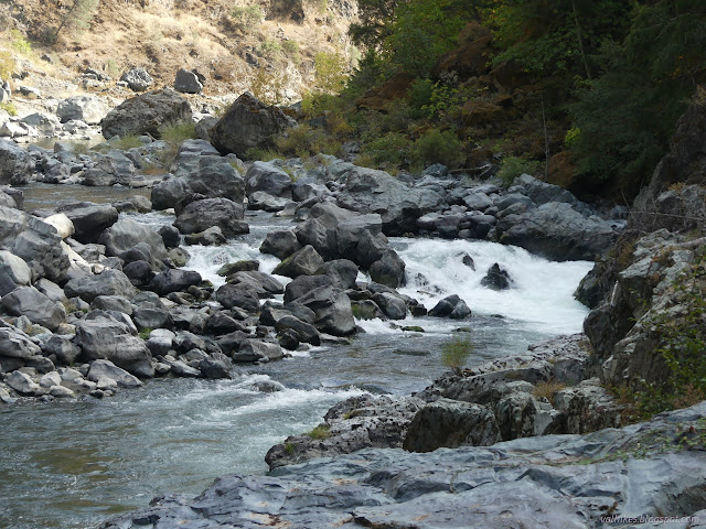
So that wasn't all that impressive. But there's more here than a disappointing waterfall.


Then I went off to see what else the trails got to. Maybe there was something more even if the map seemed pretty clear I'd already seen this waterfall.


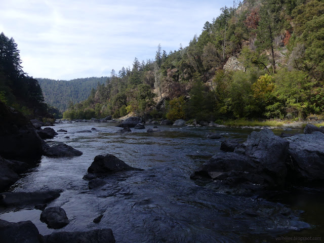
So I found myself on a little beach where the water seemed to pool a little, but is quickly swift. I was trying to get a look at the ripples from the other side, but couldn't. Oh well.
I still hadn't gotten anywhere near the geocache and it indicated I would be much higher over the river than either of these places. I turned and followed the trails back. It looks like there's a trail to connect the campground, but I didn't follow that. If I'd gone a little to the left of the steep road, I'd have found a nicer trail to go down. On the far side, I found the continuation of the road I'd come in along and followed that out a while. It shrinks suddenly, and then it finishes precariously perched high over the river and out by the geocache, or where it should be anyway.
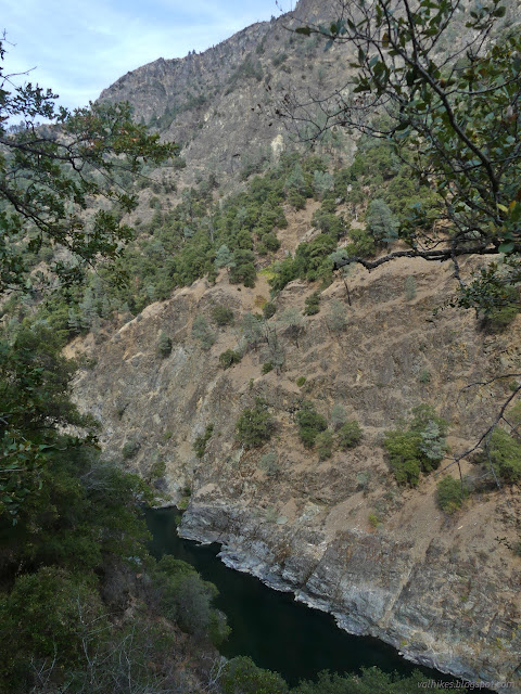
This spot was the location of a high footbridge for the New River Trail, built in 1914. (The New River is a tributary that enters just upriver.) Now there's a scary number of decaying ropes tied off to posts and trees. There's other ropes on the other side as well as goat trails that look like they might climb up to the very distinct trail that still follows a ledge off to the east.

Disconnected as it may be, it looks like the New River Trail might get a lot more travel than some other local trails. Maybe only as far as it is shown on USGS maps, which is to a structure on the far side of New River. The spot has a lot to offer, but I'm not sure about its namesake.
*Lassen 2022 photo album*
©2022 Valerie Norton
Written 30 Dec 2022
Liked this? Interesting? Click the three bars at the top left for the menu to read more or subscribe!


Comments