Water Canyon and Sonoma Peak
Humboldt River Field Office BLM
(map link)
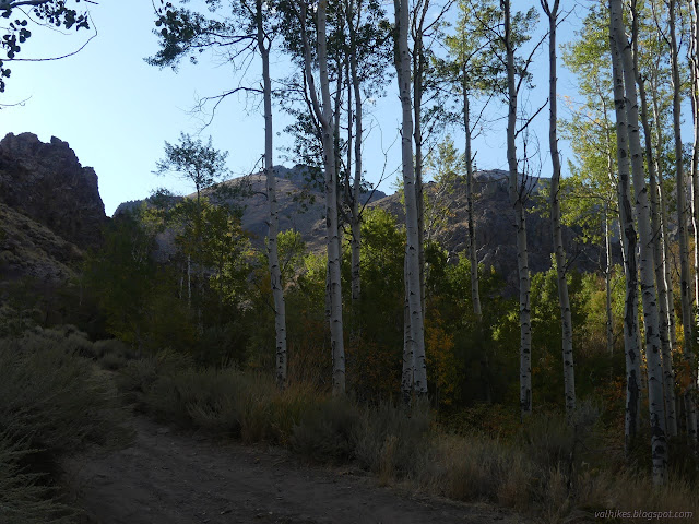
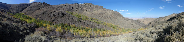
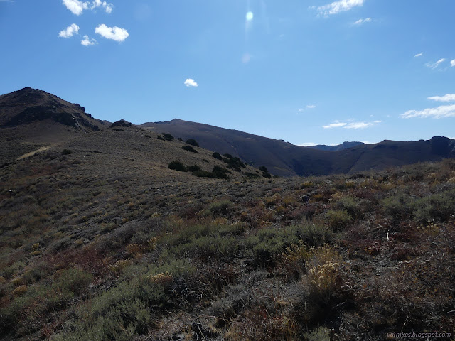
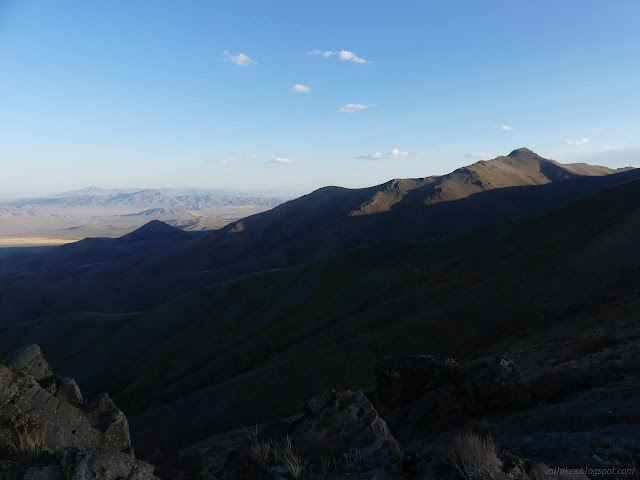
The Water Canyon Recreation Area is tucked away in one of the canyons of the Sonoma Mountains that happens to to flow with water year round. It's not a very big stream, but was one of the main sources of water for Winnemucca when the city was young. Today, it hosts free camping at designated sites, roads for off highway vehicles, and hiking. I went to the very end of the road and got lucky to find the last site empty. Mine! (For up to three nights, which is the maximum stay.) I decided to head out hiking on a combination of ATV trail and cross country. First up to an old mine, then the little bit more to the ridge to walk around the edge and back down the other side. There's a couple different options for coming down that other side. I let the canyon get a little bit of light before starting out.


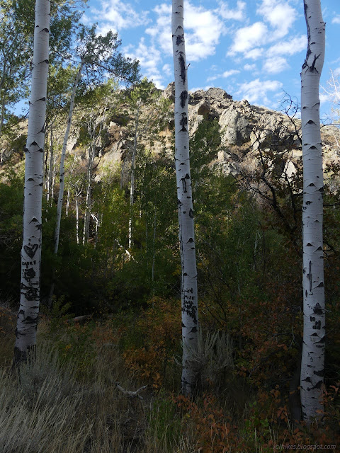
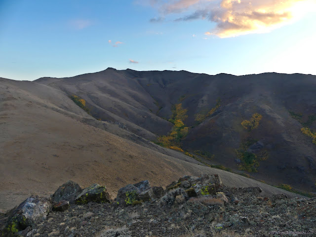
There's information signs within the canyon. One of them is about the aspen. I often wonder how much of these trees are a clonal colony and how much are different trees. It says that in the east they usually germinate from seed, but in the arid west aspens almost never propagate by seeds because the seeds need more moisture to take root. It doesn't quite come out to say that this is all one aspen tree, but it could be.
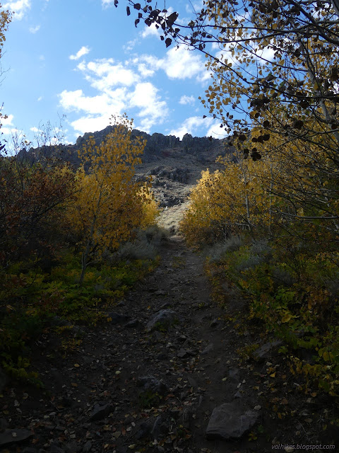
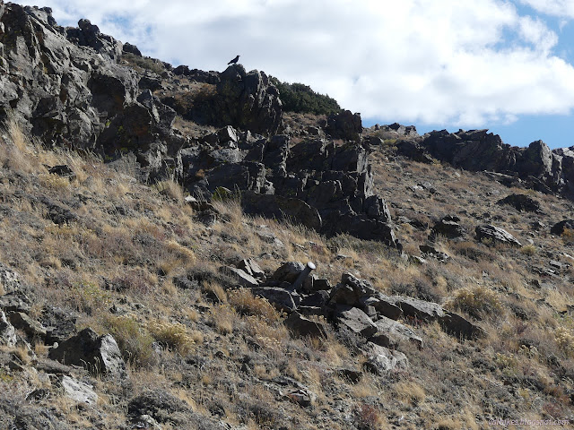
The road splits and I went right to climb toward the mine it once served. Although it is road, it gets a lot more foot traffic than wheels.


Short of the end of the road, I found a cairn beside something that looked like a bit of trail to climb to the ridge. Since the mine area looked rather loose and steep from rock getting removed, I took the trail. It didn't go all that far as a used track. Maybe people just go every which way. I chose my own which way and stepped high over some vegetation in places. It turned out the hiker just before me had set up the cairn. That explained why it could be in the middle of an occasionally used road. After he went down, I saw no one else.

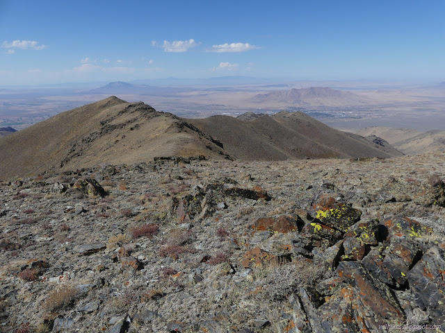
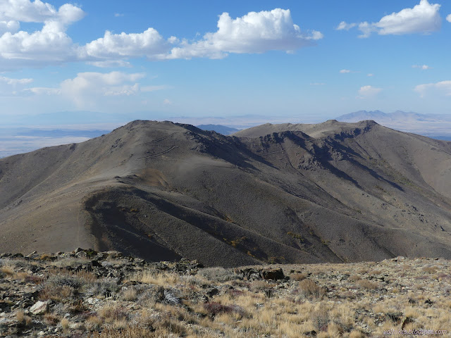
Following along the ridge, there's faint pieces of trail now and then, but not as much as I was expecting to see. I followed them where they turned up, but did not pursue them. Other than some of the spots coming up from the road, the vegetation was very easy to step along.

I had kept noticing and then forgetting about the possibility of hiking Sonoma Peak. Now I was reminded of it again. It's a 2.5 mile spur from my planned loop and if the weather programs were correct about the day's high temperature I had exactly enough water to make it out and back and around. So, should I do it?
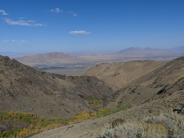
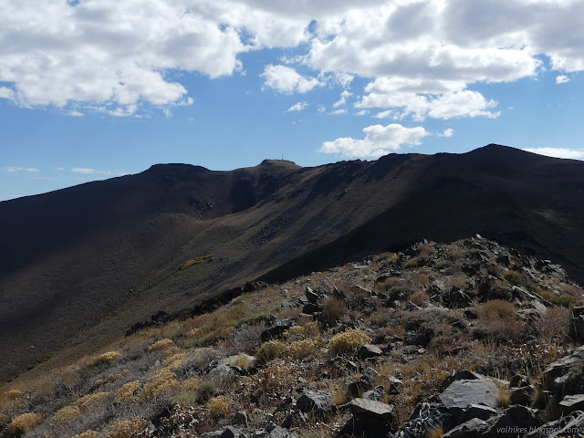
Walking the ridge was taking more time than I expected, but I did eventually get to the high point around the canyon. It's got some sort of installation near the top and this is where I met roads again.


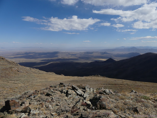
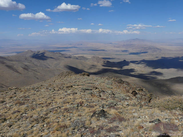
There had been a bit more clouds than predicted by the weather programs and they'd been doing a good job of keeping me shaded, far in excess of random chance for that many clouds. I hadn't drunk too much water yet and I would be able to go faster since most of the rest of the loop was on road. I decided to go for it. Sonoma Peak!

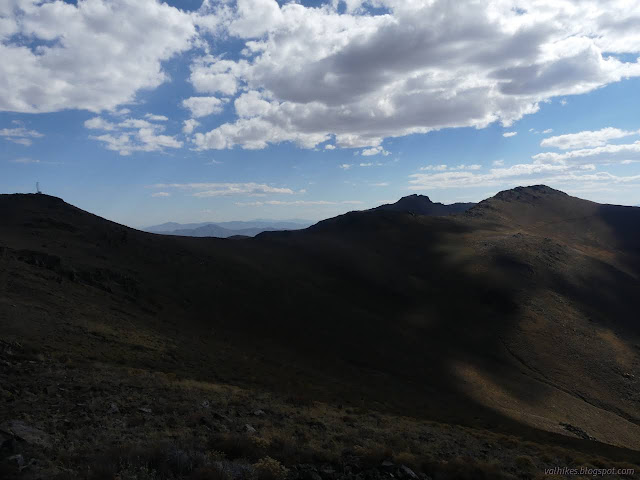
The road goes up another peak, so it ends for me above the saddle to Sonoma Peak. I was back doing cross country, but it wasn't going slowly this time.

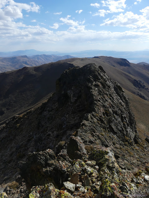
Now I had a navigation problem. I could see two peaks, but wasn't sure which one was the tallest. It certainly had looked like the north one, but maybe that's just because it's closest. USGS doesn't have enough detail on the map to say which because there's only one peak there. The logs on Peakbagger weren't mentioning which and they generally come up from the south side. That seemed to be a vote for the south peak. I decided to work my way around the cliffs on the west side to a broken piece of rocks, only to find that it was quite clearly the north peak that was tallest. One log said it looked like it would be class 4 to go up, which could have been a good clue that it was the north peak, but I didn't know what the south side of the south peak looked like. They also said that if you go around to the east, you can keep it to class 2. I went back the way I'd come and up the other route I'd been contemplating on the north side, keeping it to class 1.
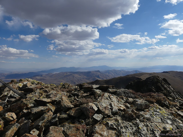

So that was a little extra effort. I had continued to enjoy some clouds, but not quite as consistently as on the climb. I was still doing well for water.
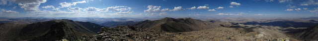
I took far too many pictures, found the benchmarks I could, then headed back down the way I'd come. All that was left was to follow roads back to the first peak, then around at a brisk pace. Had I planned to do the peak, I would have started two hours earlier and it was going to get dark on me.


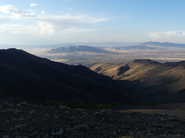
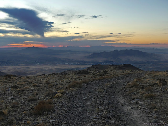
The road takes some precipitous drops. I'm not sure how people can drive them when it's hard to even walk them, but they've made it somehow. I skipped a couple spots by staying to the ridgeline instead. Although it is longer, I decided to stay high where there would be more to see in the dying light.


I made my way down, mostly by the dying light and then the light of the moon. It was full, so bright, but low.


There's a few roads and paths to choose from to get down. I took the ones that were least steep. There's a small lot a short way up that road, which puts down very close to the end of road parking area. I got it! Got the peak! And all of the ridge! There was even still a little water left. I felt like I'd cheated and gotten away with it. And my feet didn't even feel as bad as I feared they would. I'd been wearing my barefoot shoes and have been trying to use them only on 10 miles or less hikes. This one came out nearing 15.
*Water Canyon 2022 photo album*
©2022 Valerie Norton
Written 22 Dec 2022
Liked this? Interesting? Click the three bars at the top left for the menu to read more or subscribe!


Comments