Hennen Canyon: Ruby Dome
Humboldt-Toiyabe National Forest
(map link)
DAY 1 | DAY 2
The morning wasn't nearly as cold as I expected it to be. I packed up my gear, that which was needed to hike in my pack and that needed for camping into my liner bag. I crossed back over the dam and found a spot to tuck it away among some bushes and a log.
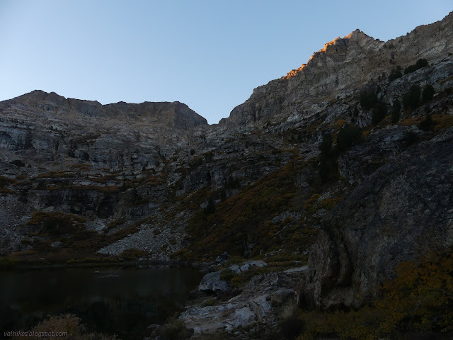
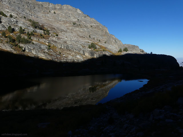
I found the trail again and started climbing. There were a few more sites people use for camping up that way. I'd been hoping for morning sun when I made my location choice.
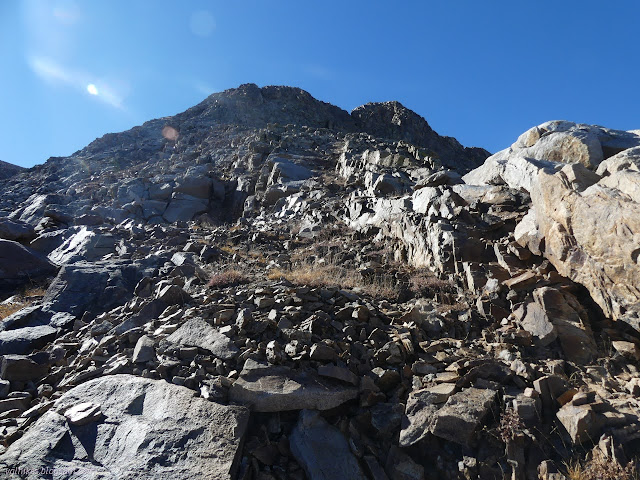
There was a little bit of hope involved in finding the trail climbing again, but once it was climbing it was easy to follow until things got rocky. It was also steep. Once in the rocks, there's choices. I ended up climbing a bit I wasn't sure I'd be comfortable going down. It was something to worry about later.


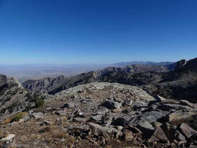
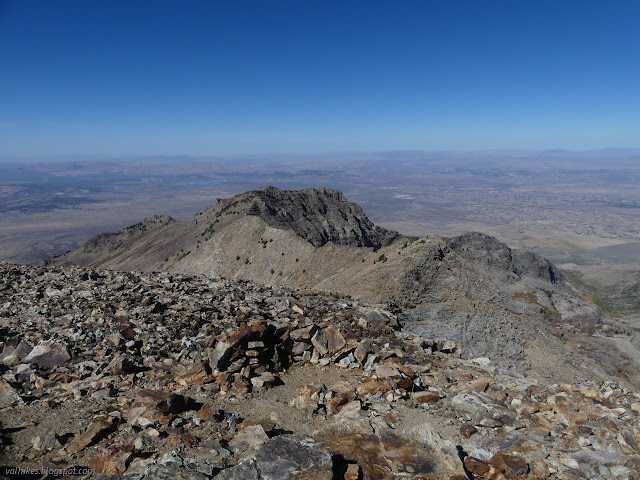
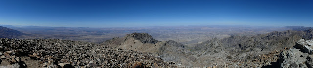
With no more problems or difficulties, I got to the ridge above. There's a large plateau to wander across following cairns before it really feels like a ridge. My instinct was to try to follow the ridge, but the route actually goes up a gully to the left of the ridge and stays left.


There's some nice wide ledges to walk along if staying left of the ridge around the lower peaks. I kept oozing more and more toward the edge of the ridge because I didn't quite trust the ledges to give a continuous path. I got to more and more climbing and started to worry there might be another spot where I'd go up and be ready to go down it again, only here there wouldn't be much other options. I was starting to scare myself.

I stopped and had a sit for a while and considered going back because this was clearly too much for me alone. I was west of all the Peakbagger tracks. No two of them are alike, but they all agreed on this even if I was seeing a cairn once in a while. I decided to give something closer to the usual route a chance and backtracked, coming to spaces with lots of cairns. Here I felt perfectly happy to walk.

There is one rather narrow spot as the ledges feed out to a saddle below the peak. This is the one spot where I got to questioning this whole thing again, but it really wasn't that bad once going along it. Three cairns mark the spot at the top to make really sure it can be found again for the return.

After the saddle, people haven't even bothered to stack cairns. It's a wide ridge covered in rocks. I picked a way and walked across them. They do move once in a while. Then I was on the Elko County high point!

I pondered how much crest there is north of Lamoille Canyon where the Ruby Crest Trail ends. I'd been looking at it as I drove by, too. So much of it is missed. There's more forest and trails on those peaks, too.

I headed down. There were some geocaches that I hadn't gone past on the way up because I was on the ledges and they were in a gully. Another peak bagger who had come up a gully stated they were a scree slog and no fun, but I was willing to give it a try on the way down. I didn't manage to hit the right gully and just ended up showing that there's lots of ledge routes that are usable. Well, there's at least two. (But do hit the spot marked by the three cairns at the top!) For the drop after the flat, I followed some well used trails toward an area that probably has more camps along with a pond, then circled back in order to avoid the short climb I had on the way up. It was a lot of extra to miss that.

Then I packed up all my gear nice and tight into my nominal day pack that I had finally actually used as a day pack. (It worked quite alright. I'd actually selected it to force myself to do this.) Heading down, I stuck to higher routes and didn't have any climbs, easy or otherwise, like I had on the way up. Closer to the line on the map is a better route.


I sped down the road through the campground seeing no one this time, but I heard people in playing in the creek. There were still footprints and bike tread. There were a few tire tracks from folks who had parked behind me, even.
Having scared myself a bit on the climb up, it was very nice to arrive back at the car without so much as a scrape. That's one more excellent Nevada county high point checked off the list. I tossed in the bag and took off for the next adventure.
*Ruby Mountains 2022 photo album*
©2022 Valerie Norton
Written 21 Dec 2022
Liked this? Interesting? Click the three bars at the top left for the menu to read more or subscribe!


Comments