Hat Creek Rim, Hat Creek, and Subway Cave loop
Lassen National Forest
(map link)
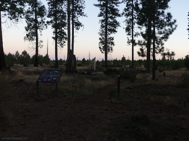
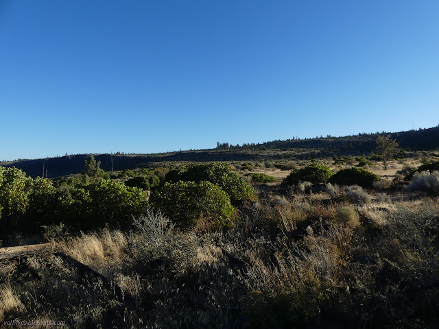
I had a hike planned with more miles than hours of daylight, which requires getting an early start. I know, some people just walk fast, but that's incompatible with taking way too many photographs, checking out all the flowers, trying to catch all the birds and lizards and everyone else out on the trail. So I got up in the dark and got moving before the sunrise. I had second thoughts about getting going quite so early, and ultimately started exactly 5 minutes late to get out to the edge of Hat Creek Rim for the best of the dawning light.
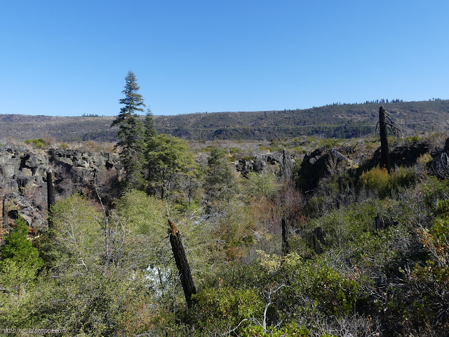
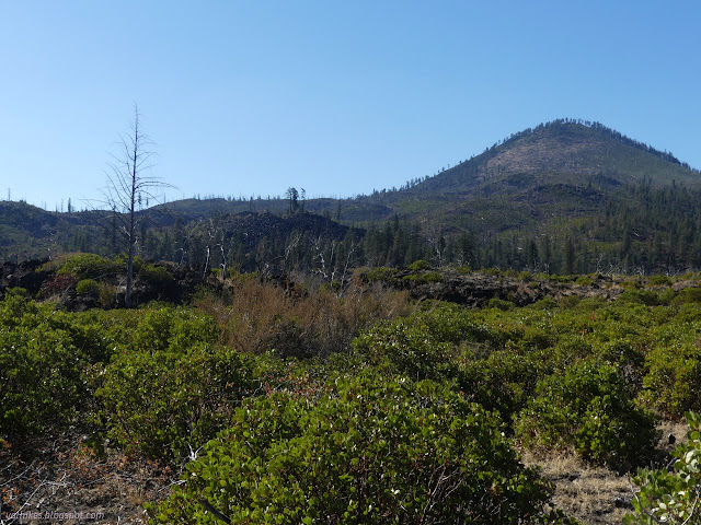
The area burned in the Hat Creek Complex in 2009 and there's hints that there was once a much larger forest here. There's a lot less burn and a bit more recovery to look at than on the last hike along the Bizz Johnson. It's still a bit, well, scrubby. Leaves the view clearer.
The walk north is easy and level along the rim, but it does diverge east now and then to avoid the odd chasm where seasonal creeks have cut through the hard top rock layer.
My plan for the hike was a loop, but I had varying certainty about the pieces. The start and finish along the PCT would definitely be there. The trail along Hat Creek is the sort of thing that tends to continue. It would make me very grumpy to utilize it, but the highway is a viable option to Hat Creek Trail. Subway Cave was a destination in and of itself and the trails would be there. I was a little suspicious that the trail I wanted to take down off Hat Creek Rim might not exist still. There's actually two intersections with the PCT prior. The second is a trail that connects to my planned trail after dropping a while. I saw no sign of it. The first is the Parhms Trail, an old route for the PCT, and even that had no visible evidence left, but goes the other direction.


I found no hint of trail when I got to where mine leaves. The line on the map goes right over a clump of rocks that any sensible person building a trail would go around, but these old lines tend to be a little inaccurate. I searched a bit for some track but still found none. I was halfway certain a visible track below was my trail even if it was invisible here. The vegetation was sparse enough that I just went for it. I soon found a fence with a ranch gate in it big enough to drive through. I still couldn't find any evidence of a track even as I knew exactly where to look.
The area has steep rocky areas separating wide flats. Some ramp downward and some stay flat and there doesn't look to be a continuous way down on the ramps. I started noticing clues of a trail, but it never seemed quite right. I finally realized I was following old road. There was sort of half a trail there and another half way over there, about a bulldozer blade away. The gate should have been sufficient clue. The brush started to get thicker, but by that time a real hiker tread started to show up. It usually stayed between the edges, but sometimes a bush was too much and it meandered off briefly.

I crossed a road that still sees ATV use. It's 33N55 on the Motor Vehicles Use Map. It's legal for that. My track seemed to be unnoticed by these users and was hard to find again on the far side. I avoided some thick brush and got back on it just before a steep section with lots of loose rocks as it almost got some switchbacks going. Then I was out on the lowest flat with something easy to follow along the edge of an old lava flow. Eventually I started seeing tire tracks there, too. It's 5E27 and not on the Motor Vehicles Use Map so it's not legal for that.


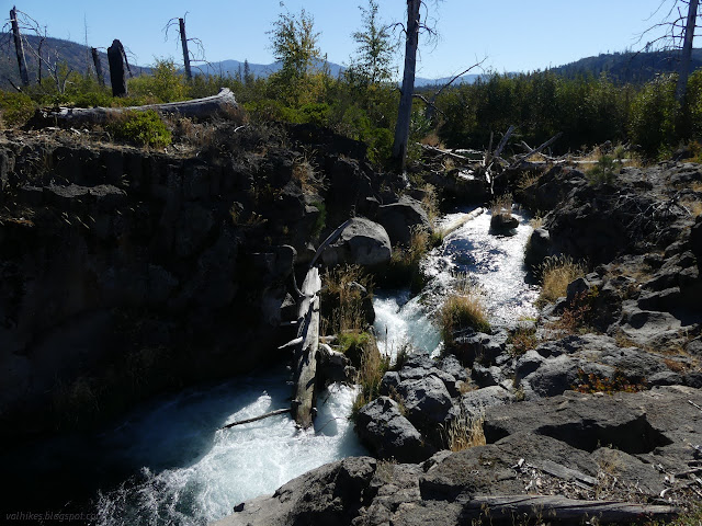
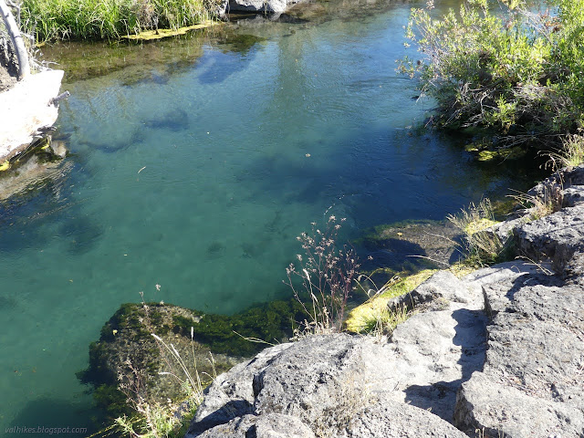
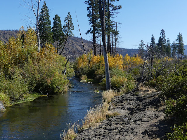
So that worked out well in getting me to CA-89. I crossed the highway and followed the line on the map (which wasn't even trail again) the short way to the side of Hat Creek. Here, the line happily crosses as if there was a ford. Hat Creek is a small and impressive body of water. It must have found a lava tube to flow along because right here, it's like a swimming pool. The sides drop straight down and it is deep. Unlike a swimming pool, the waters bubble with currents. I can't help but notice that there's a number of air bubbles flowing past, staying well under the water. These are not safe waters.

I decided against fording the creek and followed the well trod edge back to the highway and its bridge. Its narrow bridge. I waited for an RV and its many followers to pass, then crossed myself. There was nice use trail into Bridge Campground. It must be closed for the season because it was empty as I followed the roads around to the Hat Creek Trail.

Fire had been there, too. The creek was edged by a thin line of green that had been spared, but the burn at the edges was just visible. A little further on, even that was burned. It was a little shocking to see trees down in the canyon standing as only short, blackened trucks.

Rocky Campground, also closed for the season, was saved and has the first of three footbridges I was assured would be there by the map. It is still there, so I was feeling more secure that I wouldn't be trapped on the wrong side of Hat Creek. After the camp is where the burn became complete.


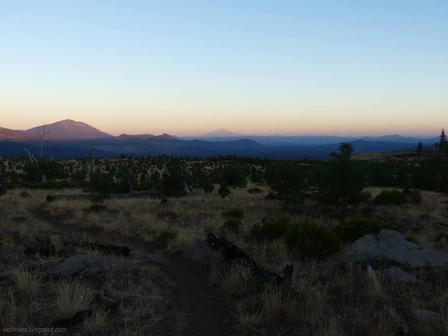
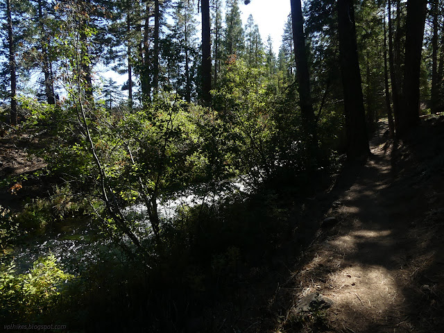
I'd heard claims that Hat Creek Rim was a grand hike. I guess I hiked the wrong little bit because I found it merely okay. There was a touch of smoke in the air messing with seeing the distances. Now, Hat Creek is quite another thing entirely. I wasn't going nearly as quickly along it. It wasn't due to lack of maintenance. It had clearly been recently maintained except for a tree near Bridge Campground. It's just I kept hearing a bit of creek I wanted to see and then poked the few feet off the trail to see it over and over and over again.


The highway is just a hop, skip, and jump from the far side, but its noise is generally drowned out by the sounds of the creek.


I passed a fisherman on the far side just before getting to the second bridge, or rather where it once was. It had such a giant manzanita growing out of the middle of its path that I suspect it was long gone by the time the last fire came through.

So that was inauspicious. On the other hand, there were few footprints that dwindled to none except deer and a bear when I started and now I had a bunch of footprints again. They had to be coming from somewhere.

They were coming from the Sugarloaf picnic area and I saw a few other hikers as I approached. There is an auto bridge there. (It's mysteriously left off the Forest Service topo where a bunch of roads come together.) Trail goes up and across or underneath. Really, the area is quite well trod all over. I continued on to the next footbridge.


I crossed to Cave Campground, which was extremely full of campers and warning signs against so much as wading in the dangerous creek. Beside the currents, it often has a few logs washing down. I didn't have to go through the whole of the crowd because there's a trail that goes around much of it. I found that and took it. It's supposed to go all the way to the Subway Cave on the other side of the highway, but it actually stopped overlooking the blacktop. Only a small track goes all the way to the road and nothing at all is on the far side. I meandered my way to the entry road and followed it to the next attraction on this loop: Subway Cave.
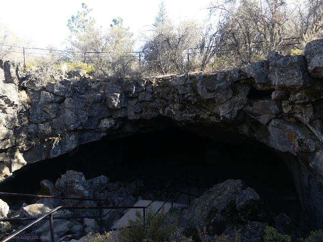
I pulled out my few warm things along with my light before descending into the cave. It stays around 46°F in there and I was dressed for hiking in an unseasonably warm sun. Some heading down went the counterindicated direction at the bottom of the steps, which should be a lesser walked cave that ends abruptly. I let myself be directed along the usual trail, stopping at the interpretive signs as I went. They are marked with red reflective tape so they can be easily spotted even with a dim light.


This was the smoothest lava tube I've ever been in. I did poke around past the final steps, but it only goes 20-30 feet. Then back up into the warm and packing away my extra cloths and lamp. There's a trail back to the parking lot for the majority of cave goers, who were quite numerous, and a connector back to the PCT along it for me. Next up on the map was Devils Half Acre, a lava flow area made extra "hellish" by having burned by the Dixie Fire in 2021.

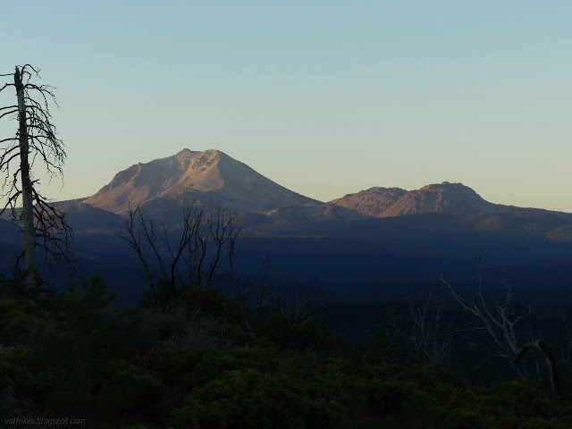
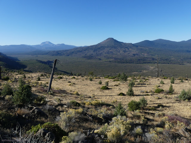
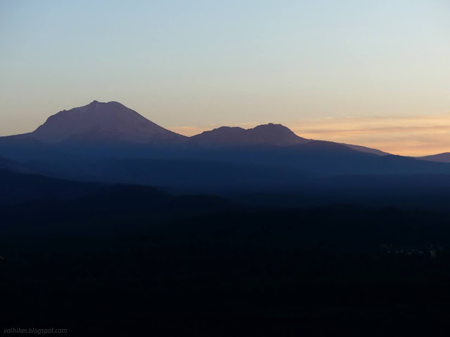
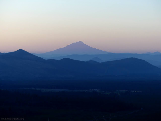
I chugged up the hill, quickly leaving the burn behind. The trail follows the old road from before straight and paved CA-44 was built above. I made it to the Hat Creek Rim Overlook about 30 minutes before I'd planned based on wanting to catch sunset there. It had gotten slightly more smoky over the day. It was only a faint smell, but over the distances on display, it was quite noticeable. I could easily pick out Hat Creek below as a reflection of bright sky in an already shadowed land. I waited for the rest of the show and the sunset colors came a little sooner than expected.

Then I made the easy stroll back to the trailhead in the fading light. It's a good loop, but as all too usual, some part of it could use a little maintenance.
*Lassen 2022 photo album*
©2022 Valerie Norton
Written 29 Dec 2022
Liked this? Interesting? Click the three bars at the top left for the menu to read more or subscribe!


Comments