Ruby Crest to Castle Lake and Liberty Peak
Humboldt-Toiyabe National Forest
(map link)
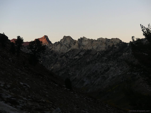
I had a big day planned and got up in the early cold. That first dim, dawn light played in a band across the western peaks of Lamoille Canyon. The edge of it diffused downward into the rest of the canyon and then the band was repeated, this time with the first light of sunrise. It took a lot longer for the edge of this light to travel down into the bottom of the canyon and I was long on the trail by the time it did.
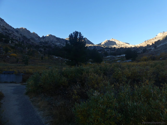
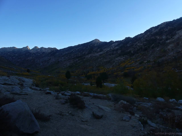

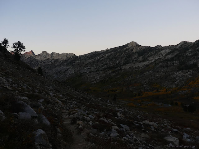
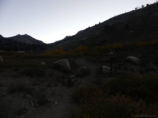
There are two trails to choose from for going up. The hiker trail travels the east side of the canyon, so would be cold longer, but would look across to the lit part of the canyon, which I hoped would make for better photographs. The stock trail climbs the other side and I could see it sitting there in the warming sun while I passed a little frost here and there.


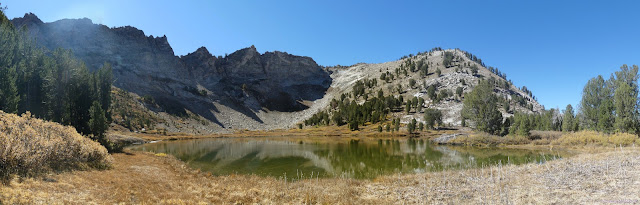
I reached the morning sunshine with the Dollar Lakes. There's a pair of them and they see some camping, as evidenced by impacted sites.
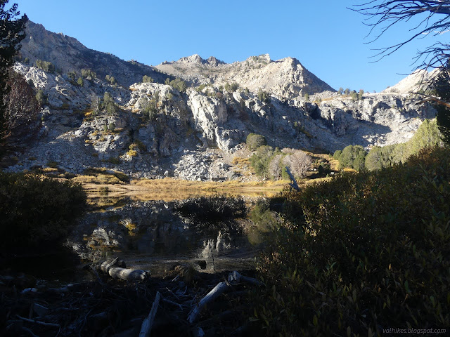

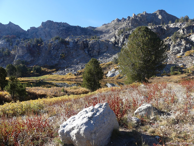
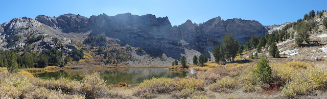
It's not much more climb to where the trails join. Past that, I took a spur trail down to visit Lamoille Lake. There's more impacted camp sites near this lake.


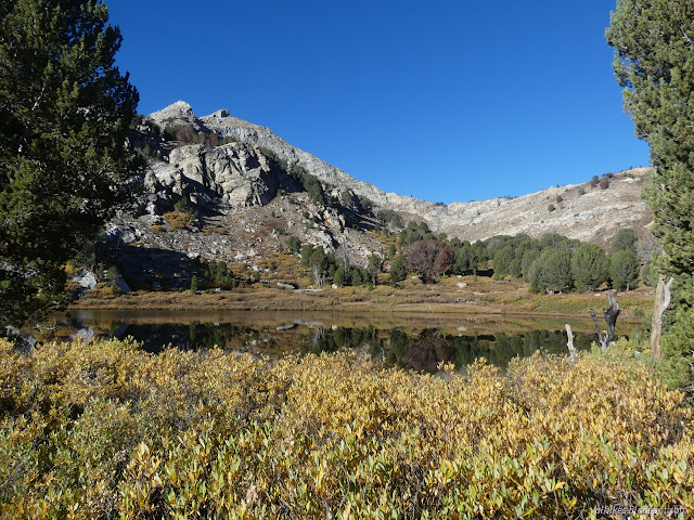
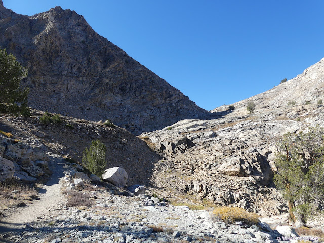
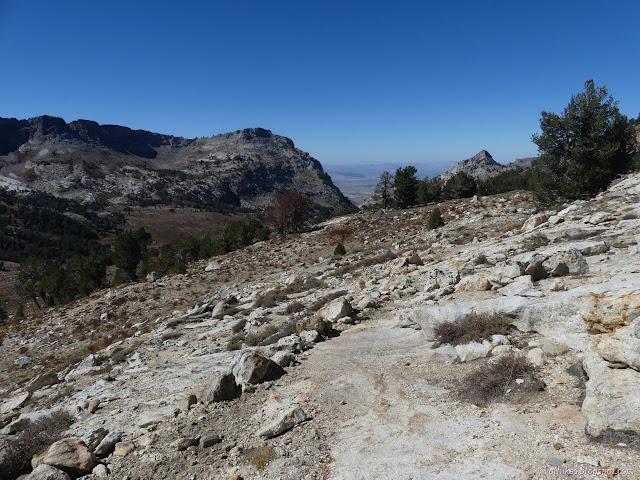
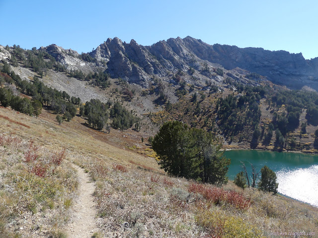
After Lamoille Lake, the trail gets pretty serious about climbing to Liberty Pass. I paused at one shelf for a snack. The view gets quite good just short of the pass. Some of it gets hidden at the pass itself.
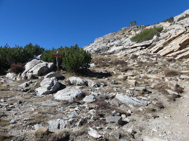
Over the top and just a little way down the other side, one finally meets the Ruby Mountains Wilderness. This wilderness has a lot of fingers sticking out on the north end and I wonder what considerations produced such a complicated boundary.


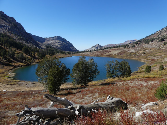
It's a long way down that I'll have to climb back up again, but I was feeling ready for it. Down I went to Liberty Lake. The trail splits beside it, so I decided to stick to the Ruby Crest for as long as I would be taking it for the day. It's not that much further.


Then it was already time to leave the Ruby Crest Trail. There's so much further along that national recreation trail that I'd wanted to see as I researched it, so that was sad, but it doesn't have to always be that way. Onward and upward! Specifically to Castle Lake.
I found more well used camp sites, but not the junction to go up to Castle Lake. Actually, finding the trail past the camps got a little hard. I hiked up where the maps said it should be and past the flatter areas, found a steep and well used trail going up. Some of it looks abandoned and reestablished by use, some of it looks rerouted to improve its long term state. Whatever, it got up to the lake.


Then I headed back down, following a better used track back to the Favre Lake Trail. It came down in another camping area. After those, it got easier to follow. Well, until it wasn't again, but climbing around the lake was easy to follow.


I found some long left undone need of trail work on the way up to Liberty Lake, which was quite startling since it's so close to the well maintained Ruby Crest. Past the junction with the Colonel Moore Trail, which comes up from the roads on the east side of the mountains and is not maintained according to the sign, I got into difficulty following the trail. I was probably following some camper trails instead. I certainly followed them back to the trail.


It's just a short way back to Ruby Crest and then I climbed some more to Liberty Pass. I was feeling rather good and had plenty of light left, so for no other reason than that there is a line of geocaches to it, I proceeded to climb the peak to the west of the pass. This is known as Liberty Peak to online peak baggers. It took a lot longer to get there than I expected since I was trying to find some medium-hard caches on the way and, at least for the first one, my device was getting reflected signal and insisting the cache was far down the hill from where it actually was. The caches are all along the ridge, just as they appeared to be on the map, and it was hard walking in random spots along the hill below. I've been too lazy to put geocache coordinates into my GPS (and the plugins to do it easily are no longer maintained or usable with a modern browser) so I've been using the phone. It doesn't do this sort of nonsense so much when it is tracking in the background.

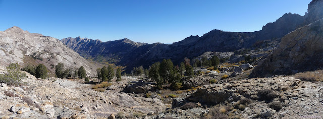
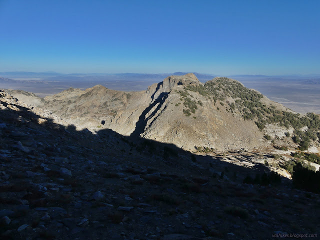
I had to have a minor freak out about the view I got with those geocaches. I thought it was nice along the trail, but that's nothing compared to what you get for going high. I got all the lakes I had visited at once. I got the basins beyond. I got the other ranges! There's something like a use trail that travels along the ridge toward the peak, which makes it an easier travel route than just a random line.

It's all easy until the last few feet. That I wasn't sure about. The last geocache I was looking for is actually past the peak and I circled around to the south rather than go over. There was a giddy moment as I approached the peak from the west side after finding the cache, but the peak itself has a nice area to sit about on. I signed a log protected, though I'm not sure how well, by a metal mess kit and took in the view.


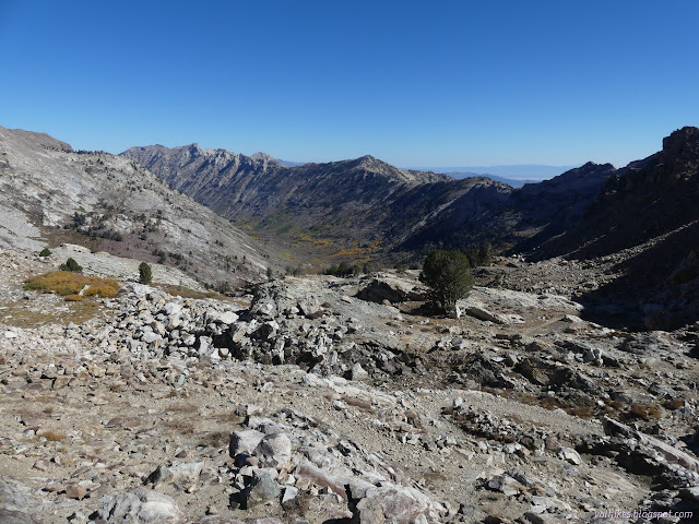
I pondered Ruby Dome, the county high point, but seem to have done more looking than photographing, then headed back down. I found a pretty easy way down by heading east and dropping to the north side, then traveling around the rest of the crest of the peak to the wide ridge. From there, I dropped off the ridge along a gully and found a better established trail that got me most of the way back to the pass. It sort of fizzled at the end and the views from it weren't nearly as nice as from the ridgeline. I was in a bit of a hurry as I went and managed the descent back to trail in 20 minutes of heavy concentration on taking solid steps. Quite a bit less than the 2 hours up in exploration, trail finding, and "treasure" finding. I had expected only 1 hour total.


My original plan for going down was to take the stock trail. Now that it was later than I'd hoped, I had additional motivation for going that way. It's half a mile shorter. The footprints showed that plenty of hikers go that way. I hardly found any hoof prints on it. Incidentally, there had been hoof prints on the hiker trail too.

*Ruby Mountains 2022 photo album*
©2022 Valerie Norton
Written 14 Dec 2022
Liked this? Interesting? Click the three bars at the top left for the menu to read more or subscribe!


Comments