Posts

Showing posts from July, 2022

Buckeye Peak

Image
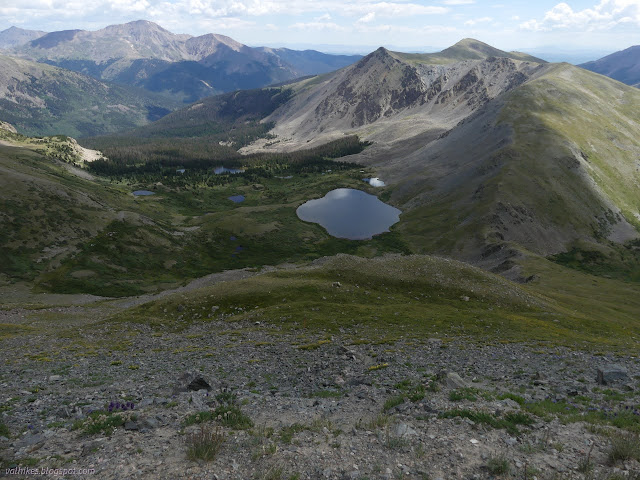
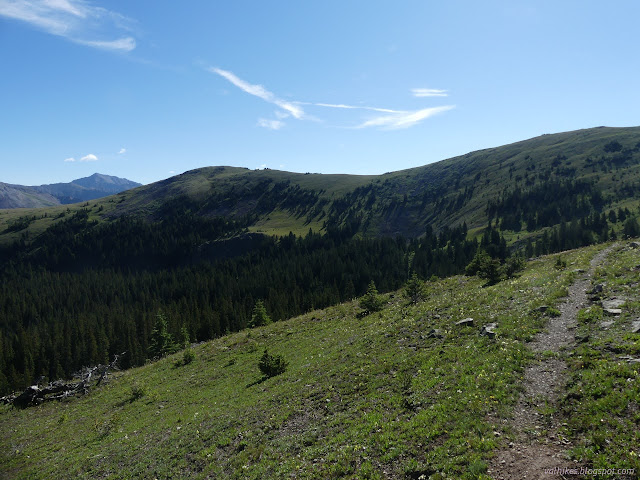
San Isabel National Forest White River National Forest (map link) In my post about Galena Mountain , I mentioned there were two very lone geocaches in the area. The second, not signed since 2015, rested south of Buckeye Peak, another peak with 1000 feet of prominence rising above Leadville. It looks like the common route to bag this peak is also from the south. I didn't much like that route because of the 4x4 access road. I decided to come at it from the north from Ski Cooper, then a bit of roughly following the Continental Divide, which serves as county line and forest line along there. To get the geocache, I'd continue over the top, then finish with a little more cross country to find a road that connects back to Ski Cooper. Looking down on the buildings at the ski area from part way up one run. The peaks are part of the Holy Cross Wilderness. I parked off to the side and started up Cooper Hill. There were a couple rough roads (authorized vehicles only) to choose

Mount Elbert

Image
San Isabel National Forest (map link) I've been feeling a little off, like I'm never quite getting in shape or not quite acclimating or maybe anemia is taking stronger hold. The Red Cross thinks about not letting me donate blood if I've not been taking my iron for a month. Then there seems to be this mild sickness of stomach that takes hold around 12.5k (and then is gone once higher) that could be any of that, or just deep nervousness since the weather is never quite cooperating for going up so high. Whatever the reason, it was causing me to pass up the very tall mountains. I did look at the usual route for Mount Yale and find it likely quite suitable for my abilities, but decided against. I didn't even look at many more. However, I could not pass up Mount Elbert. The Colorado high point. It has not one, but three trails to the top, and these trails are actively being improved to the point that they actually comply with modern trail standards. I decided to go up t

Galena Mountain and ridgeline walk, with CDT return

Image
San Isabel National Forest (map link) In pondering what I might hike, I noted Galena Mountain was a prominent local peak (with over 1000 feet of prominence, in fact) and I noticed a couple of geocaches that had not been found in over seven years. One of them was at the other end of about 2.5 miles (on paper, anyway) of ridge from the top of Galena Mountain. I examined the contours carefully and decided that just might be 2.5 miles of walkable ridgeline. I could certainly check it out from the top of Galena Mountain. If I decided against, it would still be a worthy hike. If I decided in favor, I could easily continue down the far end of the ridge and get on the Continental Divide Trail (CDT) for the return. The sketch of the route came in around 16 miles on paper, which would be a bit more once actually executed. It can be made shorter by using the Bear Lake Trailhead, but since I lack a 4x4 vehicle, I went with the Timberline Trailhead, which is paved to the last few hundred fee

Ptarmigan Lake and Jones Mountain

Image
San Isabel National Forest (map link) Ptarmigan Lake is a popular trailhead and I'd already seen that the cars spill out of it into some 4x4 parking and out along the road if you get there very late. I was the first into the parking lot at 7AM, though very nearly not the first parked. No other cars arrived as we first folks sorted ourselves, used the toilet, and got going across the bridge and up the trail. The sign at the south end of the lot: Ptarmigan Lake, elevation 12,132, 3 miles. There's a few views as it climbs out on a rocky slope at the start, but mostly the trail passes through forest. It is a hard packed, wide, and obviously well used trail. Hiking into the sun up the rocky, well used trail. Turner Peak (from yesterday) is right across the valley. This is the side with the sudden drop off. Then turning into the forest.

Turner Peak and South Texas above treeline

Image
Gunnison National Forest San Isabel National Forest (map link) There seemed to be an astonishing number of backpackers coming south through Cottonwood Pass on the Continental Divide Trail given that it is still way too early for the southbounders, which isn't even the popular direction. When I got across the road, I found a post with a second crest and everything was explained. Of course! In this area, it is also the Colorado Trail. They're all Durango-bound, which is the popular direction, and it'll be time for them for a while. Starting off on the South Texas Trail from Cottonwood Pass, which happens to host the CDT and CT. Looking down the glacial valley of South Texas Creek. On the other side, the glacial valley of Middle Cottonwood Creek. The trail to Lost Lake can be seen wiggling its way through right in the middle. I didn't stay on the trail long. When I got to that first ridge, after enjoying the view, I took a use trail up to the first peak.

Lost Lake

Image
San Isabel National Forest (map link) Since this day was expected to go all stormy for the afternoon, I hadn't really planned on going for a hike, but this particular trail is short, flirts with the tree line the whole way so views should be abundant, and finishes off at what could well be a delightful lake, so I decided it would still be a fairly restful day if I wandered on over. The Forest Service topographic map shows one entry, but OpenStreetMap shows a second that is directly across the road from a paved parking area suitable for a couple cars. I ended up parking a bit early and wandered down the road until there was an obvious trail. This turned out to be the lower entry and there were quite a few more than a couple cars squeezing onto that road edge. It's a popular trail. No signs mark this trailhead, but it sure is obvious. The suspected views are there. Jones Mountain sticks up above some trees across a meadow. An unnamed lake below the Great Divide (an

Cottonwood Pass picnic area

Image
Gunnison National Forest (map link) I was down in the cloud covered valley nearish Taylor Park and decided to head up to the picnic area near the pass for breakfast. It's a much better view. It has a small use trail from the bathroom out to the edge of the Collegiate Peaks Wilderness, and, if you look closely, a little further either up or down the ridge line. Taylor Park Reservoir still covered in cloud. Looking back along the use trail toward Cottonwood Pass. The ridge that is the usual, but certainly not only, end point for folks walking the trail by the picnic area. I looked out over the congressionally designated wilderness and took it into my mind to go there, where there was a massive green shoulder of mountain above tree line. The Collegiate Peaks Wilderness north of the picnic area. Trail along the ridge was hard to find at first, but then there was a sudden very clear piece that happens to come from the old picnic area. This is the one shown on my Fo

follow by email