Dillon Pinnacles
Curecanti National Recreation Area
(map link)
As I looked around the Curecanti National Recreation Area trails, thinking I really ought to visit it in some why as I went through it, I found a lot of things that dropped down from the road to the river. It really is a bit hot for that sort of downhill hike. Then I found a hike that wasn't just what I wanted, it was what I needed. The trail to Dillon Pinnacles is just two miles with the second half climbing somewhat and it has a couple interpretive signs along the way. Someone had even marked them all on the map and there in the middle was "Forming a Pinnacle". The parking area includes a bathroom and a sign with all the area trails numbered and described. The trail itself splits off from the road on the way to the boat launch.
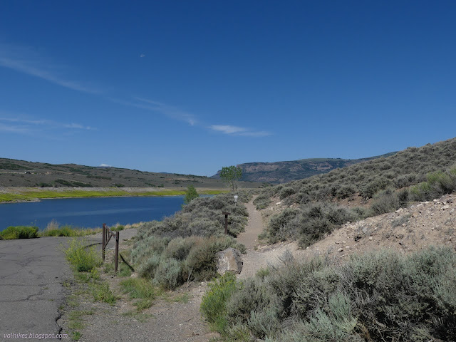
Around the corner, and one is already looking at the pinnacles. If a look is all you want, it's an easy hike. Otherwise, it drops in and across the Dillon Gulch and starts to climb. It's under 400 feet total climbing.


The first sign along is actually about dinosaurs because the rocks are old. Yeah, yeah, big lizards. Down in the corner, though, it mentions "large unidentified fossil burrows" found in the area that might have been the domain of early mammals. Will they point one out? (Nope. Not here, anyway.)

My Forest Service map actually only shows a trail coming up from the water and continuing up Dillon Gulch to a spring, where it finishes. I wondered if that was still a thing since it looked like it probably dated to before the reservoir. It is and there's a well used trail there. The sign next to it said it was off limits some of the year as it is "critical big game winter habitat". However, outside of the December 1 to April 30 closure, you are free to explore it.

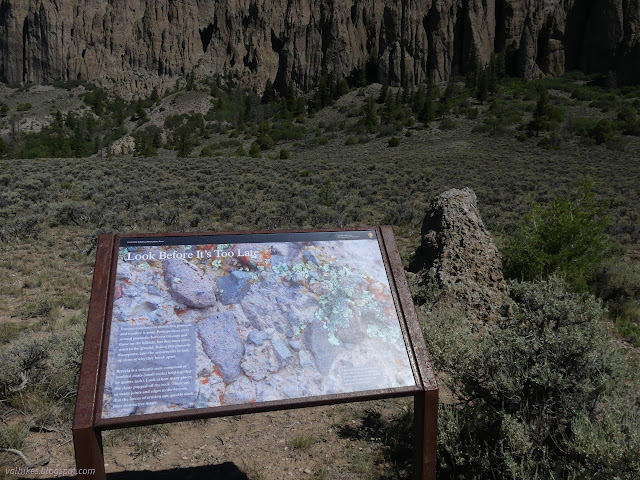
And as I was getting to be down under the pinnacles, there was the sign I was looking for.

The answer? They're essentially hoodoos after all. The hard rock is the Blue Mesa Tuff, which is slightly darker. The example they point to is the round cap seen about 1/3 of the way from the left side in the picture above. The softer rock is West Elk Breccia, composed of ash and volcanic rock chunks. Surely it's not quite as simple as that with the hard chunks in the soft stuff?
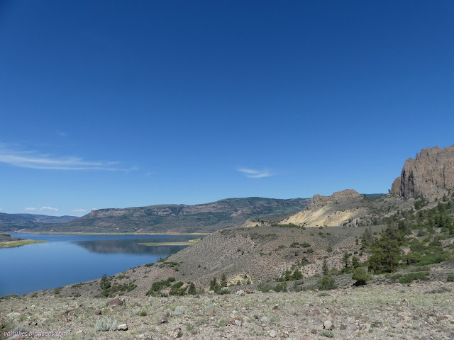
The trail continues on to a large flat where it loops about next to one more sign and a bench set to look out over the water and the rest of the view as well.


I enjoyed the view for a bit, munching away.


Then back the way I'd come.


I poked a very short way up the other trail, but wasn't prepared to go finding the spring or wherever else it might lead.

There were more people out enjoying the lake as I returned.

Since I was passing during opening hours, I stopped by the visitor center to ask if the pillars are really as simple as hoodoos. Yep. Well, mostly. And then the fellow started telling me a story about a giant ball of ash and rock rolling down the West Elk volcano... That's a volcano? This is undoubtedly all pre glacier carving. Great things have happened here, geologically.
*photo album*
©2022 Valerie Norton
Written 15 Aug 2022
Liked this? Interesting? Click the three bars at the top left for the menu to read more or subscribe!


Comments