West Elk: Soap Creek
Gunnison National Forest
DAY 1 | DAY 2 | DAY 3 | DAY 4 | DAY 5 | DAY 6(red line, map link)
It rained overnight, but that left me dry in my tent and my kitchen area dry under its little roof. Not that the sagging silnylon didn't try to at least wet my feet a little. I've got to try incorporating some elastic into the guylines to take up the slack as the silnylon stretches in the wet. Then again, the fact that it doesn't come that way has always made me wonder if it would really work. As is, it's a tent system that is weakest when most needed, and it's a universal problem with the material. I glared at the water seeping in where the fly sagged and touched the mosquito netting. What's the point of a double wall, again? At that point, it looked like to draw moisture through. But enough complaints about a tent that would be a great expense to replace. I could always go back to just the little roof and a bivy. It did work, even in rainy conditions, and it was much lighter.

I moved the soggy things into sun for a while, but with everything else very soggy too, there wasn't much drying happening. I shook it out as best I could, transferring a lot of water onto myself, and packed it away when I couldn't stand it anymore. After all, I was still expecting some heavy rain in the afternoon and might as well try to get to grander shelter before it happened. I started down the 4x4 road, which actually started with a sudden and direct up from where I was camped. It had been quite abrupt in getting down to creek level too.

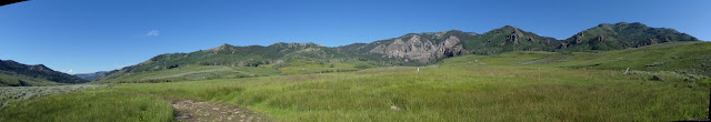
The first part of the hike is flanked by private lands, which was one reason I didn't go on to see if there were other options for camping when I found the one I grabbed. It looks like a lovely spot to rest a while, so long as you've got the vehicle that can clamber up the rocky hills over and over again. There are no crossings of Soap Creek, but a few of the tributaries take some effort. One of the streams was a giant pool on the road and West Soap Creek has a bit of water.

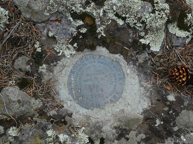
Under the crisp blue skies, it felt like I had plenty of time for meandering. I started looking for the benchmarks along the road. I didn't find the first, but then had to admit that it was only a marked elevation, it doesn't actually say "BM" next to it. In fact, it's a cattle guard. The second was across the creek and I wasn't going to sacrifice my dry socks for that.

My streak for not finding benchmarks continued unblemished, but I did see some nice camp sites along picturesque canyon. There was a little traffic. The people camped near the end of the road came slowly down and in the distance I saw a Jeep that went to the ranch before I got there. Eventually, there was a guy with a rugged trailer.
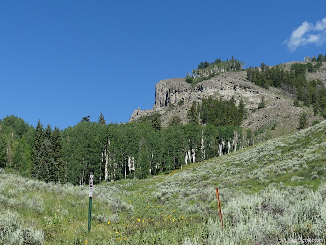

There was some indication of weather to come as I wandered through Little Soap Park, but I didn't get to any rushing.


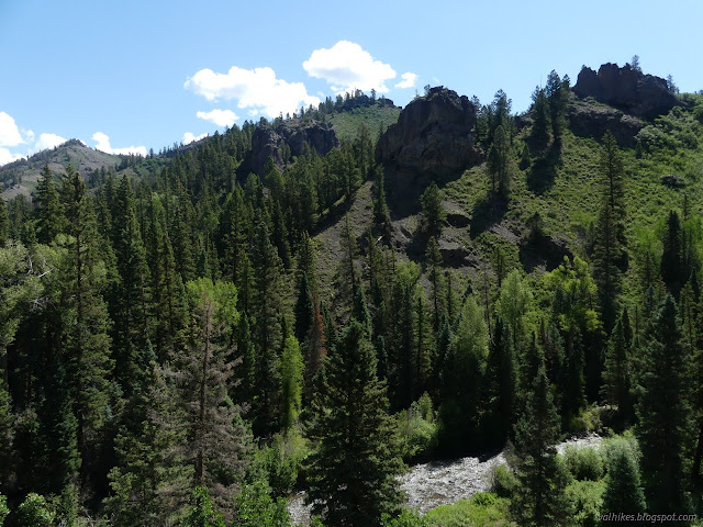
On I went as the road got high once more. The rocky hills were particularly rocky and steep going down. The flats look fine, but this really isn't a road my car would handle.


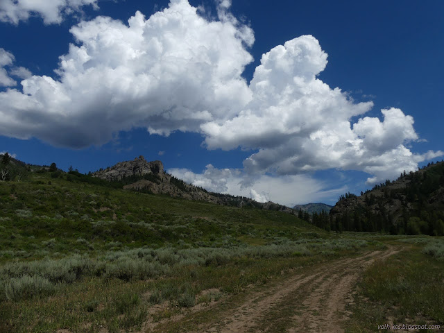
I checked out the trailhead or campground of Commissary as marked on the map. It was no more than a rather substandard dispersed camping spot and the loop shown is very suspect. Then I came to the last benchmark I looked for, and found it. It marked the change in the road from suitable for cars to 4x4. It's just two miles further than the map indicates. Then the road split and I chose left. There's no sign, but I suspect that's the real Commissary, just before the road gets rough.
I found the absolute best dispersed camp site shortly before I turned off the main road. Clearly others didn't think so because it was empty. I really considered hurrying down and packed everything up and moving up there. I wasn't entirely sure about my shortcut, but suspected it was the original road, now moved so that it doesn't go right through the middle of the campground. The current road goes a long way around, this was direct. I'd noticed some shoe prints on the road and they turned this way too, so that looked promising.


The shortcut worked beautifully for walkers. Barriers had been set for drivers trying to get too far along it. The track goes right through the walk in section of the campground, so no wonder. There were some big rain drops as I got to the corral, but the weather seemed to be holding off until I was done. It actually didn't do much more than that. I weighed that pack again at the end and came up with 24 pounds including the camera, which is still a bit much but indicates not quite as much a bit much as the measurement at the start.
*photo album*
©2022 Valerie Norton
Written 15 Aug 2022
Liked this? Interesting? Click the three bars at the top left for the menu to read more or subscribe!


Comments