West Elk: West Elk Peak and around The Castles
Gunnison National Forest
DAY 1 | DAY 2 | DAY 3 | DAY 4 | DAY 5 | DAY 6(blue line, map link)
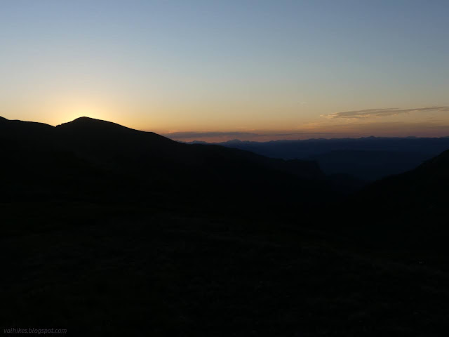
It was a cold night out there on the knobby-but-overall-flat rock. It stands to reason that the storm passing through included some cold air since the hail took so long to melt. I even pulled on my puffy pants overnight. It wasn't too hard to get up, but I still didn't make it out all that early. I had filtered enough water to camp, but decided to hike with what was left of my 3L from the day before.
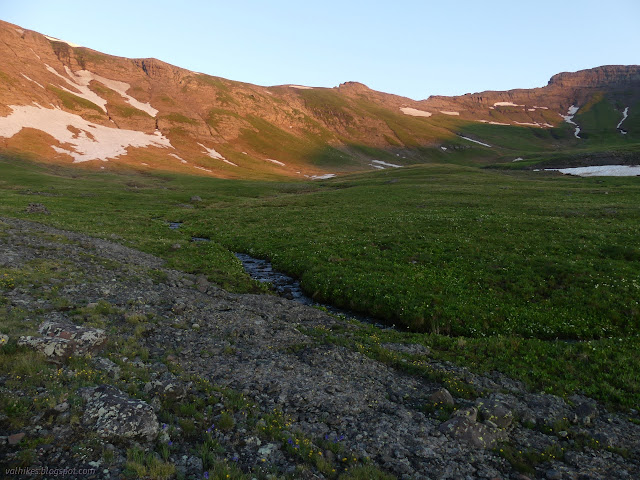
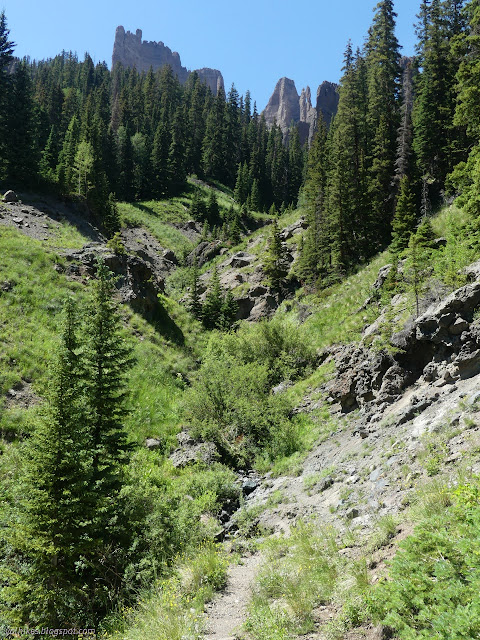
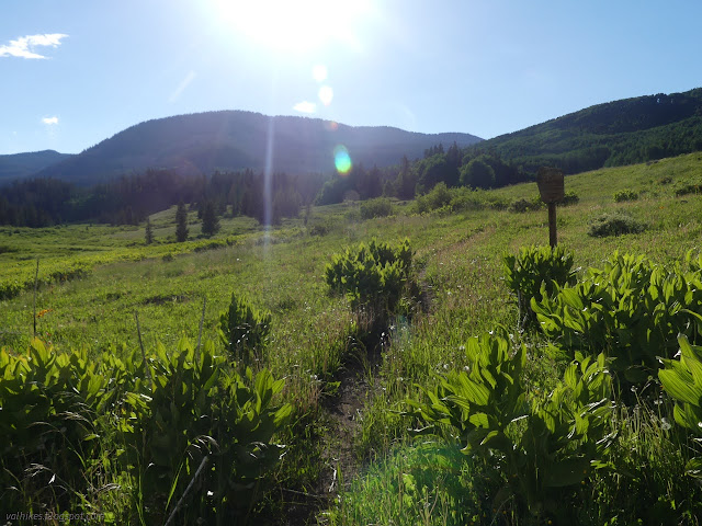
I debated trying to follow the trail past where I hadn't seen it before or just following sort of a shelf of land around to meet the trail higher up. Reporting on how, or if, it was signed at the north end wasn't important enough. I headed around, tending to go higher than where I was aiming on the map. Toward the end, the flat showed signs of becoming shallow lakes, so I took the wide ramp to the left and avoided the soggy shoes and socks that were promised. The trail was very obvious, as it should be. It might be one of the most popular in the wilderness. I actually saw two different groups on it. The first was right above me, taking the switchbacks to Storm Pass.
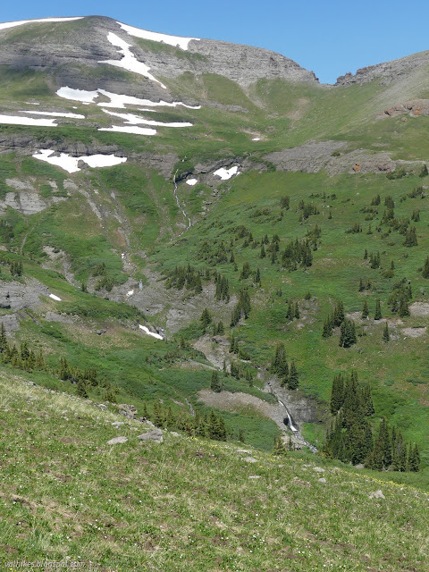
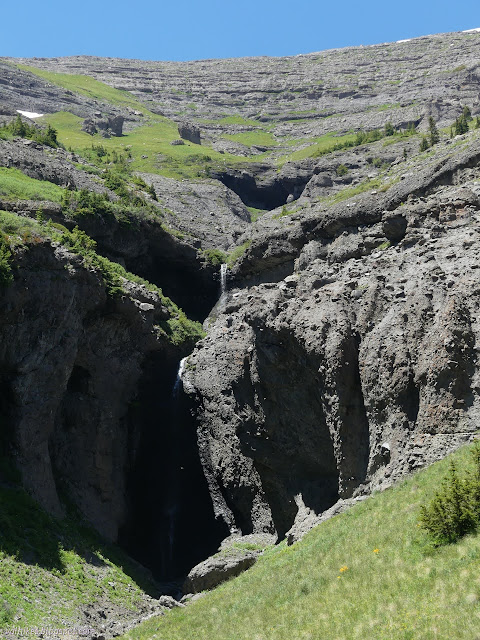
The three women were still at the top of the pass when I arrived. There was an incredulous sound from one when I suggested there was a junction down there, but another had been noticing the hints that there was a trail, so there was triumph from her for being right. So no, it's not signed at the north end. We talked waterfalls, of which we were looking at a few and they said there were plenty more on down the trail. We talked about West Elk Peak, which they were going up and I had decided that I really shouldn't. I had lost ground a little on my 10 mile marks.

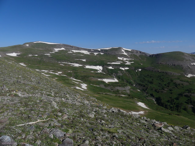
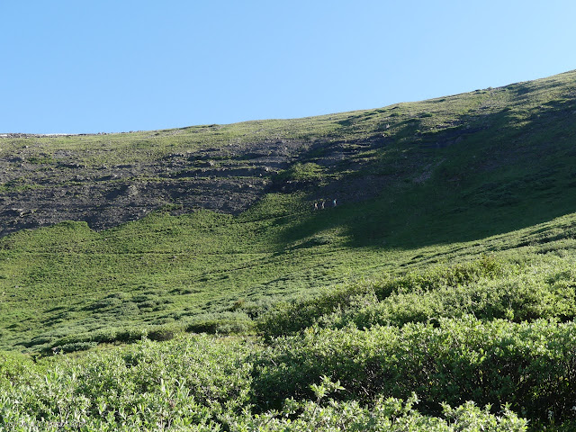
Not that I hadn't picked out the route I might come back along. I'd have to keep right as I came down to avoid the band of cliffs. From there, just stay above those willows and everything would be swell. The other hikers took off for their peak. I ate a bit more, thought a bit more, tried to keep my resolve, then followed along behind them. Hey, we may never pass this way again. That peak is the wilderness high point! Plus, it's a simple walk around the top of the rim from Storm Pass. There's even an obvious use trail. And as I did, I knew the lowest energy mode would be to drop all my unneeded heavy gear and come right back to the pass. Hey, there's a nice rock to drop it all beside, just a little way off the trail. I didn't. I had this cool possible "shorter" route planned out, after all. I couldn't do that if I left my stuff on the ridge.
I had passed them again by the time I reached the top, so I guess I wasn't in need of any energy saving strategies to add one more wilderness high point to my collection. I had also noticed that the forest was slightly on fire. The others had been slowed down by calling it in. It was probably a lightning strike but looking like it had grown past a single tree. I was concerned because I would be hiking toward it. These forests may not usually erupt into giant blazes, but I've been in a few big fire footprints not too far from this place. They do happen and there is plenty of beetle kill.
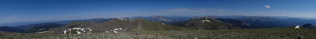
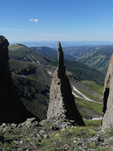
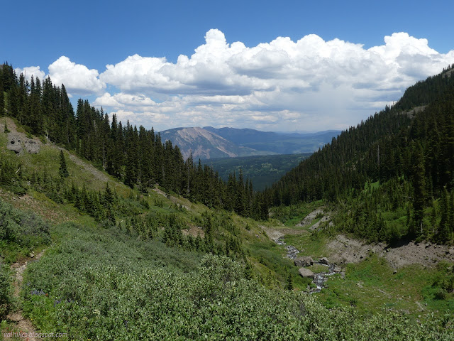
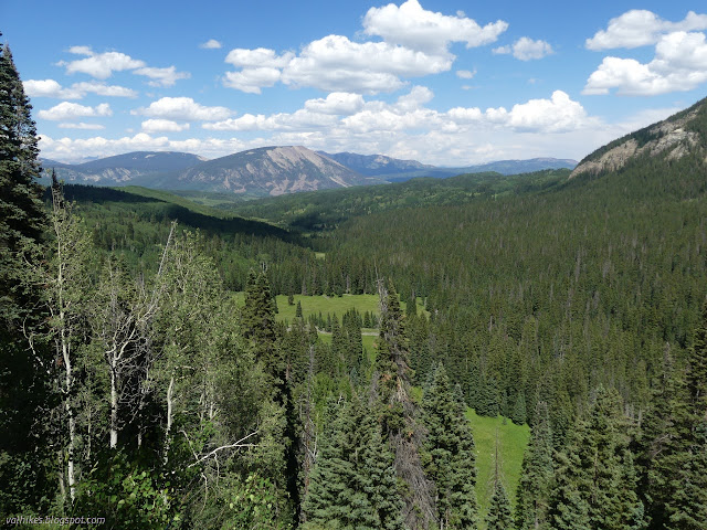
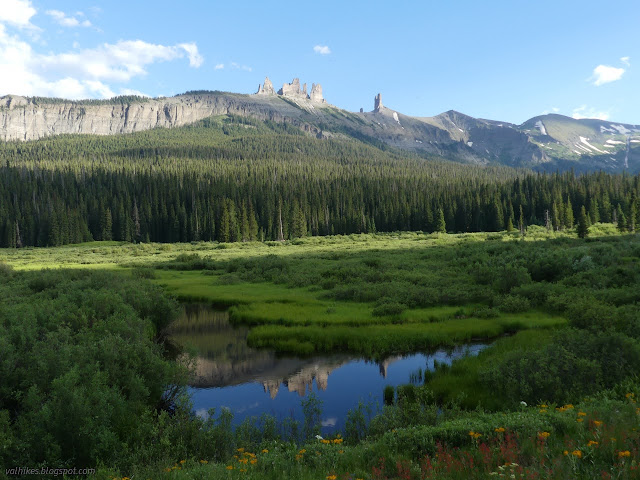
I found the references for the benchmark. They triangulated on the tallest part of the giant cairn at the top. I pondered dismantling it, or at least moving it over. It doesn't need to be in any specific place. It got to remain, for now. There was some very conservative storm avoidance going on with the other group, so they headed down again. I decided that OpenStreetMap had a most delightful option to hiking toward the smoke with a trail that continued along the ridge, then down Castle Creek to meet the trail to Costo Lake. If I could contour around from there, I'd also miss the miles of trail next to swamp, which sounded like another fine thing to miss. Besides, I'd already seen the canyon of South Castle Creek.

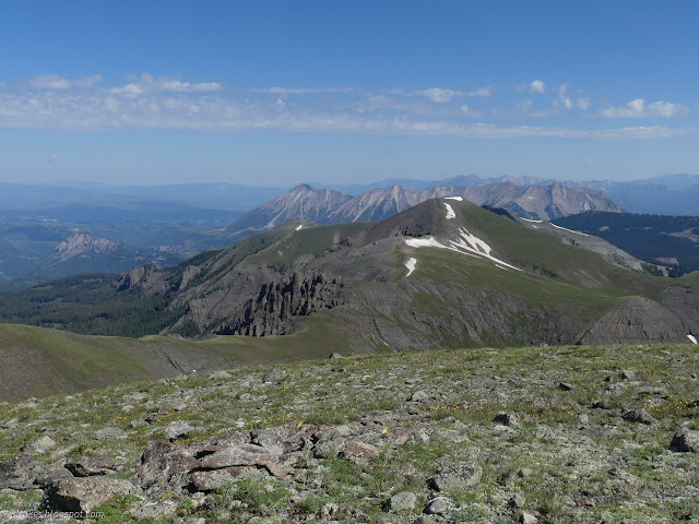
It didn't seem like such a good option when I came to the class 2 knife edge, which was the first place where there might be trail visible. Class 2 if you don't think about what a fall sideways might mean. I did the first two dips with increasing uneasiness, noted it was just going to get worse, and turned back. I'm sure it's a great route with your little day pack. I pondered the cliff lines and loose rocks below West Elk Peak on this side and decided against meeting this so called trail further down. Anyway, there must be a reason there's no cutoff between Costo Lake and Castle Pass Trail. I turned to climb back up and over West Elk Peak, which was looking extremely stormy overhead.
I followed along the path I'd selected earlier around the bowl and downward rather than hike back to the pass. It was, as I should have learned from the previous day trying to work around a bowl, more effort than just following the trail for longer. I made it to the edge of the cliff band and around it just fine, but had to wonder which willows I was supposed to stay above. When I did finally work my way around to the trail, I was still halfway up it.

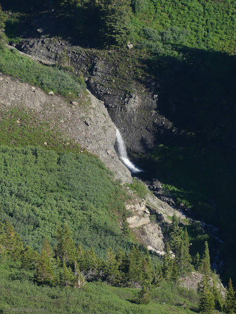
So back on trail, and back to approaching that fire, I headed down. I quickly slipped past a pair of waterfalls I hadn't yet seen. It was absolutely not true that I had already seen this valley. Meanwhile, the sky cleared up. It didn't rain on me at all although it was strongly expected. It did rain somewhere, but not where I as when I was there.

South Castle Creek was a wet foot crossing. I went for the neoprene booties and then grabbed water on the far side while my feet dried. I needed more by that time.

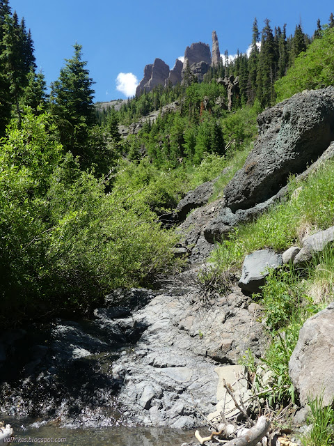
While the scenery was great, the trail was not. Plenty of trees had come down, some of them large. The trail had had lots of work to deal with this. All too many times that meant getting rerouted around a big tree instead of cutting it and the reroute was not always obvious. I found myself facing a substantial bit of wood on a number of occasions after ignoring the wrong path. The various water courses also had a few reroutes that weren't always clear. One desperately needed a reroute. The second group was along here, trying to find a place to camp. I saw one site practically on the trail next to the creek crossing and nothing otherwise.
I finally got near where the trail would wrap around the ridge to start up the main Castle Creek, but was still high up. Here the trail wound down along a half dozen interlacing paths, each steeper than the last. I selected one bit of switchback of a reasonable slope and came to a spot with no choice but an even steeper route. There's no way to select the right one. Then there was the biggest tree yet, over 4 feet wide, to navigate under on a steep bit of trail into a small creek. After that, I found fresh horse prints and knew whatever came next, it would be easier.

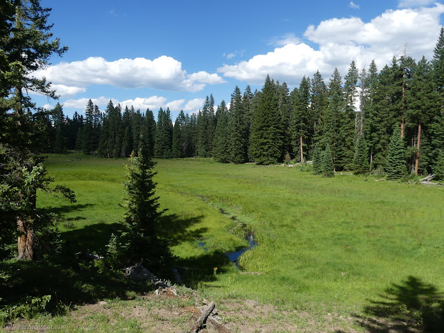
I passed ponds and streams and out of the wilderness. There seemed to be camping spots all over the place as I got near the road.


The trail passes between one pair of large ponds. The one on the right had broken its earthen dam and was not much more than a stream. The left was still a big pond. The bugs weren't bad and I'd been without a rest for a while, so I stopped for a snack.

Trails were quite clear and signed as I got to the numerous junctions that happen to be near this road end. One to swing back and complete the Mill-Castle loop, one to catch the road just before the end, one to head up to Costo Lake, then the crossing of Castle Creek. I got more water at the creek beside the Costo Lake Trail (or Costco Lake Trail, typoed on the map), then dealt with the wet crossing of Castle Creek by not letting it touch my shoes or wool socks again. Since it is marked as swamp across to the road, I expected more wet, but didn't find it. From there, there's Little Pass Creek Trail and the Lowline Trail (toward Swampy Pass) all nicely signed.


It was the part of the trail that was supposed to be high on the side of the marshes that was a muddy mess. The mosquitoes weren't quite so bad as I expected, but still quite bothersome. I was ready to find camp, but preferring to get past the marsh first. The trail passes close to a seasonal stream above the marsh, according to the map, and I aimed at that. I still went checking out one side trail expecting a horse camp. It might be good enough, after all. I found a horse camp with a complete collection of cow bones and no good place to put a tent.

The big camp I expected by the creek was there, but I didn't see it until the next day. I did see something I could make work between a couple trees lower down. I climbed up to get water and looked for something better as I did. I was still 200 feet short of the camp, but two switchbacks up and expecting the trail to leave the water where I collected. It would have been nice, but I did sleep quite well tucked between the trees, too.
Continue on to the next day ⇒
*photo album*
©2022 Valerie Norton
Written 7 Aug 2022
Liked this? Interesting? Click the three bars at the top left for the menu to read more or subscribe!


Comments