Ptarmigan Lake and Jones Mountain
San Isabel National Forest
(map link)
Ptarmigan Lake is a popular trailhead and I'd already seen that the cars spill out of it into some 4x4 parking and out along the road if you get there very late. I was the first into the parking lot at 7AM, though very nearly not the first parked. No other cars arrived as we first folks sorted ourselves, used the toilet, and got going across the bridge and up the trail.

There's a few views as it climbs out on a rocky slope at the start, but mostly the trail passes through forest. It is a hard packed, wide, and obviously well used trail.


The trail crosses an old road. It presents another route up with much easier parking since very few seem to take it. There's not much of a path plodded into the surface. It does go longer from a few feet lower to get to the crossing. The trail is marked out with sticks so no one gets lost along the crossing, then climbs some more.


The forest started to give way and the trail began to flirt with Ptarmigan Creek, the outflow of the lake.
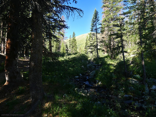

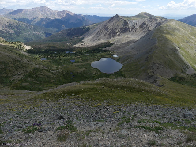
There's a number of ponds, some quite large, below Ptarmigan Lake. Here, the great amount of use starts to make the trail hard to find. Trails go off to camping spots and fishing spots all over the place. The camp trails can be especially well used. Following the crossing of Ptarmigan Creek, trails going off to the first lake or up along the creek looked equally likely to be the official trail. I went right, along the creek, and this seems to have been correct. At another turn, I got it wrong. I used the placement of a camp as a clue for the correct direction, but that camp is inappropriately set practically on the trail. Things settled out a little with more climbing toward the lake.


With a little bit of above tree line climbing, I arrived at Ptarmigan Lake.


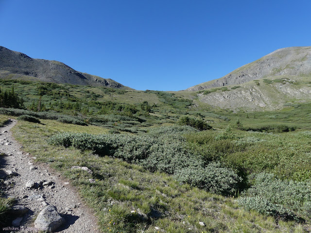
My original plan was not just to the lake, but up the pass beyond it to get that extra bit of view a pass promises. I could see two trails going between. The well used fishing trail at the edge of the lake seemed to have taken over for the higher built trail as the one that everyone used. I decided to go higher, which ultimately was a nicer trail even if getting slightly overgrown in spots. I wasn't the only one using it.


A fishing couple were coming up the other side. They'd driven their ATV up the county road on the far side for the short hike to the lake. Besides my fellow 7AM arrivers, there were a couple more filtering up the trail and finding a spot along the side of the lake. I got to noticing that the high point of long Jones Mountain was just a half mile away, although 1000 feet up. It is another 13k peak with 1000 feet of prominence. I still had enough water and the weather was holding (even if predictions were to the contrary) and suddenly my plans went awry as the peak was added to the itinerary. Since 1000 feet in half a mile is a little steep, I decided to take the road up for as far as it went and then the less steep slope to go up. It didn't really look that steep, so I'd come down the more direct route. Plan made, I set about executing it.


Shortly before the trail ran into the current road, it ran into an old road. I decided without too much investigation that this much be the climbing road and proceeded to follow what isn't even getting much animal use and is falling down the mountain. It was certainly more difficult than it needed to be especially since it simply ran into the new road further up, at which point I had the open, but full of loose rocks, new road to follow. It is differently difficult.


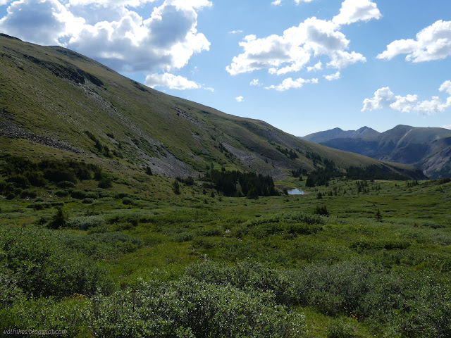
Quite a bit more view of the valley opened up after leaving the saddle and climbing higher. Roads go deep into it. The primary purpose of them was likely mining. I was crossing a few mining claims as I went.


The road took me up higher than I expected it would, but it gave up with 500 feet still to climb. I just followed the ridge the rest of the way to the peak, topped with a large cairn. I was almost beaten to the top by a woman who just came up the direct way and didn't take so many pictures of flowers on the way. She was a local on her eighth trip up, and basically tagged the cairn and zipped right back down again. The sky, which had been oscillating between clouded and bright, was looking like it might well break quite soon, so she had reason to be quick. I was a little slower. Sure, it could break soon, but it wasn't going to do it now.


The only really steep bit for the more direct route is right at the top, where it is bare rocks and slippery. There's an easy way around that to the north, so I went that way.

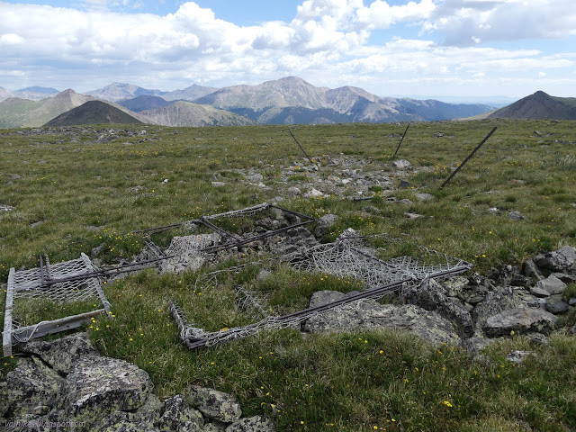
I got distracted when I spotted something man made on the large flat below the peak and went quite a bit more north than I needed to investigate it.
Then I headed back over to the ridge to follow it down. There is a trail along the bottom of the steep, rocky slide that facilitates going around it, should one want to. (As I did.) Below that, I could just wander off the ridge and find a little less steep stuff, if the grade was getting to me. Halfway down, it started to hail on me. There wasn't much and it didn't last long. The only thunder was in the distance.


There didn't seem to be anyone at the lake while the storm broke its little break, but they materialized very quickly once it was done. I decided to try the low path on the way back, which is how I got to know that it is a scruffy, less comfortable to walk path. Plus, I kept having to negotiate passing people.

I stopped for a snack with a view looking out over the other lakes, then continued down. That weather was going to rethink its short duration. I did have a distraction on the way. I looked down through the trees to see something that looked like the stacked logs of a cabin, so went exploring. It was stacked logs alright. I'd almost got to the road crossing again and the logs were stacked up to be taken away. The roads in this valley are primarily logging.

The rain held off until I was nearly to the car, and then started slowly enough that I could be in the car before it really got going.

*photo album*
©2022 Valerie Norton
Written 14 Sep 2022
Liked this? Interesting? Click the three bars at the top left for the menu to read more or subscribe!


Comments