Blue Lakes: exploration and the lakes
Uncompahgre National Forest
DAY 1 | DAY 2(map link)
I had a plan for a more elaborate Blue Lakes trip than the typical, and extremely popular, up to the first lake, the second and third lake, the pass, or the peak trips. I was going to start off with a little adventure! Well, exploration. Well, I'd already poked around on the sunny morning of a day that was supposed to rain all the way through and found the old road where segmented, blobby white lines on the map happen to be. I'd been up about half a mile, so that was known to be solid road with a well used path. The rest, though, exploring! The road went up the mountain quite a ways and there were more segments suggesting a connection to the Blue Lakes Trail. I figured I might go up to where there is a reliable creek shown and, after getting to the end of the road, might camp by the creek. I expected it was a mining road once and had visions of ore carts and other oddities strewn about once I got to wherever was the end. The next day would be using the connector to hook into the trail and up to the lakes. Up to the saddle to see what I could see, but resist the 14er Mount Sneffels since the trail to the top has a spot of "2+" or maybe people are liking to call it "3+" where you must do an extremely exposed move to get across some "V notch". It's a slip and you die moment, which is the very definition of class 4. Not having it. I did see one trip report saying they had no idea what people were on about because they never actually saw the notch, so perhaps there is hope to simply skip it. That isn't from the saddle, but from lower down the other side. I never found out any details about the route from the saddle, except that people do it. Anyway, yes to the saddle, but no to the mountain.
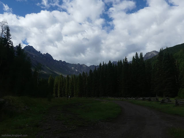
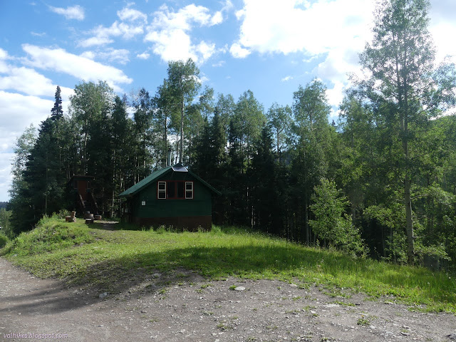
I wasn't going to drive anywhere to start. I just went a short way up the road and crossed the bridge. Here, you can see an old road cut climbing more steeply. A little further, roads used for more dispersed camping areas connect into this old road. I roughly followed along the old route as it climbs to cross the new road near its end. It gets very faint right before getting to the new road and I could actually see at least two old routes. Just before the road, there was even a sign telling me the trail was open to hikers and horses. I'm not sure why bikes are put out. They can take the Dallas Trail off the end of the current road, though. I crossed the current road and started up the still used bottom of the old road I was out to explore. The use stops at a cabin after a short distance.
From the cabin, I headed up along the well used trail I'd already been on when poking around. It follows the road, which has frequent dirt mounds to discourage any drivers. The first few have old culverts stuck on top. This was an improved road once. Sometimes I could see the path of another, older, steeper road that came before this one. Those segments had no trail at all on them and would not be half as easy to follow.
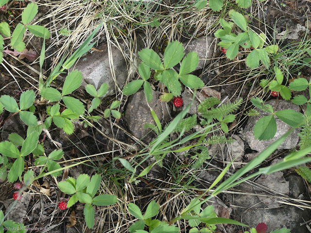

I had to reevaluate my guess as to the purpose of the old road. Every switchback had a bit of old road continuing from it. This was a logging road, not a mining road. It did tend to dampen my spirits about actually going to the end. Still, I was getting to some nice meadows along the way with a view here and there.


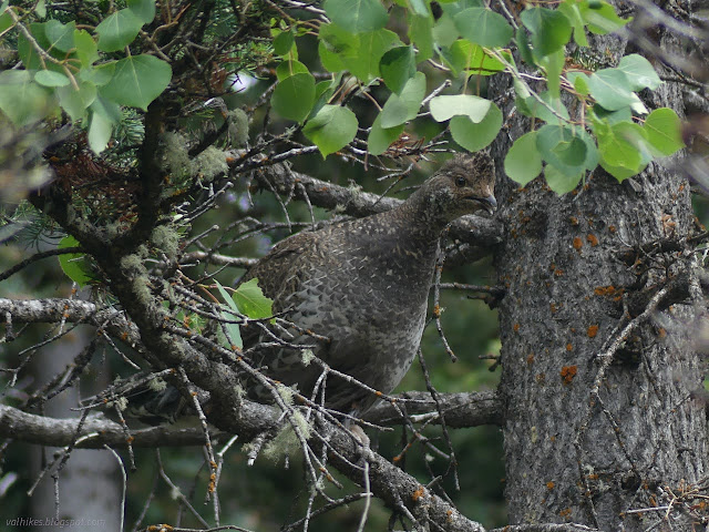
Past the meadows, I started to get views out over the valley. (I was also able to get a fresh weather report. Previously, all I had was a four day old remembered prediction on the radio for Teluride.) The trail started to get thinner and split near a rock jumble. I wasn't sure which was the main route there. I continued up (left) and tried to get lost off one of the secondary roads, but then seemed to be on a main route again. There had been trail work removing logs in that area, but it seemed older. For the first time, I had to get over a large log.

Then I arrived at the creek, or where it should be. I didn't find it. There wasn't even a bed to say this is where the Vance Creek should be. There was a well used game trail going downhill. Maybe that gets to water. I stood and listened a while and heard no splashing.

With the trail clearly having become less popular and the creek not there, I decided to turn back. There was still plenty of time to head up to the lakes.


I got a little impatient about crossing over to the Blue Lakes Trail and turned down one side road that quickly seemed a bad idea. I continued down to the next at the top of the largest meadow and the only place where continuous trail could be seen branching off the main trail and onto the side. This is an area where the map contours suggest a shelf of land. This, too, was impatient because where the blobby white lines for the possible connector were was much further down.

Apparently the trail users are just getting to a bit of meadow they like better, because the well used trail ran out abruptly. There was still road and game trail, so I followed that. The road cut got a little wiggly with fainter offshoots going off the sides where there were many stumps. Along the way were long, narrow depressions of the sort formed when edges slump off the side of a mesa, or other mountain. That's one reason for a shelf.

Then the stumps ran out and any vestige of a road was gone, but that didn't matter because I was on game trails and they kept going. I was about halfway to the trail from the old road. The game trails didn't quite go where I wanted, so I had to make my own way a little, but there's always another to follow. Eventually, I needed to follow a gully downward to arrive at the trail.

It was easy to spot with hikers walking and talking along it on this holiday weekend. I arrived on it just past a fresh fallen tree. I quickly had to navigate more trees on this well used trail than I'd needed to on the unmapped old road. But it got better quickly as the trail left most the trees and found some water to flirt with.


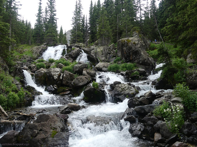
When I came upon the first big waterfall, I had to go down and see it. Without taking the extra trail, it's only kind of visible through the trees and I felt it deserved a better look.

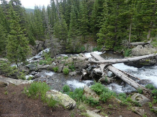
I was not so rambunctious about the second, but perhaps I should have been. It also has an approach trail and seems a little more vertical.


A little more climbing in some trees and the trail flattened out to a plethora of well used tent spaces, many of them occupied by tents. Past the trees was the first of the Blue Lakes with small crowds of hikers sitting about here and there. I headed around the west side toward the multiple inlets, then across a couple.


I decided to keep on going, so I backtracked to the junction pointing out the way to continue up. It is in the middle of the tenting area for maximum difficulty in picking out a trail. Once picked, that trail leads to the rather large outflow from the lake. I managed, very slowly and with great care and a little crawling like action, to boulder hop across with dry feet. Then I had to cross the smaller outflow from the upper lakes, which I did not quite do with dry feet. The trail joins a second main trail from a different crossing and then sets to climbing. There are 800 feet between the upper and lower lakes.

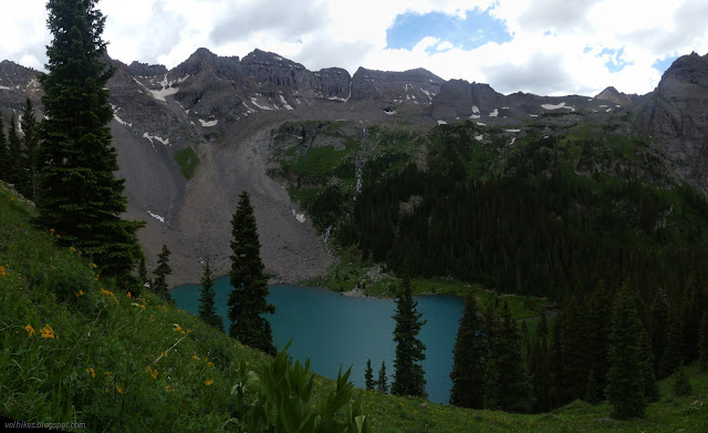

The middle lake again has that character like the land slumped away, slid and tilted, and left a long crevasse to fill with water. But looking to the size of the hill beside it, it is hard to believe this is true. There's probably a paper on it somewhere.


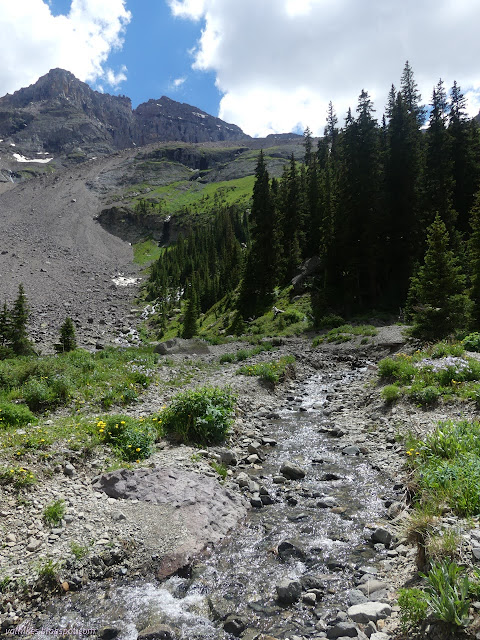
It's not a lot further to the Upper Blue Lake.

I went looking around for a campsite, but had to admit that this is not a highly impacted area. I did find two spots, one on either side of the lake, that seemed usable. Below the northern spot, I found a bit of crushed grass and the tag someone had torn from a Nemo tent, so there is definitely some impact. I had a fresh weather report with a 20% chance of thunder storms overnight, so being above tree line might not be smart. I had already seen at least half a dozen marmots, so wasn't excited to leave my gear there while going up to the pass. On the other hand, it was a long way down.


I started down all the same.

There's a camp site about halfway down, but it is very close to the water. I followed a trail off away from the lakes and water and found a space I could use, then tromped back up to the upper crossing for some water. It started to rain and hail as I did and I was glad I'd brought both the tent and the little roof to cook under.
Continue on to the next day ⇒
*photo album*
©2022 Valerie Norton
Written 26 Jul 2022
Liked this? Interesting? Click the three bars at the top left for the menu to read more or subscribe!


Comments