Lost Lake
San Isabel National Forest
(map link)
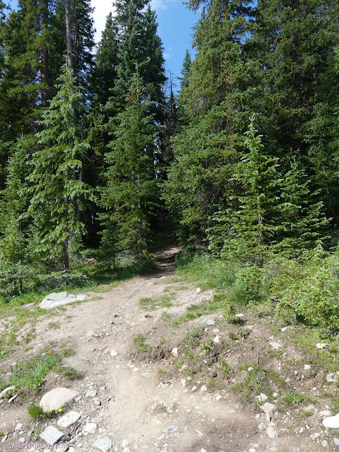
Since this day was expected to go all stormy for the afternoon, I hadn't really planned on going for a hike, but this particular trail is short, flirts with the tree line the whole way so views should be abundant, and finishes off at what could well be a delightful lake, so I decided it would still be a fairly restful day if I wandered on over. The Forest Service topographic map shows one entry, but OpenStreetMap shows a second that is directly across the road from a paved parking area suitable for a couple cars. I ended up parking a bit early and wandered down the road until there was an obvious trail. This turned out to be the lower entry and there were quite a few more than a couple cars squeezing onto that road edge. It's a popular trail.


The two entry trails combine at a spot marked by a cairn. It would be easy to blow right past it and continue on the other trail, but that was my plan anyway. The nearby lake clearly gets some camping.


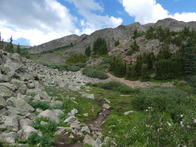
There are some challenging muddy spots as the trail gets near the lake. Thrown down sticks and rocks made it walkable. One last creek crossing and little climb and there was the lake.


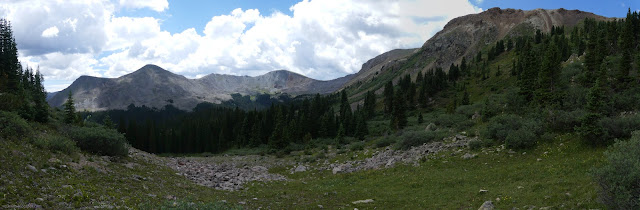
I wandered around Lost Lake by the most used path and set about taking a lot of bad panoramas (like the one above). Some locals mentioned there was trail that goes way up and all the way around. I think I was pointing at too much up, because the trail I wandered along more sort of petered out than went around and others working their way from the other side were ultimately lower. I did find the end of the alternate trail that comes up from a hairpin in the road below the regular trail, then follows a gated road most the way up. I also found a whole lot of camp spots all with multiple fire rings. At tree line! More and more forests are making it illegal to have fires at or above tree line because of the ecological impact of burning every single piece of downed wood, to say nothing of what happens to the live trees when people can't find any downed wood. One sign I saw in Gunnison National Forest, just over the divide, stated this was illegal, but I have no idea about San Isabel. As I am not a compulsive fire builder and don't much like breathing smoke, it's not a regulation I tend to check on.


I ate a while, perched up high above the lake on the south side. The sky oscillated between cloud and sunshine. There were a pair of swimmers, with life jackets even, from a large group of families. They went out to the island and bagged its peak. Others from the group were inspired to wade a bit, but when offered the floatation devices, didn't seem ready to get that wet. There was certainly plenty in the people watching to be done. I gave up my perch just before the first thunder rolled over us. It didn't seem to phase the large group, but it escalated quickly and most got moving along.

Thunder wasn't the only thing those clouds had hiding in their fluff. The first bit of rain came with hail.


I stopped under a tree to put on my jacket, but it didn't last long and soon I was hot and not getting rained on. It waited long enough for me to go ahead and get that off before starting in again, but this time harder, but with less solids, and keeping at it.

As I passed the cairn marking now splitting paths back to the road, it didn't quite look the same. I probably just didn't take enough note of it on my way out. This path passes much closer to the unnamed lake and gets into some muddy areas when crossing its outlet. It had a tendency to dwindle as it went and I had to contend with wet vegetation leaning into it. While it got near the road, it didn't quite make it to the road. I had seen trail above where I parked and tried to make it back to that, but ended up on even lesser trails. The lower, more popular trail definitely made the better route.
*photo album*
©2022 Valerie Norton
Written 25 Aug 2022
Liked this? Interesting? Click the three bars at the top left for the menu to read more or subscribe!


Comments