Galena Mountain and ridgeline walk, with CDT return
San Isabel National Forest
(map link)
In pondering what I might hike, I noted Galena Mountain was a prominent local peak (with over 1000 feet of prominence, in fact) and I noticed a couple of geocaches that had not been found in over seven years. One of them was at the other end of about 2.5 miles (on paper, anyway) of ridge from the top of Galena Mountain. I examined the contours carefully and decided that just might be 2.5 miles of walkable ridgeline. I could certainly check it out from the top of Galena Mountain. If I decided against, it would still be a worthy hike. If I decided in favor, I could easily continue down the far end of the ridge and get on the Continental Divide Trail (CDT) for the return. The sketch of the route came in around 16 miles on paper, which would be a bit more once actually executed. It can be made shorter by using the Bear Lake Trailhead, but since I lack a 4x4 vehicle, I went with the Timberline Trailhead, which is paved to the last few hundred feet. A big hike, I needed an early start.
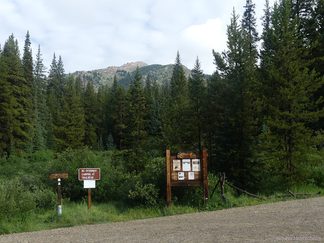
I started down the southbound trail because it's the most obvious and my maps indicate there's a short connector to meet the CDT (and the Colorado Trail), already in progress. It's not true. I turned around and found the trail going north instead. There is also an old road between the two. Little signage, but it does come to a box of permits, with a sign saying they are required for overnight stays in the Holy Cross Wilderness. I opened it up to find only a few already used forms. Good thing I didn't need one, but also good confirmation I was headed in the right direction.

I had been running low on water at camp, so needed to get some. I did so in a short excursion to the west just past the wilderness sign. It did eat into my early start which hadn't been quite as early as hoped. The water was nice, though. Then I continued up the trail to the ridge, roughly following the routes of others who have posted on Peakbagger. Mine would take me past a lower benchmark that was probably part of building the reservoir below.

The ridge looked like it had hosed a few camps. It has trees, but sparse, and a stream within a quarter mile was running with enough water to collect. Who could ask for anything more? As long as the wind isn't blowing too hard. I left the trail at the ridge and angled for the lower benchmark, crossing that stream a little higher up. It was dry there. The area is open meadow, so there was little restriction to my travel.


I got to the general location of the lower benchmark, where there were a couple scattered rock groups. I was a little low, so climbed a little higher and found it in an outcrop on a shoulder. Sure enough, DT-1 is Bureau of Land Reclamation.

Then I turned and started up toward the peak, which also has a benchmark. Here, the grassy meadow starts becoming choked with willows. They're only knee high and there are game trails through them, but they still make a slightly more difficult travel. Mostly, I went around them. The game trails sometimes stop in the middle and aren't reliable. The rocks and boulders strewn about can also be a mild challenge.


I found an old prospect on the way up, and there would be more along the way. Leadville wasn't just some ordinary mining town. Leadville was the richest mining area in Colorado, at least until 1893 or so. It's hard not to trip over some mining history.

Then, with only a little bit of clambering over boulders, I found the top marked by another benchmark.


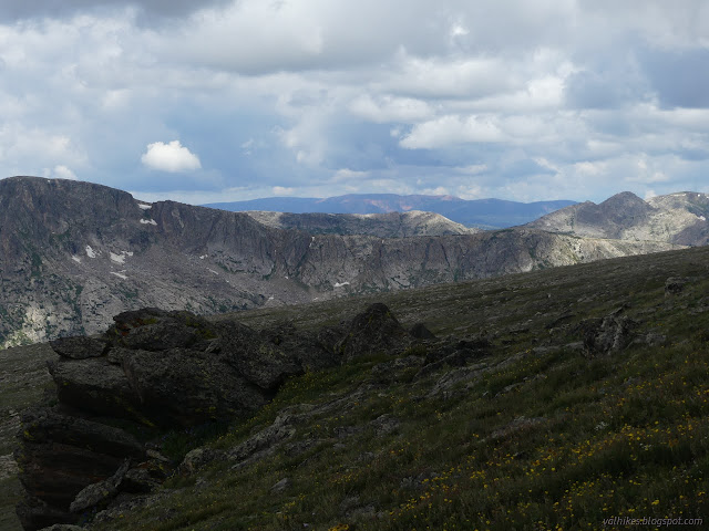
I meandered over to the second bump at the top of Galena Mountain for a better look and examined the ridge I proposed to walk. It still looked walkable. The weather... well, the prediction held little probability for thunder, just rain or even hail. Bailing options were generally too steep on this side, but should be better on the other. The problem with bailing to the other side is that it becomes an extremely long walk back to the car. I would actually want to come back up when the danger passed. There's really no good bailing options, just ducking away options. I probably put more trust into that weather prediction than is wise, because I went for it.

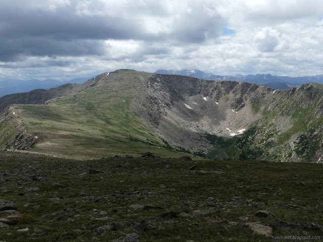
I came upon a large cairn as I made my turn off the main ridge, a part of the Great Divide, and started east. It hailed on me as I walked the shallow dip between the second and third highest points of the loop. Water drops that were flung up and frozen and flung up again until they gathered too much ice and slipped through the winds to hit me in the head. My hat took it all easily. There was thunder, but it was faint. I managed to meet some class 2 climbing in a couple spots as I descended toward the lonely geocache, but I expect I could have found a class 1 way to walk around everything, had I wanted to.


It was sunny as I crossed out of the Holy Cross Wilderness, unmarked in this fairly untracked space, and got to finding the geocache. The person who placed it had decided to show people a special spot in 2014 and so far there was one single person, also in 2014, who had taken him up on seeing it. The container had fallen from the branch it was hung on in the meantime and it took me a while to find it half buried. I actually found someone's cache of cans, a few of them still full of something the rust would not reveal, first. And you know what? It is a good spot. (And he describes how to get there in just 2 hours and with much less exposure to lightning.)

It was late, particularly after all that time searching, and I was pretty sure I could get down to Deckers Lake easily, so that's what I did. This would cut off about 2 miles from the original plan to continue along the ridge. I also had a suspicion that the lake would have a trail for the rest of the way to the CDT, even if it wasn't official. In fact, I found suspiciously people looking trails before I got to the lake, but they weren't going my way.


I followed the fisherman trail around the edge of the lake. Initial tries for trail down just found camp sites, but eventually I found it crossing the outlet.


So I headed down the trail, and lost it. But then I found it! And lost it again. But I found it again! Maybe not... I ended up following footprints through a boggy area and having to find a better crossing for a small creek, then backtrack along Longs Gulch until I found the CDT (and bridge). Just past the bridge was the indication that Deckers Lake might have once had an official trail, which was now marked by a post that I should have come down past. I was back in the Holy Cross Wilderness with less than a quarter of a mile to where the CDT enters on the east side, but I decided not to tag that imaginary line. I turned west.


I crossed that bridge and found myself among the trees climbing. There wasn't much view for a while, and when there was, there was a Durango bound Colorado Trail hiker cooking dinner to step past to see it. I mentioned I had to get a good look at the mountain I was just on. Also, it had hailed on me while I traversed the ridge. (Too scary!) He wanted to hike across Elbert instead of staying down low. I told him Wednesday was the day to do it. That was great because that was the day he'd be there. I mentioned there's still a 10% chance of thunder storms. (Too much!) I thought about encouraging him out of his comfort zone and decided against. Backpacking doesn't take the gutless after all.

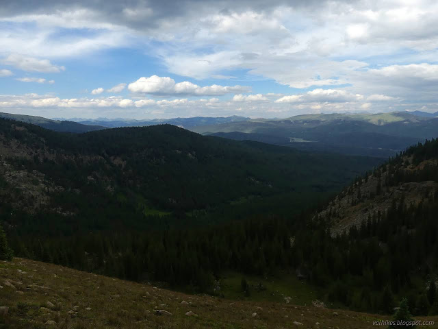
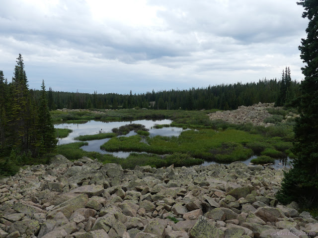
From there, the trail passes some ponds and rolls up and down through high spaces. There are sections of trees and open meadows with views. It's got a variety.


The junction with Bear Lake Trail was well used, so I guess the road must not be too horrible. Bear Lake itself was only visible slightly through the trees far below the trail, but there are a number of other lakes in the area to enjoy too.


There's one last climb up to the ridge where I left the trail, then still 2 miles and a lot of elevation loss back down to the Timberline Lake Trailhead. It was feeling like a long day by then, but still light when I found myself back in the parking lot. I wished the day hadn't been quite so gloomy, but it was still an excellent ridge walk.
*photo album*
©2022 Valerie Norton
Written 15 Sep 2022
Liked this? Interesting? Click the three bars at the top left for the menu to read more or subscribe!


Comments