West Elk: explorations and Soap Creek
Gunnison National Forest
DAY 1 | DAY 2 | DAY 3 | DAY 4 | DAY 5 | DAY 6(orange line, map link)
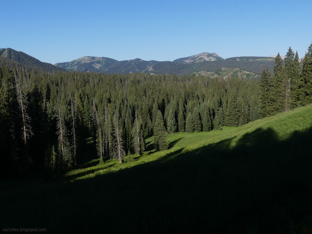
I got an early start trying to beat the mosquitoes and sort of made it. I noticed the missing bit of sign on the ground to finally discover that there's no camping (or campfires) allowed at the lake. I turned at the post, ready to take it wherever it may go. The couple at the lake thought it was silly to think it might rain in the afternoon because the air was just too dry. Indeed, I'd washed two pairs of socks (in a bag well away from the lake and creek because I'm not a barbarian and I know soil bacteria is needed to break up everything from that and you don't find that floating in water) which were very nearly dry in the morning. It was quite pleasant until I got to the long grass meadows and everything from my knees down got wet anyway.

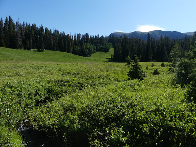
The trail started plunging downward in the meadow, but, just like the day before, I managed to spot where another one started off through the woods and took that instead. I passed a delightful and legal camp with a stream that wasn't looking a little frothy, then on through more lower extremities wetting meadow.

Then the recent trail work seemed to be getting a little lax. Only those logs that fully blocked progress were removed. Anything that could be walked around (with a horse) was. Then the hoof marks I suspected were the trail workers seemed to thin out. At the top of a meadow, they vanished. They'd turned around. I looked at the map and I was past where the cutoff turns down. In fact, it was probably the trail plunging down the meadow when I went for the trail in the woods. I was also past where the Sheep Lake Trail heads down. On the other hand, I was on a good trail and going somewhere. I shrugged and went on. I could just connect up with the Soap Basin Trail, which was an alternative to Soap Creek that I was considering.
There was some trouble finding the trail in the next forest band. What I was one went up. Another option faded away quickly. A trail I'd spotted just below me was the answer as it made very reasonable and trail-like climbs. I made my way (picking up the mylar balloon because all too often there is one, but usually not in Colorado) to Soap Creek, where I had to admit that there wasn't much of a trail anymore and it was now climbing in the opposite direction I wanted to go.

So, okay, I should just plunge back the way I came, but I decided to follow a second trail that had come up to join my trail downward. It fizzled quickly. So I started to make my way downstream. This was made difficult by all the fallen, beetle killed trees which would layer up quite high at the most inopportune times. It was tough going until I stopped worrying about the sogginess of meadows, particularly under willows and near elephanthead lousewort, and just crossed over to the drier hill on the far side where there was a trail.


So I followed this trail that was clearly made by folks who like to keep their feet dry. It was going down Soap Creek, at least until it split. One to Sheep Lake Trail and one to Soap Basin Trail? I tried left for the basin. It crossed the creek and headed up through the forest past cut logs. I was having great confidence in it until it turned just a little too much upward instead of across.

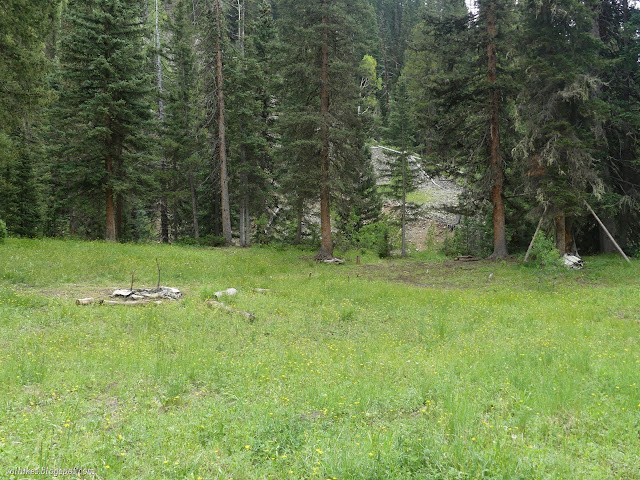
I gave up on it. Perhaps it was too quickly. I went back and turned along the other path. That was an elaborate camp.

Trail out the other side just went past a cache of milk crates, old stove pieces, cans, a tarp, rugs, then fizzled too. It should be less than half a mile to the trail, but nothing. I plunged into the forest determined to find that trail. I crossed it back and forth and never found the slightest sign it was every there. Meanwhile, the mosquitoes had become the worst along the trip. While I should have been devoting attention to the complicated terrain crisscrossed with logs, at least a third of my attention was on avoiding mosquito bites. These were vicious. There was no waiting around. I got near and they flew in quickly, usually onto my hands, plunged their suckers and went to town. And there were so very many of them. Finally, I emerged from the trees and could cross soggy meadow and a stream and be on well used trail again. Not that I found it immediately. I had to notice it was up the hill and go up and meet it.


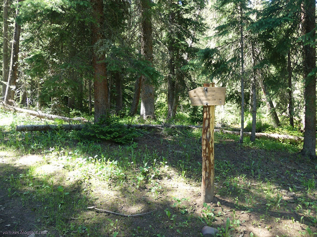
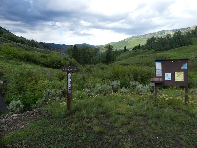
Before I knew it I was at the junction with Soap Basin, where there is indeed a camp site and nice water. Hopefully, I'd have made different decisions if coming down through the mess of trails and lack there-of at the end of the day than I did with plenty of day ahead of me. I did not note the trail over from Elk Basin and Robinson Creek Trail that is supposed to be before crossing the creek, but I also did not note the Soap Creek Trail at first either. A feeling of dread came over me that perhaps there would be more thrashing before the day was up. Soap Basin Trail was very clear, but four miles longer. That seemed like too much longer at this point. Soap Creek would have to work out.
I found a spot that looked like people crossed the creek and poked around in the meadow beyond when a bit of trail did turn up. I followed it back to find that the correct answer was quite a few feet to the left of the sign, not to the right where I went. I followed it the other way and it curled out of the meadow and into forest and a well used track. Oh, relief. Also the mosquitoes were much reduced.

The trail, or perhaps it's the trail users, did try to throw a curve ball at me navigationally. I came to a spot with, well, extra trail. The obvious trail to be extra is the one that comes up a steep hill and suddenly stops upon meeting more trail. Nope, that's the one I wanted to turn onto. Whatever the rest of the trail did probably wasn't get to where I wanted. Happily, the line of the Forest Service map was actually close to accurate for confirmation.


Coming to the junction with trail 852, I found nothing but the faintest track and no sign. One discarded plan took this up to Porcupine Cone. Ah, there were so many possible delights, but only so much food one can carry. Plus, I find it hard to throw myself at the mercy of Colorado weather for too long. This day certainly wasn't going to change that, but it was still just delightful with clouds boiling here and there, but not doing anything.


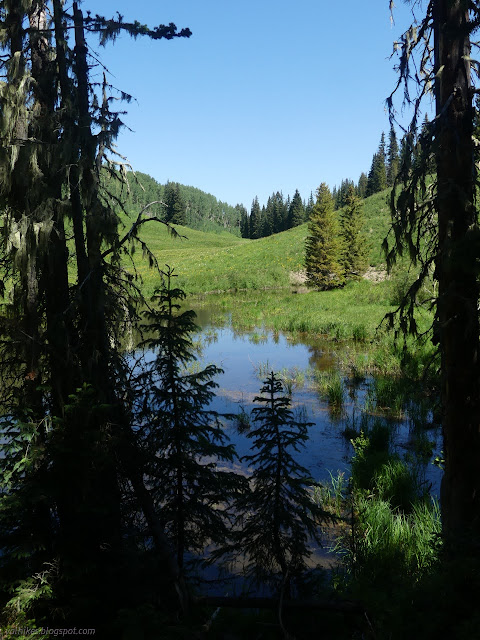
I grabbed water at a tributary and found a tick crawling on my bag. Ew ew ew. Then it was into a section of trail that crossed the creek a bit. My shoes weren't dry and could use the cleaning, so I plunged right in. My feet felt so very heavy as I came out the other side. There were more crossings than advertised and not all of them had obvious exits on the other side. The first, I just went down the creek a little then finally spotted trail through the brush and pushed my way to it. The trail was looking like someone with a horse was maintaining it, often pushing around trees instead of over and sometimes crossing instead of keeping the old trail. Perhaps the person with the huge tent that was rolled up beside a tree, wooden stakes in the ground marking its footprint.
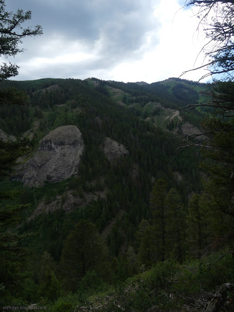
I got to where the trail was shown to climb, and it certainly did. Only a short bit was ridiculously steep. The Forest Service map suggests there's another section of crossings, but OpenStreetMap suggested that was no longer true with a second high portion after this high portion. I alternatively enjoyed and fretted about it. Sometimes it felt precarious. Along the way, I spotted a bear with a beautiful golden coat in a moment when the sun was shining and completely failed to get a picture of it before it barreled down a gully. Colorado bears seem so much more elusive than California ones. This might have been my first. It's hard to remember when there have been so many California bears.


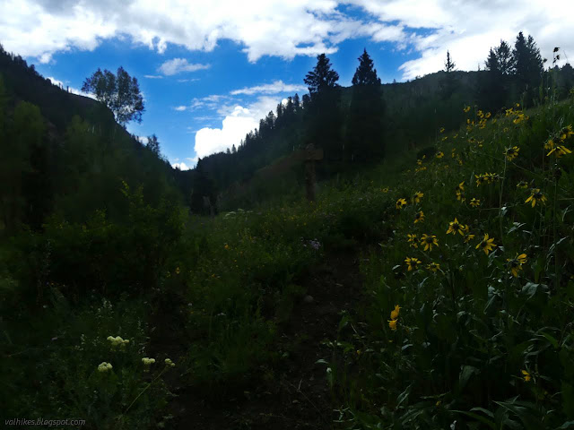
It was starting to dribble as I came to the other side of the Soap Basin Trail among the multiplicity of aspens. Both trails are quite easy to follow there. Then I had to drop a bunch of elevation to cross East Soap Creek, where there is another well used trail with connections to trails I'd been on.


Actually raining held off until I crossed East Soap Creek. Past it, the trail had captured a stream and halfway along I started questioning if I was really on trail. It did turn away again, so yes.
There was a small trail leaving as the trail got out of the stream, passing by a trail marker tree or just a winter accident. Someone obviously decided it was a marker and went that way. I was under some nice trees at that point, so stopped to put on my jacket. I should have put on my rain skirt too. It was absolutely pouring by the time I left the trees. I was quickly soaked from my waist down. It was barely warm enough to be running around so soaked. My shoes were constantly heavy as if I'd just stepped out of the creek, but it stopped being quite so annoying without the lighter condition a few minutes later to compare it to. My phone got tucked into a pocket in my jacket (and stayed dry), my camera is supposed to be "weather hardened" and it definitely was tested.

My feet slid so many times on that trail, but I managed to stay upright. Would it have mattered? It would have washed off quickly enough. It finished after about an hour and at least an inch. I slushed onward to the wilderness boundary, my goal for the day. There wasn't any place I'd like to put a tent there, so I kept slushing along carefully.


There is one last creek crossing just before the trailhead. I examined it very closely, but it didn't look to have swollen yet with the rain. It was plenty clear, too, in spite of all the dirt I'd seen billowing into it further up. I stepped in gingerly, being sure it wasn't swifter than it looked, then right across with no trouble. Then there's a tributary, but that wasn't a bother either.
There isn't much more than a loop at the end of the road. I couldn't say where people park. There weren't any obvious camping spots, but you're not actually allowed to camp at trailheads in Colorado National Forests. (There's a forest order that says so, or at least there used to be.) I turned down the road that was just as slick as the trail pondering what elaborate camps the car campers had constructed and that I might get to use.

The first spot by the creek was taken. I explored some higher places, but didn't find anything suitable. The second spot by the creek was wide open, and I could find suitable places to set my tent. The creek did look swollen here. Some people who used the area had driven out to a small island that was almost completely covered. They'd set up small log bridges that were partly underwater. What they hadn't done was any (likely illegal) construction of nice tables and things. Oh well. I set up my little roof for cooking since the sky looked threatening, but it only sent down a few drops. Even with the crazy morning going every which way but the way I should and the downpour in the afternoon, I was able to tuck in before it was totally dark. I was a little worried that the rain was supposed to be worse on Thursday.
Continue on to the next day ⇒
*photo album*
©2022 Valerie Norton
Written 14 Aug 2022
Liked this? Interesting? Click the three bars at the top left for the menu to read more or subscribe!


Comments