Posts

Showing posts from May, 2017

sketches

Image
Looks like it took going to Nevada to sketch this month.  All of them are from my travels there. Vertical rocks crop out of smooth hills at the side of one of the huge, flat basins. Cliffs of weathered rocks attract my attention near the petroglyphs. As the snow lessens, the remaining two walls of a creek house are too much to pass up. It is always a good time to pause and draw at the top of a pass. Little caves in weathered rocks seem worth a moment.

Little Cherry Creek

Image
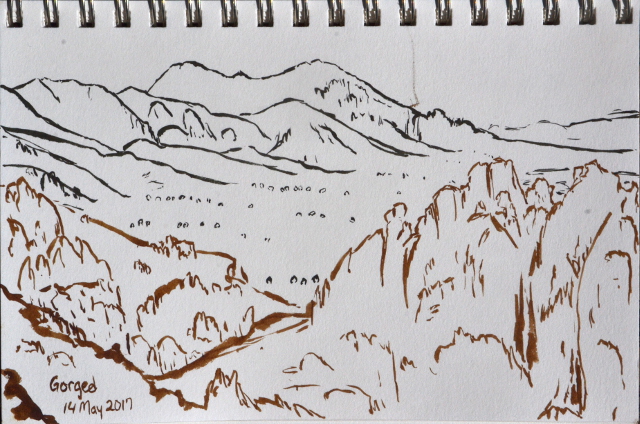
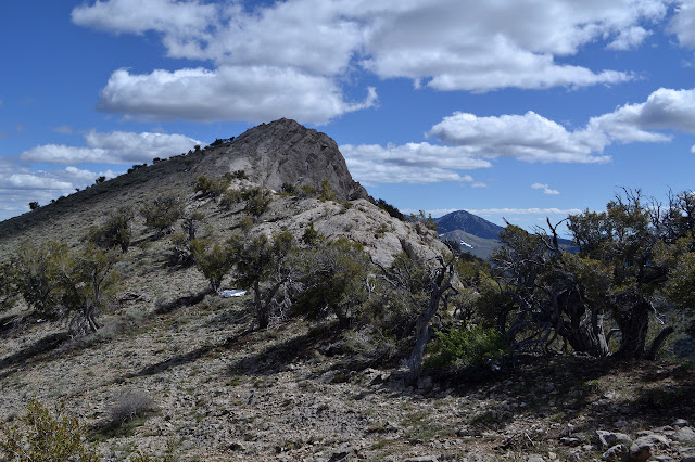
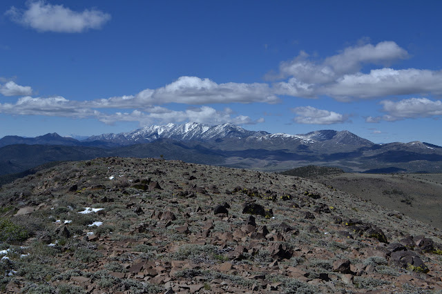
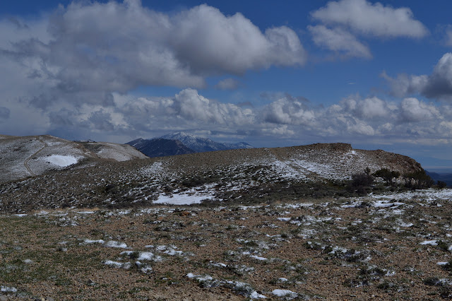
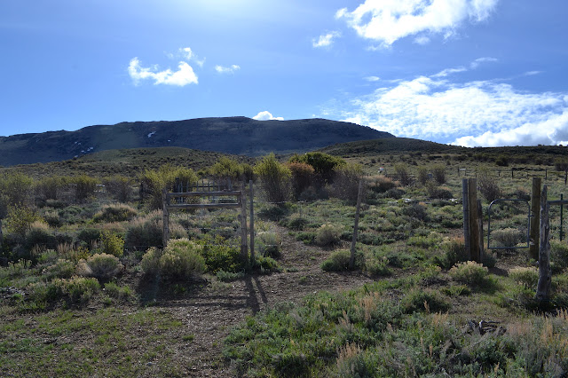
Humboldt-Toiyabe National Forest Click for map. My last day of experimentally determining that Nevada really is not flat is also my last pre-planned hike. I had spotted a labeled trailhead, which is pretty rare on the Ely Ranger District West Half map. There are plenty of spots where trails hit roads, but this was the first I saw actually marked as a trailhead. It is conveniently located next to one of the total of three forest service campgrounds on the map. I had expected a little more to it than the unofficial site I had the last two nights, but it only has tables, fire rings, and a bit of space. They do claim online that there is a pit and four sites. I only found three of the sites, maybe the pit is by the fourth. (The map indicates no restroom.) The site next to the trailhead was already taken when I got in in the evening, so I grabbed the next a bit down the road and around a canyon corner. They left early and, as I found in my walk to the trailhead, had an enthu

Troy Canyon

Image
Humboldt-Toiyabe National Forest Click for map. It started off a frosty morning where I helped the ice off with a bit of windshield wiper fluid, then passed through a shadow and had the whole mess freeze again. After getting that more completely taken care of, I could head off to the edge of Quinn Canyon Wilderness with some stops on the way for hikes. The forest website claims that, "Extreme isolation defines Quinn Canyon, a remote central Nevada Wilderness." I am not so certain about that, but there is definitely not a lot of help in getting there. I turned down the highway to find one of two dirt roads with absolutely no designation that head south from Current, Nevada. The 4WD road that weaves back and forth across it is the Midland Trail. I went right through Current because I was expecting to see a sign that said something like "Current" on it. I had seen the school and it nagged at me that this was probably thought of as a population center for

Indian Garden Mountain

Image
Humboldt-Toiyabe National Forest Click for map. After Bald Mountain, I still had half a day to play before getting down to camping for the night. I decided to go up Indian Garden Mountain, which also shows a little triangle at the top on the map. Benchmark! Although I could just start from camp again, I decided to drive up a few miles to a saddle. I had come up this way a little the day before, so knew the road got a bit rough before the intersection and they always seem to be rougher after an intersection when turning away from the highway. There was nothing too much worse this time and I even found a beautiful parking spot right next to an unexpected road heading up the mountain at the saddle. The first of the ridge line peaks on the way to Indian Garden Mountain and a mule deer. This whole area is absolutely crawling with mule deer and elk. More mysterious road, although this should go a short way to a prospect and stop, on the other side. Mount Hamilton is in t

Bald Mountain

Image
Humboldt-Toiyabe National Forest Click for map. I found a nice camp spot where the USGS map shows three buildings but now there is only a picnic table, campfire ring, and plenty of room tucked in beside the Bald Mountain Wilderness. It is possible that the prime little car accessible starting point is a little up the road from here, but there is not sufficient advantage to bother scraping off the frost to drive up there. Still cold, but not snowing. With my pack stuffed and appropriate maps tucked in, I just start up the low ridge north of the site. There are some bumps along the way it might be easiest to avoid, but otherwise navigation is just to follow it up. Just to be sure I head in the right direction, I estimate the peak position off my map and drop that into the GPS. It is only 2.6 miles away. Current Mountain from a little way up the ridge. The ridge is tree covered and there is not a lot of view except at a few more open spots. Winding through the trees an

Halfway Spring

Image
Humboldt-Toiyabe National Forest Click for map. The road around to White River got rather rough in spots, but never too much for a little careful first gear work. The road along White River after a junction turning once more toward the highway was much better. I decided to hike to another spring that was on my map with a road toward it. Finding the road was not so simple. This one has no sign.. I eventually selected a track in roughly the right place and without any markers saying it was not a road. I even took a little time to search for a benchmark that should be nearby, but was unable to find it. There had also seemed to be a road a little west (should be very short and going to a prospect) and a maybe second near a campsite with a toilet to the east. A little more west was an obvious road to the south which runs to various mines and springs. Across the White River to the south there are already a bunch of mountains to look at. Current and Red Mountains dominat

Redrock Spring

Image
Humboldt-Toiyabe National Forest Click for map. I woke up under a blanket of snow and thought it had stopped, but after knocking it off the top of the tent so it would not drop in when the fly was unzipped, I heard the soft and determined stomping of snowflakes landing. I decided it was probably time to move along. The snow was sufficiently determined to cover things in a minute or so, but once the car was warm enough that the flakes hitting the windshield melted, it was not even enough water to run the windshield wipers once in a while. I came around the long way to Ellison Creek and the old guard station. The rather good "unimproved" road deteriorates at the forest boundary. There are more ruins of stone buildings along the way beside the creek. It was still snowing, so I turned toward White River, which is lower in elevation. Not much further, there is a sign with actual words on it for a place just a mile away. I decided to see what deserves an actual sign

Harris Canyon and Mokomoke Mountains

Image
Humboldt-Toiyabe National Forest Click for map. It was an extremely windy night full of worry about losing a stake until I realized I already had. As I placed it back and an extra to help and pulled out the never-used ties specifically for holding the tent tight in windy situations, I found it had snowed but the only evidence left was a small drift tucked under one side of the rain fly. By morning, there was snow settled on everything, but it was sunny and it all quickly melted. Looking over to the highpoint of the Shellback Wilderness, it looked like this would be a fine day to go even with the snow of the previous night. Unfortunately, the "light duty" road I wanted to take decays sharply as it crosses the forest boundary where it is marked with a vertical number. This means 4WD. As I pushed on, it seemed simple enough although narrow. Crossing the creek, I came to a nice section of ditches to straddle and had to ask myself if I really wanted to push on down t

Hamilton (ghost town)

Image
Humboldt-Toiyabe National Forest I started and finished the day checking out parts of Hamilton. There is another state historic marker dedicated to this ghost town and its neighbors (Eberhardt, Treasure City, and Sherman Town) on US-50 across from the road into Illipah Reservoir and probably the most accessible route into here. It points out that this was an important place in the region once. It was the first incorporated city in the county and became the county seat in 1869, but was already disincorporated in 1875. When fire destroyed the main part of town in 1873, very little was rebuilt. After another fire destroyed the courthouse and county records in 1885, the county seat eventually moved, too. The marker notes there were as many as 10k people living around the Treasure Hill area around 1869 while the Wikipedia page claims 12k people just in Hamilton alone at the same time. In the morning, I looked around the cemetery ( location ) and a ruin I expect was a church ( locat

Belmont Mill and Babylon Ridge

Image
Humboldt-Toiyabe National Forest Click for map. I was heading up to Treasure Hill to look around for the day when I got distracted by a geocache just short of Hamilton. I had just found one at the cemetery and there were very few others because they seem to only be placed in special spots around here. It is off my path, but curiosity got the better of me. I started to drive the road in the direction, but it was quickly apparent that it would be at least a little foolish to continue. I had packed my pack in anticipation of finding some short hikes to do, so this would just be the first. What little is left of Hamilton with Treasure Hill rising behind it. The area is riddled with mines. The first one I notice is only a few hundred feet along and tunnels deep into the rocks just a few feet below the road. I wonder how safe that little bit of road might really be. The road splits, one bit heading north and a little east, one heading west to connect up with a canyon goin

follow by email