Posts

Showing posts with the label Angeles National Forest

Winston Ridge and Peak

Image
Angeles National Forest San Gabriel Mountains National Monument Click for map. My last hike for the day of a Hundred Peaks Section listed peak is out to Winston ridge. I hiked Winston Peak already one afternoon , but had not realized that I was "supposed" to continue on to the ridge beyond. They are a logical pair. Now I go for the ridge and will probably stop by the peak on the way back. First around the side. The road is a single gentle slope down to the saddle where use trails start out to the high point of the ridge beyond the saddle. The Pacific Crest Trail winds and dips and climbs so that it is both longer and steeper. I have been on both and know this, but the thought of taking the road when the trail is available seems wrong. Besides, it should have a bit more shade in the warm day. So, with my water filled up again, I turn down the trail right of the road at the side of the turnout to wind along the trail. Angeles sometimes has these dinky little w...

Kratka Ridge

Image
Angeles National Forest San Gabriel Mountains National Monument Click for map. My second little hike of Hundred Peaks Section listed peaks for the day is actually the high point of a ridge. The usual approach for this is from Vista Picnic Area or the old ski resort east of the high point. Not for me, though. I once went exploring up a mystery road just slightly east of the Buckhorn Campground to find use trails climbing both ways on the ridges once at the saddle above. I liked the spot enough to paint it later . I later explored the road further to find myself at the top of Waterman Mountain for the sunset . Today I will explore those ridge routes with a little more idea of where I will end up. First off to the east to grab the ridge high point then off to the west maybe as far as the Waterman benchmark. (This is not quite as far as Waterman where the benchmark reads "Twin".) Something about this gate makes me think this road has been very thoroughly abandoned...

Mount Lewis

Image
Angeles National Forest San Gabriel Mountains National Monument Click for map. Speaking of list padding, next up is Mount Lewis. Okay, so apparently it is the high point of the Pleasant View Ridge Wilderness, but it is also a brief jaunt up from the road at Dawson Saddle. Trails from the same area climb south a bit longer and a bit higher to Throop Peak. I was up on Throop once upon a time feeling thankful I threw in an extra dinner ( but that story has already been told ) and not noticing the peaks to the north of it particularly. I made plans for three little hikes to grab three more Hundred Peaks Section listed peaks while I was in the neighborhood and this is the first as determined by being the next one along the road. There is a big turnout and a couple little ones to provide parking near the saddle. The only official trail is near the east end of the big turnout, but there seems to be a second trail heading south nearer to the saddle. The unofficial trail up Mount Le...

Vincent's Cabin

Image
Angeles National Forest San Gabriel Mountains National Monument Click for map. I thought I'd spend the night over by Vincent's place. The cabin is supposedly built by a Civil War veteran, so it has some years on it and I will certainly not be staying in it. It is a little way down the Mine Gulch Trail, one of the five trail routes and four road routes to leave Vincent Gap. It is not the hardest to find. That one goes northwest and is a National Recreation Trail, so should get better treatment, but currently has not so much as a sign. The Pacific Crest Trail wanders through from the northeast to the southwest (for the northbound direction) and gets quite a lot of traffic going up Mount Baden-Powell. I ignored that and skirted a permanently locked gate on an old road headed south. A short way down, it is signed for Big Horn Mine along road on the right and Mine Gulch along trail on the left. I hung the left. The right is quite a popular destination and I could hear pe...

Grass Mountain

Image
Angeles National Forest Click for map. I have been thinking I will hike Grass Mountain for a few years now. Today is the day. The trail crossing is already familiar from previous visits, but this is a new direction. Guess I will add a few more miles of PCT to my done pile, for what it is worth. It is still too early for the ~3600 through hikers starting from Mexico this year. This is northbound mile 478.2 by Halfmile's current reckoning, so it will not be quite that many when most of them turn here to find out the secret of Case de Luna down the road in Green Valley. For now, there is just one set of footsteps visible in the otherwise clean dirt of the trail ahead. A spattering of pines at my start on the PCT today. The trail will not be hidden under pine needles in another month. The trail climbs the far side of the canyon. The pines are just around the fire house and the rest is manzanita and chamise. The trail hits a utility road and I turn west along it beca...

Liebre Mountain

Image
Angeles National Forest Click for map. I may have been spending too much time staring at Thomas Fire information and worrying. In those first few days, I looked at that footprint and thought this close bit coming at Carpinteria may look threatening to Santa Barbara at first glance, but it is really this bit almost at the furthest side of the fire creeping up Topatopa Bluff that is dangerous to us. That part raged across Nordhoff Ridge one night to breath its menacing breath over the entirety of Ojai and then kept on going. It jumped the highway and started in on devouring the Santa Ynez Range. It dropped into Matilija Canyon with a dreadful finality to many homes there. It raged to Romero in another jump sending those in Toro Canyon fleeing on the way, then crept over to San Ysidro. It followed the path I expected and feared it would. People watching Romero flare up a week ago from the west end of Shoreline Park. Flame could be seen above Summerland and Carpinteria as wel...

Mount Lukens

Image
Angeles National Forest Click for map. I came out to join a group of peakbaggers from the Hundred Peaks Section hiking to the high point of the City of Los Angeles. I thought that when I crossed into the city way out at the 5 and 14 split, I would not be out of it again until late afternoon, but I seem to be standing in the City of Glendale as everyone gathers up. I expected a large a-lot because it is Bill's birthday, but there seems to only be a small a-lot of just over 20 for the hike. Bill says he met his wife hiking this peak, so now we know why it is special to him and why he wanted to mark year 70 here. He is a bit of a romantic. Getting everyone together, waivers signed, introduced, and starting down the trail seems to get done fairly quickly. We hit the trail and start climbing just three minutes after the meet time. Admittedly, it was a very easy meet time to make. Hang a left and start to climb. Quickly gaining city views and the 210 and the Verdugos with thei...

Mount Hillyer

Image
Angeles National Forest San Gabriel Mountains National Monument Click for map. I hung around the area to go climbing one more peak in the morning. Very early in the morning, I noticed my stars vanishing, and by sun up they seemed to be doubly gone with the slightest bit of moisture coming down. The weather has changed. Traveling to my planned hike, there was a moment looking out over the clouds, which was quite nice, but then I was back in them. At the trailhead, I seem to be under them ever so slightly. I live in hope as I stuff puffy things and the emergency poncho into the pack in case things get quite cold and wet. Maybe this peak is high enough for that over the clouds view. Signage at this trailhead in the middle of the Silver Moccasin Trail. This is not the shortest route to the peak, but it is the shortest drive. The trail gets on with climbing quite quickly with a few switchbacks. What I can see of the view is surprisingly colorful, full of all different reds and...

Mount Akawie

Image
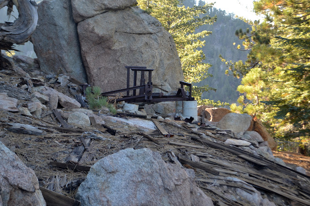
Angeles National Forest San Gabriel Mountains National Monument Click for map. There is still enough light left for something, at least for a silly little thing like Mount Akawie, AKA Buckhorn Peak. It rises a little above the campground and is most easily accessed by a road east of Cloudburst Summit and west of the picnic area. It does not seem to appear on maps and is blocked by a thin yellow gate. The spot has a huge parking area for those times when there is a grand party up on the peak, I suppose. For no good reason, I want to go up the little peak west of the main peak as well, so although the road is wide and easy and clearly the main route, I scramble upward to follow the ridge. Getting high for a view, a peek at peaks east through a wide gap. They do tend to be taller over there. In the small saddle before the little peak, there is a scattering of weathered planks. It looks rather like there was once a simple structure in the somewhat flat area. A scattering of r...

Will Thrall Peak and Pleasant View Ridge

Image
Angeles National Forest San Gabriel Mountains National Monument Click for map. A new day and new peaks to bag, but this time I will join a planned outing of the Hundred Peaks Section for some company. I have been really wanting to do the traverse of Pleasant View Ridge from Burkhart Saddle to the other side of the closed bit of the Pacific Crest Trail, especially if there is going to be a car shuttle. Unfortunately, this is not that. This is heading up to the saddle and then turning the other way to grab a couple nearby peaks. Still, it gets me into an area I have enjoyed visiting before, then out to some new spots. First, it is a little over a mile downhill on well used trail to Cooper Canyon, past various falls and with the sun thinking about getting down into the depths of the canyon. There is a lot of vertical to the land as Cooper Canyon empties out into Little Rock Creek. Past the Cooper Canyon waterfall that marks the end of previous exhibitions in this direction,...

Cucamonga Wild: Ontario and Bighorn Peaks

Image
Angeles National Forest San Bernardino National Forest Click for map. DAY 1  |  DAY 2  |  DAY 3 Although 2000 feet higher, Kelly Camp was not much cooler than Commanche Camp the night before. I pack up and tuck my gear away. This place does not have anything like the traffic at Icehouse Saddle, so I am not as worried about getting it totally hidden. Heading up the old camp steps along the trail gets me out of came and climbing to the ridge. In between is an area where burn and regrowth has left a trail that circles about in ridiculous ways. Looking north to Timber Mountain and Mount San Antonio. At the top of the ridge, it shows an advantage of saving these peaks with a similar view for a new day. It is a whole new world down there today compared to yesterday. The city grid stretching far west and east is now gone in favor of a sea of clouds with a few islands. There were vast connected cities here before and now there is just Santiago Peak in...

Cucamonga Wild: Cucamonga and Etiwanda Peaks

Image
San Bernardino National Forest Angeles National Forest Click for map. DAY 1  |  DAY 2  |  DAY 3 The night was about as cool as my sleep system could go without a little help, but I did not have to sacrifice my pillow for the warmth of the jacket within it. Bright stars shone through the breaks in the trees when I looked. Today, there are mountains to climb and then a stop at Kelly Camp before climbing some more. I expect the established camp probably has a spring associated with it, but there is certainly no water source to be seen on my map. The rangers at the station googling were able to find the suggestion this may be true and that it was dry in May. For a stream, that would be damning, but springs run on their own offset schedule. Not knowing where to find it, I really need to get water where it is known. That means either here and carry it up 2000 feet or from a spring on the other side that is out of my way, but only 1000 feet below the saddle. The...

Redrock Mountain

Image
Angeles National Forest Link to map. Redrock Mountain really catches the eye when viewed from the west side where its deep red heart is on display. Since I have plodded along on a few trails that do this, the mountain has eaten into my consciousness. The area around it was once quite popular among hikers and each excursion I have done around its base has shown me new reasons why. Today, any entry into the area requires first a mile along paved roadway before getting to a trail that can get one to the good stuff. It tends to weed out anyone who is not looking for a long hike. Today, I am looking for a long hike. I will head up Fish Canyon and climb that mountain, then return via Redrock Canyon and (Old) Telephone Road. A previous excursion that returned via Telephone Road lead to a bit of disappointment in being only able to see some of the beauty around me because it was already getting dark. Timing for off trail travel is uncertain, so I could end up in the same situa...