Mount Lewis
Angeles National Forest
San Gabriel Mountains National Monument

Click for map.
Speaking of list padding, next up is Mount Lewis. Okay, so apparently it is the high point of the Pleasant View Ridge Wilderness, but it is also a brief jaunt up from the road at Dawson Saddle. Trails from the same area climb south a bit longer and a bit higher to Throop Peak. I was up on Throop once upon a time feeling thankful I threw in an extra dinner (but that story has already been told) and not noticing the peaks to the north of it particularly. I made plans for three little hikes to grab three more Hundred Peaks Section listed peaks while I was in the neighborhood and this is the first as determined by being the next one along the road. There is a big turnout and a couple little ones to provide parking near the saddle. The only official trail is near the east end of the big turnout, but there seems to be a second trail heading south nearer to the saddle. The unofficial trail up Mount Lewis starts just west of a large shed.

The trail up is well ground in and well steep. Plenty of people do this, more than just the peakbaggers keeping up with their list. Maybe it does have something going for it after all.
In little time, I am at the top. It is not much more than a quarter mile, if even that, and the constant, determined slope mellows out once close.

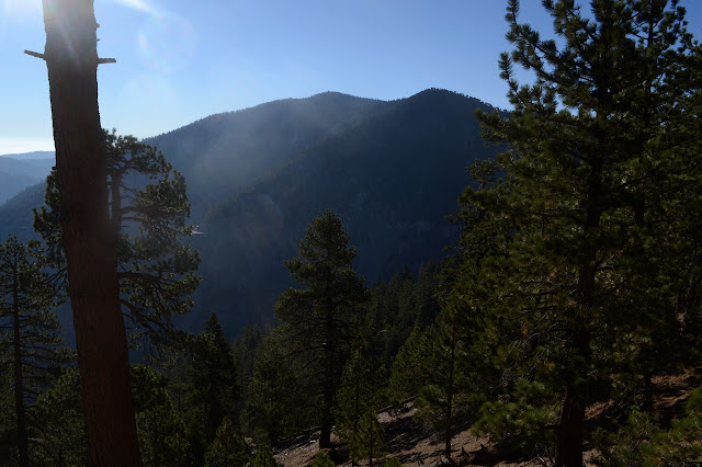
I wander around. Although wooded, it is an airy and open wooded and there are views to be had as the flat top drops away at the sides. There is a camp site toward the north side.


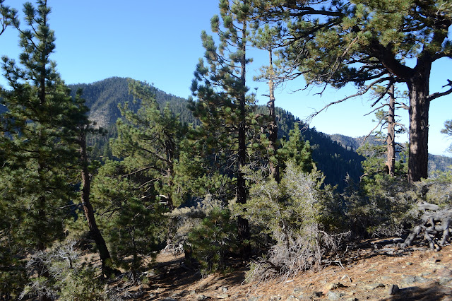
After the wander, I follow the trail back down. There is a blocked off route that stays higher on the ridge that looks almost as well used. There were I couple of trails leaving the main route to get up to the edge of the ridge, so it will go through somewhere. I go for this one for a little variety and like it better because it adds views to the west plus more views to the east to the hike.

The ridge trail turns into the main trail again shortly, but there is another stretch of trail going up to follow the ridge again. This is a little less traveled. I take it anyway and stick to it as much as I can as thin trails drop back down to the main one. I expect it to get suddenly steep as the road gets close and indeed it does. I plunge down the steep, soft dirt in some other footprints before making my way to the side and getting on the main trail again. It is getting too low for better views at that point anyway.

It really did not hold much. Wilderness high point and a bit of view. A firefighter saw it as a short, steep workout and signed the register that he got up it in full gear in 14 minutes. On to the next.
©2018 Valerie Norton
Posted 12 August 2018
Liked this? Interesting? Click the three bars at the top left for the menu to read more or subscribe!


Comments