Woodpecker Trail
Coralville Lake
Click for map.
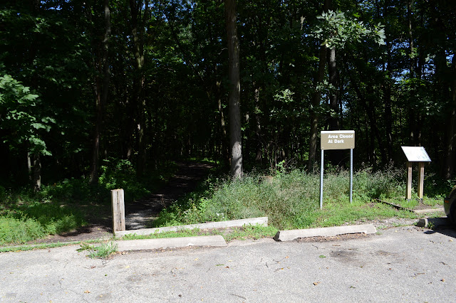
As I dropped down off the mountains and into Denver, there was just one brief look out over what I knew was there, an infinite seeming plane of grass known as the Great Plains. It was nice to finally find hills again in the west of Iowa. On the way back through, I took a turn for something tucked into those hills: a lake. This particular one is actually a dammed bit of the Iowa River. It has a few clusters of trails and I ended up at the Woodpecker system, a loop with a couple trails across that allow the short loop to become even smaller. A trail segment across a bridge connects it with the Squire Point system, of similar size, and both are shown on the map at the trailhead. The parking is sunny, but the trail plunges quickly into shady forest. The trees are some broad leaved oaks, cottonwoods, and somewhere there are a few walnuts. The thick green hulls and a few shells lie scattered on the ground.

The trail soon comes to a junction and there is another sign with a full map on it. They have defeated the problem of the "you are here" dot vanishing after too many fingers have stabbed at it by simply drilling a hole through the metal. I head right to drift around the outside of the largest loop.


Actually getting to see the lake seems to be difficult. There are some claims that the trail is an interpretive trail (and the brochure can be downloaded for this), but actually seeing any numbers along the way is also difficult. I do find a mysterious structure of sticks.


The trail comes to a junction with a trail not on the map. It is clearly official, with a solid bridge across something small and dry. I follow it, but it starts to climb toward the campground as another trail wraps around the lake. This one looks rather unofficial, but it actually gets down to a place to see the water without much obstruction. In fact, it seems to drop down into area that can be flooded although it does not quite go to the water where it currently sits.


The trail thins quickly, so I turn back and follow around the edge some more. It turns out there are official spots where the lake becomes more visible, too.


There is a downed tree that makes a low bridge across the trail and has clipped the end of a bench. It is not quite the only minor difficulty on the trail as a few spots are muddy and slippery, but is the only sign of needed maintenance on a well developed trail that even has steps when it gets the least bit sloped.


I wander out toward the second trail system, Squire Point, but decide against it. No real reason why not. The connection is made over a large bridge over another creek. This one is not quite dry, but the bridge still seems like a bit much at its level.

So I climb back up the hill. It is quite an easy climb back from the lake to the parking lot.
©2018 Valerie Norton
Posted 3 September 2018
Posted 3 September 2018
Liked this? Interesting? Click the three bars at the top left for the menu to read more or subscribe!


Comments