Posts

Showing posts with the label Ventura County

Frazier Mountain on snowhoes
Image
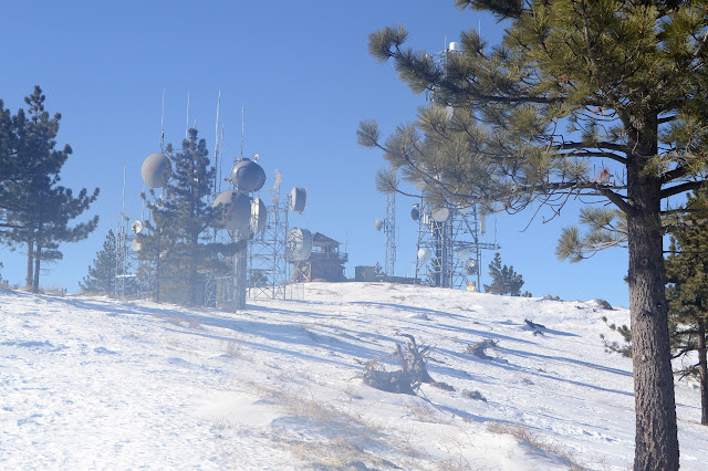
Los Padres National Forest Click for map. Frazier Mountain is the second mountain on the Hundred Peaks Section's list of peaks that I have been up, but only in a car. Since I don't feel like counting drive-ups, I need a plan to hike it. I've had one to go in from the east side at the edge of Hungry Valley, but with all the snow on the ground, a 20 mile hike is probably too much for the short days. From the north, I can get up and down by two routes in 7 or 7.5 miles. That's still almost 15 miles and the trip up Tecuya showed the snow can start very early, and that was the south side of the mountain. How long can one go on snowshoes in a day? They certainly aren't as fast nor as easy walking as hiking on dirt. Hopefully I'll have the good sense to quit if it gets to be too much, not that I have a good record of that. With the memory of the frigid wind at the top of Tecuya, I have my puffy mittens and a few other things to be sure I'm warm enough. ...
Cuyama Peak

Image
Los Padres National Forest Click for map. The automated weather says today is the brief sunny moment between a couple small storms, or did when I could get a weather report. There are some clouds, but they are clearing. Getting up to the peak is going to be a 12 mile hike if I take trails. I plan to go up using a ridge for a shortcut and come back on the trails, but it will still be a 20+ mile day. If the gate weren't locked, it could be shortened by three miles, but I'm pretty sure my car wouldn't make it across the river so it doesn't really matter that the gate is locked. My arms still hurt from shifting trees on Deal Trail, so I really hope Tinta is not in a similar shape. Starting the same place as for the loop with Deal Trail, but a bit earlier. There's a bit more ice on the unstable log that crosses most of the Cuyama River, but I'm not keen for another spill into the water. It was 24°F earlier and probably hasn't got much warmer yet. ...

Deal Trail

Image
Los Padres National Forest Click for map. I come to the gate at Rancho Nuevo to climb a peak, but not today. Today is for another round on Deal Trail, which loops up and around to find its way back to CA-33, then I get to come back down. It's an excellent candidate for dropping a bike off at the top to get back, but I haven't got one anymore, so it will be a road walk to finish. There's one of the many wilderness information beside the gate. Leave no trace principles, a map, and fire recovery information. I think we're getting to year 14 of recovery for this area. The gate is closed for the winter season, not that it would help me if it weren't. The first thing it does is cross the Cuyama River. Today, this is a series of ever deeper ditches until I finally get to one that holds water. It is more of a big creek today. There is a log to cross it. I'm not a fan, but go for the increasingly ice covered and wobbly bridge. Even with poles for balance,...

Cozy Dell to Valley View Camp

Image
Los Padres National Forest Click for map. I've been thinking I should go back to Cozy Dell for years now, then Thomas came roaring through, but I still kept thinking it. Thomas is a fire, of course. It stayed California's biggest for 6 whole months. That was just over two years ago and the forest was open again before it was officially out. Bernard's somehow never been on this trail, so he wanted to come along. It's not that he's never noticed it when passing along on CA-33 to somewhere further by a little or a lot, just that he's never stopped to see where it goes. There's a bit of potential for exploration, but I only plan to take the official trails to check on Valley View Camp. If I lived in Ojai, I would know all the little tracks up here and have got myself to Nordhoff Peak by a half dozen different routes including some from here, I expect. I've done it by a quarter dozen others anyway. The trail is well signed at the highway and ther...

Sisar Canyon and Horn Canyon

Image
Los Padres National Forest Click for map. I actually took the time to ask if someone else wanted to hike and when the dust settled, we were three strong and had a shuttle hike going up Sisar Canyon (which Matt wanted to do) and down Horn Canyon (which I was more keen about) doing maintenance on all the geocaches along the way. The hike up is via road which makes for a very gentle climb, at least by our standards, nearly up to the top of the hills (AKA mountains) behind Ojai. Parking has changed at Sisar since I was last there . Previously, there was a nice lot after a not particularly nice bit of dirt road, but now the road has a gate because people wouldn't quit treating the adjacent private property like it was public property, and in rather abusive ways at that. Now they have ruined it for us all and there is much less parking further back. We left a car at the bottom of Horn, which has not changed much , then got around to Sisar in time to claim one of the few spots....

Ortega Hill and Ortega Peak

Image
Los Padres National Forest Click for map. While watching the progress of the Thomas Fire over the south side of Ortega Hill, leaving the north side alone, I decided I would hike Ortega Peak again once the closure was lifted. This time, I would give Ortega Hill a try too. After all, it is the actual named thing. I do wonder what historically conspired to give that lower hill a name while leaving the bigger peak with only a benchmark. Bonus, it is unlikely to still be the miserable, masochistic bushwhack without a single view that has been reported by both groups that visited it in the last 20 years. Okay, so that last might be why I would even think about doing it when there is a better peak right next to it. The Thomas Fire closure was lifted a lot earlier than expected, but I remembered my musings eventually and here I am. A slightly early start because the days are getting hot. This one only promises about 80°F instead of 85°F of the nearby days. I brought two bags of water...

Matilija, Upper North Fork trail work

Image
Los Padres National Forest Click for map. Matilija has been a place that seems to suck in the rain. There have been a few times it has come down 15 or 18 inches in a single night and the creek surged for days, but the canyon took it. After the Thomas Fire, when the rains came heavy, Matilija got at least its share. This time the canyon itself flowed although just a third of the big dumps it had withstood before. We came up it for a day of trail work aiming to get up to Matilija Camp. That is a brief one mile from the trailhead. Since we are working, we got to park at the trailhead instead of behind the gate, which turns out to be at Murietta a little further down the road. The trail is obvious, but there is no evidence of the sign with a map in it. We gather up tools, mostly little saws and trail Smiths and Pulaskis, get a safety talk, and gather into three groups to see what we can accomplish. Quite a big group: about 30 volunteers. Standing within the burn. There is a l...

Woodridge and Rocky Incline

Image
Woodridge Open Space Lang Ranch Open Space Click for map. Down into the Thousand Oaks area for one last set of trails that are part of the COSCA Open Space Challenge with whoever is in the group. Trouble is, with Geowoodstock on and it being Memorial Day weekend, it looks like all the social geocachers have wandered off somewhere (or caught a cold) and the "group" is me. Well, that is just sad for me. The required trails to be hit today are the Woodridge Loop and Rocky Incline (marked as Hidden Canyon on some maps). The first wraps around a gated community in the hills near it, the second touches into the loop I did while popping up to the top of Simi Peak . The loop has a small parking lot area that is mostly gravel, but paved on one end. The end heading south is obvious next to the paved portion of the lot and the end heading north has a gravel path leading to a spot across the street from it, so is not too hard to find. My plan was to start south, so south I go...

Western Plateau, Elliott Peak, and Hawk Canyon

Image
Conejo Canyons Open Space Click for map. After missing one, I am out for another round of trails for the Conejo Open Space Challenge with geocahers. Today, our required trails are a pair of short pieces in the Conejo Canyons Open Space: Elliott Peak and Hawk Canyon. They are joined together with a long and elaborate loop that goes for an estimated 8 miles. I arrive a bit confused about where to start. We are only five strong today and Matt says I am in charge because I was the one doing the little bit of pushing to make sure everyone remembered there was a hike scheduled for the day, what it was, and determined a meeting time. (I did all that for the last one, too, and was not even going.) This is unfortunate because, as I say, I seem to be a bit confused about where the start is. I promptly compound it all and get somehow more confused and we go ahead and start down a different trail which will get us to our loop and does mean we have a nice parking lot to leave the cars. It...

Old Boney Trail

Image
Rancho Sierra Vista/Satwiwa Point Mugu State Park Click for map. Back not far from where I was hiking last week, I am out to either hike up to Tri Peaks again or take a big loop along the side of Boney Mountain. I probably should have chosen before starting, but I am still pondering. Although I want to go up to Tri Peaks again, I sort of want to do it via a different route than the one I have already done, so most likely this will be the larger loop to new spots. My start is new too. Previously, I started from by the cultural center, which has parking behind a gate that locks at sunset giving an annoying deadline for getting back. This time I am using the trail at the end of Windy Drive that everyone else seemed to be using so that I have no timing worries. Wide trail past informative signs to start off at the end of Windy Drive. The trailhead has a sign about fire inspired by the Springs Fire of 2013. My previous trip was just 3 months after that fire, so this whole ...

Rocky Peak

Image
Rocky Peak Park Indian Springs Open Space Click for map. I am not entirely sure how it happened, but we finished planning the outing for yesterday with plans for today as well even though there was never any question as to where or when the other would be. It is a much smaller group today with just Scott, who was generally the instigator of plans, and Linda, who decided to hike just today. Linda brought along Milo, who should be good for sniffing out geocaches and better be a good hiker because we should come out around 10 miles again today. She says that he is. I joined up because this hike swings past Rocky Peak, which is on the Lower Peaks Committee list and has a county line marker up on top. It should be a little harder to get to than the one I nearly tripped over by Random No. 2 , but a bit easier than the one up on top of Dome Mountain . Scott has been before, Linda seems so disinterested that she forgets a peak was mentioned within seconds. Milo seems ready to get to w...